




💧 A Guide to the Rivers, Waterfalls and Lakes of Racha-Lechkhumi
💧 Every Drop Here Belongs to One River
The water system of Racha-Lechkhumi runs on the Rioni: it starts at the glaciers of the Caucasus watershed and gathers almost everything that flows in the region. The other rivers, the waterfalls and some of the lakes are its tributaries, or what those tributaries have carved into the limestone on the way down.
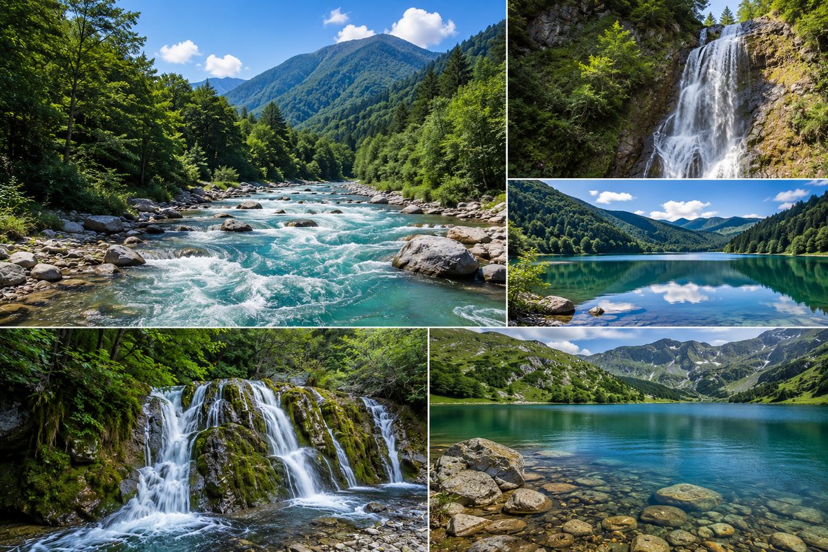
The rivers of Racha-Lechkhumi form the Rioni basin: the Rioni itself and its tributaries, the largest being the Tskhenistskali, Lukhuni, Lajanura, Ritseula and Sakaura on the right bank, and the Shareula, Jejora, Chanchakhi, Gharula, Krikhula and Znakura on the left. Almost every drop of water in the region ends up in the Rioni and leaves with it for the Black Sea.
The mechanics are simple. The region sits on the southern slope of the Central Caucasus, with an average relief height of around 1,750 metres. Glaciers on top, a limestone basin below, squeezed between ridges. Water comes down off the ice, cuts into the limestone, and where it cuts hardest you get narrow gorges and waterfalls. Nearly everything people come here to look at is the result of one process stretched over millions of years.
What follows: the rivers first, then what they've done to the landscape.
💧 The Rioni: The Main River and Its Numbers
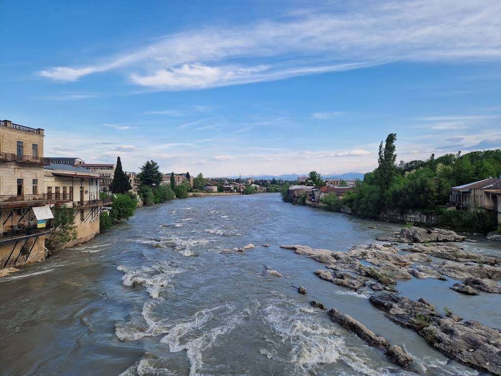
The Rioni is Georgia's second-longest river: 327 kilometres, with a basin of 13,400 km². Its source lies on the southern slope of the Caucasus range on Mount Pasismta, at 2,960 metres. It meets the Black Sea at Poti. Roughly 130 kilometres of its course fall inside Racha-Lechkhumi, which means close to half the river belongs to this region.
Its character shifts along the way. From the source down to the village of Ghebi, the Rioni heads southeast through a wide, deep valley, and as far as the Zopkhitura confluence that valley is a trough, ploughed out by an ancient glacier, with a broad floodplain and a braided channel. Below Saglolo the valley narrows and the river turns south, then southwest, into a deep gorge. At Oni it swings west and runs to the village of Alpana, where the valley opens out again: the floodplain here floods almost completely at high water, the river splits into channels and forms islands. Terraces along the banks stand between 2–3 and 20–35 metres high.
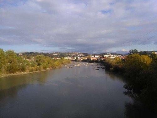
The numbers explain the river's character better than any description. Average flow at Ghebi's neighbour Glola is 27.3 m³/s, at Kutaisi it's already 134, and at Sakochikidze 406. Maximums run twenty times the minimums and more: at Glola, from 16 up to 345 m³/s. Over a year the Rioni delivers roughly 12.9 km³ of water to the Black Sea. Seasonally the runoff splits like this: spring 38.8%, summer 28.5%, autumn 18.4%, winter 14.3%. Feeding is mixed, and glaciers account for only 4.6% of it, with groundwater at 34.7% and rain at 32.5% doing most of the work.
Oni, Ambrolauri, Kutaisi, Samtredia and Poti all stand on the Rioni. The Rioni HPP, two Gumati plants and the Vartsikhe plant work on the river itself; the Lajanuri, Shaori and Tkibuli plants sit on its tributaries. Upper Rioni in Racha is one of Georgia's best-known rafting runs, thanks to that narrow, deep upper channel.
One more piece of context: the Rioni's ancient name was Phasis. The river was the spine of the Kingdom of Colchis, the Colchis the Argonauts sailed to. There's more on that in Racha and Imereti on the Trail of the Golden Fleece.
🌊 The Tributaries: A Reference Table
A tributary joins from either the right or the left bank, looking downstream. Here's what the Rioni collects inside Racha-Lechkhumi.
📋 Rivers of Racha-Lechkhumi: Length, Basin, Source
Lengths for the Gharula, Notsarula, Chveshura, Zopkhitura, Znakura, Kheori and Kheledula aren't recorded consistently in open sources, so they're left out of the table rather than guessed at.
🐎 The Tskhenistskali: The Region's Second River
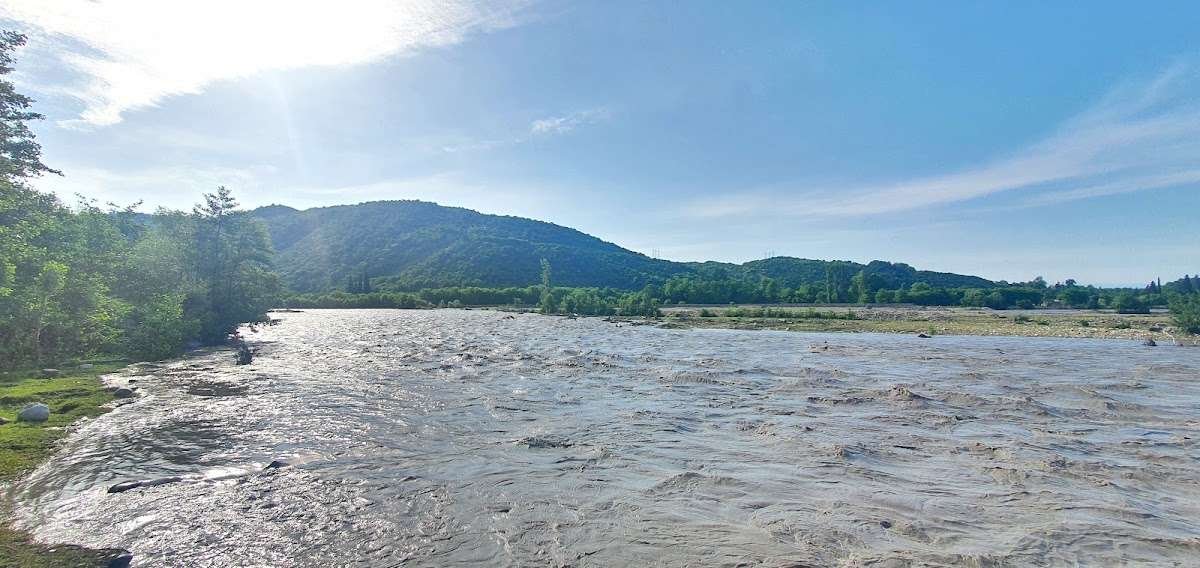
The name translates as "horse water." The Tskhenistskali is the Rioni's longest tributary: 176 kilometres, basin 2,120 km², rising on the southern slope of the Svaneti Caucasus west of the Pasismta peak at 2,710 metres. It joins the Rioni from the right near the village of Sajavakho, which is already outside Racha-Lechkhumi, so within the region it's a transit river. Average flow at the mouth is 90.4 m³/s, and over a year it hands the Rioni about 2.84 km³ of water. Tsageri, the administrative centre of Lechkhumi, stands on its bank.
There's a man-made twist too. Part of the Tskhenistskali's flow is diverted by canal and tunnel into the Lajanura for the Lajanuri hydro plant, and a dam was built near Tsageri to do it. The Lajanuri reservoir sits by the village of Surmushi: 3.2 km long, up to 70 metres deep, holding around 50 million m³.
Together the Rioni and the Tskhenistskali do the thing the region is shaped by: both cut through limestone ridges and open narrow, deep gorges, called kldekari in Georgian. The best known are Khidikari, Alpana-Tvishi, Muri and Saretskela. These gorges, rather than any postcard view, are what determines how Racha-Lechkhumi looks from the road.
❄️ Where the Water Comes From: The Glaciers
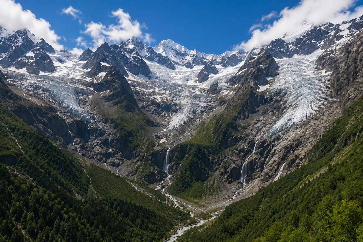
The question nobody asks, though it explains why there's so much water here. The Rioni basin holds 73 glaciers covering roughly 60 km². Most sit on the southern slope of the Caucasus watershed above 3,300–3,400 metres, with a few smaller ones on the Shoda-Kedela and Lechkhumi ridges.
The large ones are the Kirtisho, Edena, Zopkhito, Laboda, Khvargula, Boko, Buba and Tbilisa. Each covers more than 2 km² and runs 3–5 kilometres long, and all of them are valley glaciers. Water peaks in spring and summer during the melt, drops to low flow in winter, and spikes again with autumn rain. That's the pattern for the whole basin, and it's why the same waterfall looks like a different object in May and in September.
💦 The Waterfalls: What the Water Carved
The region's waterfalls sit on those tributaries of the Rioni and Tskhenistskali. Here are the ones in the catalogue, plus one that isn't in it yet.
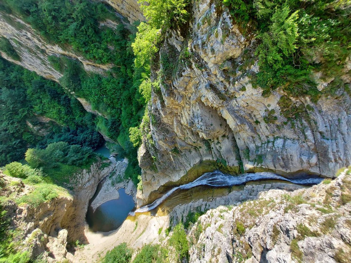
Znakvi Waterfall, Also Spelled Zbakvi
This one is worth its own heading, because it's genuinely hard to find, and because the name causes trouble.
Znakvi Waterfall stands on the Znakura River, a left tributary of the Rioni, near the village of Znakva in the Ambrolauri Municipality, about 10 kilometres from town. The village sits at 850 metres. Locally it's known as the Big Waterfall of Znakva, and there's more than one drop in the gorge.
In Latin script the name gets mangled fairly often, and "Zbakvi" is the same waterfall as "Znakvi" — the n turns into a b, and the misspelling has stuck well enough that people search for it that way. If you arrived here looking for a "Zbakvi waterfall," this is the place you meant.
The honest part: this is not a developed site. There's no marked trail, and even experienced travel guides covering Georgia's waterfalls say the route is best confirmed with locals in the village. The access road is roughly at 42.5112, 43.0726, but that's the road, not the drop itself. Don't rely on a single online pin, and don't attempt it straight after heavy rain.
Do not confuse it with the Sikvaruli Waterfall, described below. That one is at the entrance to Ambrolauri, about 10 kilometres away, and is an entirely different place.
The Rest of the Waterfalls
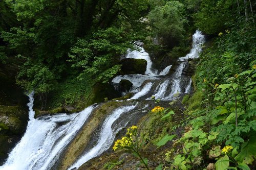
Gvirishi sits in the Lechkhumi mountains near the village of Kveda-Gvirishi, Tsageri Municipality. Water falls off a cliff into a gorge, forming a small pool in a rock bowl, and there's a glass viewing platform built above the drop at around 625 metres. Entry and parking are free, and there's one bench on the terrace. Reviewers note the access road is in poor shape though passable in an ordinary car, and the platform is windy.
Rachkha, Tsageri Municipality, on the road to the village of Isunderi.
Sikvaruli, the Waterfall of Love, at the entrance to Ambrolauri on Gurgeniani street, at around 560 metres. Water falls from an opening in a moss-covered rock shaped like a heart, hence the name. It's the region's most accessible waterfall: almost no walking required.
Verdzistava, near the village of Tvishi. Chkumi, in Tsageri Municipality by the village of the same name.
🧭 A Navigator to the Region's Nature
open a group💦 Waterfallsfive sites on the Rioni and Tskhenistskali tributaries ›
🏞️ Lakes and Reservoirsfrom alpine Udziro down to Shaori ›
🕳️ Caves and Icekarst and natural iceboxes ›
🏔️ Mountains, Plateaus and Passeswhat stands above all this water ›
🏞️ The Lakes: Two Different Kinds
The region's lakes fall into two groups, and it's worth keeping them apart.
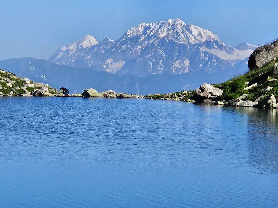
The first is glacial and high-altitude. Udziro lies at 2,800 metres, reached from Shovi or Glola, and it takes a full trekking day. Mravaldzali, also known as Cholevi, sits by the village of the same name in Oni Municipality. The Kulbaki lakes are tucked into the Lechkhumi mountains by the village of Kulbaki.
The second is man-made. The Shaori Reservoir at 1,100–1,200 metres is Racha's largest artificial body of water, created when the Shaori River was dammed. It covers 9.2 km², runs 7.1 km long, and reaches 14.5 metres at its deepest. Autumn and winter bring people here for the reflections: coloured forest and snow-covered peaks in the water.
One name collision worth knowing in advance: near the village of Mravaldzali there's also a heart-shaped karst lake that locals call the Lake of Love. It has nothing to do with the Sikvaruli Waterfall near Ambrolauri, also nicknamed the waterfall "of love." Two different places, one romantic nickname, same region.
🗺️ Rivers, Waterfalls and Lakes of Racha-Lechkhumi
Open in Google Maps🕳️ Karst: Why There Are So Many Caves
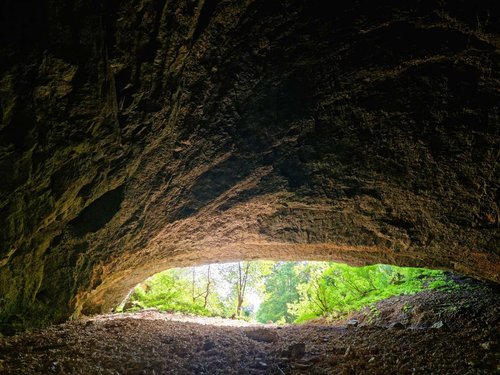
The Racha-Lechkhumi basin is built from Oligocene and Miocene sediments: clays, sandstones, conglomerates and limestone. Water dissolves limestone, and what you get is karst, meaning caves, sinkholes, underground cavities and wells. The karst landforms cluster on the Racha ridge, on the Khvamli massif, and in the gorges of the Chanchakhi and Jejora rivers.
Hence the sites: Sakinule cave three kilometres from Nikortsminda, Usholta cave on the Racha ridge, and the Skhvava icebox well where ice sits through the heat. On the Khvamli massif itself there's the Tekeneti karst well, 16 metres deep at an elevation of 1,620 metres, and a "God's icebox" at 1,700 metres where icicles form in high summer.
The Labechina ridge splits the basin in two: Lechkhumi to the west, Racha to the east. That's not a technicality. It's the working division locals still use.
🗿 What Else Is Nearby
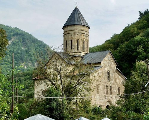
The water theme pairs naturally with what stands on the banks. At the village of Tsesi, where the Rioni and Lukhuni meet, you'll find Barakoni church, and not far off the 11th-century Nikortsminda Cathedral with its stone carving. Beside Nikortsminda are the Udabno and Sakinule caves with an arched spring. Over in the Lechkhumi district stand the Sairme pillars, a rock formation 35 kilometres from Ambrolauri.
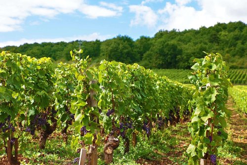
And the vineyards: they sit along the Rioni and its tributaries for a reason. Vines on the right bank get southwest-facing slopes and more light, which is why the grapes for Khvanchkara wine grow there, in villages like Bugeuli, Tvki, Khvanchkara and Chkvishi at 500–800 metres. River geography decides where the good wine happens.
For a broader picture of the region with its resorts, fortresses and food, see Racha-Lechkhumi and Lower Svaneti.
Understanding the nature of Racha-Lechkhumi is easier than it looks: there's the Rioni, there are 73 glaciers feeding it, and there's limestone that the water has been cutting for millions of years. Everything else, the waterfalls, the gorges, the caves, the karst wells, follows from that. Hold that picture in your head and the region stops being a scatter of pins on a map and turns into one system you can travel through on purpose.
Been to Racha-Lechkhumi? Tell us in the comments on Madloba: which rivers and waterfalls you caught, and in what season, running full or down to a trickle.
Information is current as of July 2026. Water levels in the rivers and waterfalls change sharply with the season: peak in spring and early summer, low flow in winter. Lengths for some tributaries differ between sources or aren't recorded, and that's noted in the table.
📚 Read Next Racha-Lechkhumi in more detail
❓ Frequently asked questions
The main one is the Rioni. Its major tributaries in the region are the Tskhenistskali, Lukhuni, Lajanura, Ritseula and Sakaura on the right, and the Shareula, Jejora, Chanchakhi, Gharula, Krikhula, Znakura, Notsarula, Chveshura and Zopkhitura on the left. Practically all the region's water belongs to the Rioni basin.
327 kilometres, with a basin of 13,400 km². About 130 kilometres of its course run inside Racha-Lechkhumi.
On the southern slope of the Caucasus range, on Mount Pasismta at 2,960 metres above sea level. It reaches the Black Sea at Poti.
"Zbakvi" is a common misspelling of Znakvi. The waterfall sits on the Znakura River near the village of Znakva in the Ambrolauri Municipality, roughly 10 kilometres from town. There's no marked trail, so ask for directions in the village.
No. They're two different places about 10 kilometres apart. Sikvaruli, the Waterfall of Love, is at the entrance to Ambrolauri and known for its heart-shaped cave opening. Znakvi is on the Znakura River near Znakva village and is undeveloped.
Phasis is the river's ancient Greek name. It was the central artery of the Kingdom of Colchis, the place the Argonauts sailed to for the Golden Fleece. For a time the Greeks treated the Phasis as the border between Europe and Asia.
The Tskhenistskali, whose name means "horse water." It's the Rioni's longest tributary at 176 kilometres and the second river of Lechkhumi.
73, covering roughly 60 km². The largest are the Kirtisho, Edena, Zopkhito, Laboda, Khvargula, Boko, Buba and Tbilisa, each over 2 km² and 3–5 kilometres long.
Spring and early summer, during the snow and glacier melt. Winter is low water; autumn brings rain-driven spikes.
The Labechina ridge divides the basin: Lechkhumi to the west, centred on Tsageri on the Tskhenistskali, and Racha to the east, centred on Ambrolauri on the Rioni.
Read also

1 comment
Log in to leave a comment