




🏔️ The Chalaadi Trek in Svaneti: Route, Altitude, Timing and the One Safety Rule
🏔️ Chalaadi: two starting points and one rule
The most accessible glacier near Mestia and the most walked trek in Svaneti. The length of the route depends on where you start, and the difference is fourfold.
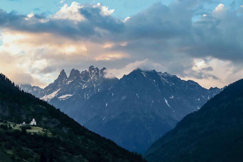
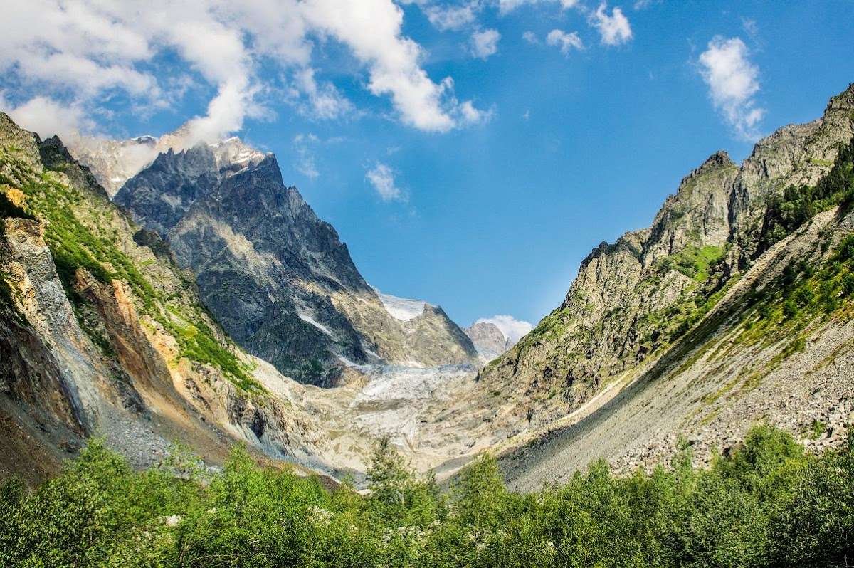
Chalaadi is a glacier tongue about six kilometres long. It begins on the slopes of Ushba and Chatini and descends through the gorge of the river of the same name into the Mestiachala gorge.
For Mestia this is the nearest glacier and the most popular day trek. The reason is not only the distance: the walk is easier than the one to the Koruldi lakes, and everybody does it, including people in the mountains for the first time.
Map point and reviews: Chalaadi Glacier.
📏 On altitude and size
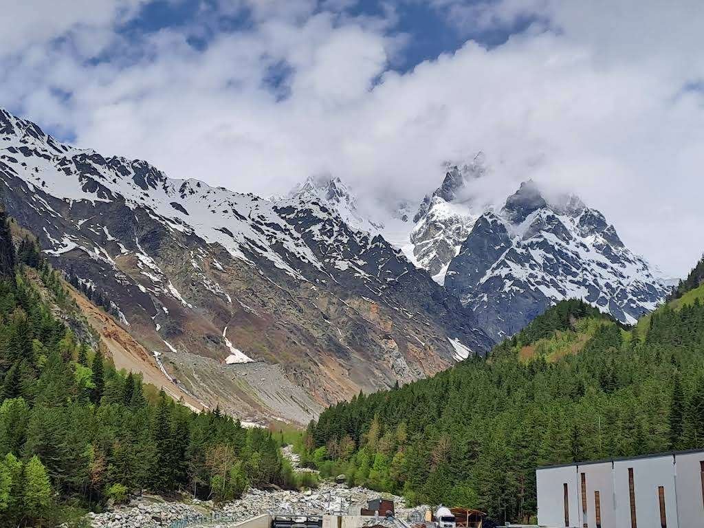
The question asked most often, and the answer does not reduce to a single figure.
The length of the tongue is about six kilometres, and this is the most reliable figure: different sources agree on it.
The glacier begins on the slopes of Ushba (4,710 metres) and Chatini (4,368 metres), high in the Greater Caucasus range.
The trek itself involves almost no ascent. Mestia sits at around 1,500 metres, the road to the bridge follows the floor of the gorge, and the trail beyond climbs gently. That is precisely why the route is done with children and without preparation.
Sources give different figures for the elevation of the snout itself, and it changes in any case: glaciers retreat. What matters in practice is the other thing, you are walking slightly uphill rather than climbing a mountain.
🚗 Two starting points, and why it matters
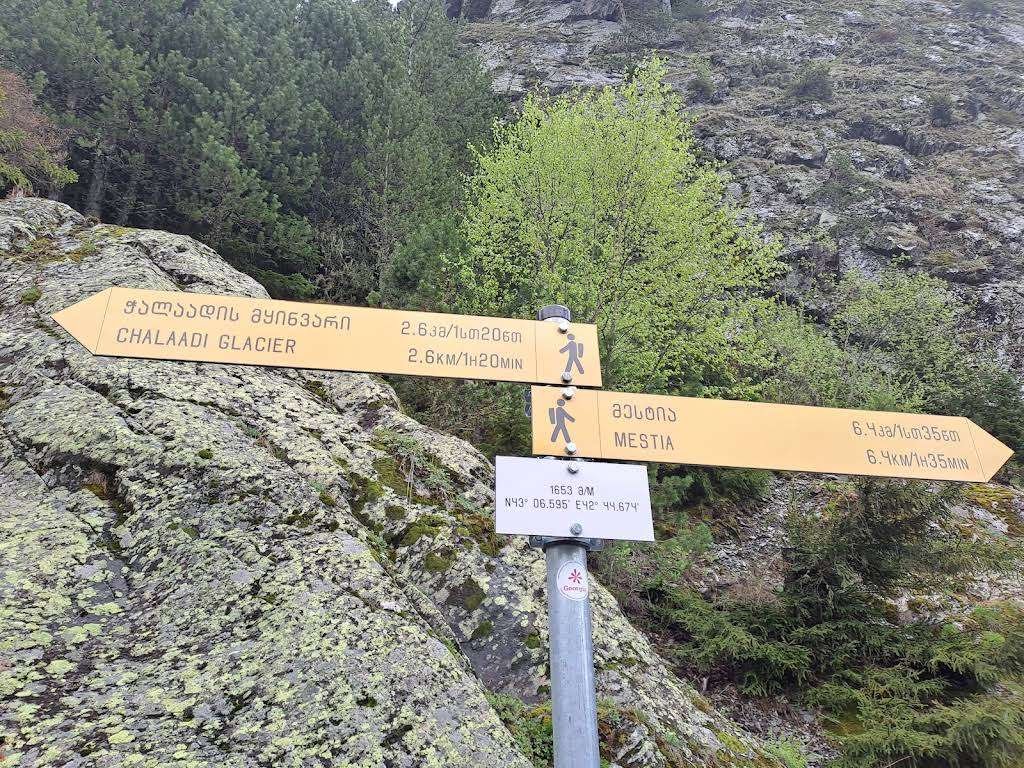
The main decision comes before you set off.
From the centre of Mestia it is about twenty-four kilometres there and back. The road follows the gorge floor, there is almost no ascent, and getting lost is impossible. But it is a full day of walking.
From the bridge over the Mestiachala some six kilometres remain. The bridge is about ten kilometres from Mestia by road, any car will manage it, and there is parking there.
Most people choose the second option. Taxi drivers usually wait at the bridge, so you can get there without your own car.
There is also a signpost and a large map of the area. Free maps are handed out at the tourist information office in Mestia too.
🥾 How the trail runs
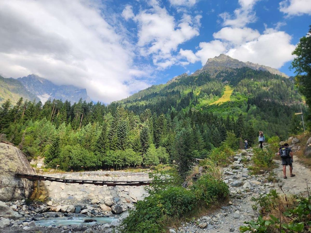
It starts with a suspension bridge over the Mestiachala. The river is narrow but fast, and the bridge looks the sort that makes people pause before stepping on.
Beyond it a well-trodden path climbs gently: first through forest, then along the riverbank. The water is drinkable, born of the glacier, so you need not carry a supply.
The glacier comes into view fairly soon, and it serves as the marker: keep going straight.
At the boulder field the trail forks. This is the scree just before the glacier, and it is where the two routes diverge.
Markings at the fork: what the stripes mean
Before the boulder field the trail splits in two. The choice is made by the colour painted on the rocks, and it determines both difficulty and time.
The easy walking trail. Made up and marked, walkable in ordinary shoes, suitable for families and for anyone new to the mountains.
The hard option across a field of boulders. The rocks shift underfoot, the climb needs your hands, and it takes roughly twice as long.
🥾 The easy trail is simple to lose among the rocks, and some walkers end up on the hard one by accident. If boulders start moving under your feet, go back to the fork and look for the yellow and white marks.
⚠️ The one rule: keep your distance
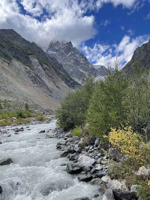
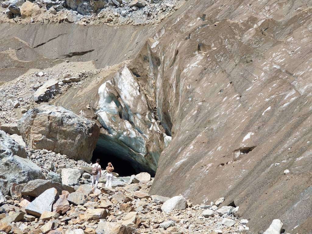
The section this article was worth writing for.
Rocks are thrown from the glacier over long distances. This is not an abstract warning: people who have written up walks here report fatalities at the snout itself.
The glacier is alive, it moves and brings down rock, and there is no predicting where it will come from.
What follows from that. Look from a distance; do not go close and do not scramble onto the ice. A photograph at the snout is worth less than it seems, and the risk is entirely real.
Also. Rocks can come down from the slopes along the trail too, so leaving the marked route to climb the scree is not advisable.
One more thing: mountaineers use Chalaadi on their way to Ushba and Chatini. That is a different level of preparation, equipment and permission, and it has nothing in common with the day walk.
🌊 Traces of the mudflow
Another detail that explains the look of the ground at the start of the route.
The gorge went through a severe mudflow, and the consequences are still visible. At the trailhead stands a hut buried almost to its roof, and the road there was raised by about two metres. Spoil from the flow lies on the opposite bank.
Restoration work is under way, reinforcing the banks with concrete. For the route this means the approach and the start of the trail may look different from photographs of previous years.
There is more on the gorge itself in the Mestiachala valley.
🗓️ When to go
The trek is a summer one. Svaneti sits high, and out of season the accessibility of routes changes.
The best time is from midsummer to early autumn: the trail is dry, the roads open and the daylight long.
On the weather. It changes fast in the mountains, and rain makes the boulder field considerably more dangerous. If the weather turns, it is wiser to head back without reaching the glacier.
The first button leads to the parking area at the bridge over the Mestiachala, where the trek begins. The second plots the walking route from the bridge to the glacier.
🚗 Getting to Mestia
From Zugdidi, about three hours on a mountain road. Marshrutkas run from the station, where trains from Tbilisi and Batumi also arrive.
From Tbilisi you can fly: Mestia has an airport served by small aircraft, with flights in season.
From Batumi and Kutaisi the road runs through Zugdidi. If you are driving up from the coast, our piece on getting from Batumi to Svaneti by car will help.
From Mestia to the bridge is another ten kilometres, by your own car or by taxi.
🧭 What else is nearby
The Koruldi lakes, the second most popular trek from Mestia. It is harder than Chalaadi and involves real ascent, but the views are wider.
The Lekzyr glacier, four kilometres from the fork by the suspension bridge. The trail there is neither made up nor marked and some approaches are closed, so it is not for the unprepared.
Ushba Falls, also called Shdugra, fed by the same mountain as Chalaadi.
Svan towers in Mestia itself, the region's defining architecture.
The Museum of History and Ethnography in Svaneti in Mestia, if you want context after the mountains.
🧭 Where to stay
The base is Mestia, and for this trek there is effectively no alternative. The town lives on tourism: guesthouses, hotels, gear hire, a tourist information office handing out free maps.
Staying near the centre makes sense: it is easier to find a taxi to the bridge from there, and closer to the other routes.
On how many days. Half a day covers Chalaadi alone, but there is no point coming to Svaneti for it by itself. Three or four days is the usual allowance: Chalaadi, Koruldi, the towers, Ushguli.
🗣️ Over to you
Walked to Chalaadi? Tell us where you started from, how long it took and what state the trail was in after the mudflow. Leave a review on Madloba: the route changes along with the gorge, and recent observations are worth more than any description.
Information is current as of August 2026. The condition of the trail, the access road and the bridges all change, and restoration work is under way in the gorge. The glacier is an active natural feature: keep your distance and do not approach the snout.
📚 Read next
❓ Frequently asked questions
💬 In Mestia Municipality, Upper Svaneti, in the gorge of the Chalaadi river, which opens into the Mestiachala gorge. The trailhead is about ten kilometres from Mestia by road.
💬 Two ways. On foot from the centre of Mestia, about twenty-four kilometres there and back along the gorge floor. Or drive to the bridge over the Mestiachala, where there is parking, and walk some six kilometres there and back. Taxis usually wait at the bridge.
💬 The tongue is about six kilometres long. It begins on the slopes of Ushba, 4,710 metres, and Chatini, 4,368 metres. The trek itself involves almost no ascent: Mestia sits at around 1,500 metres and the trail climbs gently.
💬 About two hours there and back from the bridge at a good pace, three with a rest before the glacier. Longer on the hard trail across the boulder field.
💬 The easy trail is made up and marked, the climb is gentle and ordinary shoes will do. The difficulty appears only at the boulder field before the glacier, where the route splits: one option over the rocks, the other on the path.
💬 You should not. Rocks are thrown from the glacier over long distances and there have been fatalities here. Look from a distance, without scrambling to the snout or leaving the marked trail for the scree.
💬 Not necessarily. A drinkable river born of the glacier runs along the gorge floor and follows the trail for almost the whole way.
💬 Summer and early autumn, when the trail is dry, the roads open and the daylight long. In rain the rocks on the boulder field become considerably more dangerous.
💬 The Koruldi lakes, the second most popular trek from Mestia: harder than Chalaadi and with real ascent. Ushba Falls, fed by the same mountain. And the Lekzyr glacier four kilometres from the suspension bridge, though the trail there is not made up.
💬 About three hours from Zugdidi by marshrutka on a mountain road; trains from Tbilisi and Batumi arrive in Zugdidi. Small aircraft fly to Mestia in season.

3 comments
Log in to leave a comment