




💧 Georgia's Largest Lake: Paravani in the Javakheti Mountains, the Secret on Its Bed and the Road There
💧 Paravani Lake: The Essentials
Georgia's largest lake by surface area, and at the same time one of its shallowest: across 37.5 km² the depth never exceeds 3.3 metres. It lies on the Javakheti volcanic plateau at 2,073 metres and freezes over for several months each winter.
Samtskhe-Javakheti, Ninotsminda municipality, in a basin between the Samsari and Javakheti ranges. The villages of Poka, Vladimirovka, Tambovka, Rodionovka and Aspara stand around the shore.
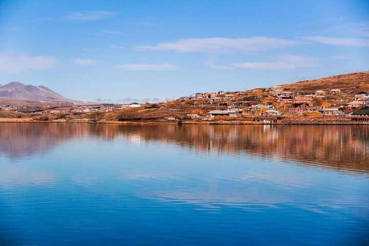
Paravani is Georgia's largest lake by surface area, with a mirror of about 37.5 km². Though "large" here applies to width, not depth. The maximum depth is just 3.3 metres and the average around 2.2, so by volume of water Paravani falls well short of the country's deep mountain lakes. Other natural sights of the region are gathered in the catalog on the Natural Attractions of Samtskhe-Javakheti page.
The lake sits in Ninotsminda municipality on the Javakheti volcanic highland, in a basin between the Samsari and Javakheti ranges, at 2,073 metres. Paravani is the largest in the chain of lakes we covered in our overview of the volcanic lakes of Javakheti, and the plateau itself was shaped by the ancient volcanoes of Javakheti. The landscape is unlike most of Georgia: no forest, no gorges, just open highland, wind and water to the horizon. Below is what's known about the puzzle on the lake bed, what fish live here, when to come and how to get there.
📊 The Lake in Numbers
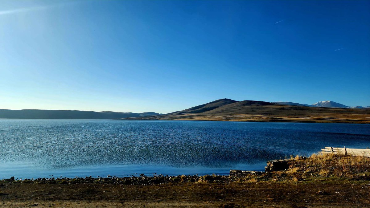
The lake is volcanic-tectonic in origin. The surrounding water network is poorly developed: the climate is dry and the volcanic rock heavily fissured, so water drains away underground. Small rivers feed the lake, the Shaori, Sabadostskali and Rodionovkistskali among them, plus a few seasonal streams, while the Paravani river flows out of the southern shore and joins the Kura from the right 74 km later, at the village of Khertvisi, where the Khertvisi fortress stands. We traced where that water goes next in our piece on the Kura river and the canyons of Vardzia. The river carries some 45 million m³ out of the lake each year.
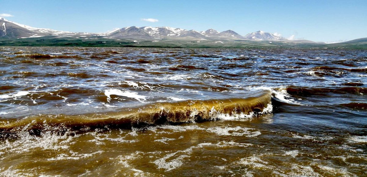
Water levels shift noticeably with the seasons: at their lowest in October and November, at their highest in May and June. The water is murky in summer, with transparency of around 30 centimetres, and that isn't pollution but a property of a shallow lake where wind constantly stirs up bottom sediment. Under the winter ice the water clears.
🔍 The Secret on the Lake Bed: What's Actually There
The most common question about Paravani is exactly this: what's hidden at the bottom. The story runs as follows. Divers noticed a large object underwater, and a geophysical survey revealed an extended structure on the bed covering almost a thousand square metres. An expedition was then assembled, and by the widely repeated account an ancient burial was found there, with household items and ceramics, and a corridor leading to the centre of the structure.
An honest caveat is needed here, because it's usually left out. Dozens of travel sites retell this story and it has even reached English Wikipedia, but the ultimate source in every case turns out to be the same travel material rather than a scientific publication. Worse, the datings contradict each other: some write of the Bronze Age, others of the 4th century BC, and those are eras separated by millennia. So it's worth treating as an intriguing story rather than an established fact.
The archaeology around the lake, meanwhile, is real and well studied. The Javakheti plateau holds kurgans, megalithic structures, stone-walled settlements and ancient obsidian workshops, and its Bronze Age monuments have proper scholarly publications behind them. The remarkable material is genuinely here, it just isn't on the lake bed but on the shore.
🎣 Fishing on Paravani
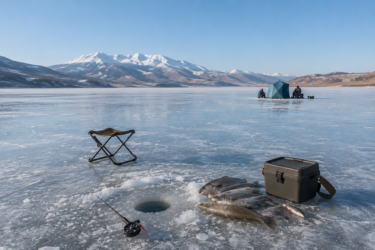
The lake is popular with anglers, and that's one of the main reasons locals come. Paravani holds khramuli, trout and carp among other species, taken both from boats in summer and through holes in the ice in winter. Ice fishing is a story of its own here: the cover lasts for months and bears weight confidently.
You can try the catch at small cafes by the lake, and pick up homemade cheese from locals while you're there, goat cheese included. Fishing is subject to rules and seasonal restrictions, so check the current requirements and any permits before you travel.
❄️ Weather and When to Come
The climate here is harsher than people expect of Georgia. An altitude of 2,073 metres, an open plateau and almost no tree cover add up to wind, sharp temperature swings and an early winter. The ice holds for four to five months and runs from 47 to 73 centimetres thick, so in winter the lake becomes an enormous white field that locals walk across.
For an ordinary trip, summer and early autumn are the most comfortable. Even in July, though, bring a windproof layer and something warm: evenings on the plateau are noticeably colder than in the valleys, and the weather turns fast.
🏰 What to See Nearby
The lake itself is mainly landscape and quiet, so it makes sense to build the trip around the sights around it.
Poka Monastery. On the lake shore, in the village of Poka, stands a convent of St Nino. It's known not only for its church but for its enterprise: the sisters make cheeses, herbal teas, preserves and chocolate, all of which you can buy on site. Other foundations of the region are gathered in Churches and Monasteries of Samtskhe-Javakheti.
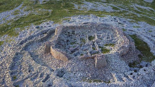
The Abuli and Shaori fortresses. These are megalithic structures of large basalt blocks laid dry, without mortar. Shaori fortress stands on the summit of the mountain of the same name at around 2,752 metres, northwest of the lake, with an unusual rhomboid plan, circular interior spaces and two parts on neighbouring peaks. Its construction date can't be pinned down: no excavations have been carried out. Abuli fortress is built along the same lines and belongs to the same group of monuments, while the mountains themselves are described in our piece on the Abul-Samsari range. All the region's fortresses are in the Ancient Ruins, Fortresses and Castles section.
Neighbouring lakes. Half an hour to an hour away lies Tabatskuri Lake, and the protected nature of the plateau as a whole is covered in our article on Javakheti National Park.
🚗 How to Get to Paravani Lake
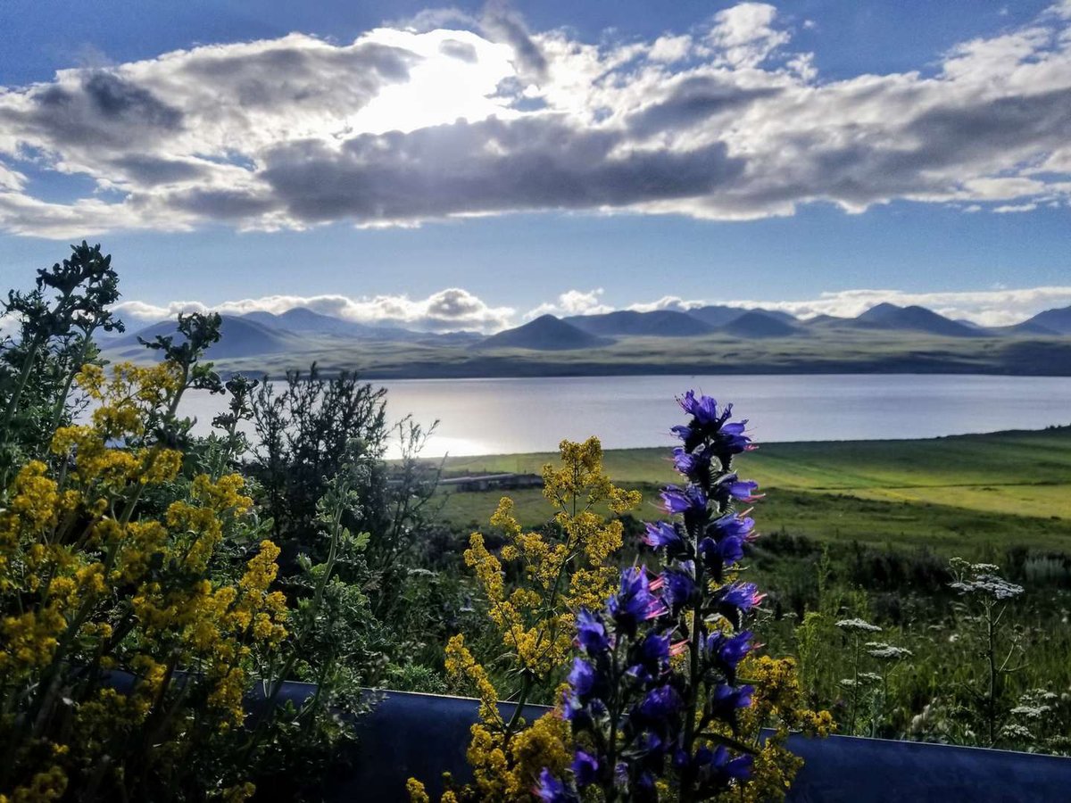
The lake sits on the Akhalkalaki to Ninotsminda road, which is the simplest reference point of all: the route runs along the shore, so you can't miss it. The nearest towns are Ninotsminda and Akhalkalaki, and that's where to look for lodging and food, since there's no visitor infrastructure on the shore itself.
Driving from Tbilisi takes several hours, either via Tsalka or via Borjomi and Akhaltsikhe. By public transport, people take marshrutkas to Ninotsminda or Akhalkalaki and arrange the last stretch locally. In winter, build in extra time: the plateau is exposed, blizzards and ice are routine, and passes can close.
🧭 Where to Stay and Eat Nearby
Ninotsminda and Akhalkalaki are the nearest towns with lodging and cafes. Below are the catalog sections for them and for the region.
Been to Paravani? Leave a review on Madloba: tell us which season you went, how the road was, whether the fish were biting and whether a boat is worth bringing. Your experience will help first-timers plan.
Information is current as of July 2026. Weather on the plateau, road conditions and fishing rules all change; check the current situation before you travel.
❓ FAQ
💬 In the Samtskhe-Javakheti region, Ninotsminda municipality, on the Javakheti volcanic plateau between the Samsari and Javakheti ranges, at 2,073 metres above sea level. The Akhalkalaki to Ninotsminda road runs along the shore.
💬 Yes, by surface area: around 37.5 km². By volume of water it falls behind the country's deeper lakes, because Paravani is no more than 3.3 metres deep.
💬 About 3.3 metres at most and roughly 2.2 metres on average. It's a very shallow lake, which is exactly why the water is murky in summer: wind stirs up the bottom sediment.
💬 Divers and a geophysical survey identified an extended structure of about a thousand square metres on the bed, described as an ancient burial. The story is widely retold, but it rests on travel sources and the datings in them contradict each other, so it can't be treated as proven.
💬 Khramuli, trout, carp and other species. The lake is popular with anglers year-round, with fishing through the ice in winter. Check the rules and seasonal restrictions before you go.
💬 Yes, the ice cover lasts four to five months and runs from 47 to 73 centimetres thick.
💬 There's no resort infrastructure on the shore. This is a high-altitude lake in open steppe country, with cool, murky water, so beach holidays aren't what it offers. Ninotsminda or Akhalkalaki are the practical places to stay.
💬 The convent of St Nino in the village of Poka on the shore, where the sisters make cheeses and herbal teas, plus the megalithic Shaori and Abuli fortresses of basalt blocks laid without mortar.

5 comments
Log in to leave a comment
Осы көлде өткенді, кешегі күндерді іздеуге ұмтылғанда, мен де саяхаттап, сенімен бөлісу үшін бар күшімен жолға шығамын. Балық аулаудың қызығы мен аяқ-киімді суға түсіру, барлығы да есте қаларлықтай. Грузияның орман-тау тынысы біздің отбасының саяхатын одан да ерекшелендіреді. Сіздер үшін паравани көлінде қандай балықтар бар?