




Guide to Akhalkalaki in Javakheti: The Fortress Town, Kumurdo and the High Plateau
🏙️ Akhalkalaki: What to Know Before You Go
The administrative centre of Javakheti, in southern Georgia, on a volcanic plateau at around 1,700 metres. Most residents are Armenian, which is why villages here often carry two names. The town's principal monument is a fortress town site with a citadel, a caravanserai and the ruins of a mosque. There is almost no tourist infrastructure, and that accounts for half the character of the place.
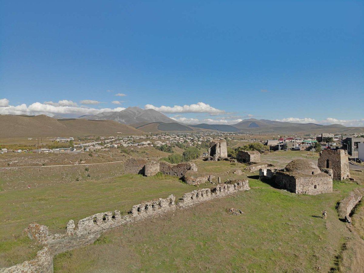
Akhalkalaki is a town in southern Georgia, the administrative centre of the municipality of the same name in the Samtskhe-Javakheti region. The name translates from Georgian as 'new town', though it stopped being new a thousand years ago.
The place is unfamiliar territory for anyone who knows Georgia through Tbilisi, Kakheti and the sea. There are no vineyards and no subtropics here: a volcanic plateau, treeless hills, stone houses, and a winter that arrives early and leaves late. Here is what to see, how the place came to be what it is, and how to reach it.
📍 Where Akhalkalaki Is and Why It Is So Cold
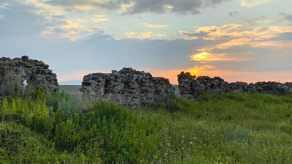
The town sits on the Javakheti volcanic plateau at roughly 1,700 metres. The plateau itself rises from 1,500 to 3,300 metres, and the southern boundary of the municipality coincides with the state border between Georgia and Turkey.
That explains the climate. Akhalkalaki is reckoned the coldest district in the country: long winters, snow lying for months, a short and cool summer. One mistake travels from text to text about the town, calling it the northernmost district. This is southern Georgia, and the cold comes from altitude and an open plateau where nothing breaks the wind, not from latitude.
The 1990s were hard on Javakheti. The economy collapsed, heating ran short, and residents felled old trees to warm their homes. The plateau has little woodland to begin with, so the mark those winters left is still visible.
One more thing you notice straight away. Most of the municipality's population is Armenian, and many villages carry two names, one Georgian and one Armenian. You hear it within minutes of arriving.
🕰️ From 'New Town' to the Russo-Turkish Wars
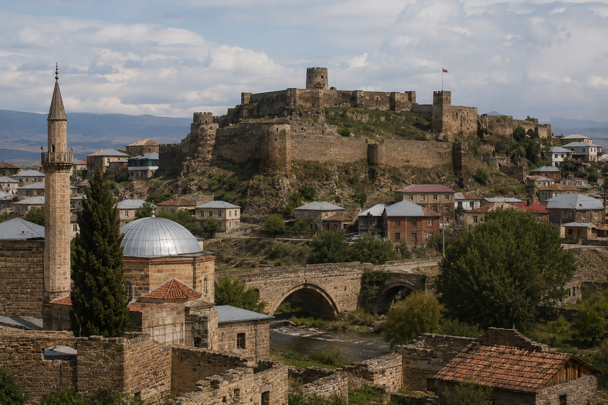
By the conventional dating, the settlement received town status in 1064 and became one of the centres of Javakheti. Local tradition pushes the story back to the days of Noah, but that is tradition rather than documented chronology.
What follows shaped the place. Fertile land at a crossroads changed hands for centuries, until in the sixteenth century the region passed to the Ottoman Empire. The Ottoman period ran for more than three hundred years and left behind a mosque, a layer of building inside the fortress, and part of the local place-name stock.
The early nineteenth century compressed those changes of power into a few years. In 1811 the Russian army took the town. In 1812, under the Treaty of Bucharest, Akhalkalaki went back to the Ottoman Empire. The matter closed on 22 September 1828, when forces under General Paskevich took the town.
In the Soviet period Akhalkalaki lay within a border zone, which seriously restricted movement for residents and visitors alike. A Russian military base stood here until 2007, and its departure was a significant economic event for the town.
🏰 Akhalkalaki Fortress Town Site: What Survives
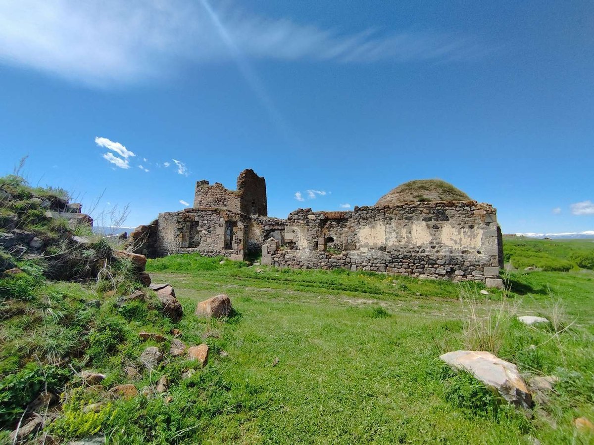
Older lists of the town's sights often give the fortress and the 'eleventh-century walls' as separate entries, though they are one and the same. It is more accurate to speak of a fortress town site: not a single tower, but the remains of a fortified settlement with several layers of building.
The complex is dated to the eleventh to thirteenth and the eighteenth centuries, and that spread is not accidental. The place was rebuilt so many times that the traces of alteration are visible to the naked eye, yet fragments from the period of foundation still survive.
Inside you can make out a citadel, towers, a caravanserai, the remains of a church with cells, traces of domestic buildings and the ruins of a mosque. The list speaks for itself: this was not merely a garrison post. People traded here, lived here and worshipped here, in different ways in different eras.
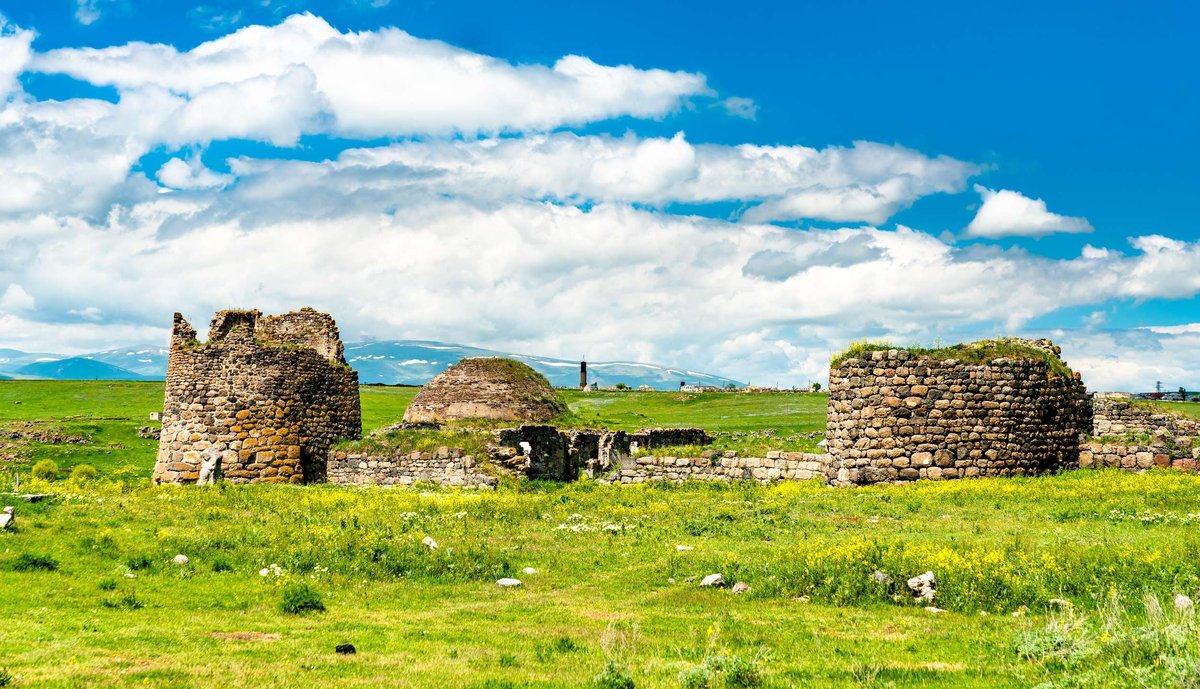
Between 1811 and 1828 power changed hands here three times. For a border town on the road to Kars that was ordinary life, and it explains why a church and a mosque sit within one complex.
Today the site has no facilities at all: no ticket office, no marked routes, no barriers. Allow for its fragility and take care on the loose ground. The map location and reviews are on the Akhalkalaki Fortress page.
.
⛪ What Else to See in the Town Itself
The town is small, and its centre can be walked in a couple of hours. Almost everything standing here carries the marks of neglect, which is precisely why Akhalkalaki looks nothing like a restored fortress such as Rabati.
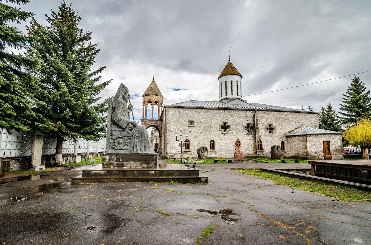
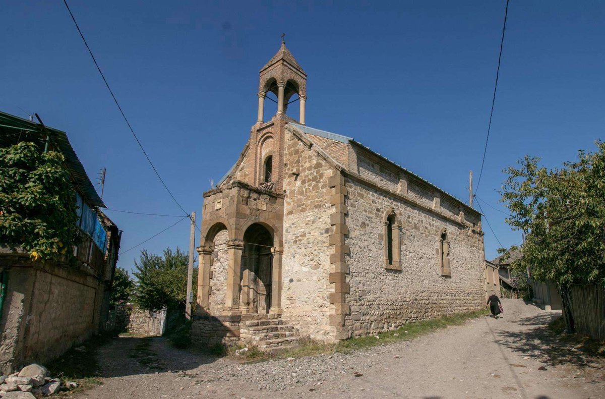
Surb Khach Church. A nineteenth-century Armenian church, the town's principal religious building and a sensible first stop.
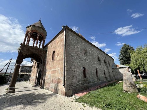
The old Turkish mosque. A trace of the three-century Ottoman period, of which little remains elsewhere in Georgia.
Vank Chapel. Small, but conspicuous in the town's skyline.
Monuments to Mesrop Mashtots and Archbishop Karapet Bagratuni. Mashtots created the Armenian alphabet, and a monument to him in a Georgian district centre explains the demographics better than any statistic.
Khas Park. The town park, with rare plants and shrubs, and the place locals go to walk.
The full list with addresses and reviews is gathered under things to see in Akhalkalaki.
🏔️ Beyond the Town: The Rest of the Municipality
Javakheti gets most interesting once you leave the district centre.
Kumurdo Cathedral, roughly ten kilometres from the centre. A domed church built in 964, one of the key monuments of Georgian architecture from that period and the main reason to drive out of town.
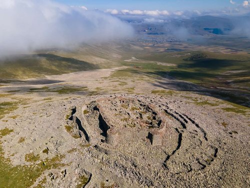
Abuli Fortress on the slopes of the volcanic massif. Cyclopean masonry, meaning a structure of huge undressed stones laid without mortar, with an age measured in millennia. The details are gathered in the piece on Abuli Fortress.
The churches of Murjakheti and Khorenia and other village churches of the municipality, which few visitors ever reach.
The Javakheti lakes and volcanoes. The plateau is studded with extinct volcanic cones and lakes, some of them within protected areas.
🚗 Getting There and What to See on the Way
The drive from Tbilisi used to take an unreasonable amount of time. A short road route opened in 2010, and once rail services began in 2017 the district stopped being isolated for good.
Today you can arrive by car via Akhaltsikhe, by marshrutka from Tbilisi, or by train. In winter allow extra time: snowfall on the plateau is common and passes are sometimes closed.
The road through Samtskhe runs past a whole string of monuments, so the trip is best planned as a route rather than a dash to one point. Along the way stand Atskuri Fortress at the mouth of the Borjomi gorge, the Khertvisi citadel at the meeting of two rivers, and the cave city of Vardzia. A little off the route lie Surami Fortress and Borjomi-Kharagauli National Park.
🧭 Where to Stay and What Is Nearby
Akhalkalaki's own accommodation is modest, so many people use the town as a daytime stop on a route and sleep in Akhaltsikhe or Borjomi.
Been to Akhalkalaki? Leave a review on Madloba: tell us what season you travelled in, whether you managed to reach the fortress, and what you would tell someone planning a Javakheti route for the first time.
Information is current as of July 2026. Transport links and road conditions on the plateau vary by season, so check before you travel, particularly in winter.
❓ Frequently Asked Questions
💬 In southern Georgia, in the Samtskhe-Javakheti region, on the Javakheti volcanic plateau at around 1,700 metres. The southern boundary of the municipality coincides with the state border between Georgia and Turkey.
💬 Akhalkalaki is reckoned the coldest district in the country, and the reason is altitude rather than latitude: the plateau is open and treeless, and winter here is long. Calling the district the northernmost is simply wrong, this is southern Georgia.
💬 It translates from Georgian as 'new town'. By the conventional dating the settlement received town status in 1064, so it stopped being new nearly a thousand years ago.
💬 It is a fortress town site rather than a single tower. Within the complex you can make out a citadel, towers, a caravanserai, the remains of a church with cells, domestic buildings and the ruins of a mosque. It is dated to the eleventh to thirteenth and the eighteenth centuries.
💬 The Russian army took it in 1811, the Treaty of Bucharest returned it to the Ottoman Empire in 1812, and on 22 September 1828 forces under General Paskevich took the town for good.
💬 Most of the municipality's population is Armenian, so Armenian is heard more often than Georgian, and many villages carry two names. It shows in the townscape too, from Surb Khach Church to the monument to Mesrop Mashtots.
💬 Kumurdo Cathedral of 964, about ten kilometres from the centre; the cyclopean fortress of Abuli; the village churches of Murjakheti and Khorenia; and the lakes and volcanic cones of the Javakheti plateau.
💬 By car via Akhaltsikhe, by marshrutka, or by train. The short road route opened in 2010 and rail services began in 2017, and the district has not been isolated since.
💬 From late spring to early autumn. Winter on the plateau is long and snowy and roads are sometimes closed, so a winter trip needs spare time and an eye on the forecast.
💬 Atskuri Fortress at the mouth of the Borjomi gorge, the Khertvisi citadel where two rivers meet, and the cave city of Vardzia. Slightly off the route are Surami Fortress and Borjomi-Kharagauli National Park.

35 comments
Log in to leave a comment