




🏔️ At 2,379 Metres: The History Behind Krestovy Pass and Its 1824 Cross
🏔️ Krestovy Pass on the Georgian Military Road
The highest point of the Georgian Military Road: 2,379 metres at the geographic saddle, up to 2,395 metres on the road surface itself. The pass crosses the Main Caucasus Range from the Terek valley into the Aragvi valley, between Gudauri and Kobi, and remains essentially the only year-round mountain crossing between Georgia and Russia.
🗺️ A One-Day Route: Tbilisi, Krestovy Pass, Kazbegi
~210 km one way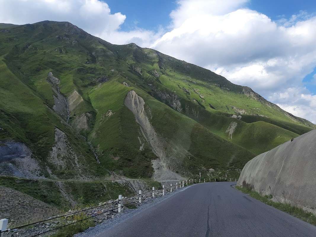
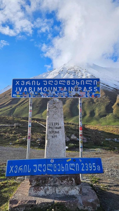
Krestovy Pass, also called the Gudauri Pass, is the highest point of the Georgian Military Road, the historic route linking Tbilisi and Vladikavkaz. The pass crosses the Main Caucasus Range at a geographic saddle of 2,379 metres, while the road itself, laid a little higher up the slope, climbs to 2,395 metres. It's the only practical crossing through the central part of the range: neighbouring passes sit considerably higher, have no roads, and stay buried in snow for more than half the year.
The pass takes its name from a stone cross marking the highest point of the route. Travelling here in the 19th century, Pushkin, Griboyedov and Lermontov all saw that cross, and later so did Alexandre Dumas père.
📍 Where the Pass Is and Why There's No Way Around It
Krestovy Pass lies between the villages of Gudauri and Kobi, in the Kazbegi Municipality, leading from the valley of the Terek River into the valley of the Aragvi. The stretch of road through the pass itself, from Gudauri to Kobi, runs about 15 km, and this 23-km section of the Georgian Military Road is considered the most difficult and dangerous on the entire route.
There's effectively no alternative: neighbouring passes across the Caucasus range sit considerably higher, have no roads at all, and stay closed under snow for more than half the year. That's what makes Krestovy Pass practically the only year-round way to drive from Russia into Georgia through the mountains, aside from occasional closures due to bad weather, mostly in winter.
✝️ Where the Name Comes From
The pass earned the name "Krestovy" (Cross) in 1824, when a stone cross marking the highest point of the route was erected here, or more precisely, renewed. A popular legend held that the cross was first put up by Peter the Great crossing the Caucasus, even though the cross itself bears an inscription stating it was placed by order of General Yermolov, specifically in 1824. Lermontov mentioned this confusion in A Hero of Our Time, noting that the legend persisted despite the inscription.
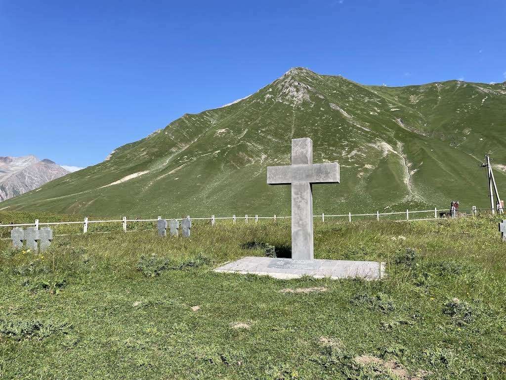
In fact, a cross had stood here even earlier; in 1824 it was simply renewed. It was seen by Alexander Pushkin and Alexander Griboyedov as they travelled the Georgian Military Road, and later, still in the 19th century, by Alexandre Dumas père. In his notes on the journey to Arzrum, Pushkin describes stopping at Kobi at the foot of "Krestovaya Gora" (Cross Mountain) and weighing how to make the climb, whether to abandon the carriages for Cossack horses or send for Ossetian oxen.
After the road was shifted slightly and paved in 1863, the historic cross ended up about 50 metres off the modern route. Most travellers today photograph themselves at the pass marker right on the road, but it's worth walking those fifty metres to see the actual stone.
The pass's other name, Gudauri Pass, comes from the village of Gudauri, today known as a ski resort.
🏗️ The Road Across the Range: From Pack Trail to Tunnel
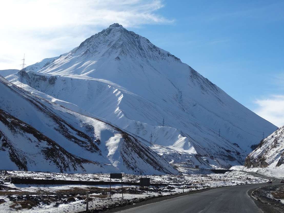
The route over Krestovy Pass has been known since antiquity as the Darial route. Systematic development of the road began after 1783, when the Treaty of Georgievsk placed the Kingdom of Kartli-Kakheti under the protectorate of the Russian Empire, and the Russian military administration took over building and maintaining the route. In 1799 the road opened as a pack trail, and by 1814 it had become passable for wheeled carriages. Between 1825 and 1827, eleven postal stations appeared along the route, including Kobi and Gudauri on either side of the pass.
In 1837 an attempt was made to bypass the difficult section via the Gudamakari and Gudushauri gorges and the Kvenati Pass, but ten years later, in 1847, after further surveys, the route reverted to the original path over Krestovy Pass. It has remained the main route ever since.
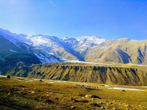
Today, a road tunnel is under construction beneath the pass, part of the new Kvesheti–Kobi road, which forms part of the North-South international transport corridor. Once complete, the roughly 9-km tunnel will become Georgia's longest and will bypass the dangerous section underground. Construction began in 2021; tunnel boring was completed by 2024, and full commissioning of the road is expected in 2028, according to plans published as of 2025. It's worth checking the current status before your trip, as timelines for large infrastructure projects often shift.
🌋 A Volcanic Plateau and a Mineral Spring
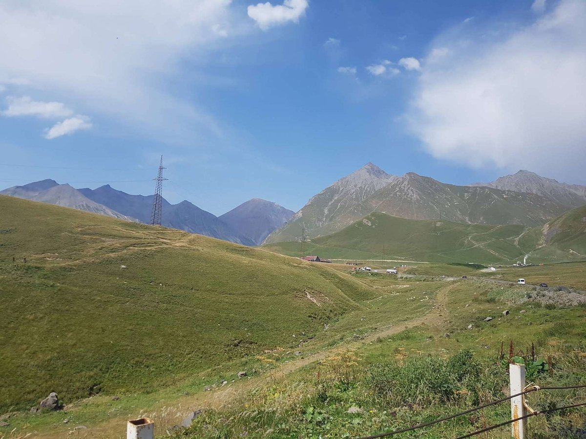
West of the pass lies the Kel Volcanic Plateau, and from the road you can clearly see an extinct volcanic massif known as the "Seven Brothers." Not far from the road there's a mineral spring that forms a small smoky-blue pool, narzan water, and travellers often stop here to stretch their legs after the switchbacks and try the cold mineral water.
Five avalanche galleries have been built along the dangerous stretch to protect the road from snow slides. Even so, in severe weather, most often in winter, traffic through the pass is sometimes temporarily suspended.
🚡 The Cable Car and Getting There
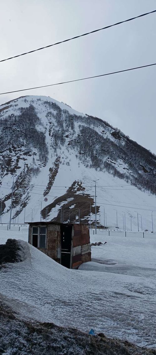
Since 2019, a cable car has run near the pass, connecting the village of Almasiani, at the start of the Truso Gorge, with the Gudauri ski resort. The route, with two transfers, covers about 7.5 km, in cabins that hold up to ten people. It's not just a tourist attraction with views over the pass and surrounding mountains, but also a backup way to get around on days when the road through the pass is blocked by bad weather.
Reaching the pass yourself is straightforward by car or as part of a tour along the Georgian Military Road: from Tbilisi via Gudauri, the drive takes a few hours depending on traffic and weather. From Krestovy Pass, it's about 26 km further to Stepantsminda (Kazbegi).
🗺️ Krestovy Pass on the Map
Open in Google Maps🗿 What to See Nearby
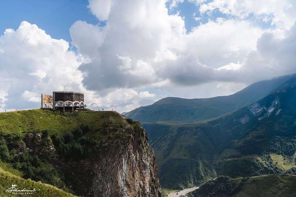
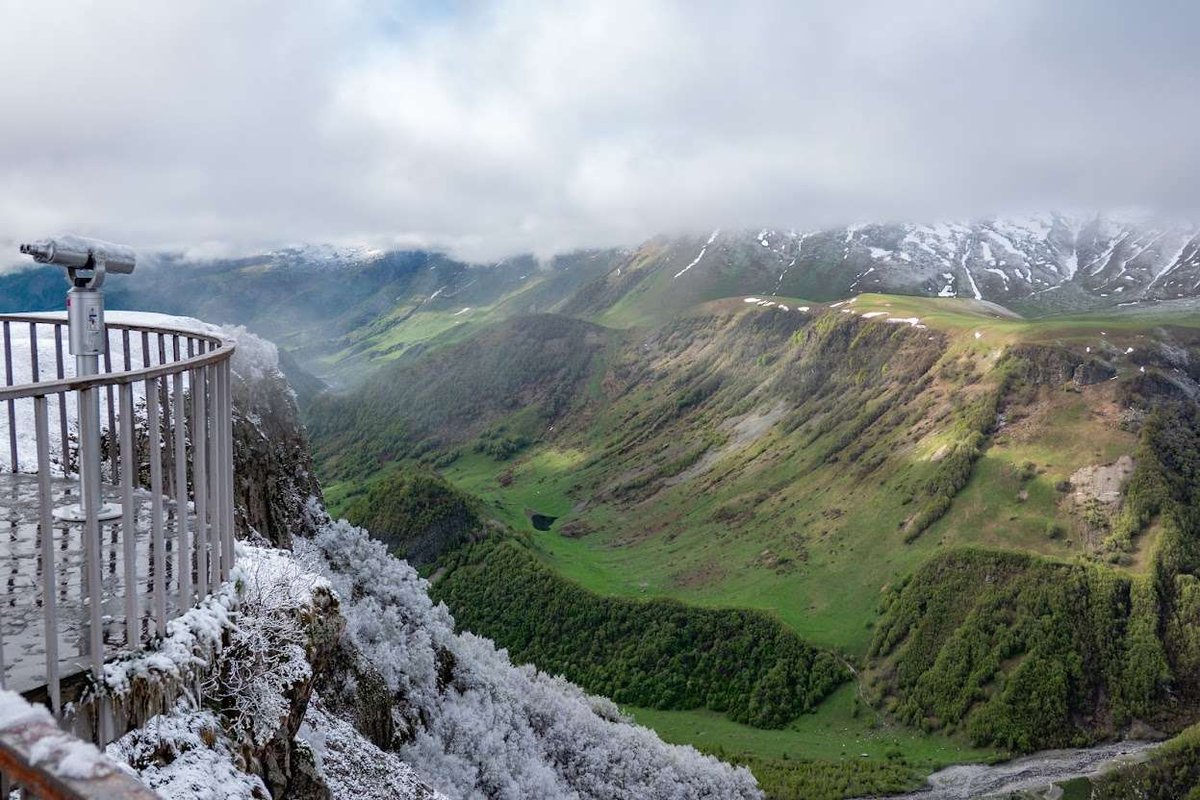
Near the pass, on the Gudauri side, there's a viewpoint with the Russia-Georgia Friendship Arch, built in 1983 to mark the 200th anniversary of the Treaty of Georgievsk, offering one of the most famous panoramas on the whole road. On the way to Stepantsminda, the route passes Sno Fortress and, closer to the town itself, the famous Gergeti Trinity Church set against Mount Kazbek.
In the other direction, closer to Tbilisi, the route runs past Zhinvali Reservoir and Ananuri Fortress, so the whole stretch of the Georgian Military Road, from Tbilisi to Stepantsminda, easily makes a full day trip with Krestovy Pass as its high point, literally and figuratively.
Krestovy Pass isn't just the highest mark on a map: it's a place where you're standing on the very ridge that splits the Caucasus in two, beside a cross that remembers Pushkin and Lermontov, near extinct volcanoes and a mineral spring. The drive here is demanding, but points like this are exactly why people travel the Georgian Military Road, not simply to get from one city to another.
Have you driven over Krestovy Pass? Share in the comments on Madloba: what the road was like, whether you found the historic cross off to the side, and what stuck with you most.
Information is current as of July 2026. In winter and bad weather, the road through the pass can close temporarily due to avalanche risk, check the road status before your trip. Timelines for the tunnel construction beneath the pass may change.
📚 Read Next the Georgian Military Road and Kazbegi
❓Frequently Asked Questions
Between the villages of Gudauri and Kobi, in the Kazbegi Municipality, on the Georgian Military Road linking Tbilisi and Vladikavkaz.
The geographic saddle sits at 2,379 metres above sea level, and the road itself climbs to 2,395 metres at its highest point.
After the stone cross marking the highest point of the route. The cross was renewed in 1824 on the orders of General Yermolov, though it had stood there earlier too.
Alexander Pushkin, Alexander Griboyedov and Mikhail Lermontov in the 19th century, and later Alexandre Dumas père. Pushkin described stopping at Kobi at the foot of "Krestovaya Gora" in his notes on the journey to Arzrum.
Practically yes, it's the only mountain crossing between Georgia and Russia that's open nearly all year. Temporary closures are possible in winter due to avalanche risk.
Yes, a tunnel about 9 km long, part of the new Kvesheti–Kobi road. Boring was completed in 2024, with full commissioning expected in 2028 based on plans published in 2025.
The viewpoint with the Russia-Georgia Friendship Arch, the volcanic plateau with the extinct "Seven Brothers" volcanoes, and a mineral spring not far from the road.
There's a cable car nearby connecting the village of Almasiani to the Gudauri resort, but it links the resort with the gorge rather than replacing the drive over the pass itself.
From Tbilisi, it's a few hours' drive via Gudauri, depending on traffic and weather. From the pass, it's about 26 km further to Stepantsminda (Kazbegi).

3 comments
Log in to leave a comment