




💧 A Trout Lake in Lechkhumi Where the Climb to Askhi Plateau Begins
Kulbaki Green Lake at a Glance
A small artificial trout lake near the village of Kulbaki in Lechkhumi. People come here to pitch a tent, have dinner by the water and, above all, to start the climb up to the Askhi Plateau.
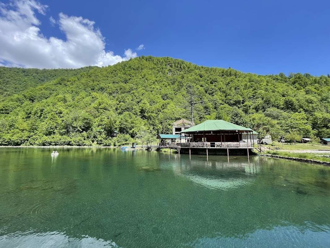
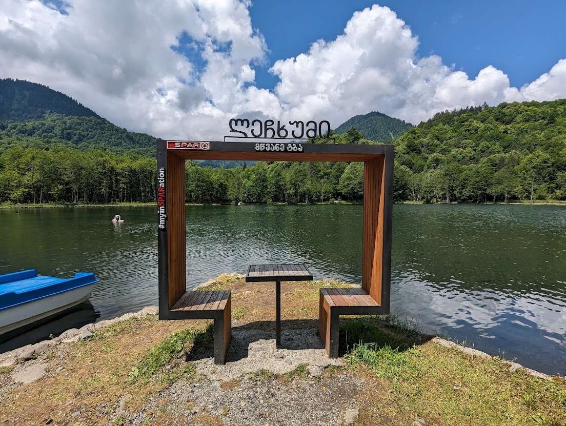
Let's clear one thing up right away, because almost everyone trips over it. If you typed "green lake Georgia" into a search box and landed here, there's a decent chance you were looking for somewhere else entirely. Georgia has several green lakes, and they're scattered across opposite ends of the country.
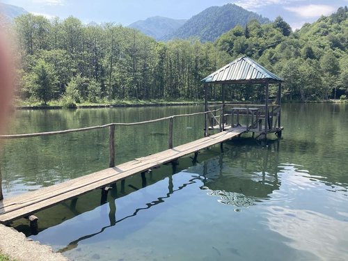
The lake we're talking about sits near the village of Kulbaki, in Lechkhumi, and hand on heart, it won't make a postcard. What it does have is something else: it stands exactly where the road up to the Askhi Plateau begins, one of the most underrated places in western Georgia.
💚 Hold On, Which Green Lake?
Fair question, and worth answering before you drive anywhere.
Three Georgian "Green Lakes" That Keep Getting Confused
All three share a name, but they sit in different regions and look nothing alike.
So if someone promised you turquoise water surrounded by alpine meadows, you're headed for Adjara. If you want quiet, trout and a solid climb into the mountains, then welcome to Kulbaki, read on.
🎣 What This Lake Actually Is
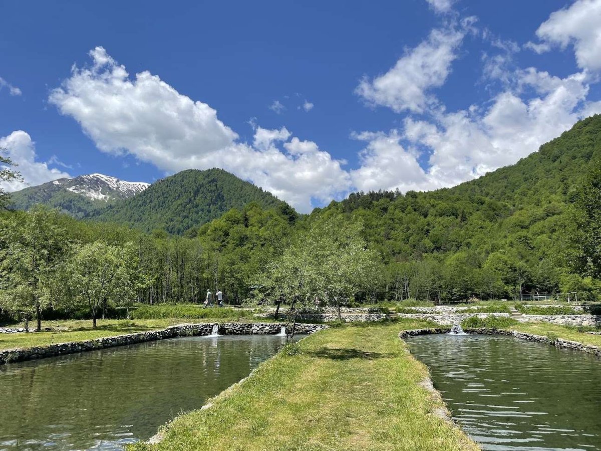
No dressing this up: the lake is artificial, and it's essentially a trout farm. Not a natural monument, not a glacial lake, not a geological marvel. Just a man-made pond in the mountains, with a small life of its own grown up around it.
And you know what? There's nothing wrong with that, as long as you understand why you're coming. People come here to pitch a tent by the water, nobody chases you off. They come for dinner, and trout is very much the local specialty. And they come to use it as a base camp before heading up to the plateau. That last one is the real draw.
🚗 Getting There
The drive is straightforward enough, once you know the turn. From the Tsageri road, turn onto the newer concrete road toward the village of Chkumi. Drive through Chkumi, the gravel starts, and about four kilometres later you're at the lake.
You'll want a car that copes with rough surfaces, gravel is gravel. There's no public transport out here, so it's your own car, a rental, or an arrangement with locals.
⛰️ And Now the Real Reason People Come
This is what the whole thing is about. The climb to the Askhi Plateau starts from the lake, and that's a different conversation entirely.
Look closely at those numbers: 4.5 kilometres sounds like nothing, but 1.2 kilometres of elevation gain is a serious mountain climb. Six hours just going up, and that's for someone of average fitness. So "I'll head out in the morning and be back by lunch" isn't happening here.
The horseback option, by the way, isn't a tourist gimmick, it's a normal local way of getting up there. If your legs aren't feeling it, ask around in the village.
🗺️ What the Askhi Plateau Is, and Why It's Worth the Climb
Askhi is the highest karst massif in western Georgia, 2,519 metres, covering roughly 450 km². Look at it on a map and the plateau is shaped something like a fish: it starts in the west at the Tekhuri river gorge and drops away sharply in the east toward the Kvereshule and Tskhenistskali rivers.
Here's the thing, though: Askhi remains poorly studied. It's officially a protected natural area of Georgia, and yet research on it is genuinely thin, which for 21st-century Europe borders on remarkable. Its caves are home to some fairly rare residents, including the cave cricket Dolichopoda euxina and underground amphipods of the genus Niphargus.
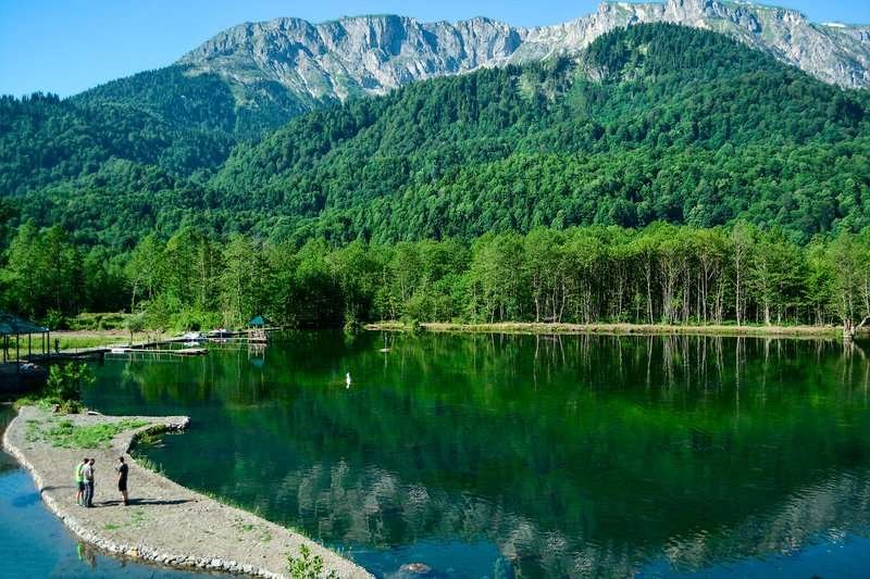
That said, the plateau is far from deserted. People from the surrounding villages, Zubi, Okureshi and Kulbaki, drive cattle and horses up there for long grazing seasons, and there's a herders' hut by a lake on the plateau itself. So you're climbing into a working landscape, not a sterile reserve, one where livestock has been grazed for centuries.
If you want the route itself in more detail, we have a separate piece on the Zubi, Askhi massif and Kulbaki route, which walks through the path properly.
And one more detail that explains a lot about this area: the Kinchkha waterfalls and Okatse canyon, the ones every tourist knows, are fed by the waters of Askhi and its karst streams. The plateau is effectively the water tower for half the region's famous sights, and hardly anyone knows it exists.
🎒 What to Bring
If you're just coming to the lake for an evening, it's simple. If you're planning the climb, the list changes.
If You're Heading Up to the Plateau
Askhi is a long way from any city, and there's not much up there to rely on.
One more note on driving: you can reach the approaches to the plateau from several directions, from Imereti via Kinchkha, from Samegrelo via Balda or Salkhino, from Lechkhumi via Isunderi or Kulbaki. What makes the Kulbaki route appealing is precisely this: there's somewhere decent to spend the night by the water before you set out.
Been to the Green Lake at Kulbaki, or climbed up to Askhi from here? Leave a review on Madloba: tell us what shape the gravel road was in, how long the climb actually took, and whether the horses are worth it. There's very little information out there about Askhi, so your experience genuinely counts.
Information is current as of July 2026. Road and trail conditions can change, so check locally before you set out.
📚 Read Next Askhi and Lechkhumi in more detail
❓ FAQ
💬 Near the village of Kulbaki in the Tsageri Municipality, in the historic region of Lechkhumi, part of Racha-Lechkhumi and Kvemo Svaneti.
💬 No. The famous Green Lake (Mtsvane Tba) is in Adjara, near the Goderdzi Pass. There's also a Green Lake in Tskaltubo. The Kulbaki one is a third, entirely separate place.
💬 No, it's artificial, stocked with trout. It's not a natural monument but a man-made pond, though it makes a handy base before heading up to the Askhi Plateau.
💬 From the Tsageri road, turn onto the concrete road toward Chkumi village, drive through it, then about four kilometres of gravel. There's no public transport out here.
💬 Yes, people do occasionally pitch tents by the lake, it's a common enough practice.
💬 About 4.5 km of route with roughly 1.2 km of elevation gain. At average fitness that's around six hours for the climb alone. You can also ride up on horseback.
💬 The highest karst massif in western Georgia, at 2,519 metres, covering roughly 450 km². It's a protected natural area, yet it remains thinly researched.
💬 Yes, people from the villages of Zubi, Okureshi and Kulbaki graze cattle and horses there, and there's a herders' hut by a lake on the plateau.

5 comments
Log in to leave a comment
თქვენი აზრით, როგორი იქნება ასხის პლატოზე ასვლა, თუ ადრე ჯერ არ ყოფილხართ?