




💧 Eight Lakes of Mtskheta-Mtianeti: Which Are an Hour from Tbilisi and Which Need a Trek
💧 The Region Has Two Completely Different Kinds of Water
Mtskheta-Mtianeti runs from the outskirts of Tbilisi to the Greater Caucasus ridge, and its lakes split along exactly that line. Some are an hour away on tarmac; others sit at 2,600 metres at the end of a six-kilometre trail. Choose by how much time you have and what you're driving, not by whose photos you saw.
Tsodoreti and Chili — near Mtskheta, picnics by the water
Bazaleti — 879 m, a resort with a sanatorium, 5 km from Dusheti
Sioni Reservoir — fishing and swimming, 45 km from Tbilisi
Zhinvali Reservoir — turquoise below Ananuri fortress
Abudelauri — Green, Blue and White
Altitude 2,600 m, Khevsureti, glacial
6–7 km of trail from Roshka, 600 m of ascent
Season is June and July; frozen until May
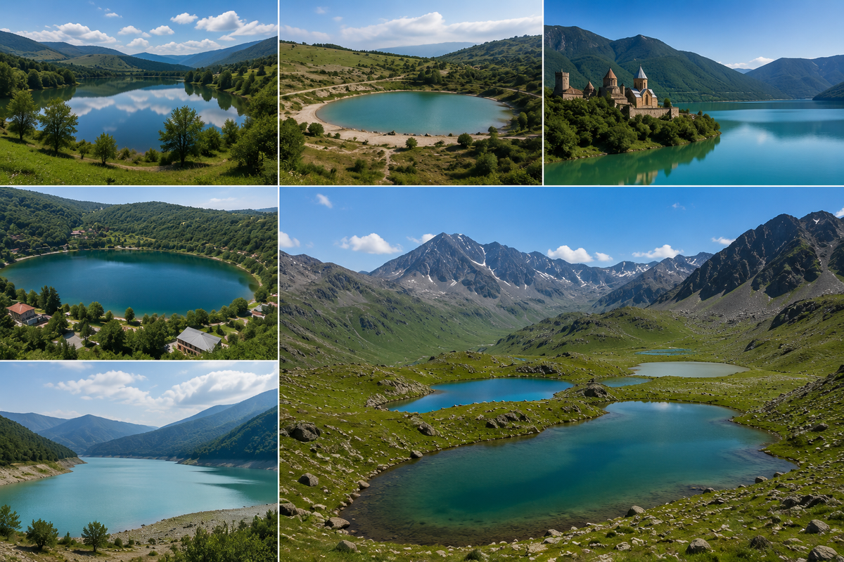
The lakes of Mtskheta-Mtianeti come to eight bodies of water, and they have less in common than you'd expect. The region stretches more than a hundred kilometres north to south: it starts at the edge of Tbilisi and ends against the Greater Caucasus ridge. The water at those two ends differs in everything, in origin, in colour, in season, and in what it takes to reach it.
Down low, on the Bazaleti plateau and in the valleys, sit Tsodoreti, Chili, Bazaleti, and the Sioni and Zhinvali reservoirs. These are day trips: drive out, eat, swim, drive back. Up high, in Khevsureti at 2,600 metres, sit the three Abudelauri lakes, reached by a mountain trail whose access road isn't passable in just any car.
What follows runs south to north, and bottom to top.
🚗 Tsodoreti and Chili: Lakes Below Mtskheta
Both sit in Mtskheta Municipality, both are half an hour from Tbilisi, and both are considerably more modest than the photos suggest.
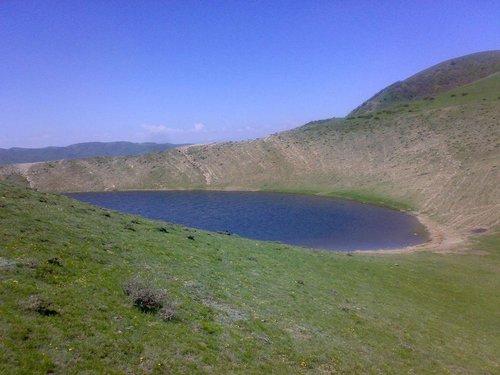
Tsodoreti (41.76573, 44.63070) lies beside the village of the same name, 12 km from Mtskheta. A small, isolated lake in a quiet spot with hills around it. Here's the thing guidebooks leave out: depending on the season and rainfall, the lake can dry out to the bottom. Locals who come here for picnics say the same thing every time: it's no good for swimming, but the surroundings are lovely. So if you're making a special trip, check recent photos or ask on arrival whether there's water. Details and pictures on the Tsodoreti lake page.
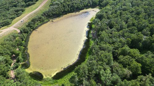
Chili (41.81241, 44.67865) is closer to Mtskheta, just 5 km, and the same distance from Tbilisi as Tsodoreti. We have a separate piece on Lake Chili covering how to get there and what's around.
Neither is a destination, honestly. They're a pleasant stop. Their strength is elsewhere: from central Tbilisi they're closer than many parts of Tbilisi itself at rush hour.
🌋 Bazaleti: A Volcanic Lake with No Inlet and No Outlet
The only lake in the region with its own legend, its own battle and its own sanatorium.
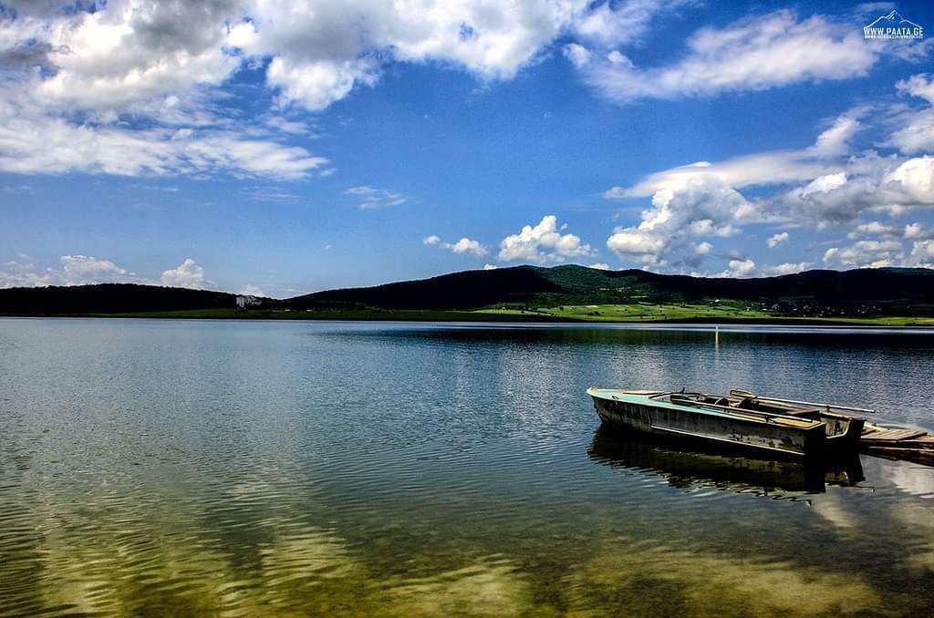
It sits at 879 metres, 5 km from Dusheti and about 40 from Tbilisi (42.03808, 44.67911). Area 1.22 km², maximum depth just 7 metres. The origin is volcanic, and its defining feature is total isolation: no river flows in and none flows out. A source is known to exist, but nobody has found it.
The history here is dense. A medieval town stood around the lake. The Battle of Bazaleti was fought nearby in 1626. In the Soviet period they farmed fish here, mostly carp. Today it's a resort: a sanatorium, therapeutic mud, boat and pedalo hire, a developed shoreline.
And the legend it's remembered for goes like this. On the bottom, in a cradle of pure gold, sleeps a golden-haired infant, and the lake itself formed from the tears of his mother, weeping on the shore. There's a second, more down-to-earth version: a well stood here, a bull fell into it, the water splashed out and spread. More on the resort side in Lake Bazaleti.
💧 Sioni Reservoir: A Village on the Bottom
The region's largest body of water after Zhinvali, and the only one with a village underneath it.
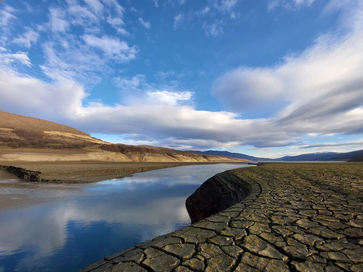
Created in 1963 on the Iori river, between Sioni settlement and Lelovani village in Tianeti Municipality (41.99798, 45.00656). The numbers are serious: 12.8 km² of surface, 67 metres at its deepest, 25.4 on average, over 325 million cubic metres of volume, a catchment of 587 km². The altitude is around 1,000 metres, it's 45 km from Tbilisi, the Tbilisi–Tianeti road is scenic, and even a marshrutka makes it in about an hour.
Filling the basin meant flooding several old villages. Part of Sioni village still lies on the bottom, along with an old church. Hence the local nickname, the Sioni Sea.
The banks differ: the right one is steep and rocky with landslide scars, the left is gentler, with deciduous forest higher up the slopes. Water peaks in July and bottoms out in March; temperatures run from 2.7°C in February to 23–24°C in August. People come to fish, swim and take a boat out. The area counts as a climatic resort, where lake, mountain and forest air meet in one place, covered in our piece on the Sioni climatic resort. The site page is Sioni Reservoir.
🏞️ Zhinvali Reservoir: That Turquoise You've Seen
If you've seen a photo of Georgia with vividly turquoise water and a fortress on the shore, it's almost certainly Zhinvali.
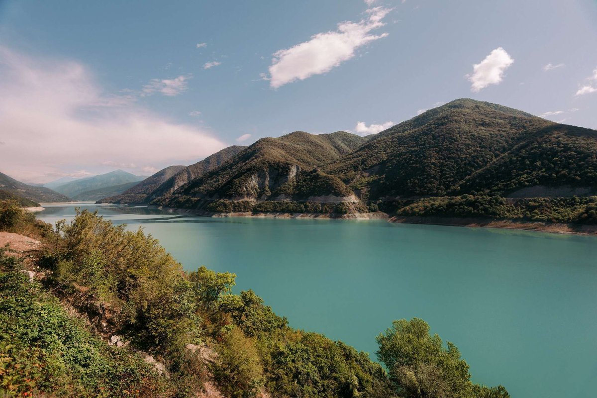
It sits on the Georgian Military Road, 40 km north of Tbilisi, in Dusheti Municipality (42.14974, 44.77239). Six kilometres away stands Ananuri fortress, the vantage point every photo is taken from. The basin lies where the White Aragvi and the Pshavi Aragvi meet.
The colour has a simple explanation, and it's more interesting than "magic": the water here is very deep, the bottom drops to 75 metres, and sunlight refracts through the column so the surface reads as turquoise. Which means on an overcast day, or in the shallows, you won't get that picture: the colour needs sun and depth.
The easiest way to see it is from the E117 on the way to Kazbegi, with the reservoir on your right. Site page: Zhinvali Reservoir.
🏔️ The Coloured Abudelauri Lakes: Three of Them at 2,600 Metres
This is where the tarmac ends and a different Georgia begins.
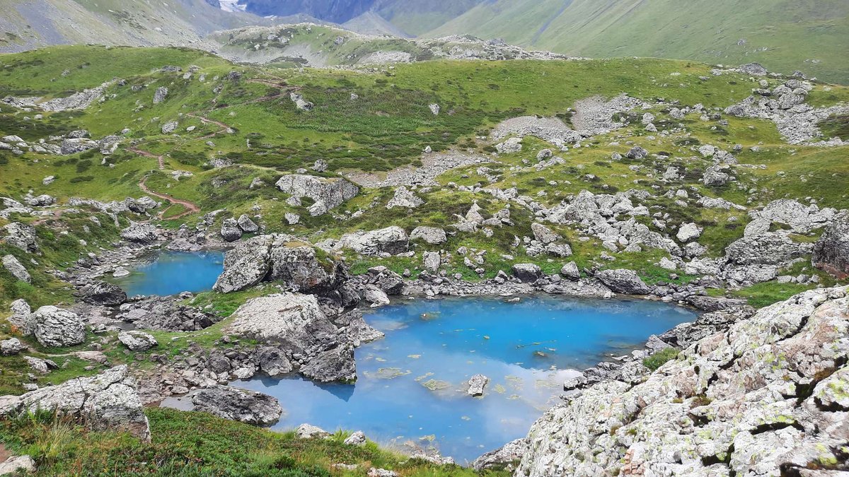
Three glacial lakes sit at the head of the Abudelauri river gorge, in Khevsureti, Dusheti Municipality, at around 2,600 metres. They're fed by meltwater from the Abudelauri glacier and by rain. They're called coloured because each holds a different shade.
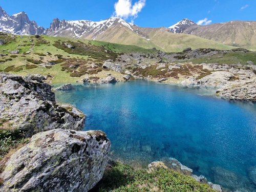
Walking up from Roshka, the order runs like this. Green comes first (42.54328, 44.83958), cupped in soft grassy slopes. Two hundred and thirty-five metres on, practically alongside it, sits Blue (42.54448, 44.83722): deep, with clear icy water fading into turquoise darkness. Another kilometre and a half brings you to White (42.54617, 44.81994), right at the foot of the Chaukhi massif. It's milky white, and that isn't a trick of the light: the colour comes from mineral suspension carried down off the glacier.
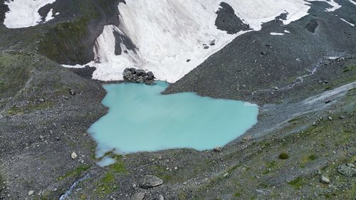
The approach works like this. The starting point is Roshka village at around 2,000 metres, roughly 3 hours' drive from Tbilisi, with the final stretch best tackled in a high-clearance 4x4. Then the trail: 6–7 km one way, about 600 metres of ascent, waymarked, hard to lose. Gentle at first, then a climb. A second option comes from the west, over the Chaukhi pass from Juta, but it's markedly harder and suits people doing a point-to-point route.
The season is narrow. The lakes freeze in November and stay under ice until May. The peak is June and July. By August, White drops sharply and all but dries out. So "a quick autumn trip to the coloured lakes" isn't a thing: you'll arrive to snow or to a puddle.
A full breakdown of the route and what's up there is in The Abudelauri Lakes. Site pages: Blue Lake and White Lake.
📋 Eight Lakes: Altitude, Origin, Access, Season
🗺️ The Lakes of Mtskheta-Mtianeti on the Map
Open in Google Maps📅 When to Go: Top and Bottom Run on Different Calendars
The main planning mistake is assuming the region has one season. It has two, and they barely overlap.
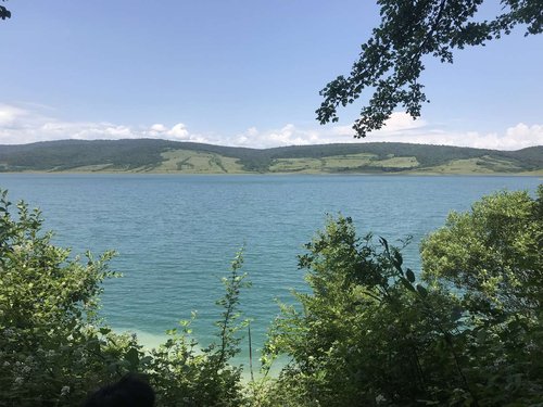
The lower waters run on an ordinary summer-holiday schedule. Sioni warms to 23–24°C by August and drops to 2.7 in February. Its level peaks in July and bottoms out in March, so the shoreline in spring looks nothing like it does in summer. Bazaleti operates as a resort year-round, though swimming only makes sense in the warm months. Zhinvali is beautiful when the sun is out; without it the turquoise never appears. Tsodoreti depends on rainfall and can vanish in a dry summer.
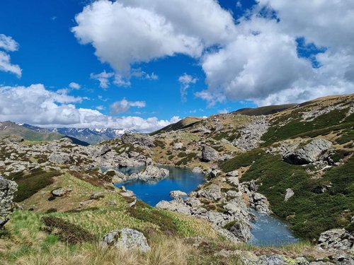
Abudelauri runs on a mountain calendar, and it's unforgiving. Ice sets in November and holds until May. Realistically you can walk in June and July. By August, White has dropped sharply, because the glacier is feeding it less. Then snow again. A two-month window a year.
Which gives a simple rule: if you're in Georgia in May or September, don't plan on Abudelauri, but the lower lakes will be fine.
🗿 What Else Is Nearby
Lakes are rarely the point here, and that's fine: they slot neatly into routes you were driving anyway.
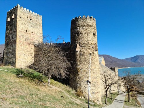
Zhinvali sits directly on the road to Kazbegi, with Ananuri fortress six kilometres away, the spot every photo comes from. Tsodoreti and Chili are half an hour from Mtskheta, the ancient capital. Abudelauri belongs to the larger Khevsureti story of stone towers and the Chaukhi pass.
If the water theme lands for you, we have a comparable breakdown for another region: the rivers, waterfalls and lakes of Racha-Lechkhumi, where the water is organised differently, around one large river.
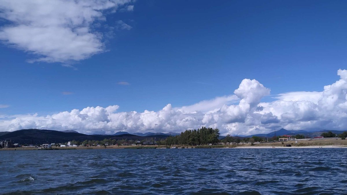
Boil it all down and it comes to this: in Mtskheta-Mtianeti there's no such thing as "going to see the lakes." There's an hour in the car and a barbecue by the water, or there's a two-month window, a 4x4 to Roshka and six kilometres uphill. Those two scenarios share nothing but an administrative boundary. Choose honestly, based on your time and your legs, not on someone else's photographs.
Been to the lakes of Mtskheta-Mtianeti? Tell us in the comments on Madloba: which ones you reached, in which month, and whether Tsodoreti had any water in it.
Information is current as of July 2026. The water level at Tsodoreti depends on season and rainfall, and the lake can dry out. The Abudelauri lakes are accessible roughly from June to July, and the road to Roshka requires a 4x4. Check the weather and road conditions before setting off.
📚 Read Next the region's water in detail
❓ Questions and answers
Eight bodies of water: Tsodoreti and Chili below Mtskheta, Bazaleti near Dusheti, the Sioni Reservoir near Tianeti, the Zhinvali Reservoir on the Georgian Military Road, and the three Abudelauri lakes in Khevsureti, Green, Blue and White.
Tsodoreti and Chili, both about 14 km from the city and half an hour's drive. Bear in mind that Tsodoreti can dry out in a dry season.
In Khevsureti, Dusheti Municipality, at around 2,600 metres. You walk from Roshka village, 6–7 km one way with about 600 m of ascent on a waymarked trail. Roshka is about 3 hours from Tbilisi, and the last stretch of road is best done in a 4x4.
Because of the water: Green, Blue and White. Green sits in grassy slopes, Blue is deep and turquoise, White is milky from mineral suspension off the glacier. All three are glacial in origin.
June and July. The lakes freeze in November and stay under ice until May, and by August White has shrunk sharply and nearly dries out. It's a two-month window.
Because sunlight refracts through the water column: the bottom drops to 75 metres. So the colour shows on sunny days and over deep water; on an overcast day you won't get the picture.
Yes, in the warm season. The lake has a resort with a sanatorium, therapeutic mud, and boat and pedalo hire. Maximum depth is only 7 metres.
Created in 1963 on the Iori river, 12.8 km² in area, up to 67 metres deep. Filling it flooded several villages; part of Sioni village and an old church still lie underwater. The water reaches 23–24°C by August.
By tradition, a golden-haired infant sleeps on the bottom in a cradle of pure gold, and the lake formed from his mother's tears. Another version has it that a well stood here, a bull fell in, and the water splashed out and spread.
The Sioni Reservoir: it's fed by the Iori, which holds nearly every fish species in eastern Georgia. In the Soviet period fish were also farmed at Bazaleti, mostly carp.

5 comments
Log in to leave a comment
Непонятно, как меняются переживания с каждым новым визитом - вроде одни и те же места, а чувства совершенно разные. Могу сказать одно: эти озёра создают нечто совершенно особенное. В такие моменты понимаешь, что красота прячется не только в ландшафтах, но и в самом процессе поиска, в том, как пробираешься к ним. Каждое озеро - это словно новая история, и они меня не отпускают.