




🏔️ Twin-Peaked Ushba: 4,710 Metres Above Svaneti That Few Ever Reach
Mount Ushba at a Glance
A twin-peaked granite mountain above Svaneti, its southern summit reaching 4,710 m and the northern one around 4,690 m. Known as the "Matterhorn of the Caucasus" for its two-horned silhouette, best seen from the village of Mazeri.
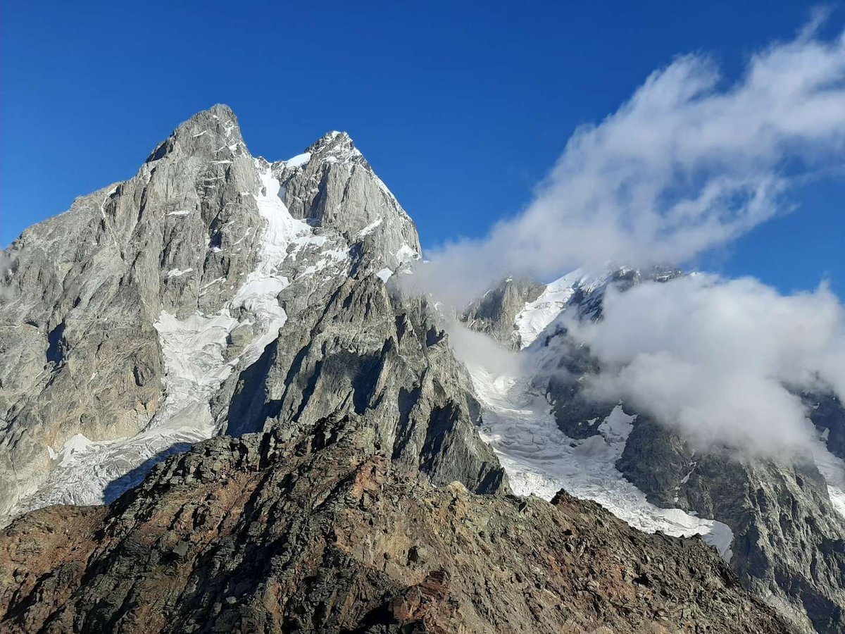
Mount Ushba rises above Svaneti as two granite summits, a southern one at 4,710 metres and a northern one at roughly 4,690 metres, joined by a narrow saddle. It's one of the most recognisable and, at the same time, one of the most dangerous peaks in the Greater Caucasus, and that combination, beauty and risk in equal measure, is exactly why so much gets written about Ushba and so few people actually stand on top of it. For the full listing, coordinates and photos, see the mountain's entry in the Madloba catalogue.
The rest of this article keeps two things clearly separate, since they're often confused: the hike to the glacier, open to ordinary hikers, and the technical climb to the summit, which is not.
🔤 The Name and the Legend

In Svan, the mountain's name translates roughly as "the mountain that brings misfortune": "ush" means disaster or misfortune, "ba" means mountain. There's also an alternative reading from Karachay-Balkar, where "üch bash" means "three-headed mountain." Both versions appear in the sources, and there's no single agreed origin.
A local legend ties the mountain to a hunter named Betkil, who climbed the peaks of Svaneti with ease in search of game until the day he set out for Ushba itself, and to Dali, the goddess of animals and mountains in Svan folklore, who fell in love with him. Legends like this are part of why the mountain was regarded as mysterious, almost sacred, long before alpinists took any interest in it.
⛰️ Two Summits, Granite, and Glaciers
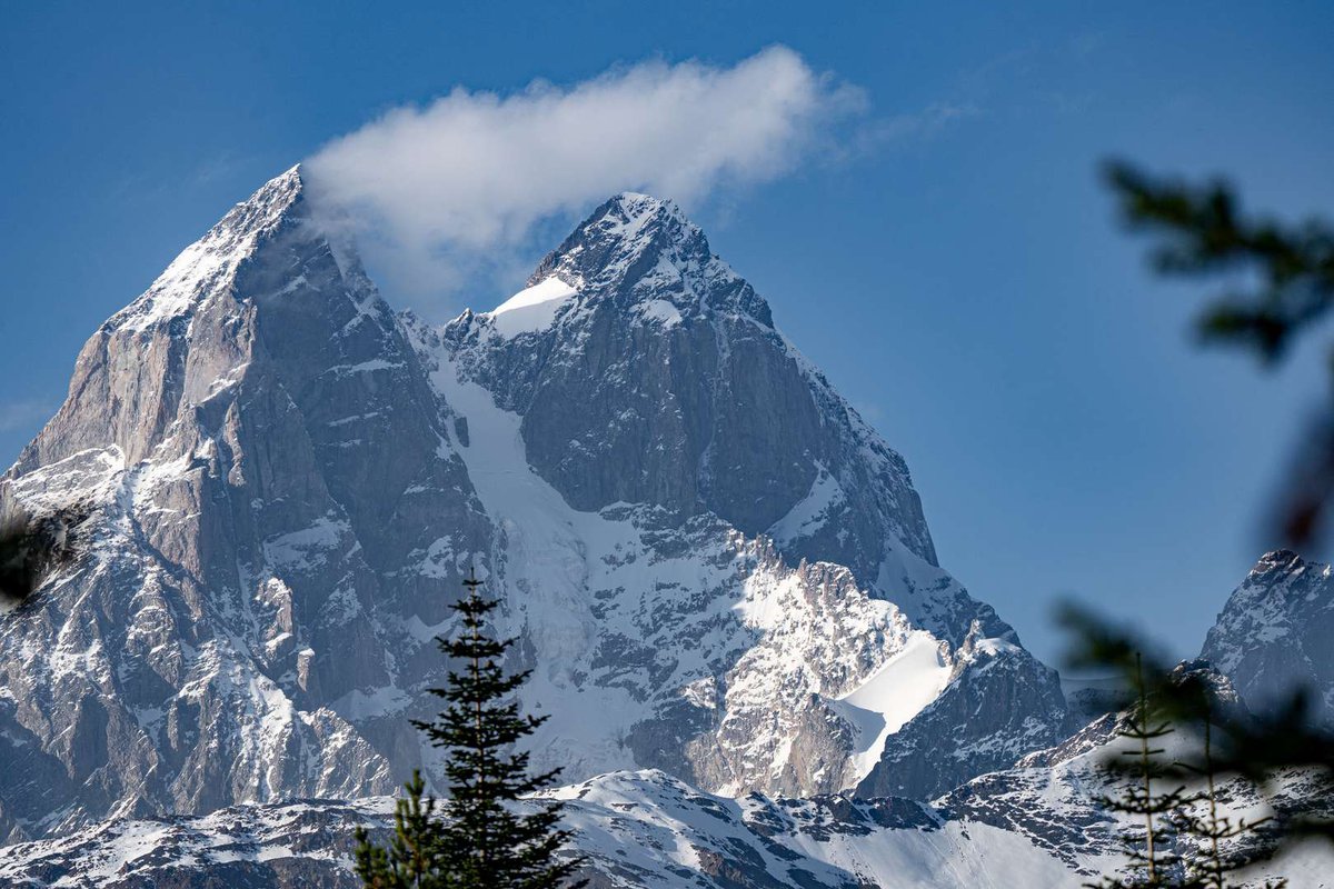
Ushba is built of granite rather than the sedimentary rock common to many neighbouring peaks, which is part of why its silhouette is so sharp and rocky. Two glaciers flow off the mountain, the Gul and the Ushba, feeding the rivers that eventually reach the well-known Ushba Waterfall in the same area, worth combining into one trip if you're planning a visit to Svaneti.
It's the twin-summit silhouette that earned the mountain its nickname, "the Matterhorn of the Caucasus," after the famous Alpine peak. That distinctive two-horned view only appears from a particular angle, though, best seen from the village of Mazeri, which is also where most routes up the mountain begin.
🧗 A History of Ascents, and the "Ushba Mirror"
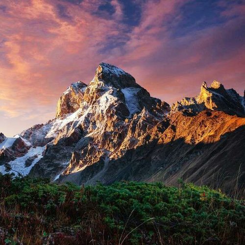
The north summit was first climbed in 1888 by the Briton John Garford Cockin and the Swiss Ulrich Almer. The south summit, more difficult, held out until 1903, when a German-Swiss-Austrian expedition reached it. Ascents remained rare for decades afterward: between 1888 and 1936, only ten climbers repeated the north summit and just five reached the south.
One of the mountain's most notorious technical sections, the so-called "Ushba Mirror," a smooth vertical rock wall over a kilometre long on the north face, wasn't climbed until 1964. That first ascent was made by Mikhail (Gabriel) Khergiani, a Soviet alpinist born in Svaneti.
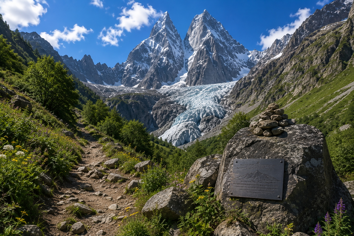
It's worth being honest here: Ushba is known for more than its beauty. Along the trail to the glacier stands a memorial stone with plaques honouring climbers who died on the mountain over the decades. These aren't isolated incidents, they're part of the mountain's history, and not something worth glossing over.
🥾 The Glacier Trek: Open Without Climbing Experience
For anyone not planning a technical ascent, there's a hiking route to the Ushba Glacier and the memorial stone. The trek starts in Mazeri, takes roughly eight hours one way, and requires no climbing gear, ordinary good fitness is enough. Along the way, you get views of the glacier itself, an ice cave, and that famous twin-peaked silhouette.
It's a reasonable way to get close to Ushba without taking on the risks of a technical climb.
🧗♂️ Summiting the Peak: For Experienced Climbers Only
Actually climbing Ushba is an entirely different undertaking. The north summit is rated 4A to 6A, the south summit 5A to 6A, on the Soviet/Russian grading system, both among the highest difficulty categories. The classic route to the north summit, via the Ushba Pass, takes 8 to 16 hours depending on the team's fitness and the weather, not counting the multi-day acclimatisation climbs that come before it.
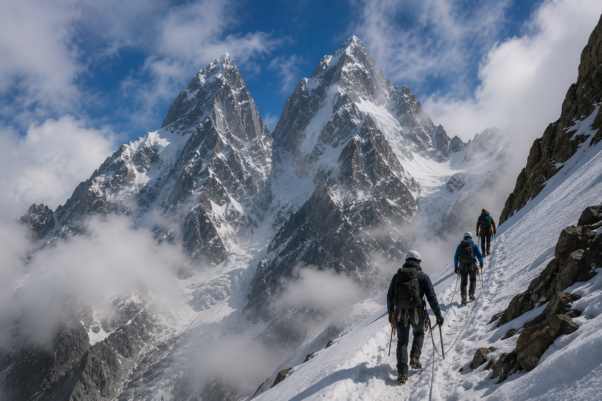
This is not a route for beginners, full stop. Organisers of serious programmes recommend prior ascents of Elbrus or Kazbek, a mountaineering course, and solid rope and rock-climbing skills before attempting Ushba. The mountain has its own unpredictable microclimate: the valley can be clear while the summits sit wrapped in cloud. Climbing from the Russian side, incidentally, is prohibited, that territory falls within a border zone.
If you're seriously considering an ascent, it has to be with a qualified guide, through an organised programme with proper registration with border and rescue services, never solo.
🥾 Glacier Trek
🧗 Summit Climb
👀 Where to See Ushba From
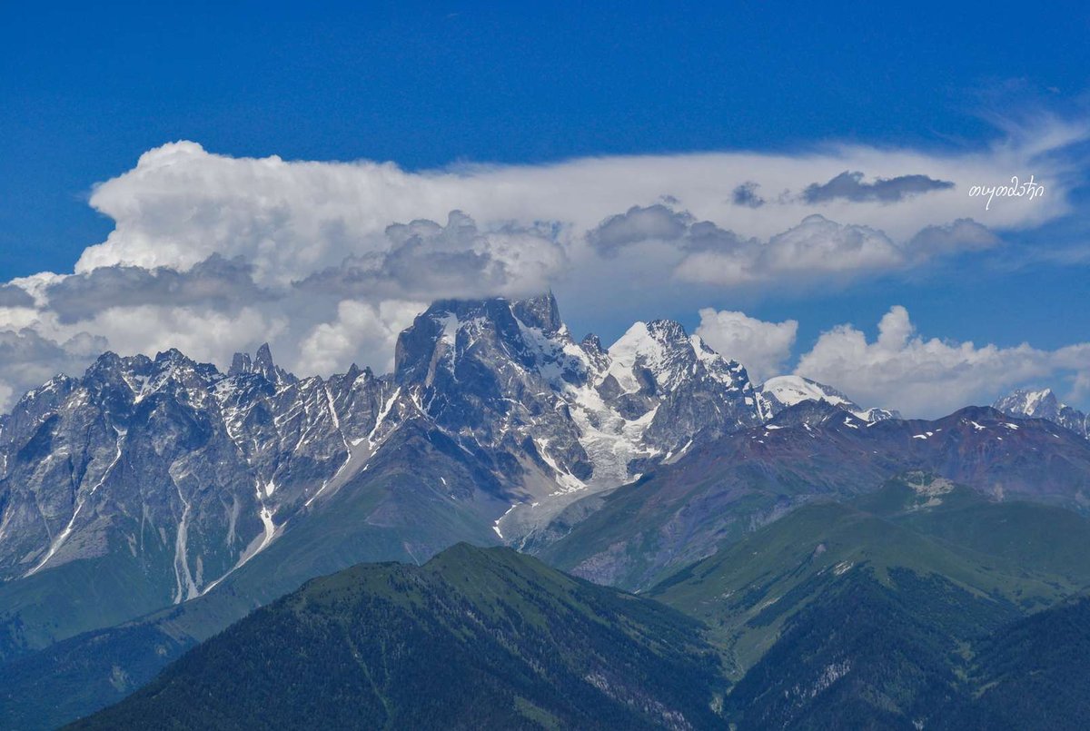
The classic view of both "horns" opens up from the village of Mazeri, the most famous and most photographed vantage point. There's also a good view from Mestia, the administrative centre of Svaneti, about 10 km from the mountain, and a convenient base for planning the trip, accommodation and logistics. On a clear day, Ushba is visible from further away too, including from Elbrus, roughly 30 km distant as the crow flies.
📌 What to Keep in Mind Before You Go

Weather on Ushba shifts quickly and unpredictably, and that applies to the glacier trek too, not just the summit climb. Check the forecast before heading out, and don't assume clear skies in the valley mean the same up top. No special gear is needed for the trek, but sturdy hiking boots and a full day's worth of time are essential, it's a long route.
If you're planning a full ascent, arrange it with an experienced guide well in advance, this isn't a route to improvise on the spot.
Have you stood at the foot of Ushba, or climbed it? Leave a review on Madloba: tell us which route you took, whether you caught clear weather on the peaks, and what first-timers planning a similar trip should know.
Information is current as of July 2026. Route grades, glacier conditions and border-zone rules can change, check current information with accredited guides and border authorities before attempting a serious ascent.
❓Frequently Asked Questions
💬 In Samegrelo-Zemo Svaneti, in historic Upper Svaneti, 1.5 km from the Russian border. The nearest villages, Mazeri and Becho, are about 10 km from Mestia.
💬 The southern, higher summit reaches 4,710 metres. The northern summit is lower, with sources putting it at around 4,690 metres.
💬 Yes, the hiking trail to the glacier and memorial stone is open to hikers in good general fitness, no special gear required. Summiting the mountain itself is a separate, far more demanding undertaking.
💬 Very. The north summit is graded 4A to 6A, the south 5A to 6A, among the highest difficulty categories in the Soviet/Russian system. It's not a route for beginners.
💬 Yes, the mountain is known for a high accident rate. A memorial stone along the glacier trail carries plaques honouring climbers who died on the mountain over the decades.
💬 In Svan, it translates roughly as "the mountain that brings misfortune." There's also an alternative Karachay-Balkar reading meaning "three-headed mountain."
💬 The classic view of both summits opens up from the village of Mazeri. There's also a good vantage point from Mestia, Svaneti's administrative centre.
💬 No, climbing from the Russian side is prohibited, that territory lies within a border zone between Georgia and Kabardino-Balkaria.

3 comments
Log in to leave a comment