




Kudar Caves Guide: Complex, Height and Acheulean Period
Recent discoveries, in particular the Dmanisi excavations, confirm the fact that man settled on the territory of modern Georgia as early as 1 million 800 thousand years ago. Gradually he began to move to distant distances and explore more and more new territories. The Stone Age Neanderthal was already carefully and intelligently choosing a place to live, which had to have a defensive function as well.
The glaciation that began at that time forced him to seek shelter in caves. However, not all caves were suitable for habitation: the entrance to the cave had to be either to the south or to the east, so that the cave could be heated and exposed to the sun for as long as possible.
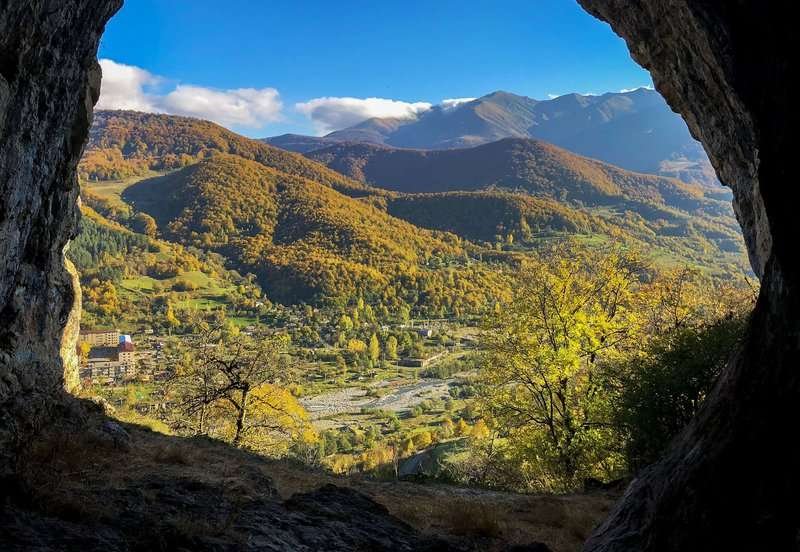
In those distant times the inhabitants of the Kudar Gorge managed to find a remarkable shelter. The cave complex (5 caves were found) is situated rather high (1500 m above sea level), 15-20 km away from the mountains which are covered by snow eternally.
Found in the deepest cultural layers of the caves are chisels, rough, cutting tools, sharpeners, chisels and other similar implements recreate a relatively complete picture of the economic activities of the Stone Age people.
Ash layers preserved in the caves are indisputable evidence that ancient settlers of the Kudar Gorge used fire for heating, cooking and protection against predators. They hunted cave bears, rhinos, deer, ibex, bison and other animals.
The special significance of the Kudar Caves is that these caves are at the highest altitude of all the world's monuments of the Achelian period. The caves are of great scientific value, as they well preserved the contents of the cultural layers of different periods.
Location:
Java District, left bank of the Dzedjori River, southern slope of Mount Chasavali; at an altitude of 1,428–1,500 meters above sea level.
Coordinates:
42°03′12″N; 43°02′22″E.
How to get there:
A road from Adigeni Municipality leads toward the area; from the Gori – Tskhinvali – Oni highway near the village of Chasavali, a rocky road branches off toward the caves. Distance from the junction to the caves — 5 km. Distance: from Tbilisi (via Ertso Pass) — 165 km, from Ambrolauri — 47 km, from Oni — 20 km.

38 comments
Log in to leave a comment
Мне очень понравилось, что в рейтинге не просто перечислены природные достопримечательности, а есть подробное описание истории, советы по тому, как добраться, и даже подсказки от местных жителей. Это сильно облегчает планирование маршрута, особенно если хочется увидеть что-то действительно уникальное, а не только популярные туристические точки. Плюс, в комментариях читателей можно найти полезные детали и ответы на частые вопросы — для путешественника это просто золото!
Теперь я всерьёз думаю включить Кударские пещеры в свой маршрут по горам Грузии — такие места дают ощущение настоящего прикосновения к древней истории. 🌄
А вы бы решились отправиться к таким малоизвестным пещерам высоко в горах, или предпочитаете более популярные и оборудованные локации? 😊
Теперь я точно хочу их посетить, хотя подниматься так высоко, наверное, непросто. А кто-нибудь уже был там? Поделитесь впечатлениями!