




🏰 Samshvilde: A Guide to the Ancient Fortress City, Its Churches and the Canyon
🏰 Samshvilde: A Fortress City on a Cape
One of the oldest cities of Kartli, founded before the common era, now lies in ruins on a narrow cape between two canyons, at the confluence of the Khrami and Chivchavi rivers, 4 km south of Tetri Tskaro. It's not a single monument but a whole complex: a citadel, churches, palaces and walls along a strip about 2.5 km long.
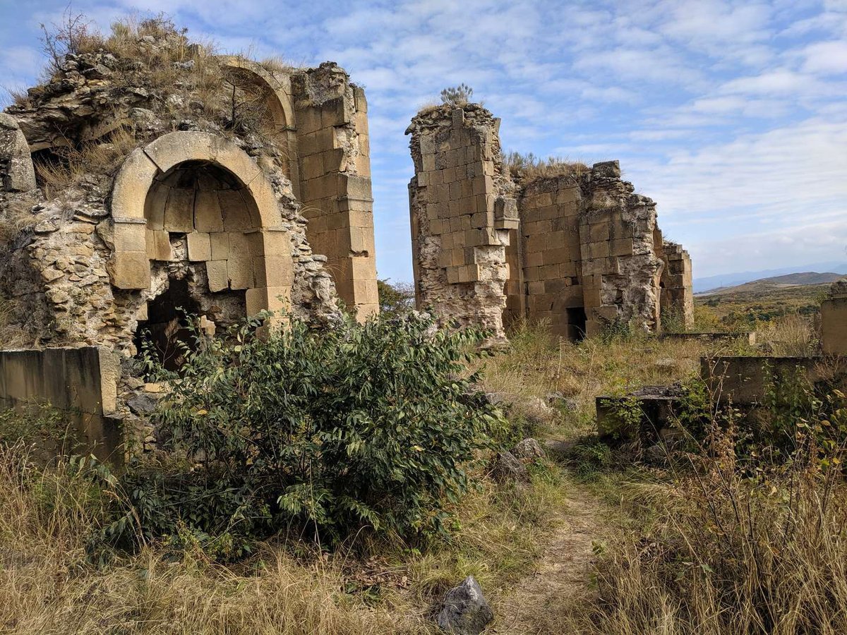
Samshvilde is the ruin of an ancient fortress city in southern Georgia, in the Tetri Tskaro Municipality of the Kvemo Kartli region, about 70 km from Tbilisi. The city stood on a narrow rocky cape at the confluence of the Khrami and Chivchavi rivers, protected on three sides by deep canyons, and was unassailable from every direction except the west, where a massive wall shielded it. Medieval Georgian chronicles name Samshvilde among the oldest cities of Kartli.
This isn't a single sight but a whole archaeological complex: a citadel, several churches, feudal palaces, houses, baths, water reservoirs and a bridge stretch along the cape for 2.5 km. Below is a guide to the parts of Samshvilde: where to start, what matters most, and how to tie the trip in with the canyon and nearby sites. Open the navigator to jump to a specific spot.
🧭 Samshvilde Navigator
expand a site🏰 Fortress city and citadelthe core: walls and towers ›
⛪ Samshvilde Sioni cathedrala domed church of the 8th century ›
🧱 Three-nave basilicaa basalt church of the 10th–11th c. ›
🕳️ Samshvilde Canyonlava walls and caves ›
🏛️ Museum reserveSamshvilde and Kldekari ›
Below, a closer look at the key sites and the history.
🏰 The Fortress City: A Citadel on the Cape
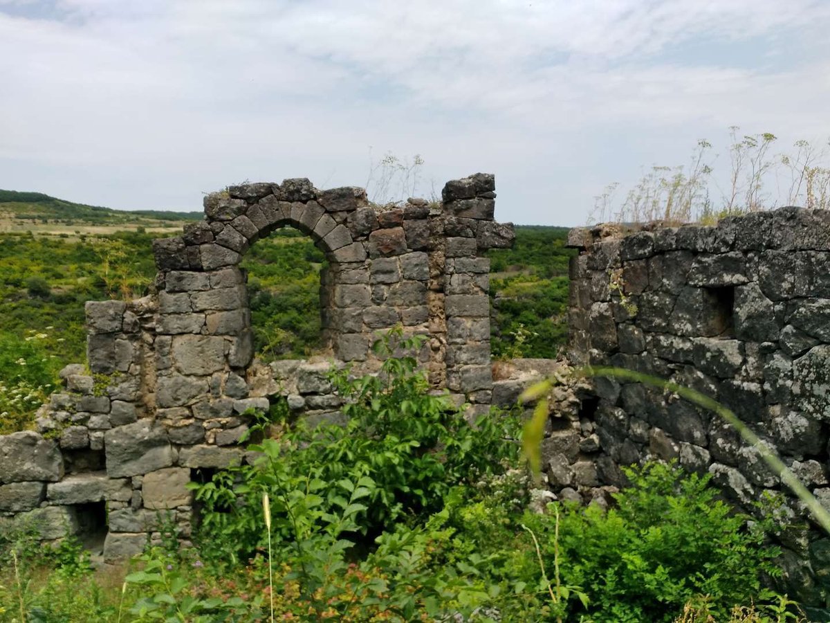
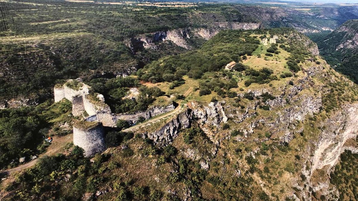
The core of Samshvilde is the citadel at the very tip of the cape, about 60 metres long. Towers stand along the canyon edges, with walls between them. Huge stones are visible in the base of the citadel, which leads researchers to suspect an older, possibly megalithic foundation on which the later fortification was raised. Rounded towers and openings hint at the later use of cannon.
Inside the fortress is a bathhouse with a developed water system, and beyond it began the city's "aristocratic" quarter with two reservoir pools whose purpose isn't fully clear. Feudal palaces and houses ran along the cape. The canyon cliffs guarded the city on three sides, and only on the west, where the cape joined the plateau, stood a wall 4–5 metres thick. That wall, crossing the cape from canyon to canyon, made Samshvilde nearly impregnable. More on the fortifications on the Samshvilde fortress city page.
⛪ The Churches of Samshvilde: Sioni, the Basilica and Others
The most recognizable monument is Samshvilde Sioni, a central-domed episcopal cathedral from the 8th century. By tradition, the first church on this spot is linked to Queen Sagdukht, a convert to Christianity. The cathedral was large for its time and remains one of Georgia's few domed churches of the era. Today the best-preserved parts are the eastern wall with its apses and an ancient inscription on it.
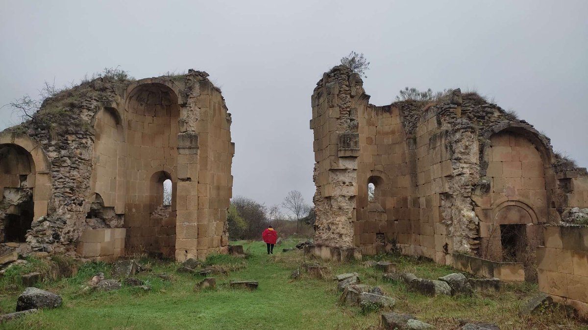
West of Sioni, about 120 metres from the citadel, stands a three-nave basilica of dark basalt, from the 10th–11th centuries. It was built after the cathedral, and its facing reused stone blocks from the already-ruined Sioni. The basilica is tied to the period when Samshvilde was the capital of the Tashir-Dzoraget (Kiurikid) kingdom, which is why it's called Kiurikid, or Armenian. A separate Samshvilde basilica page covers it.
Beyond these, the complex holds a hall church of St. Theodore with remnants of frescoes and an inscription mentioning King David IV (1089–1125), a small Church of the Assumption inside the walls with a prehistoric menhir and an Armenian inscription about Prince Smbat, and the Teogenida church of the 12th–13th centuries by the Khrami River, beside which stands a tetralith, three large stones resting on a fourth.
🕳️ Samshvilde Canyon: The City's Natural Defence
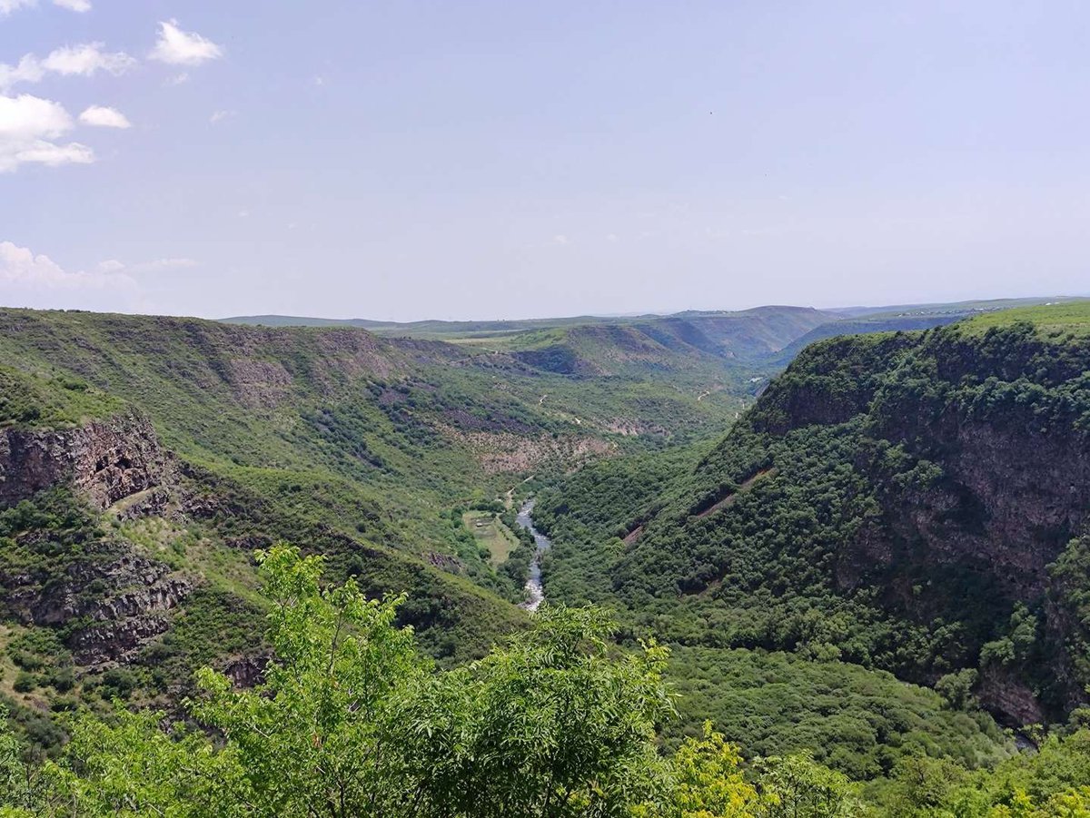
What once made Samshvilde impregnable is today its main natural attraction. The canyon wraps the city on three sides: lava walls rise about 300 metres, riddled with volcanic caves, with clear rivers running along the bottom. The Samshvilde canyon begins at the Samshvilde cape and, together with the gorge of the Chivchavi River, runs about 6 km in total.
Caves are carved into both slopes of the valley, and right by the city there's a large cave complex. The caves, along with the remains of settlements and burials, date to the second half of the 4th millennium BC, meaning people lived here long before the fortress city. For details on the geology and routes, see the separate article on Samshvilde Canyon.
📋 Samshvilde in Facts
📜 The History of Samshvilde: From Eristavi to Decline
Samshvilde arose as one of the oldest cities of Kartli and, as early as antiquity, became the centre of a saeristavo, an administrative unit ruled by an eristavi. Tradition ties the first appointment of a Samshvilde eristavi to Pharnavaz, first in the list of Kartli's kings. Later King Archil gave the city to his son Mihrdat, who then took the throne of Kartli himself.
In the 8th–9th centuries, Samshvilde fell under the Tbilisi Emirate. In the late 10th century the city became the capital of the Armenian Tashir-Dzoraget (Kiurikid) kingdom, and in 1001 it was taken by Gagik I of Ani. In the 1060s, Bagrat IV returned Samshvilde to Georgia, and in 1110 the forces of David IV freed the fortress from the Seljuk Turks. The city served as an important stronghold on the southern approaches to the Georgian lands.
After that came a run of losses. In 1440, Jahan-shah took Samshvilde by deception. In 1747 a major battle took place on its grounds between Erekle and Abdullah-Bek. By the late Middle Ages the city had lost its military role and gradually emptied, and since the late 18th century the complex has lain in ruins. It's this long history of battles and changing rulers that gives the empty city above the canyon its particular atmosphere.
🗺️ Samshvilde on the Map
Open in Google Maps🚗 Getting There and What to Know
Samshvilde is about 70 km from Tbilisi, 4 km south of Tetri Tskaro. A car is the easiest way: from Tetri Tskaro it's only a few minutes to the trailhead, then on foot along the cape. Public transport reaches Tetri Tskaro, but from there to the site you'll need to arrange the last leg separately.
The site is wild: there's no organised infrastructure, no ticket office, no fences, no cafe. That's both a drawback and a plus, you'll almost certainly have the ruins and the canyon to yourself. Bring water and a snack, and wear sturdy shoes with a firm sole: the trail is rocky in places, and the final stretch runs along the edge of the drop.
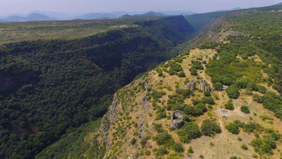
The best time is spring and autumn, when it's cooler and the greenery sets off the stone. In summer the sun is harsh on the open cape, with almost no shade. Allow a couple of hours for the site itself, and half a day or more if you want to descend to the canyon and the caves.
Samshvilde is a rare place where a single trip lets you see several eras at once: prehistoric caves, an 8th-century domed cathedral, an Armenian basilica, traces of Georgian kings and Ottoman raids, all above a canyon 300 metres deep. There are no crowds and no souvenir stalls here, only stone, history and the wind over the gorge. If you like places where you have to piece the history together yourself, standing among the ruins, Samshvilde gives you exactly that.
Have you been to Samshvilde? Tell us in the comments on Madloba: how you got there, whether you went down into the canyon, and which church impressed you most.
Information is current as of June 2026. Some datings and historical details of Samshvilde vary between sources; the site has no fences or signposts, so take care near the canyon edges.
📚 Read Next Samshvilde and around
❓ Frequently asked questions
In the Tetri Tskaro Municipality of the Kvemo Kartli region, about 70 km from Tbilisi and 4 km south of Tetri Tskaro. The city stood on a cape at the confluence of the Khrami and Chivchavi rivers.
It's a whole archaeological complex: a citadel, several churches, palaces, houses, baths and reservoirs run along the cape for about 2.5 km, plus the surrounding canyon with caves.
Samshvilde Sioni, a central-domed episcopal cathedral of the 8th century, one of Georgia's few domed churches of the time and the most recognizable structure at the site.
Medieval chronicles name it among the oldest cities of Kartli, and archaeologists found Bronze Age layers here from the mid-4th millennium BC. So people lived here long before the fortress city.
Yes, in the late 10th century the city became the capital of the Armenian Tashir-Dzoraget (Kiurikid) kingdom. It later changed hands several times between Georgia and neighbouring rulers.
Yes, the canyon is part of the Samshvilde experience: lava walls up to 300 metres and caves. But the descent takes time and care, and there are no facilities or equipped trails here.
No. No ticket office, no fences, no cafe. Bring your own water and food, wear sturdy shoes, and take care near the drops, especially with children.
Both belong to the single Samshvilde and Kldekari Museum Reserve (since 2015). It covers sites across Tetri Tskaro and Tsalka: the city, the Kldekari fortress, megaliths and other Trialeti monuments.

31 comments
Log in to leave a comment
Мне нравится, когда в описаниях есть не только факты, но и пояснения о значимости места: в Самшвильде, как я понял, каждая стена и башня — это часть истории региона, которая ощущается, даже если просто стоять и смотреть на долину. Это даёт материалу дополнительную глубину и помогает не просто пройти по маршруту, а прочувствовать его.
Материал в блоге можно смело взять с собой при планировании поездки — он облегчает ориентирование и делает поездку более осмысленной.
А вы больше предпочитаете такие места с панорамными видами или всё же исторические объекты с хорошо сохранившимися постройками?