




🏔️Birtvisi Canyon: How to Get There and What to See in the Algeti Gorge
🏔️ Birtvisi Canyon at a Glance
A maze of limestone rock needles, narrow gorges and deep clefts in the Algeti river valley, with a medieval fortress tucked onto a sheer cliff at its centre. The whole canyon-and-fortress complex spans roughly a kilometre across.
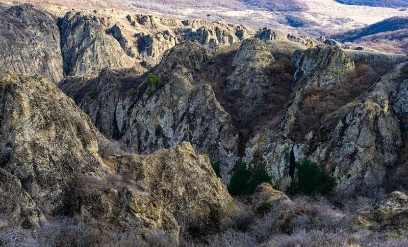
Birtvisi Canyon is a gorge carved by the Algeti River in the Tetritsqaro Municipality of Kvemo Kartli, where water has spent thousands of years cutting sharp stone needles, narrow passages and deep clefts into the rock. Inside this natural maze, on a nearly vertical cliff, stand the ruins of a fortress once considered one of the most impregnable in Georgia.
The place has a double identity: people come here both for the hike through the canyon itself and for the history hidden at its centre. This article is about the first part, the canyon and the route through it. The fortress's history, Tamerlane's siege and the legend of Sheupovari Tower are covered separately, in the article on Birtvisi Fortress.
📍 Where the Canyon Is and Where to Start
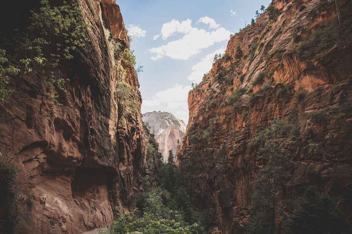
The canyon sits on the left bank of the Algeti River, north of the Algeti Reservoir, roughly an hour's drive south-west of Tbilisi. The exact distance varies between sources, anywhere from 40 to 55 km depending on how the route is measured, but travel time is consistently around an hour by car.
The canyon has two entrances. The main one, on the south side, starts from the village of Tbisi, and it's where most visitors go in. The second, less well known, is on the north-west side near the village of Amlevi, sometimes described as the backup route. For planning purposes, the village of Partskhisi is a useful reference point: from there a walking stretch leads to the canyon entrance, and from there the trail continues through the gorge to the cliffs and the fortress. It's worth opening the Birtvisi canyons catalogue listing beforehand to save the location and check photos.
Worth knowing in advance: there's almost no signage or built infrastructure here, the trail is poorly defined in places, and it's genuinely easy to lose your bearings inside the canyon. That's one reason people bring a local guide for the harder stretches.
🏞️ How the Canyon Is Shaped, and Why
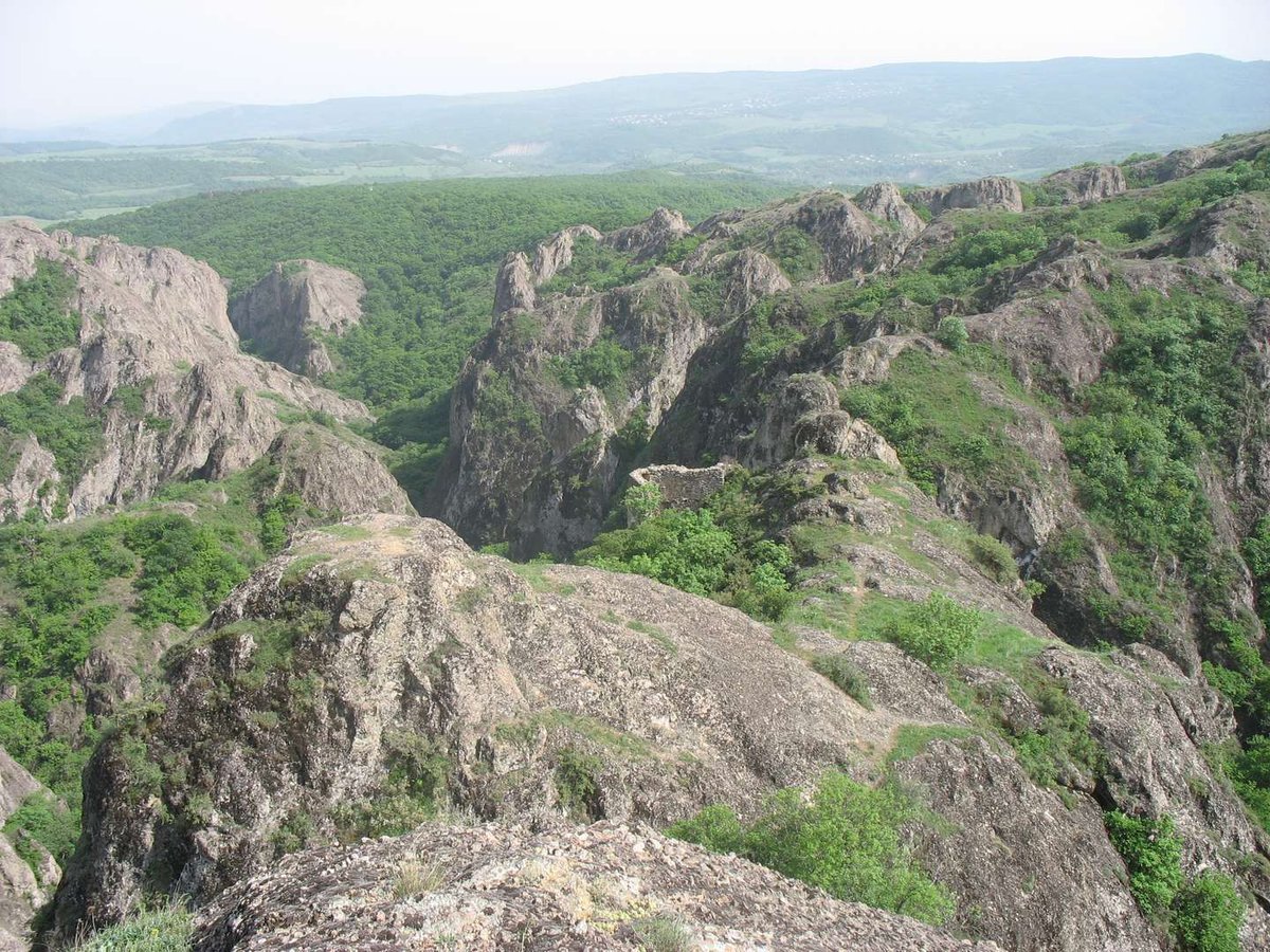
Birtvisi's landscape is the result of long-term erosion. The Algeti and Birtvisi rivers, at their point of confluence, spent thousands of years wearing away the rock, and water combined with wind carved out the sharp, tooth-like pillars that draw people here in the first place. Most descriptions, including reference sources, call Birtvisi's cliffs limestone, though a version claiming volcanic origin does appear in some travel material, there's no single agreed answer, so it's best to leave the exact rock type without overstating certainty.
The stone needles and the narrow passages between them aren't just a scenic backdrop. It was the terrain itself that turned Birtvisi into a natural fortress: the hard-to-reach cliffs and tight gorges served as a barrier on their own, and medieval builders simply added walls and towers into the natural clefts. That's why the canyon and the fortress are physically inseparable here, one grew out of the other.
According to some hiking accounts, deeper in the gorge there's a cascade of waterfalls and natural pools stretching several kilometres, with sections too difficult to reach without gear and an experienced guide. This comes from individual hikers' reports rather than official data on the natural monument, so treat it as a general pointer rather than a guarantee of what you'll find.
🥾 Hiking the Canyon: What to Expect on the Trail
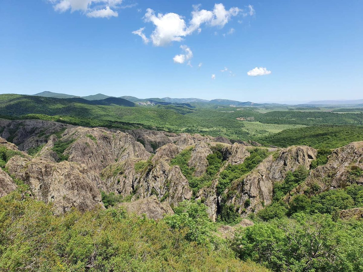
From Tbisi village, the trail first runs through forest before dropping into the gorge itself. That's where the real experience begins: narrow stone corridors, climbs over rocky sections, sometimes with ropes fixed in place, and open ledges giving views over the whole canyon and the fortress towers.
Difficulty varies a lot. The upper and lower stretches of the gorge are relatively manageable and suit an ordinary walk. The middle sections, where you need to scramble and pull yourself up by hand, demand more than stamina, they demand attention to exactly where you place your feet. According to hikers' accounts, getting through the canyon end to end isn't possible without gear and a guide, some passages are simply too technical.
- From Tbisi village, follow the forest trail to the entrance of the gorge, the gentlest stretch of the walk.
- Enter the canyon and move through the narrow passages between the rock pillars, following the worn sections of trail.
- On the climb toward the fortress, expect rocky sections, sometimes with ropes, where you'll need both hands.
- Reach the fortress ruins and Sheupovari Tower at the top, the best panoramic view over the gorge.
- Head back the same way to Tbisi, or, if you have the energy and a clear sense of direction, exit toward Partskhisi.
Navigation deserves its own mention. The trail isn't marked throughout, junctions aren't always obvious, and it's genuinely possible to get lost in this maze of rock. Many people bring an offline map with a downloaded track, but even with one, it's better to make a first visit with company or a local guide who knows the passages.
🏛️ What's Inside the Canyon: The Fortress
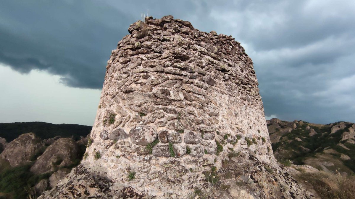
At the centre of the gorge, on a tall, sheer cliff, stand the ruins of Birtvisi Fortress. What survives includes fragments of walls, a gate and the remains of buildings, with Sheupovari Tower rising above everything else, the most inaccessible part of the citadel. The fortress controlled the entire Algeti gorge for centuries and was considered nearly impregnable, until Tamerlane took it in 1403, and even then only through a trick, not a direct assault.
There's little point unpacking the full history here, the fortress has its own subject and its own dedicated piece. If you want to know who held this ground and when, and how the legend of Sheupovari Tower fits in, read the article on Birtvisi Fortress. For the hike itself, it's enough to know that the fortress isn't a separate stop off to the side, it's the natural high point of the canyon route.
🚗 How to Get There
By car from Tbilisi, the drive takes about an hour. It's easiest to head toward Marneuli, then turn off toward Tbisi village near the Algeti Reservoir, brown tourist signs start appearing closer to the canyon. Cars are left at Tbisi, the rest is on foot.
Public transport is harder but doable. You can take a marshrutka toward Tetritsqaro and ask the driver to drop you at the bridge in Partskhisi village, from there it's about half an hour on foot to Tbisi. Another option is a marshrutka from Tbilisi's bus station heading toward Tsalka, which passes through Tbisi. Either way, confirm the return schedule in advance, or you risk being stuck in the village until evening.
👨👩👧 Is It Suitable for Kids
There's no simple yes here, it depends entirely on how far you plan to go. The easy upper and lower stretches of the canyon are manageable for active, school-age kids with adults along. But the technical middle sections, with scrambling and ropes, aren't suitable for children, there's a real risk of a fall. If you're hiking with kids, it makes sense to stick to the accessible part rather than push to reach the fortress at any cost.
What to Bring Into the Canyon
📌 What to Check Before You Go
The main thing is the weather. During and right after rain, the rock gets slippery and the technical sections turn genuinely risky, so this is a dry-weather-only route. Work out ahead of time how far into the canyon you can realistically manage, and don't plan on the full traverse without preparation. If you're unsure about the route, arrange a local guide, especially for a first visit. And always confirm your return transport if you're travelling without a car.
Have you hiked Birtvisi Canyon? Leave a review on Madloba: tell us which entrance you used, how far you got, and what first-timers should know.
Information is current as of July 2026. Check the weather and trail conditions before heading out, conditions on a natural route with no infrastructure can change quickly.
❓ Frequently asked questions
💬 In the Tetritsqaro Municipality of Kvemo Kartli, in the Algeti river gorge, north of the Algeti Reservoir. About an hour's drive south-west of Tbilisi.
💬 Two. The main one, on the south side, from Tbisi village, where most visitors go in. The second, less well known, from Amlevi village to the north-west.
💬 Difficulty varies. The upper and lower parts of the gorge are relatively easy, while the middle sections require scrambling over rock, sometimes with ropes. Getting through the canyon end to end isn't possible without gear and a guide.
💬 For the easy sections, yes, if you have an offline map with a downloaded track. But the trail isn't marked throughout, and it's easy to get lost in this maze of rock, so a local guide is worth it for the harder parts and for a first visit.
💬 Only partly. The easy sections are manageable for active, school-age children with adults. The technical climbs with ropes aren't suitable for kids, there's a real risk of falling there.
💬 They're parts of the same place. The canyon is the gorge itself with its cliffs, the fortress is the ruins on the cliff at its centre. A hike through the canyon usually ends up at the fortress as its natural final point.
💬 By car, about an hour, via Marneuli to Tbisi village near the Algeti Reservoir. By public transport, a marshrutka to Tetritsqaro with a drop-off at Partskhisi and then on foot, or a marshrutka toward Tsalka that passes through Tbisi.
💬 Spring and autumn, in dry weather. Less foliage means better views of the cliffs and fortress, and the trail isn't as slippery as it gets after rain.
💬 Based on available information, entry to the canyon area is free. Budget separately only if you're hiring a local guide or arranging transfer.
Read also

33 comments
Log in to leave a comment
რა მRefი ვიყავი მაშინ, კინაღამ დავიჭირე სუნთქვა ბუნების სილამაზით. მეორე შესასვლელი ჩვენთვის უფრო რთული აღმოჩნდა, მაგრამ შვილებთან ერთად ყველაფერი რთული სიმარტივედ იქცევა. არ ვიცი, როგორ გამომივიდოდა, რომ ოჯახი ასე ახლოს უნდა იყოს ამ შთამბეჭდავ ადგილას.
თქვენი სტატიიდან გამომდინარე, ალბათ, ბევრი რამ არის გასარკვევი. როგორი ბილიკები შეიძლება შევხვდეთ იქ ახლახან?
Особенно вдохновляют советы от местных 👣💬 — они подсказывают оптимальные точки для начала маршрута, где сделать самые эффектные фотографии 📸 и как пройти тропу так, чтобы увидеть всё самое захватывающее. Такие лайфхаки делают подготовку к поездке намного интереснее и помогают прочувствовать атмосферу места ещё до путешествия 💛
После насыщенного дня у Биртвиси так приятно представить, как ты зайдёшь в уютное кафе ☕🍰, обсудишь впечатления с друзьями за чашечкой ароматного кофе и бокалом грузинского вина 🍷 — отличный способ завершить активный день на свежем воздухе 🌞
Мне очень нравится, как этот рейтинг помогает почувствовать дух каньона: живые описания, реальные отзывы и полезные подсказки делают путешествие по‑настоящему вдохновляющим 🌍✨
А вы уже были в каньоне Биртвиси? Какие виды или маршруты впечатлили вас больше всего, и в какое время года, по вашему мнению, сюда стоит отправляться, чтобы поймать самые красивые кадры? 🏞️📸💚