




🏛️ The Submerged Bridge of Mtskheta: What Pompey Actually Built and When the Mtkvari Retreats
How to tell whether the bridge will show
This monument keeps no timetable. But three things let you judge the odds before you set out.
The practical conclusion: there is no point going to Mtskheta for the bridge. Go for the town, and keep the bridge in mind as a bonus that may or may not come up.
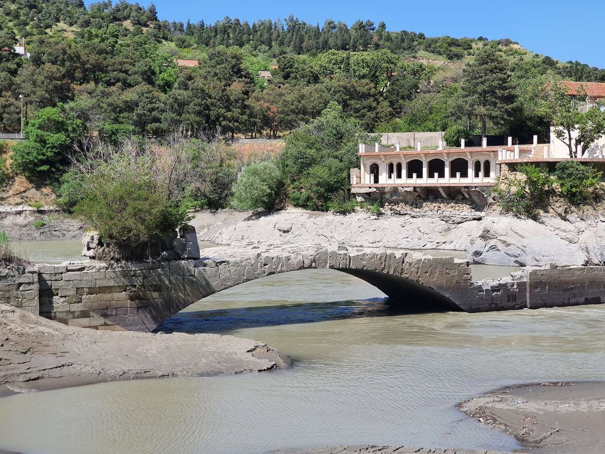
Pompey Bridge is among the best known monuments of Mtskheta and at the same time the hardest to reach: you almost certainly will not see it.
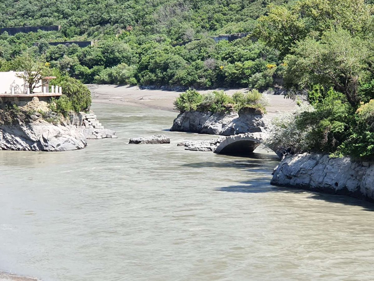
It lies at the entrance to the town, about a hundred metres east of the present bridge over the Mtkvari. And it is nearly always under water.
Its other name, less familiar but rather better, is the Bridge of the Magi, in Georgian მოგვთა ხიდი.
💧 Why it is under water
The reason is technical and precisely dated. After the Zemo Avchala hydroelectric station was built in 1927, the river level on this stretch rose and the bridge went under.
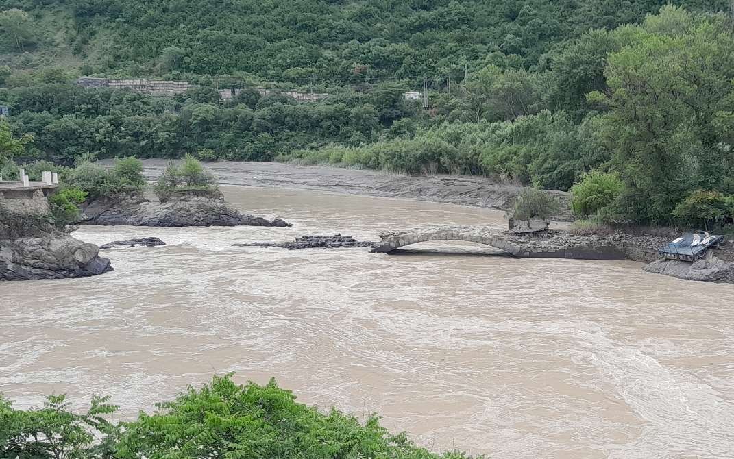
Since then it has appeared only when the Mtkvari drops to a minimum. That happens irregularly, depends on how the hydro scheme is being run, and cannot be predicted in advance.
The people of Mtskheta spent years asking for the water to be released deliberately. In 2021 it happened: the culture ministry reached an agreement with the energy company to lower the level so that the monument could be recorded on film and given a first archaeological inspection. The minister said at the time that there were 48 to 72 hours for the work, and that the first task was to clear the plants whose roots were breaking up the stone.
In effect, in more than ninety years the monument has been seen a handful of times.
⚔️ What Pompey has to do with it
The name has stuck firmly to the bridge, but its connection to the facts is thin.
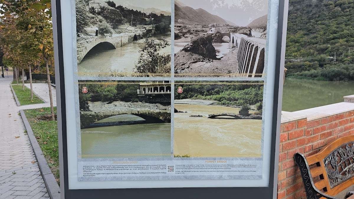
Tradition attributes the construction to Gnaeus Pompeius, the Roman general who passed through Georgia in 65 BC pursuing Mithridates and supposedly had his legionaries build the crossing.
The difficulty is that a bridge was already here. Georgian sources say so plainly: the crossing existed before Pompey's campaign, and the Roman general contributed nothing to its construction.
As Radio Tavisupleba puts it in the headline of its own account, the question runs differently: 'Pompey's bridge or Nicholas I's?' And that is not rhetoric but the next fact.
🧱 What actually lies beneath the water
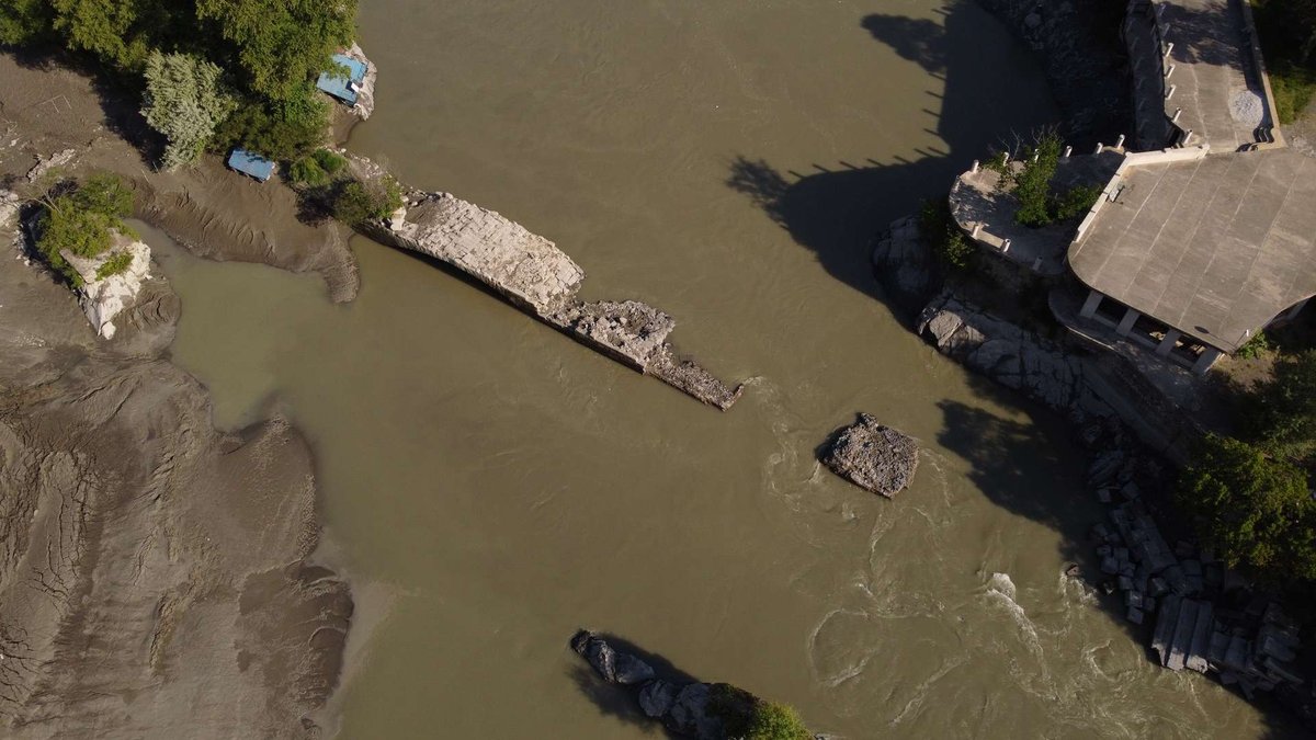
Here comes the unexpected part.
By the nineteenth century, as heavy traffic developed, the old bridge had become dangerous to use. It was dismantled, and in its place, between 1839 and 1841, a tall four-span stone arch bridge was built.
It stood for 85 years and went under with the arrival of the power station.
So the masonry that shows when the river falls belongs to the first half of the nineteenth century, not to antiquity. That does not make the monument less interesting: the crossing point is the same and layers from different periods are present. But a caption reading 'a Roman bridge of the first century BC' would be inaccurate.
In 1926, four hundred and fifty metres from the old bridge, a new three-span iron bridge was built, designed by the architect I. Karelin with the engineer B. Mikeladze. Neither it nor any of Mtskheta's later bridges took the fame from the drowned one.
Three bridges within a kilometre
Visitors mix them up constantly, because all three get called the bridge at Mtskheta.
The landmark on the ground is simple: stand on the working bridge facing downstream, and the site of the old one is on your right, closer to the bank.
🛣️ Why the crossing was here
This is the part worth understanding about the site.
The bridge was in use from at least the fourth or third century BC, when trade in the region took on an international character. And the spot was not chosen at random.
The main roads of the South Caucasus met at the bridge in Mtskheta. North to south: from the Darial gorge to Georgia's southern border. West to east: from the Black Sea to the shores of the Caspian.
In other words, both axes along which goods and armies moved between Europe and Asia passed through this one point. Mtskheta became the capital of Iberia not in spite of its geography but because of it, and the crossing was the knot that held the whole thing together.
Standing on the bank of the Mtkvari in Mtskheta, it is worth remembering that under the water lies the place both Persians and Romans came here to control.
👀 Can you actually see it?
The honest answer is almost certainly not, and it is not worth counting on.
The bridge shows at minimum river level. That depends on how the hydro scheme is run and on the season, happens irregularly and is not announced in advance, except in rare cases like the 2021 release.
What to do if the subject interests you. Follow the news: when the bridge surfaces the Georgian press covers it, and there is usually a window of a few days.
What you can see in any case. The place where it lies, a hundred metres east of the present bridge, and the river itself at the point where the roads of two directions met.
A word on preservation. The 2021 release revealed that plants growing in the masonry are breaking up the stone with their roots. Conservation of the monument is under discussion in Georgia, and some specialists argue that funds would be better spent on sites that are visible and visibly deteriorating.
The marker shows where the bridge lies, roughly a hundred metres east of the working bridge over the Mtkvari. The structure itself is under water.
🚗 Getting there
Mtskheta is twenty kilometres from Tbilisi and easier to reach than any other historic town in Georgia.
From Tbilisi, marshrutkas run from Didube metro station and the journey takes about half an hour. The same by car.
On the road to Kazbegi, Mtskheta is the first stop: if you are taking the Georgian Military Road, the detour costs a few minutes.
The site of the bridge is at the entrance to town, east of the working bridge over the Mtkvari. The map point and reviews are on the Pompey Bridge page, and the rest of the town's sites are in the things to see in Mtskheta section.
🧭 What to see in Mtskheta
Since the bridge itself will probably be under water, it is worth knowing what you actually came for.
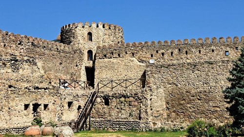
Mtskheta. Svetitskhoveli Cathedral, the eleventh-century cathedral in the centre of town, the principal site of Mtskheta and a UNESCO World Heritage property.
Jvari Monastery, the first domed temple in Georgia, on the hill above the confluence of the Mtkvari and the Aragvi, and the viewpoint over the town.
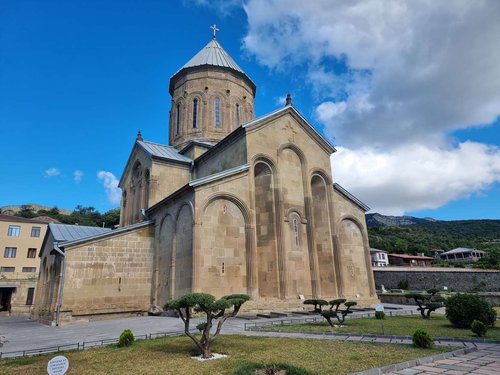
Samtavro Monastery, with the tombs of King Mirian and Queen Nana.
Armaztsikhe (Bagineti), the inner fortress of old Mtskheta on the far bank, which the bridge led to. Beside it stands Armazi Fortress.
The State Archaeological Museum-Reserve of Greater Mtskheta, if you want to see what the excavations around the crossing turned up.
Mtskheta is compact and all of this fits into a day. A ready-made route is set out in Historical monuments in Mtskheta, and the fuller portrait of the town in The oldest Georgian capital Mtskheta.
🗣️ Over to you
Have you seen Pompey Bridge when the water pulled back? Tell us which month it was and what you could make out. Leave a review on Madloba: observations like these matter, because the monument surfaces so rarely that there is little on record.
Information is current as of August 2026. The level of the Mtkvari depends on how the hydro scheme is run and on the season, and the bridge's appearance cannot be predicted in advance.
📚 Read next
❓Frequently Asked Questions
💬 At the entrance to Mtskheta, about a hundred metres east of the working bridge over the Mtkvari. The structure itself is under water; all you see on the surface is a stretch of river.
💬 Only at minimum river level, which happens irregularly and is not announced in advance. Since 1927, after the Zemo Avchala power station was built, the bridge has been under water almost permanently.
💬 No. A crossing existed here before his campaign, and the Roman general contributed nothing to its construction. Tradition attached the name to Gnaeus Pompeius, who passed through Georgia in 65 BC, but that is tradition rather than record.
💬 First half of the nineteenth century. In 1839-1841 the old bridge was dismantled as unsafe for heavy traffic and replaced on the same spot by a four-span stone arch bridge, which lasted 85 years.
💬 The main roads of the South Caucasus met at the bridge in Mtskheta: from the Darial gorge to Georgia's southern border, and from the Black Sea to the Caspian. The bridge was in use from at least the fourth or third century BC.
💬 In 2021, when the culture ministry agreed with the energy company to lower the level. There were 48 to 72 hours for filming and initial archaeological work.
💬 The Bridge of the Magi, მოგვთა ხიდი in Georgian. In scholarly writing and among local people, though, 'Pompey Bridge' remains the usual form.
💬 About half an hour from Tbilisi: marshrutkas run from Didube metro station, and it is the same by car. Mtskheta sits on the Georgian Military Road, so the detour on the way to Kazbegi is easy.

2 comments
Log in to leave a comment