




🏰 What Uznariani Fortress Guarded Above Tsagveri, and Where Its Name Comes From
🏰 Uznariani Fortress: The Essentials
An early medieval stronghold on a rock above the settlement of Tsagveri, in Borjomi Municipality. The tower is built tight against the cliff and forms a single structure with it. The fortress watched the road running from Borjomi into the Gujareti gorge, and it was the first link in a signal chain that closed on Gori fortress.
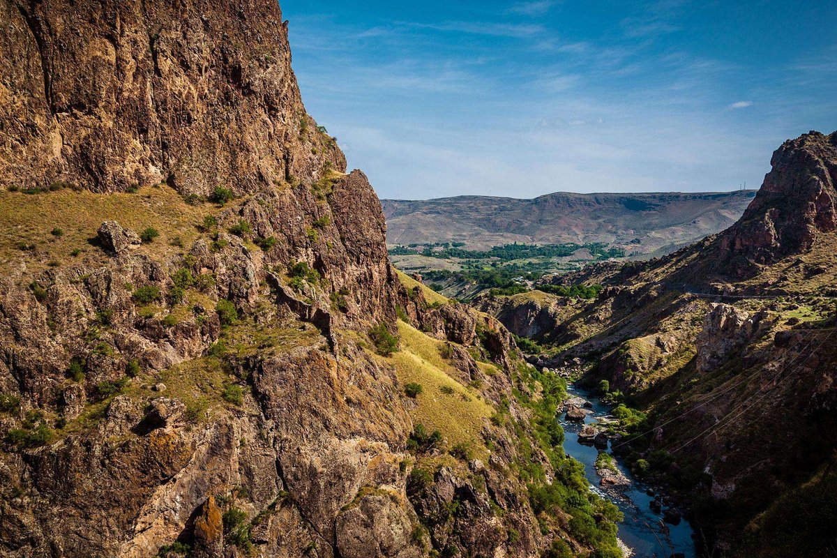
Uznariani Fortress stands above the settlement of Tsagveri in Borjomi Municipality, Samtskhe-Javakheti, on a rock to the right of the Gujaretistskali river. Older texts call that river the Tori, and the whole gorge takes its name from it.
Most writing about Uznariani says the same three things: it grew into the rock, it looks grim, its history is unknown. The history is in fact known. It simply sits in the work of Vakhushti Bagrationi, Sergi Makalatia and Devi Berdzenishvili rather than in guidebooks, and it comes with a clear military function, archaeological finds, and an argument about the name that has run for decades.
🗺️ Where the Fortress Stands and Which Road It Watched
The Borjomi gorge is the historical region of Tori. In the Middle Ages two roads crossed it: one up the Mtkvari gorge from Samtskhe into Kartli, the other over the Tskhratskaro pass from Samtskhe-Javakheti towards Trialeti. Both led inland, towards Shida Kartli, where the political and economic centres of the kingdom lay.
Uznariani sits on a rock in an unreachable spot, looking down on the road that runs from Borjomi through Tsagveri into the Gujareti gorge and on towards Khashuri and Kareli. Put plainly, the fortress was the chief watchman of the Gujareti gorge: nobody passed it unseen on that road.
Sergi Makalatia, writing on the Borjomi gorge, stated the task of the whole region directly: hold the southern frontier and keep an enemy out of Shida Kartli. That is why this border country was fortified with towers and strongholds, whose remains survive to this day.
🔗 The Tori Chain: How the Signal Line Worked
Taken on its own, a modest tower above Tsagveri does not look like much. It makes sense the moment you look at the whole system.
An enemy came from the south up the Mtkvari gorge. Atskuri fortress, on the border of Samtskhe and Tori, blocked the way first. Beyond it, garrisons passed the signal from one to the next, and the fortresses formed a single line. From Uznariani that line split into two branches.
Through the Tori and Gujareti valleys the signal ran to Kerdzeni, on to Aletsi, then Samtsvrisi and Gori. The second branch went through Gujareti into the Dzama valley: Totkhami, then Ortubani fortress, also known as Mzovreti, then the same Samtsvrisi and Gori.
Both branches closed on Gori fortress. Gori worked as the central node and covered the road to Tbilisi. So a small tower above Tsagveri stood at the head of the chain along which an alarm reached the capital.
Niko Berdzenishvili noted that in the twelfth century Tori appears as one of the strong military units among Georgia's others. The Toreli family held the region, and its density of fortifications was a consequence of its position on the frontier rather than an accident.
Branch through Tori and Gujareti
Branch through Gujareti and the Dzama valley
🗿 How the Fortress Is Built
Uznariani abuts the rock and forms one body with it. From the road it reads as a solid mass, which is where the endless phrase about growing into the cliff comes from.
The main part of the complex is a heavy ridged tower with a wall built hard against it. The tower rises roughly eight metres above ground level, which is usual for fortifications of this type. Its side facing the mountain slope is rounded; the side facing the river is flat. The flat side is harder to make out, because the ground beside it sits higher.
The two parts are built differently. The tower is rubble stone bonded well with lime, the wall is small stone. The features point to the early feudal period.
There is one way in, from the south, along a narrow path that comes up through the forest. That is not simply what the terrain allows, it is the design: with a single approach, a small garrison could hold this crossroads reliably and cheaply.
📜 What Vakhushti Bagrationi Wrote About It
The fortress appears in Vakhushti Bagrationi's Description of the Kingdom of Georgia. He places it below Kimotesmani, on the eastern edge of the Tori river, and describes it in two words: „ფრიად მაგარი“, very strong.
Kimotesmani in that passage is identified with Timotesubani, the monastery standing nearby in the same valley, three kilometres from Tsagveri on the right bank of the Gujaretistskali. The form 'Kimotesubani' also turns up in descriptions of the monastery itself, so the reference is sound: it gives a fixed point and confirms that this is the fortress in question rather than one of its neighbours.
One more thing follows from Vakhushti's phrasing. In the eighteenth century, when he was writing, Uznariani was still regarded as a serious stronghold. A fortress raised in the early feudal era was therefore still in service in the late Middle Ages.
🌿 Uzani or Uznadze: Where the Name Came From
This is the question readers ask most often. There is an answer, but not a single one.
The family version. Sergi Makalatia held to it. The surname Uznadze appears among the flock of the Catholicos of Samtskhe-Saatabago, credited with a monastery and a court church at Kalmakhi. The reasoning runs: if the family was noble and owned a church, it could also have held a fortress bearing its name, 'Uzni' or 'Uznariani'.
The objections. Ketevan Kapanadze examines this version and concludes that it stays a conjecture. No source confirms that the Uznadze family owned a fortress. Their possession of a monastery and church in the late Middle Ages is not in doubt, but no stronghold appears among their holdings. The Uznadzes also enter the nobility lists of the fourteenth to seventeenth centuries, whereas Uznariani was built earlier, in the early feudal era, as the archaeological material indicates. Iakob Akhuashvili classes them as treasury nobles, and the surname does not figure at all among those recorded on Borjomi territory: in his six-volume study it is tied to Shida Kartli.
The plant version. Devi Berdzenishvili derives the name from the plant uzani. In his lexical material on the Javakheti dialect, Grigol Beridze describes uzni, or uzani, as a supple tree: it yields good switches, and oil is pressed from it and used medicinally.
Then the grammar does its work. The suffix '-nar' attaches to the stem 'uzn-' or 'uzan-'; it is added to plant names and marks the place where they grow. The suffix '-ian' follows. What comes out is 'Uznariani', a place where a great deal of uzani grows.
Other toponyms with the same root across Georgia support this reading: Mount Uznari, and an Uznariani mountain used as pasture. Naming places after plants is ordinary in Georgian toponymy, whereas a fortress named after a family that rose several centuries after it was built looks forced.
The precise botanical identity of uzani in other languages is not settled, so no species name is supplied here: Beridze's description gives the characteristics of a tree, not an identification.
🏺 What Was Found on the Site
Archaeological work turned up what you would not normally expect from a lookout post: traces of ordinary domestic life.
Kvevri were found, the vessels used for wine, though some may also have held water. Household objects were found. And a kharo was found, a food storage pit lined with stone and lime.
That changes the picture of the place. The garrison did not simply keep watch and leave: people lived here, kept stores and made wine. For a fortress standing at a crossroads and, by all appearances, provisioning itself over long stretches, the assemblage makes sense.
🚗 Getting There and What Is Nearby
Tsagveri lies on the road from Borjomi to Bakuriani, roughly halfway between them, so calling in is easy: this is a settlement on a busy route, not a remote corner. It is a short drive from Borjomi, and a short drive from Bakuriani.
Then the walking starts. The fortress stands on a rock above the settlement, and the only approach is from the south along a narrow path through the forest. The climb is short but unmade, with no steps and no railings, so proper footwear matters and wet weather is a reason to postpone.
On accessibility, plainly: the site is not set up for visitors in any numbers. There are no barriers, no markings, and the walls are old. Climbing to the tower itself is not advisable with small children, though Tsagveri and the views over the gorge suit anyone.
Three kilometres away, further up the valley, stands Timotesubani Monastery, the very landmark Vakhushti used to fix the fortress. Its main church was built at the turn of the twelfth and thirteenth centuries by Shalva Akhaltsikheli, ruler of historical Tori, which is to say of the region whose frontier Uznariani guarded. Half an hour's drive away are Borjomi with its mineral water park, and Bakuriani.
🧭 Where to Stay and What to See Around
Borjomi or Bakuriani both work as a base: each has places to stay and plenty to do beyond the fortress.
Climbed up to Uznariani? Leave a review on Madloba: tell us where you started from, how long the walk took, and what condition the path on the southern side is in now.
Information is current as of July 2026. The state of the path and the approach to the fortress changes with the season, so check locally before you travel.
❓ Frequently Asked Questions
💬 In Georgia, Samtskhe-Javakheti region, Borjomi Municipality, at the settlement of Tsagveri. The fortress stands on a rock to the right of the Gujaretistskali river, above the settlement. Tsagveri sits on the road between Borjomi and Bakuriani, not in Bakuriani, as is sometimes written.
💬 The exact date is unknown. The fortress is assigned to the early feudal period on the basis of architectural features and archaeological material. No document records its construction, so published estimates vary.
💬 A ridged tower rising roughly eight metres above ground level, with a wall built hard against it. The tower is rubble stone bonded with lime, the wall is small stone. The fortress abuts the cliff and forms one structure with it.
💬 The road running from Borjomi through Tsagveri into the Gujareti gorge and on towards Khashuri and Kareli. Uznariani was the chief watchman of that gorge and the first link in a signal chain that closed, by way of Samtsvrisi, on Gori fortress.
💬 In his Description of the Kingdom of Georgia he places the fortress below Kimotesmani, on the eastern edge of the Tori river, and calls it very strong. Kimotesmani is identified with Timotesubani. So in the eighteenth century it was still regarded as a serious stronghold.
💬 The main reading ties it to the plant uzani. The suffix '-nar' attaches to plant names and marks where they grow, and '-ian' follows. The result means 'a place where a great deal of uzani grows'. Devi Berdzenishvili supported this reading.
💬 Sergi Makalatia proposed that, but it stays a conjecture. No source confirms that the Uznadze family owned a fortress, and the surname itself enters the nobility lists of the fourteenth to seventeenth centuries, whereas the fortress was built considerably earlier. The name does not appear among those recorded on Borjomi territory.
💬 Kvevri for wine, which may also have been used for water, household objects, and a kharo, a food storage pit lined with stone and lime. The finds show that people did more than stand watch here: they lived on the site and kept stores.
💬 There is one approach, from the south, along a narrow path through the forest. The climb is short but unmade, with no steps or railings, and the walls are old. Climbing to the tower itself is not advisable with small children, and wet weather is a reason to postpone.

31 comments
Log in to leave a comment
Вживленная в скалу крепость, такого мне точно ранее не встречалось.
Определённо стоит включить в свое путешествие это место!