




💧 How to Reach Bateti Lake in the Dzama Gorge, and What to See Around It
💧 Bateti Lake: What to Know Before You Go
A forest lake in the Dzama Gorge, Kareli Municipality, Shida Kartli. It formed when a landslide dammed the Batetistskali stream. The lake itself is modest, roughly 190 by 150 metres, but it sits inside unbroken beech and conifer forest, with dozens of old monasteries along the road up.
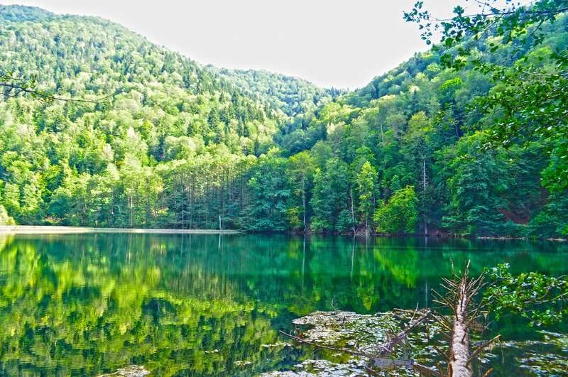
Bateti is a small freshwater lake of landslide origin in Kareli Municipality, Shida Kartli, on the northern slope of the Trialeti Range. It lies at 1,313 metres above sea level, in the upper Dzama Gorge, on the Batetistskali stream.
A fair amount of confusion surrounds this lake online. It gets placed in Adjara or Imereti, described as a karst sinkhole, and listed at 920 metres. None of that holds up: the lake is in Shida Kartli, southwest of Kareli, and it was created by a landslide. Here is what is actually there, and how to get to it.
📍 Where Bateti Lake Is
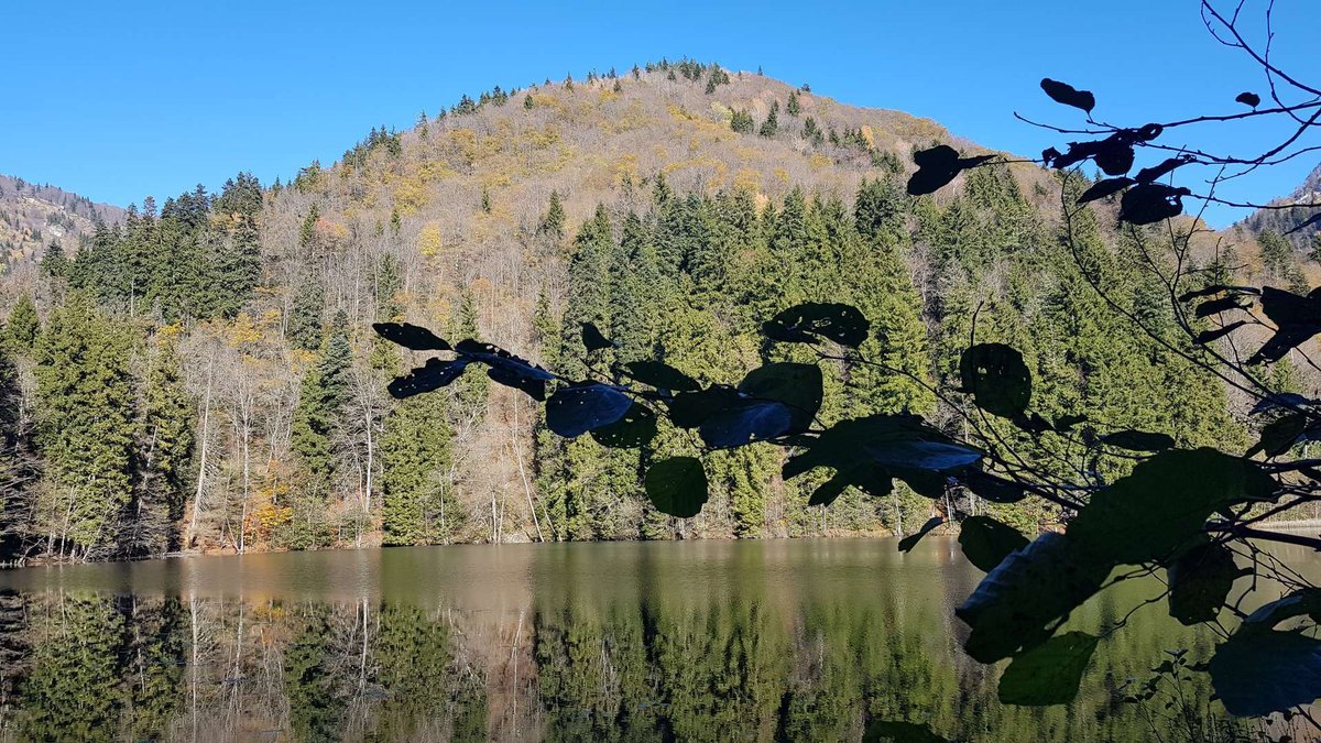
Your reference point is the town of Kareli on the Tbilisi to Gori to Khashuri highway. From there a road runs south, up the valley of the Dzama, and the lake sits roughly 23 kilometres away. The nearest village is Kodmani, though some sources tie the lake to the village of Bateti, which is where the name comes from.
From Tbilisi it is about 120 kilometres, near enough two hours to the mouth of the gorge, plus the climb up.
One point of geography worth stating plainly. The Dzama Gorge runs south from the Mtkvari towards the Trialeti Range, which is the opposite direction from the Tskhinvali region. There are no access restrictions here: an ordinary municipal road, open to anyone.
💧 How the Lake Formed
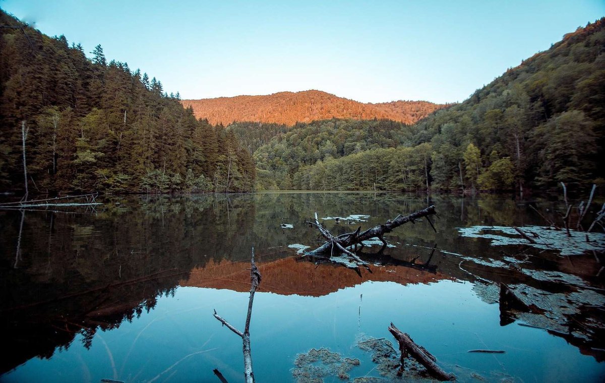
Bateti is a landslide lake. A mass of ground came down the slope from the south and blocked the valley of the Batetistskali. Water built up behind the blockage and filled the hollow.
The numbers give a sense of scale. The surface covers just 0.02 square kilometres, the catchment about 5 square kilometres, average depth is 7 metres and the maximum 12. The lake runs roughly 190 metres long and 150 wide. A stream drains out of it and becomes the Batetistskali again further down.
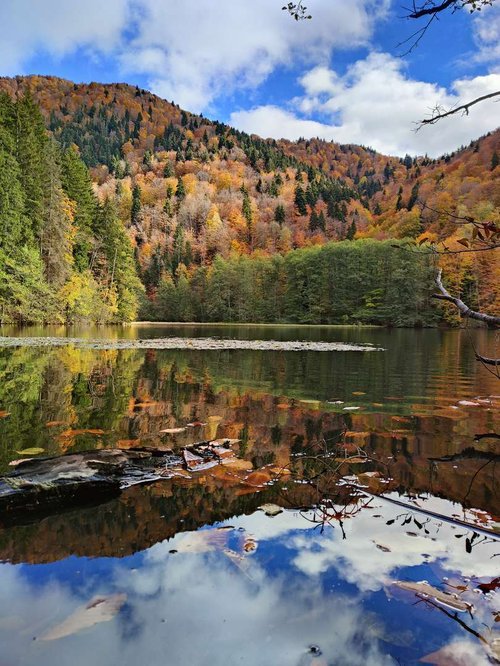
There are no broad, gentle shores at Bateti: the basin is wedged into a narrow section of the gorge, with slopes dropping almost to the waterline. The southern tip has turned to marsh, where water-loving plants have taken over, and that corner is the one that ends up in most autumn photographs.
🚗 Getting to Bateti
Public transport into the upper gorge is effectively non-existent. That leaves two realistic options: your own vehicle, or a taxi from Kareli with the return time agreed in advance.
Tarmac. A decent road climbs the valley from Kareli, used by locals and by pilgrims heading to the monasteries. Almost any car will manage it.
The turning. Look for the sign to Tbeti Monastery. That is where the road branches off and turns to gravel, with about three kilometres left to the lake.
Gravel and the climb. The last section gains height. In dry weather people drive it in a four-wheel drive; after rain the ruts turn to soup and it makes more sense to leave the car below. On foot the climb takes roughly forty minutes, sometimes an hour.
Bring footwear that can handle mud even in July. The forest here holds damp, shade lies across the track all day, and it dries slowly.
🍂 When to Go and What Waits at the Water
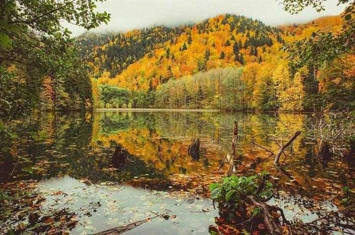
The season opens in late spring, once the mud has gone, and holds until mid-autumn. October is the peak: the beech forest around the basin turns yellow and red, the water mirrors the slopes, and that is what most people come to photograph.
In summer this is where locals escape the heat of the Shida Kartli lowlands. From December to March the lake sits under ice, which looks striking, though the road up becomes anyone's guess.
At weekends tents go up by the water; walkers discovered this place long ago. There is no infrastructure whatsoever: no kiosks, no toilets, no bins. Water comes from the stream or from a spring on the way up, near the monastery grounds. Whatever you carry in, you carry out.
| Season | Road | At the lake |
|---|---|---|
| April, May | Gravel still wet, ruts heavy after rain | New green, a full stream, very few people |
| June to August | Passable, easiest of all in dry spells | Shade and cool air, tents at weekends |
| September, October | Usually dry, the best window for a trip | Autumn colour in the forest, the most photogenic weeks |
| November to March | Snow possible, the climb unpredictable | Ice on the water, short daylight hours |
🐸 What Lives in the Lake
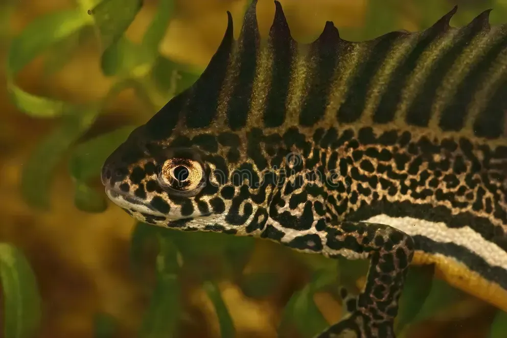
There are no fish in Bateti, so tackle can stay at home. What does live in the water is a newt listed in Georgia's Red Book. Georgian sources identify it as Ommatotriton ophryticus; Russian-language writing on the lake more often calls it the Caucasian newt. Spotting one takes luck: it keeps to the vegetation along the marshy edge.
Nobody swims here, and the newt is only part of the reason. The banks are soft, the bottom silted, and the southern end of the basin grades into bog. Dipping your feet is fine; a proper swim is not on offer.
The surrounding forest is mixed beech and conifer, and it comes almost down to the water. That is what produces the view people travel for: a green wall right around the rim with a small mirror of water in the middle.
⛪ What to See on the Way Up the Dzama Gorge
The road to the lake is more interesting than the lake, and that is not an exaggeration. The Dzama Gorge holds dozens of historic monuments, from churches to fortresses, so the sensible plan is a day in the valley rather than a run to a single point.
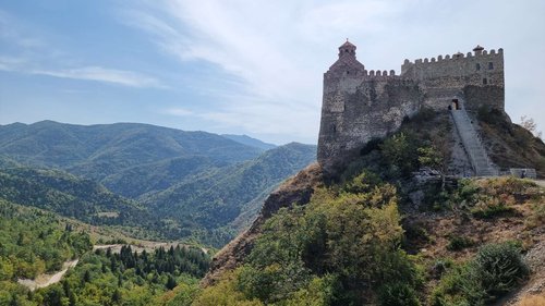
Downstream from Bateti stands the Fathers' Monastery of Mzovreti with its hilltop fortress, roughly six kilometres from the lake as the crow flies. Lower still, near the mouth of the gorge, sits Kintsvisi, a 12th and 13th century monastery whose frescoes are known well beyond the region. A full account of the valley, with every monastery and a sensible order to see them in, is in the separate piece linked below.
If you have the day to spare, Kareli puts you within easy reach of the Ruisi Cathedral of the Mother of God, or you can turn off to Gori for the Stalin House Museum. Both sit on the same highway that takes you to the gorge.
🧭 Where to Stay and What Is Nearby
Kareli and Gori serve as bases: the only way to sleep at the lake itself is under canvas, as there are no guesthouses in the upper gorge.
Been to Bateti? Leave a review on Madloba: tell us what shape the gravel track was in, how long the drive and the walk up took, and whether the lake and the valley monasteries work as a single day.
Information is current as of July 2026. The condition of the gorge road and the climb to the lake changes with every spell of rain, so check locally before you travel.
❓ Frequently Asked Questions
💬 In Georgia, Shida Kartli region, Kareli Municipality, in the Dzama Gorge on the northern slope of the Trialeti Range. The nearest village is Kodmani, about 23 kilometres from the town of Kareli. The lake has nothing to do with Adjara or Imereti.
💬 A landslide. Ground came down the southern slope and blocked the valley of the Batetistskali stream, and water built up behind it. The claim about a karst sinkhole in limestone is not supported for this lake.
💬 1,313 metres above sea level. That is mid-mountain forest country rather than an alpine zone, which is why the lake sits inside beech and conifer woodland instead of meadow and rock.
💬 Up the Dzama Gorge from Kareli on tarmac, then turn at the sign for Tbeti Monastery and cover about three kilometres of gravel. There is essentially no public transport into the upper valley, so you need your own car or a taxi from Kareli.
💬 Around forty minutes uphill, sometimes closer to an hour, depending on where you leave the car. In dry weather part of the track is driveable in a four-wheel drive; after rain the ruts turn to mud.
💬 From late spring to mid-autumn. October is widely considered the best for the forest colour. From December to March the lake is frozen and the road up is unpredictable.
💬 Neither. There are no fish in the lake, the banks are soft, the bottom is silted and the southern part of the basin turns into bog. No swimming area has been set up.
💬 Yes, tents go up by the water regularly, especially at weekends in the warm season. There is no infrastructure at all: no toilets, no bins, and water comes from the stream. Everything you bring in has to go out with you.
💬 A newt listed in Georgia's Red Book, identified in Georgian sources as Ommatotriton ophryticus. It stays near the marshy bank, so plenty of visitors never see one. There are no fish.
💬 The Dzama Gorge and its dozens of monuments: Mzovreti with its fortress about six kilometres down the valley, Kintsvisi with its 12th and 13th century frescoes near the mouth of the gorge, Shatberdi and others. Plan a day in the valley rather than a trip to one spot.

42 comments
Log in to leave a comment
אז, אני תוהה, יש שם גם מסלולים טיולים או שזו פשוט גן עדן לקמפינג? 🌲🔥
The idea of camping there and soaking up all that serenity might be a dream come true! But I find myself wondering, how on earth do you even get there? Are there trails, or do I need to channel my inner explorer and figure it out on the go? The thought of those monasteries nearby is just a cherry on top! Can't wait to hear more about your adventure!
Мне особенно понравилось, как автор передаёт атмосферу места: вода действительно выглядит спокойной и прозрачной, а лёгкий ветерок над озером создаёт ощущение умиротворения и тишины — идеальное место для отдыха от городской суеты.
Полезные советы в статье тоже радуют: где лучше расположиться у воды, какие ракурсы выгоднее всего для фотографий, и в какое время дня озеро особенно красиво. Такие подробности делают планирование путешествия намного проще и приятнее.
После прочтения захотелось не только прогуляться вокруг озера, но и заглянуть в близлежащие сёла — почувствовать местную атмосферу, пообщаться с жителями и попробовать блюда кухни региона. Такое сочетание природы и культуры делает поездку по‑настоящему насыщенной. 🌄✨
Спасибо за интересный и вдохновляющий обзор!
А вы уже были у озера Батети? Какие виды вокруг него кажутся вам самыми красивыми — зеркальная вода, лесные склоны или панорамы гор? 🏞️💫
Не удивительно, что это место популярно среди любителей походов. Здесь можно не только отдохнуть душой и любоваться природой, но и сделать потрясающие фотографии.
Думала в озере обитают различные маленькие рыбки, а там, не всем может приятный на вид, тритон.