




🏰 Imereti Castles: Seven Medieval Fortresses on the Land of Ancient Colchis
🏰 What to Know About Imereti's Castles
Seven medieval fortresses across five municipalities: from Shorapani, a strategic point since antiquity, to remote ruins that barely appear in guidebooks. Free entry everywhere, almost no infrastructure, and very few other visitors.
Imereti is the historical core of Colchis, the ancient kingdom that Greeks knew through the myth of Jason and the Argonauts. The Golden Fleece was kept here, in the land east of the Black Sea, and while the myth is legendary, the geography is real: Colchis occupied what is now Imereti, Samegrelo and neighbouring regions of western Georgia. Whoever controlled the Kvirila River valley controlled the main trading route from the Black Sea coast into the Caucasus interior. That explains the castles.
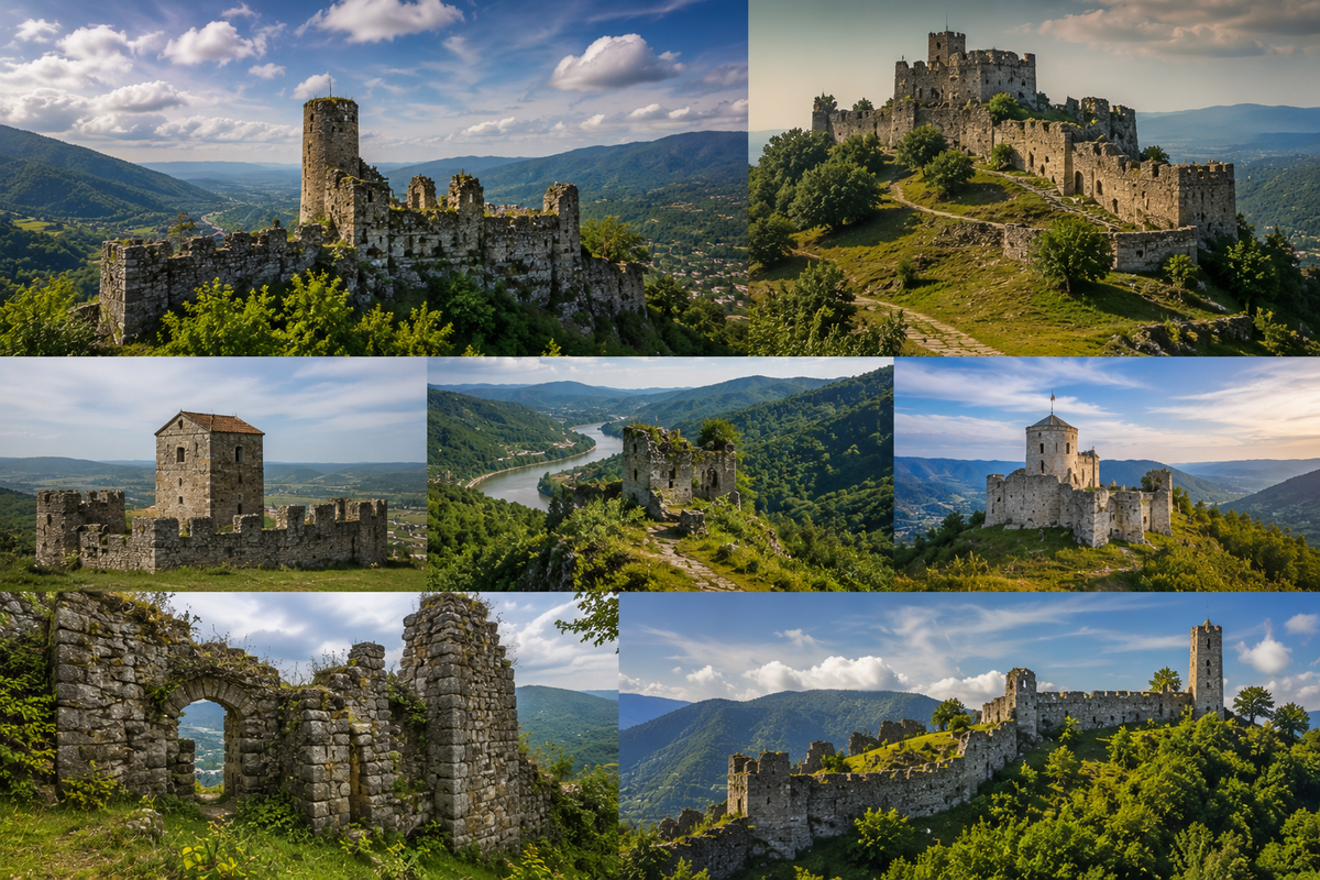
Seven of them survive in Imereti, catalogued on Madloba. The oldest, Shorapani, goes back to classical antiquity. The youngest, Modinakhe, was built in the 1730s. The other five sit somewhere between those dates, each on a rocky outcrop or ridge that commanded the approaches below. None of them are restored heritage sites with visitor centres. They are what they are: stone walls, towers and rubble in various states of survival, standing where someone decided they needed to see the enemy coming.
The castles scatter across the region. Modinakhe and Sveri are in the east, near Sachkhere and Chiatura. Shorapani and Sazano cluster around Zestaphoni in the centre. Skanda sits between Zestaphoni and Kutaisi, Telephisi reaches the western edge near Samtredia, and Dimna lies south in Baghdati Municipality. Seeing all seven in one day isn't realistic. Grouping two or three close ones is.
This guide covers all seven: location, what survives, how to get there and which ones repay a dedicated trip versus which ones are for completists. For a broader picture of what Imereti has to offer historically, the Madloba rating of architectural attractions of Imereti puts the castles alongside temples, palaces and other monuments of the region.
Seven Castles of Imereti by Area
Select an area to open the castle's catalogue page.
🏔️ Sachkhere and Chiatura (east) 2
🍷 Zestaphoni (centre) 2
🗺️ Terjola and Samtredia (west) 2
🍇 Baghdati (south) 1
To get a sense of the distances between all seven sites before planning a route, here's an interactive map with every castle marked. Dark red markers are the two main sites, Shorapani and Modinakhe. Gold marks Sveri and Telephisi. Beige marks Sazano, Skanda and Dimna. Click any marker to open the catalogue entry.
🗺️ Castles of Imereti on the Map
Open in Google Maps🏰 Shorapani: The Ancient Guardian of the Kvirila Valley
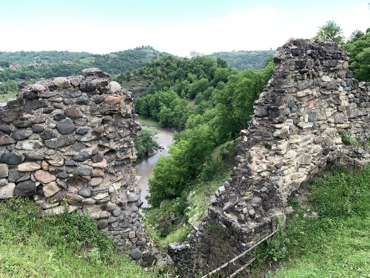
Shorapani Fortress stands in the town of Shorapani, Zestaphoni Municipality, on a rocky spur at the confluence of the Kvirila and Dzirula rivers. Coordinates: 42.09753, 43.08374.
The site makes immediate sense once you look at the map. In antiquity, this was the eastern frontier of Colchis, and whoever held the rock controlled the main land route from the Black Sea coast into the Caucasus interior. Classical authors mention it as a significant point in the region, and archaeologists place the earliest fortifications here before the Common Era. This isn't a medieval castle that happens to stand on an old foundation — it's a location that was strategically decisive for two thousand years.
What visitors see today reflects many later centuries: stone walls, towers and fragments of fortification rebuilt and extended through the Persian, Ottoman and medieval Georgian periods. Each new ruler found the same thing to be true about Shorapani: the high ground above two rivers gave a view that was worth fighting for.
The climb from the town is short but steep in places. From the top, the confluence of the two rivers is visible below, and that view alone justifies the detour. Shorapani comes up naturally when visiting the wider Zestaphoni area, and the two work well combined.
🏰 Modinakhe: The Tsereteli Clan's Fortress Above Sachkhere
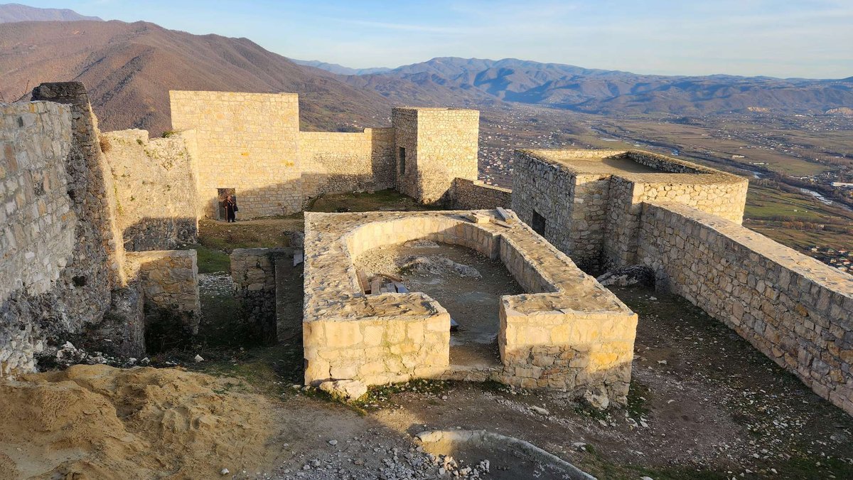
Modinakhe Fortress sits one kilometre north of Sachkhere, on a chalk limestone ridge at 700 metres above sea level. Coordinates: 42.34871, 43.40429. Of all seven castles in this guide, Modinakhe has the most detailed and dramatic documented history — a full account is in the dedicated Modinakhe guide.
The short version: the Tsereteli noble clan built the fortress in the 1730s. In 1767 they transferred it to the king. The site was close to impregnable by geography — remote, surrounded by steep slopes, visible from a distance but very difficult to assault. In its entire history Modinakhe was captured only once, during the Imereti Uprising of 1810, and only then because the defenders had run out of food and there were traitors inside.
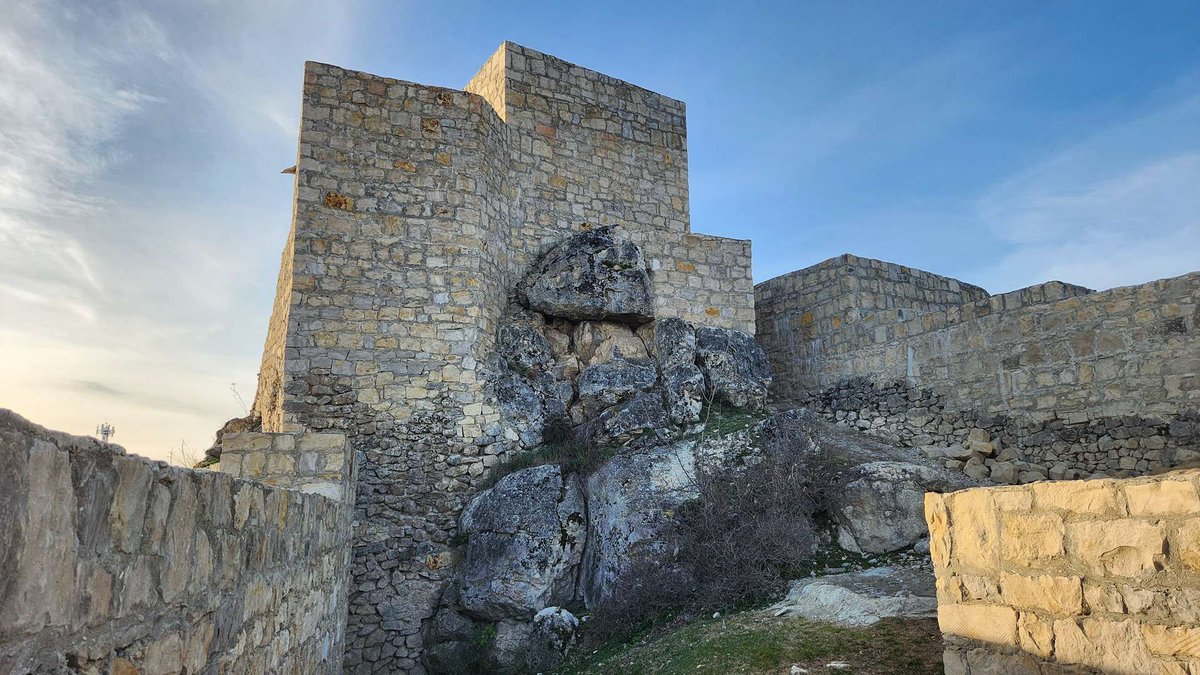
Much of the fortress was deliberately destroyed in 1830. The earthquake of 1991 brought down a large section of what remained. Today a substantial wall and several towers still stand. Archaeological work on the ridge found three distinct cultural layers: early Bronze Age, late Bronze and early Iron Age, and classical antiquity. Modinakhe was granted national monument status in 2018 and has been under rehabilitation since 2019.
The climb from Sachkhere is on foot. The views from the ridge across the valley are good, and the town itself is worth a walk before or after.
🏰 Sveri: A Hilltop Fortress near Chiatura
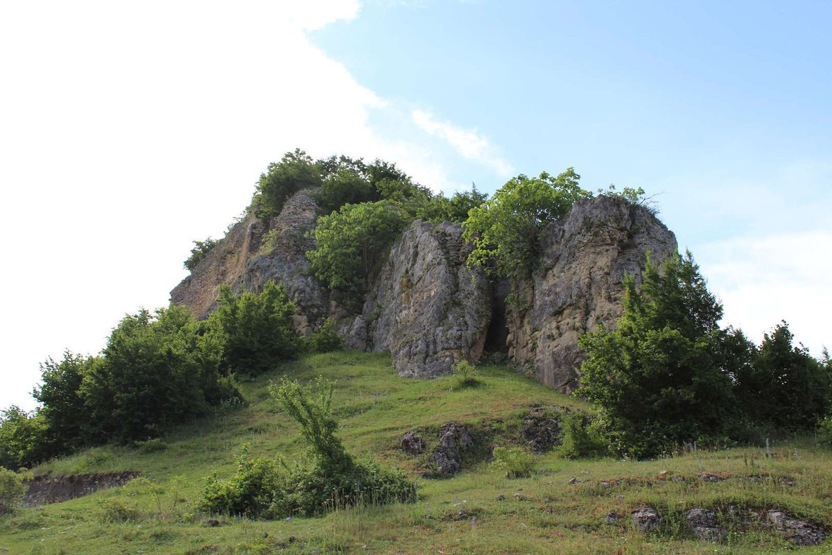
Sveri Fortress stands 7 kilometres south of Chiatura, on the edge of the village of Sveri in Chiatura Municipality. Coordinates: 42.23392, 43.31246.
Chiatura and its surroundings are cut through by the gorges of the Kvirila River and its tributaries — the kind of terrain where hilltop fortresses made obvious defensive sense. Sveri is typical of the type: compact, on a rise, with surviving fragments of walls and a tower. It commanded the approaches to the local roads and gave its garrison clear sightlines in most directions.
There's nothing set up for tourists here, which is exactly why Sveri tends to attract people who specifically want ruins without the crowd. The path up from the village is walkable; the views from the top stretch across the surrounding hills and valley. A visit usually takes between half an hour and an hour including the climb.
Chiatura itself is worth combining with the fortress. The town is famous for its Soviet-era cable cars, still running across the gorge, and the cave monastery of Mgvimevi is nearby — a full Chiatura day can include all three.
🏰 Telephisi: Ruins on the Western Edge of Imereti
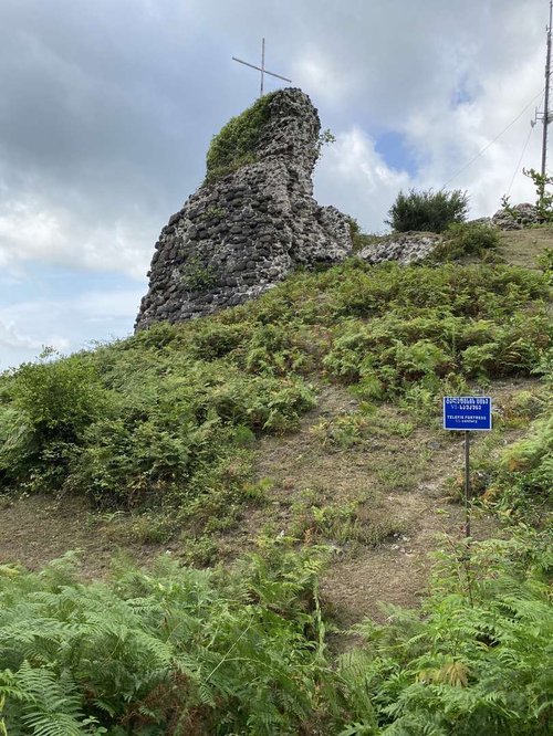
Telephisi Fortress is in the village of Tolebi, Samtredia Municipality, on the western edge of the region. Coordinates: 42.06731, 42.25452.
This is the westernmost of the seven, positioned not on the mountain trading routes but closer to the Colchian lowland — the marshy coastal plain that made up western Colchis in antiquity. The fortress is medieval, on elevated ground, with surviving stone wall fragments. Historical documentation on Telephisi is thinner than for Shorapani or Modinakhe, which makes it feel more like a discovery than a destination.
Getting there takes some planning. Samtredia sits on the main railway line and is reachable by train, but the village of Tolebi requires a car or local taxi from town. Visitors are rare. This is a site for people who travel with a clear reason, not one that rewards a casual detour.
🏰 Sazano: Above the Dzusa River Gorge
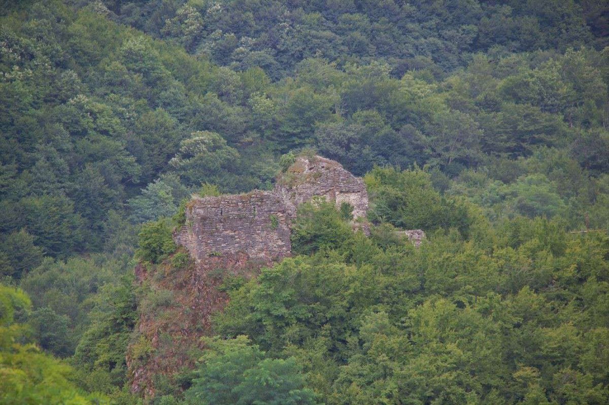
Sazano Fortress sits near the village of Kveda Sazano, Zestaphoni Municipality, in the gorge of the Dzusa River, southwest of the village. Coordinates: 42.18730, 43.08748.
The logic of the site is the same as Shorapani's: control over a river passage, elevated position, long views of the approaches. Sazano is closer to Zestaphoni than most of the other castles in this guide, and that proximity makes it the natural second stop after Shorapani when spending a day in the Zestaphoni area. Both are in the same municipality, both stand on rocky positions above water.
Preservation is partial: wall sections and traces of fortification on the ridge. No infrastructure, the approach is on foot. For anyone making a circuit of Zestaphoni Municipality's historical sites, Sazano adds a point without requiring a major detour.
🏰 Skanda: Central Imereti's Fortress
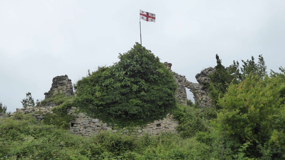
Skanda Fortress is in Terjola Municipality, in the interior of Imereti. Coordinates: 42.26831, 43.04613.
Skanda appears in regional historical surveys alongside Shorapani and Sveri as one of the documented fortresses in the Imereti defence network. A medieval hilltop fortification, it guarded the local road network in the area between Zestaphoni and Kutaisi. Wall fragments survive.
Like most castles in this guide, there's no tourist infrastructure and the approach is on foot. Skanda is convenient for anyone routing through central Imereti who wants to add a historical stop between Zestaphoni and Kutaisi without a significant detour.
🏰 Dimna: The Least-Known Fortress of the Seven
Dimna Fortress stands on the eastern edge of the village of Zemo Dimi, Baghdati Municipality, in the south of Imereti. Coordinates: 42.18142, 43.05819.
Baghdati is best known to the outside world as the birthplace of Vladimir Mayakovsky and as a wine-growing area, but it has its own defensive history. Dimna is part of that layer: a medieval fortress on a rise above the village, controlling the southern approaches to the region. It's the least documented and least visited of the seven.
Preservation is modest. Dimna makes sense for travellers who are working through the full set, or for those already spending time in Baghdati Municipality for the wine and landscape and willing to add one historical point.
🗺️ How to Plan a Route
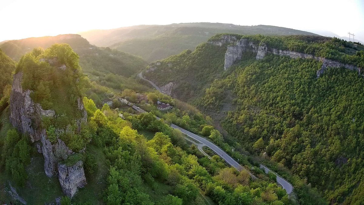
Route options grouped by area
Here's a practical transport breakdown for each castle. The general principle: Shorapani and Telephisi can be reached by public transport to the nearest city and then a taxi. Skanda, Dimna and Sazano are essentially car-only.
Getting There nearest transport hub for each castle
📜 Colchis, the Golden Fleece and the Defence Network
To understand why Imereti has this many castles, it helps to understand what the land was in antiquity. This was Colchis — the kingdom at the far eastern edge of the Greek-known world, the place where Jason sailed to find the Golden Fleece. The myth is legendary, but the geography is real: Colchis occupied the territory of modern Imereti, Samegrelo and adjacent regions of western Georgia.

Colchis was wealthy, and the Kvirila River valley was the main overland corridor connecting the Black Sea coast with the Caucasus interior and the trading routes towards Persia. Controlling transit meant collecting tolls and holding power. Shorapani sat at the entrance to this corridor. The other fortresses were positioned along the roads behind it. This wasn't a chain of feudal strongholds in the European sense; it was an infrastructure of control over movement.
Over the centuries the castles were rebuilt to face new threats. Persian campaigns, Ottoman incursions, internal struggles between Georgian principalities, rebellions against Russian rule in the early 19th century — each period left its layer of stone or removed someone else's. Modinakhe, built as late as the 1730s, shows that this kind of defensive construction was still active in Imereti well into the modern era.
The story of ancient Colchis and the Golden Fleece is told in more detail in the Racha and Imereti in the footsteps of the Golden Fleece article on Madloba. For those combining the castles with religious heritage, Gelati Monastery near Kutaisi — a UNESCO World Heritage site and the medieval academy founded by King David the Builder — sits in the same region and completes the historical picture.
📌 What to Bring
Download the Imereti Castles Guide
All 7 castles with coordinates, history, access level and Madloba catalogue links. Save to your phone for offline use on the road.
Have you visited any of Imereti's castles? Leave a review on Madloba: tell us which one you found, how you navigated to the less-known sites and whether any of them surprised you.
Information is current as of June 2026. Check road conditions and weather before setting out, particularly for the smaller sites in Baghdati and Terjola municipalities.
❓ Frequently Asked Questions
The Madloba catalogue lists seven: Modinakhe, Shorapani, Sveri, Telephisi, Sazano, Skanda and Dimna. They are distributed across five municipalities, from Sachkhere in the east to Samtredia in the west.
Shorapani. Archaeological evidence places the earliest fortifications on the site before the Common Era, and classical authors mention it as a significant point in the ancient kingdom of Colchis. It has been occupied and rebuilt in every major historical period since.
Shorapani and Modinakhe. Shorapani is the most historically significant and its clifftop position above the river confluence is immediately striking. Modinakhe has the best-preserved walls and towers, a dramatic recorded history and a full guide available. Both are reasonably accessible from the main road network.
For some, partially. Trains and minibuses reach Zestaphoni (for Shorapani), Sachkhere (for Modinakhe), Chiatura (for Sveri) and Samtredia (for Telephisi). From each town you'll need a local taxi and then a walk uphill. Skanda and Dimna are effectively car-only.
Between thirty minutes and an hour including the climb. The smaller sites, Sveri, Skanda and Dimna, are compact and quick. Shorapani and Modinakhe, with more to see and better views, are worth taking more slowly.
Imereti's castles were primarily military control points on trading routes, not religious compounds. Most have no functioning church inside. They are monuments to the region's military and political history rather than its spiritual life.
Imereti is the historical core of Colchis, the kingdom Jason and the Argonauts sailed to in the Greek myth. The castles were part of the defence network that protected Colchis's trade routes from the Black Sea coast. The Racha and Imereti in the footsteps of the Golden Fleece article covers the connection in more detail.
Shorapani and Sazano pair naturally with Zestaphoni and local wine. Modinakhe with Sachkhere town. Sveri with Chiatura, its Soviet cable cars and Mgvimevi Monastery built inside a natural cave. From anywhere in Imereti, Gelati Monastery near Kutaisi — UNESCO World Heritage — is within reach and rounds out a visit to the region's medieval heritage.

2 comments
Log in to leave a comment