




💧 Tobavarchkhili: The Trek to Samegrelo's Silver Lake at 2,650 Metres
Tobavarchkhili at a Glance
The largest of the lakes on the Egrisi range, sitting at roughly 2,650 metres. The name translates as "silver lake," and it's a shared name for several clear mountain lakes in this alpine zone.
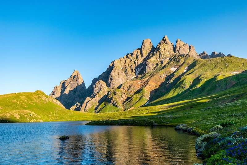
Tobavarchkhili, the largest of the lakes on the Egrisi range, sits at roughly 2,650 metres in the Chkhorotsku Municipality of Samegrelo-Zemo Svaneti, inside Samegrelo National Park. Sources give slightly different figures for its elevation, from 2,634 to 2,650 metres, with no single agreed number, so treat it as a range.
The place is remote and largely untouched by mass tourism, and that's precisely what defines it: the lake is reachable for roughly six weeks a year, and getting there takes nearly a week of self-supported trekking. What you get in return is mirror-still water reflecting the surrounding cliffs, and almost no one else around.
🔤 What the Name Means, and Why There's More Than One
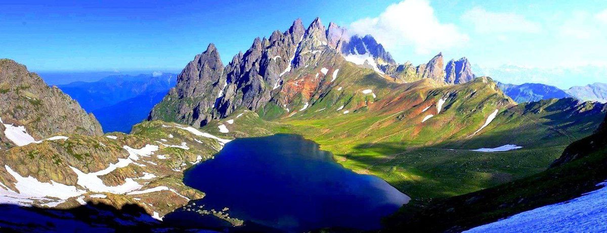
The name translates as "silver lake," a reference to the clear, mirror-like water. Its etymology is read differently across sources, some tie it to the Mingrelian language, others to Old Georgian, and there's no single verified version. Locals typically shorten it to simply "Toba," meaning "lake."
Worth understanding: "Tobavarchkhili" isn't the unique name of one body of water. It's what several clear mountain lakes in this alpine zone are called, and the name often refers to a whole cluster: Tobavarchkhili itself, the fairly large Lake Okhodje (also known as Tsashkibuli Toba, meaning "small lake"), and several smaller pools nearby.
Not One Lake, But a Whole Cluster
All of them are glacial in origin, though their depth suggests tectonic processes played a part too. The links lead to separate articles on the neighbouring lakes.
🏔️ What the Egrisi Range Is
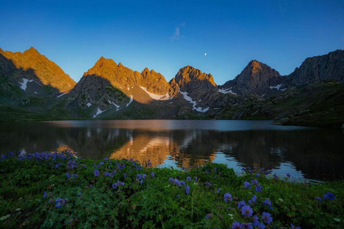
The Egrisi range stretches roughly 62 km in length and 37 km across, covering the municipalities of Mestia, Tsalenjikha, Chkhorotsku, Martvili, Lentekhi and Tsageri. Its highest point, Mount Lakumurashdudi, reaches 3,255 metres. Several karst massifs sit along its southern belt: Tsulishi, Kvira, Migaria and Askhi.
The range feeds several of the region's rivers: the Magana, Tekhuri, Khobi, Tkheishi, Kasleti and others. Tobavarchkhili's own outflow is a waterfall that drops into the Magana valley, and the Magana goes on to carve a canyon further downstream.
🌲 How the Landscape Changes as You Climb
One of the more interesting things about this route is that over a few days you pass through several completely different natural zones, and the scenery shifts visibly around you.
📜 The Lake's Legends
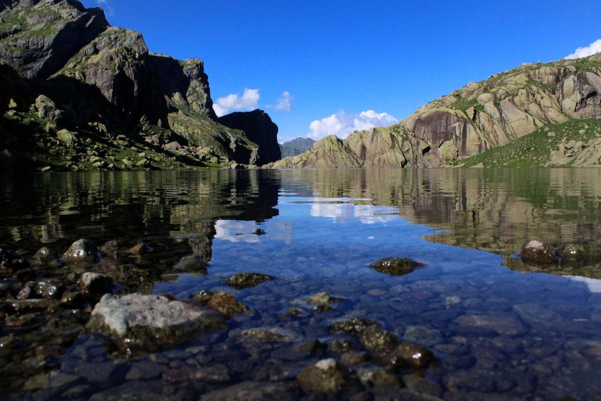
Several stories attach to Tobavarchkhili, passed on by guides and residents of the surrounding villages. In one, a descendant of God named Aramkhutu washed a wound here, at the sacred lake, after a fight against an evil giant while defending the place. Another local belief holds that dipping your hand into the water will bring on rain and a thunderstorm, which is why people treat the water here with some caution.
All of this is oral tradition, not documented fact. Take it as local folklore, the kind that gives the lake the status of a revered rather than merely scenic place. Visitors, incidentally, have given the Tobavarchkhili area an unofficial name of their own: the "magic lakes."
🥾 The Route: What to Expect
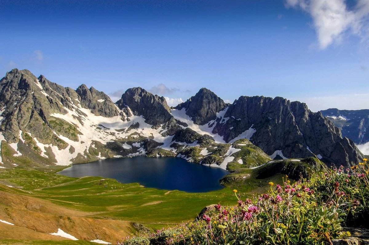
The way to Tobavarchkhili runs through the Khobistskali valley and is dense with natural features. Part of the journey is usually covered by off-road vehicle, which brings groups as far as the area around Mount Natipuru (roughly 2,055 metres), and from there it's on foot.
What You'll Pass Along the Way
The hut deserves a mention of its own. If you find local shepherds there, you may get to try elarji, a traditional Mingrelian dish of cornmeal with stretchy cheese folded through it. You'll likely also hear those lake legends firsthand rather than secondhand. If Mingrelian food is new to you, it's worth reading up on the dishes of western Georgia beforehand so you know what's being offered.
From there the route traverses Mount Natipuru past green meadows, then drops slightly to a beech forest with cascading waterfalls, where groups usually stop for lunch and a rest. After that comes the climb to the Okhodje pass, past cliffs and scree slopes, and one of the passes on the route reaches roughly 2,900 metres.
⏱️ How Long It Takes, and How Hard It Is
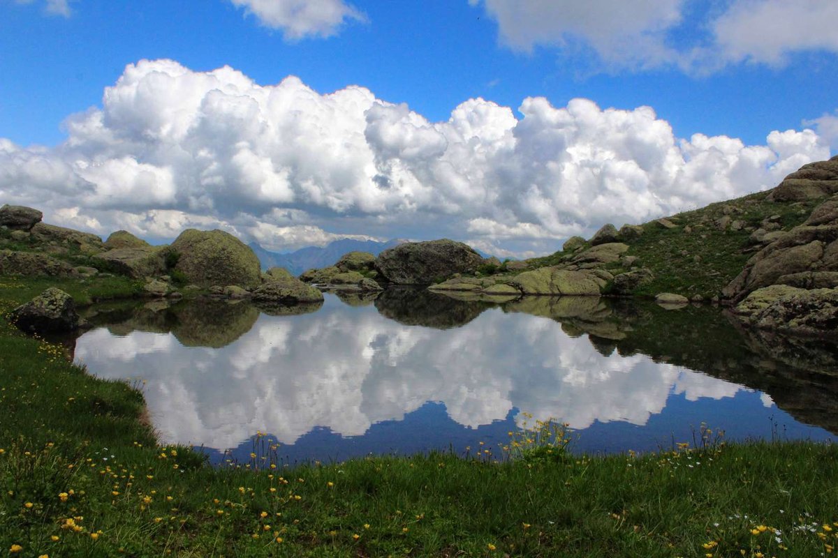
Honesty matters here, because this route gets underestimated regularly. According to tour operators, the trek runs six to seven days and is entirely self-supported, meaning no shops, no signal, and no chance to resupply along the way.
Total elevation gain exceeds 2,000 metres. The route includes mountain river crossings, glacier sections, and technically demanding ascents and descents. Organisers state outright that prior mountain trekking experience is required, and advise contacting them in advance if you have doubts about your fitness. This isn't a route where you learn as you go.
On the weather: snowfields turn up on the route even in August, and night temperatures at around 3,000 metres can drop to freezing. Sharp temperature swings and fast-changing conditions are the norm here, not the exception.
🗓️ When You Can Actually Get There
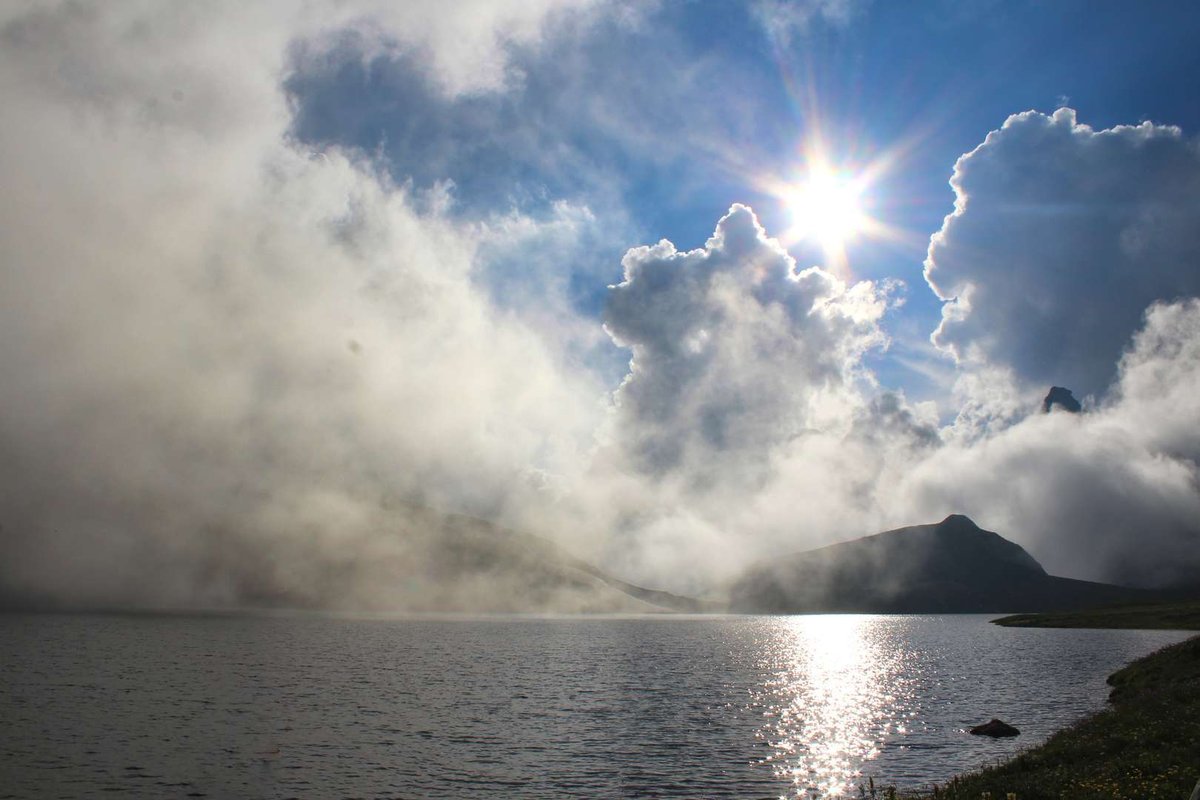
The access window is genuinely narrow: by trek organisers' estimates, the lakes are reachable for only about six weeks a year, in the height of the warm season. The rest of the time, the passes and trails are under snow.
That's probably the main reason Tobavarchkhili stays quiet even as its reputation grows: you physically cannot show up whenever you feel like it.
What Matters on a Self-Supported Trek
This list isn't exhaustive: your exact kit depends on your group and the weather in any given year.
📌 What to Sort Out Before You Go
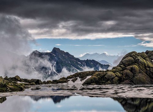
The key decision gets made at home: this route is either done with an organised group and an experienced guide, or not done at all. Setting out alone without multi-day mountain trekking experience and local knowledge isn't safe here, particularly given the glaciers, the river crossings and the complete lack of support.
Plan strictly within the seasonal window and check current conditions in advance: snow conditions vary from year to year, and the route may open earlier one season and later the next.
Have you been to Tobavarchkhili? Leave a review on Madloba: tell us which route you took, how many days it ran, whether you hit snowfields, and what first-timers planning this trek should know.
Information is current as of July 2026. Trail conditions, snow cover and route accessibility change from season to season. Before a multi-day trek, check the current situation with local guides and the Samegrelo National Park administration.
📚 Read Next Samegrelo in more detail
❓ Frequently Asked Questions
💬 In the Chkhorotsku Municipality of Samegrelo-Zemo Svaneti, on the Egrisi range, inside Samegrelo National Park, at roughly 2,650 metres.
💬 "Silver lake," a reference to the clear, mirror-like water. It isn't the unique name of one lake but a shared name for several clear mountain lakes in the zone. Locals shorten it to "Toba."
💬 Six to seven days according to tour operators, entirely self-supported, with no shops or signal along the way.
💬 Difficult. Elevation gain exceeds 2,000 metres, and there are mountain river crossings, glacier sections, and technically demanding ascents and descents. Prior mountain trekking experience is required.
💬 The access window is narrow, roughly six weeks a year at the height of the warm season. The rest of the time the passes are under snow.
💬 Yes, trek organisers report snowfields on the route in August, and night temperatures at around 3,000 metres can drop to freezing.
💬 The outflow is a waterfall that becomes the Magana river, which goes on to carve a canyon downstream.
💬 Okhodje (Tsashkibuli Toba), Didgalish Toba, Kaliashi Toba, Tsakatskarish Toba, Okare Toba and Lakumurashi, all on the same Egrisi range.
💬 In one, a descendant of God named Aramkhutu washed a wound here after fighting an evil giant. In another, dipping your hand in the water brings rain and a thunderstorm. Both are folklore, not historical fact.
💬 There's a shepherd's hut at the foot of Mount Natipuru where you may get to try elarji if you find local shepherds there. But it can't be counted on as a food source, the trek is self-supported.

43 comments
Log in to leave a comment
Мне особенно нравится, что в статье есть советы от местных 👣💬 — они подсказывают лучшие маршруты вокруг озера, где спрятаны живописные уголки и с каких точек открываются самые красивые виды 📸. Такое место идеально подходит для пикника, медитативных прогулок и вдохновляющих фото!
После прогулки вокруг озера так приятно представить, как я зайду в уютное кафе ☕🍰, обсудим все впечатления с друзьями за чашечкой ароматного кофе и бокалом грузинского вина 🍷 — ведь такие моменты отдыха остаются в сердце надолго 💛
Мне очень нравится, как этот рейтинг помогает почувствовать атмосферу места ещё до поездки — живые описания, реальные отзывы и полезные подсказки делают путешествие по‑настоящему ярким 🌿💫
А вы уже были у озера Тобаварчхили? Какие виды или уголки вокруг него вас особенно впечатлили, и в какое время года, по вашему мнению, сюда стоит отправляться, чтобы поймать самую красивую атмосферу? 🏞️🌞💙
Отдельно благодарю автора за фотографии и даже горы в близи озера по-особенному красивые.
Прочитала статью «Горные озера, которые стоит посетить. Озеро Тобаварчхили в Грузии» на сайте madloba.info. Что можно сказать о статье.
✅ Положительный момент статьи: Увлекательная статья об озерах Тобаварчхили в Грузии. Сегодня Тобаварчхили остаются местом паломничества и привлекают множество туристов, желающих насладиться красотой природы и узнать больше о легендах и истории этого уникального места. Здесь можно провести незабываемый отдых, заняться рыбалкой, гулять по живописным окрестностям и наслаждаться широкими панорамами горного пейзажа. Тобаварчхили – это красивые, загадочные и удивительные озера, которые не оставят никого равнодушным.
✅Отрицательный момент статьи: Хотелось бы дополнить статью информацией о доступности для купания озера Тобаварчхили в Грузии. Также разъяснить понятие, которое содержится в последнем предложении статьи, а именно: «Озеро является укрытием для туристов», что в Вашем понимании «укрытие».
Несмотря на положительные и отрицательные моменты статьи, я благодарю автора на каталоге Мадлоба за исчерпывающую информацию!
озёр на Эгрисском хребте. На фотографиях, водной глади озера очень чётко видно
горные склоны, верхушки и растительность как на зеркале. От этого идёт и его
название зеркальное. Вода кристально чистая. Эти озёра ледникового происхождения.
В статье говорится что в происхождений его сыграли тектонические явления, значит
в следствие землятресения и вулканического извержения произошли и эти ямы для озёр.
В историй очень много легенд о происхождений и зеркальности озёр.
Спасибо автору об интересном изложений о местности и легендах про озёр
озёр на Эгрисском хребте. На фотографиях, водной глади озера очень чётко видно
горные склоны, верхушки и растительность как на зеркале. От этого идёт и его
название зеркальное. Вода кристально чистая. Эти озёра ледникового происхождения.
В статье говорится что в происхождений его сыграли тектонические явления, значит
в следствие землятресения и вулканического извержения произошли и эти ямы для озёр.
В историй очень много легенд о происхождений и зеркальности озёр.
Спасибо автору об интересном изложений о местности и легендах про озёр