




🌉 Tamara Bridges in Adjara: Where are the old arched crossings and how to see them?
How to read this guide to Adjara bridges
Not all “Tamara Bridges” were built in the same period. Here the legendary name is separated from the facts, and the routes are arranged so you can understand where it is realistic to go from Batumi.
Old stone crossings have survived in the mountains of Adjara, and locals often call them “Tamara Bridges” 🏰 This name appears in almost every route from Batumi to Makhuntseti, Keda, Machakhela, Shuakhevi or Kintrishi. But behind the beautiful legend there is a more complex story: some bridges are connected with medieval roads, some were repaired and rebuilt in different periods, and some structures, such as Khutsubani, appeared only in the 20th century and only look like ancient arch crossings.
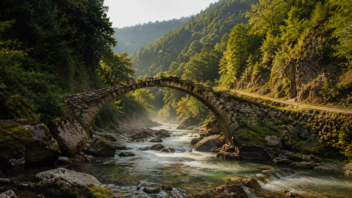
The arch bridges of Adjara matter not only as photo points. They are traces of old roads that connected mountain villages with valleys, monasteries, markets and the Black Sea coast. A stone arch allowed people to build a narrow crossing over a fast river without intermediate supports. In the mountains, this was not decoration, but an engineering necessity: rivers rise after rain, carry stones, wash out banks and quickly test any structure for strength.
This hub brings the whole topic together in one place. It includes the main bridges, routes from Batumi, the difference between legend and facts, links to Madloba cards, related articles, categories and connected guides. If you need a short description of one object, open its card. If you need a ready route, use the route blocks. If you want to expand the topic, below there are links to waterfalls, fortresses, national parks, viewpoints and city routes in Batumi.
For a first introduction, it is easiest to travel through the Adjaristskali valley: Old Makho Bridge, Mirveti Arch Bridge, Makhuntseti Bridge, Dandalo and Dzhaimela form a clear one-day route. If you want less tourist flow, look at Furtio, Tskhemlar, Tskhemvani, Tskhmorisi, Khabelashvili and Zemlyanoy Bridge.
📜 Why they are called Tamara Bridges
The name “Tamara Bridges” lives in Adjara as a folk expression. Old arch crossings are often called this way, even when the exact dating is disputed or when the bridge appeared later than Queen Tamara’s era. For a traveller, it is a convenient name: it immediately connects the crossing with Georgian medieval history, mountain roads and legends about a powerful ruler.
Historically, the picture is more complex. Different researchers have dated Adjaran arch bridges in different ways. Some attributed part of the structures to the early Middle Ages, others connected individual bridges with the 9th-12th centuries, and others speak more cautiously about a wide period because the crossings were repaired, rebuilt and changed their appearance. In mountain terrain, this is natural: a bridge could stand for centuries, but after floods people strengthened it, relaid upper stone rows, changed the surface or repaired the approaches.
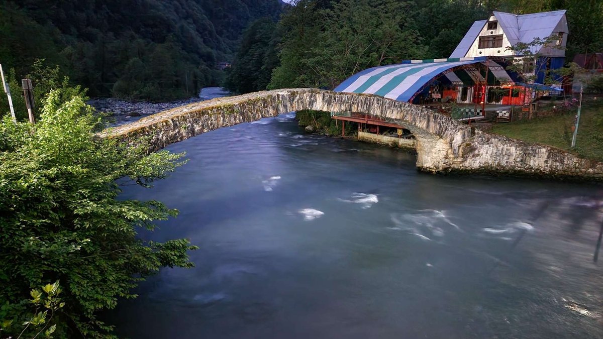
That is why in this article “Tamara Bridges” is used as a cultural name, not as a precise claim that all bridges were built by order of the queen. This approach is more honest: it keeps the legend in place, but does not turn it into an unsupported fact.
The confusion is also strengthened by visual similarity. A stone arch, a narrow pedestrian part, support on rocky banks, a green gorge around. But details matter: number of spans, material, traces of concrete, Soviet symbols, masonry type and support position help understand which period a specific crossing may be connected with.
If you want to understand the image of Queen Tamara more broadly in Georgian culture, also see the article about the Tamaroba holiday. And if you are interested in places connected with Tamara outside Adjara, open the article about Queen Tamara’s Castle in the Darial Gorge.
Interactive map
Arch Bridges of Adjara on the Map
Click a point, choose a district or select a ready-made route. This map helps you quickly understand which bridges are convenient to combine in one trip from Batumi.
Makhuntseti Bridge
KedaA popular crossing near Makhuntseti Waterfall. It is a good first stop for travellers who want to see an arch bridge without a long road.
Ready-made routes
This scheme helps you plan the order of stops. Before leaving, check the road and weather: in the mountains, routes can change faster than plans.
🏞️ Bridges of the Adjaristskali valley
The Adjaristskali valley is convenient for a first route to bridges from Batumi. Here you will find crossings that are easier to reach by car or with a tour. In one day you can combine bridges, Makhuntseti Waterfall, small villages, mountain views and stops by the river.
Dandalo
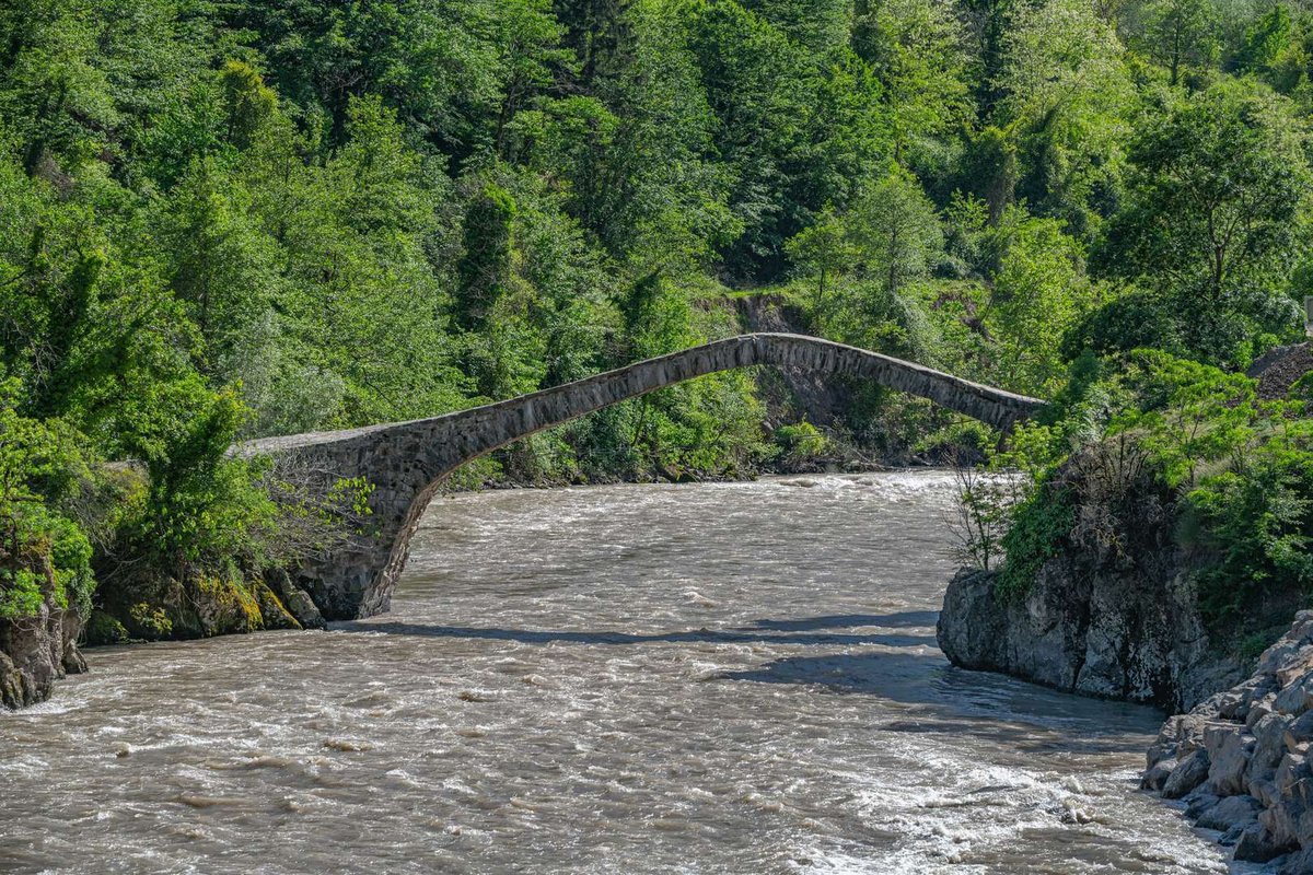
Dandalo Bridge is located in Keda Municipality, near the village of the same name and the road through the Adjaristskali valley. It is a stone arch bridge that clearly shows how old engineering worked in mountain terrain: the arch crosses the river, while the supports are connected with the natural relief of the banks.
Dandalo is valued for its proportions, curved line, stone masonry and connection with a historical road. Visually, the bridge does not feel heavy: the arch is stretched, and the silhouette is easy to read from lower points near the water. According to the Madloba card, the object has the status of a cultural monument of state importance, and the bridge length is listed as 34.5 m.
For a route from Batumi, Dandalo is convenient after Makhuntseti: the road gradually leads from a more visited area toward quieter parts of Keda. If you have time, do not limit yourself to a photo from above. Go down toward the river, but only if the path is dry and safe. After rain, the stones can be slippery.
If you need a separate article about this object, Madloba has a material about the stone arch bridge of Dandalo. In this hub, Dandalo works as a key route point, while the article gives more detail about history, the road and impressions from a visit.
Makhuntseti
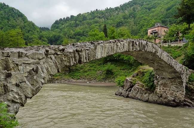
Makhuntseti Bridge is located near the popular Makhuntseti Waterfall. Because of this, it often becomes the first old arch crossing that travellers see in Adjara. It is easy to reach from Batumi, with a road, stopping points, cafés and excursion traffic nearby.
The bridge stands above the Adjaristskali River and clearly shows the principle of an old stone arch: without modern supports in the middle, relying on natural banks. In the card and related descriptions, the parameters appear as about 28.7 m in length and 2.5 m in width. These numbers are useful not as dry data, but for understanding scale: the bridge looks light, but it was designed for serious load.
It is better to come in the morning or closer to evening. During the day, there are often more people here, especially in summer and on weekends. If you want to calmly look at the masonry, take photos without crowds and go down to the river, do not plan Makhuntseti as your only midday stop.
Nearby you can combine the waterfall, the bridge, a short walk and lunch in mountain Adjara. If you are building a wider route, after Makhuntseti it is logical to go to Dandalo, Dzhaimela or farther toward Furtio.
Furtio
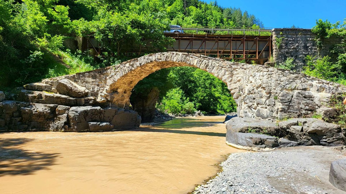
Furtio Bridge is located in Shuakhevi Municipality, between the villages of Zamleti and Furtio, on the Adjaristskali River. It is less convenient for a random stop than Makhuntseti, but it suits travellers who want to move away from the standard excursion line.
Furtio is often called the “royal bridge”. According to legend, Queen Tamara, travelling to Skhalta Monastery, dismounted from her mule and crossed this bridge on foot. It is hard to verify such a detail historically, but the legend explains why the bridge has an important place in local memory.
From a practical point of view, Furtio is interesting because of its location. It stands in a narrowing of the riverbed, where the bridge rests on rocky banks. Tourist descriptions give the length of the roadway as 19.7 m, the width in the middle part as 2.2 m, and the arch thickness as about 60 cm. These parameters are better to use than the disputed figure of 35 m that sometimes appears in retellings.
Furtio is convenient to include in a route through Upper Adjara together with Skhalta, Khikhani and Shuakhevi. If you are gathering historical places, related materials about fortresses in Adjara and individual articles about mountain villages, for example rest in the village of Garetke, will fit the topic.
Mirveti
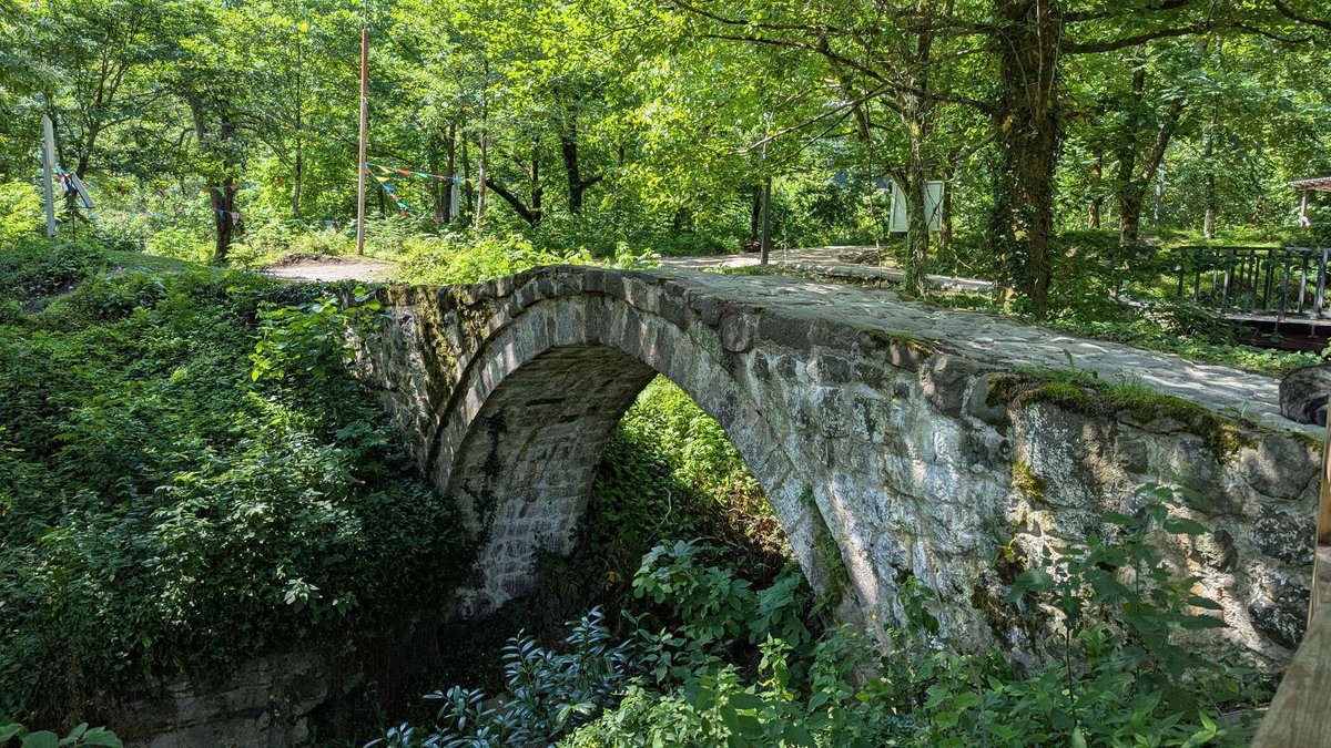
Mirveti Arch Bridge is located in the village of Mirveti, near the road and a green gorge. It is convenient to include in a route through Keda, especially if you are driving from Batumi toward Makhuntseti and want an additional stop without a long detour.
Mirveti is important not only as an old bridge, but also as an example of confusion in names. In the same area there is the Mirveti Suspension Bridge, but it is a different structure. The arch bridge is connected with a stone crossing and a historical route, while the suspension bridge belongs to another type of walking object.
According to the Madloba card, Mirveti Arch Bridge dates to the 11th-13th centuries, is about 12 m long, about 2 m wide and rests on natural rocks. This is a narrow crossing, so it is important not to crowd on it and to walk carefully on the surface, especially after rain.
Near Mirveti, travellers often visit a waterfall and boxwood forest. If time is short, Mirveti can be placed between Old Makho Bridge and Makhuntseti. If you have more time, stay in the village, walk toward the water and compare the old arch with modern crossings nearby.
Tskhmorisi
Tskhmorisi Bridge is located in Keda Municipality and suits those who want to expand the Adjaristskali route beyond the obvious points. It has less tourist flow than Makhuntseti, so the impression is calmer.
Tskhmorisi shows the second line of Adjaran bridges well. Such crossings do not always appear in standard excursions, but they help show how dense the network of old roads was in mountain Adjara. These were not isolated monuments, but part of everyday movement, local economy and communication between villages.
If you are driving independently, check the map, road condition and parking point in advance. Some bridges in the region do not have major tourist infrastructure, and that is normal. Such places require a little more preparation, but they give more of the feeling of real mountain Adjara.
Tskhmorisi can be left as an additional stop if you have a car, good weather and spare time. For a trip with children, it is better to assess access and safety near the bridge in advance.
Dzhaimela
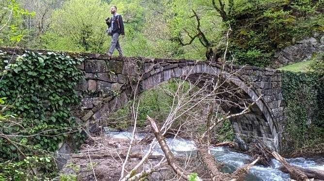
Dzhaimela Bridge is located near the village of Tsoniarisi. This is an important crossing for understanding old routes: the bridge connected not only river banks, but also directions between gorges, monastic complexes and neighbouring regions.
Descriptions give the bridge length at about 22 m and width at about 2.5 m. For an old mountain crossing, this is a noticeable scale. These dimensions show that the bridge had practical importance, not just a local footpath for a few houses.
Dzhaimela fits well into the route after Dandalo or as a separate point for those exploring Keda Municipality more deeply. Here it is worth looking not only at the arch itself, but also at the surrounding relief: bridges were built where the road could cross a difficult riverbed and remain usable after floods.
In cards and descriptions, different name variants may appear: Dzhaimela, Tsoniarisi. For readers, it is useful to understand from the beginning that this is one crossing in the Tsoniarisi area. If you are going to Dzhaimela, check nearby points in the category of architectural landmarks of Adjara.
Key bridges for the route
The table does not replace the descriptions below, but helps quickly compare the points by area, type and role in the trip.
| Bridge | Where it is | What matters | Route type |
|---|---|---|---|
| Dandalo | Keda, Adjaristskali valley | stone arch, expressive silhouette | Keda in 1 day |
| Makhuntseti | near Makhuntseti Waterfall | convenient stop from Batumi | first introduction |
| Furtio | Shuakhevi, between Zamleti and Furtio | legend of the “royal” crossing | Upper Adjara |
| Mirveti | village of Mirveti | nature and waterfall nearby | Keda and Makhuntseti |
| Dzhaimela | Tsoniarisi, Keda | old crossing between routes | extended route |
| Tskhmorisi | Keda, Adjaristskali River | quiet point outside the standard flow | addition to Keda |
| Tskhemlar | Machakhela | narrow pedestrian bridge in a green gorge | Machakhela |
| Tskhemvani | Kobuleti Municipality | legend of Tamara’s lost shoe | Kintrishi |
| Old Makho Bridge | Khelvachauri, near Batumi | convenient as the first stop | from Batumi |
| Makho Bridge | Khelvachauri | modern neighbourhood with an old crossing | object comparison |
| Khabelashvili | Shuakhevi | stone crossing away from the main flow | quiet route |
| Zemlyanoy Bridge | Pirveli Maisi, Keda | unusual masonry and name | unusual point |
| Khutsubani | Kobuleti Municipality | built in 1924, not medieval | important distinction |
🌿 Bridges of other valleys
Not all old crossings in Adjara stand in the Adjaristskali valley. Some lead into Machakhela, Kintrishi, Chvani and neighbouring areas. These places require more time, but they give a different character to the trip: less excursion rhythm, more gorges, forest and village roads.
Tskhemlar
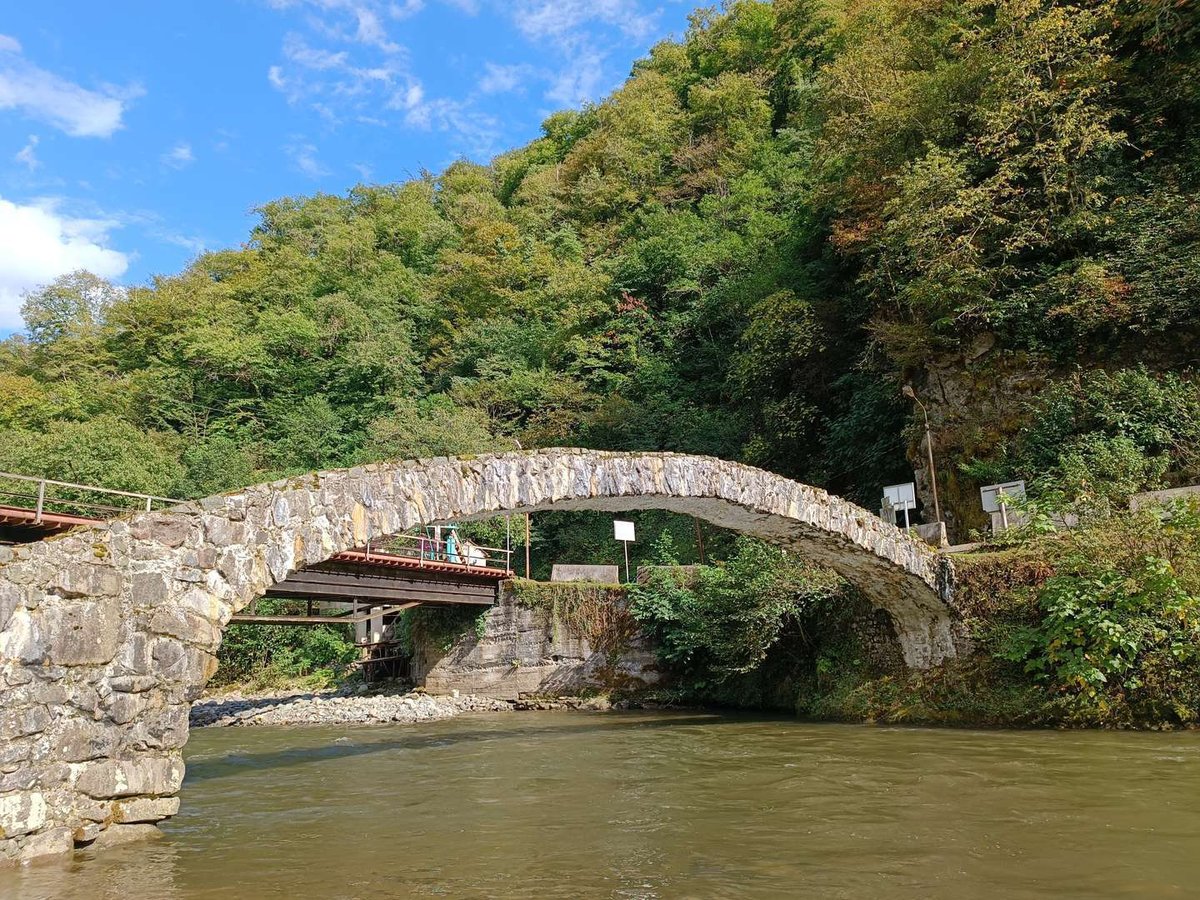
Tskhemlar Arch Bridge is located on the Machakhela River in the village of Tskhemlar. It is a narrow pedestrian crossing in a green gorge, where the humid climate quickly covers stones with moss, lichen and vegetation.
For a route, Tskhemlar is valuable because it combines architecture and nature. Machakhela feels different from the Makhuntseti valley: there is more of a national park mood, forested slopes and borderland history. The bridge can be visited together with Machakhela National Park, the Machakhela Visitor Center and Twins Waterfall.
According to the Madloba card, the bridge length is about 19.6 m and the arch height is 5.55 m. The crossing is narrow, so if you are with children, keep them close and do not linger on the bridge during rain or high humidity.
Tskhemlar should not be perceived as simply “another stone bridge”. Its value is in the setting: the arch, the river, the green slope and the feeling of an old pedestrian road that was part of local life before modern road bridges appeared.
Tskhemvani
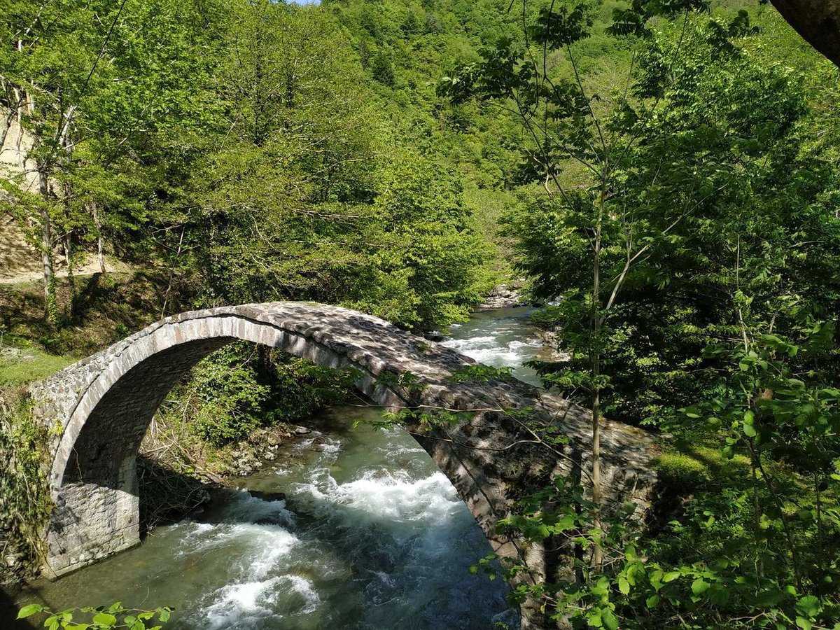
Tskhemvani Bridge is located in Kobuleti Municipality, in an area connected with the Kintrishi gorge. It is linked with the legend of Tamara’s lost shoe: according to the story, while crossing a fast river, the queen lost a shoe and ordered a bridge to be built that would withstand both river and time.
Like other legends, this story is better understood as part of local memory, not as a documentary chronicle. But it clearly shows how such crossings were perceived: the bridge was not just an engineering object, but a sign of power, protection and a road across dangerous water.
Tskhemvani is convenient for those travelling toward Kintrishi, Kobuleti or northern Adjara. It is not the first point for travellers who have only one day in the region, but it is a good stop for a deeper route. If you have already seen Makhuntseti and Dandalo, Tskhemvani will expand your understanding of the geography of old bridges.
Before the trip, check access. In places like this, the condition of the road and path matters more than the distance on the map.
Old Makho Bridge and Makho Bridge
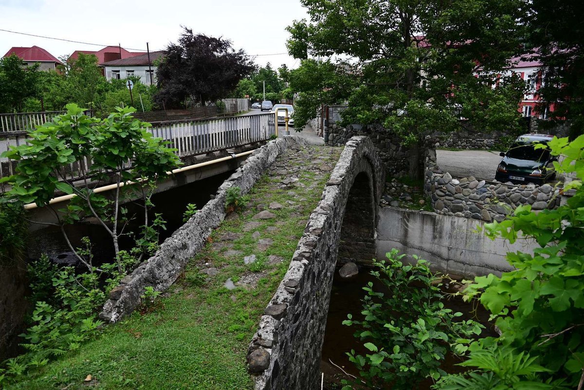
Old Makho Bridge is located in Khelvachauri Municipality and is convenient because it is relatively close to Batumi. It can be included before travelling to Mirveti, Makhuntseti and Dandalo.
In the Makho area, it is important not to confuse objects. The catalogue has Old Makho Bridge and a separate card for Makho Bridge. These are different points with similar names, so check the card and coordinates before adding a stop to your route.
Old Makho Bridge is interesting as the historical crossing closest to Batumi in this topic. If a traveller does not have time to go far into Keda or Shuakhevi, Makho can be used as a short introduction to the type of old arch bridges.
But it is not worth promising that it fully replaces the route through Adjaristskali. For a general impression, it is better to reach at least Makhuntseti and Dandalo.
Khutsubani
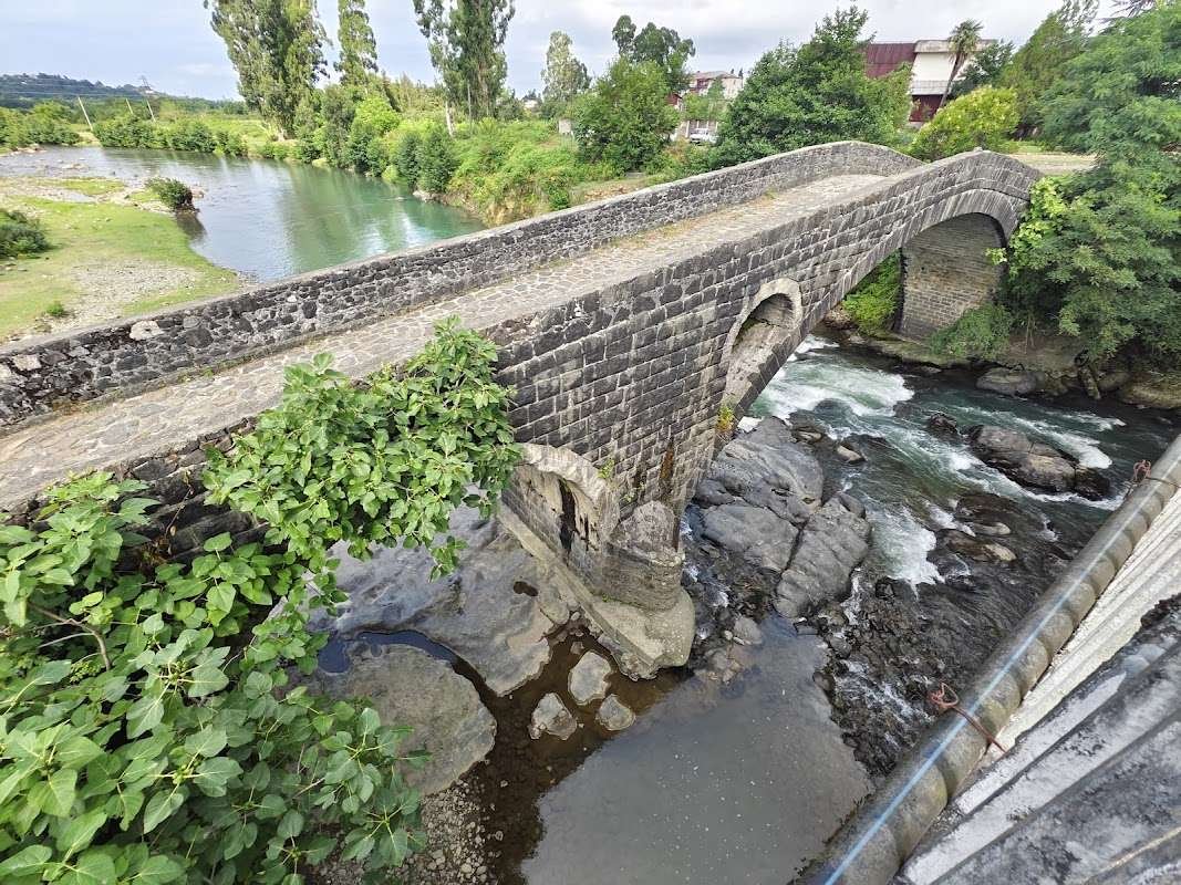
Khutsubani looks like an old arch bridge: stone facing, expressive form, a crossing over the river. That is why it is often added by habit to “Tamara Bridges”. But this is an important trap for travellers: Khutsubani was built in 1924 by the Italian architect Augusto Verci.
The main signs of later origin are two spans, a reinforced concrete structure under basalt facing, massive supports and Soviet symbols. On the stone slab in the crown of the large arch, you can see a relief with a sickle, hammer and star. This is not a medieval bridge detail, but a direct marker of the 20th century.
Khutsubani should be included in the article not as a mistake, but as a useful explanation. It helps show why appearance does not always prove age. In the region there are bridges that were repaired, rebuilt and received later elements. Khutsubani shows this principle especially clearly.
If you are building a route in the Kobuleti direction, Khutsubani can be seen together with Kintrishi, Tskhemvani and northern objects. The distinction is important: Khutsubani is not a medieval Tamara bridge, but a later crossing stylistically similar to old arch bridges.
Khabelashvili
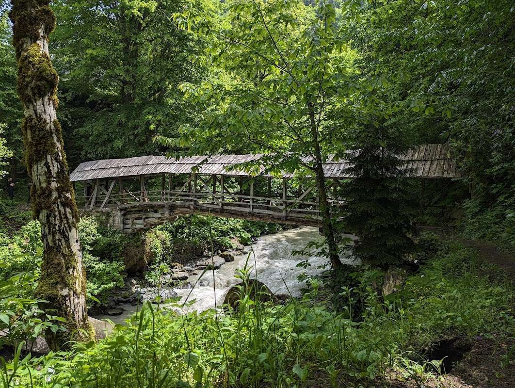
Khabelashvili Bridge is located in Shuakhevi Municipality and stands out among more famous objects because it lies away from the standard flow. The Madloba card describes it as an old stone crossing over the Acharistskali River, surrounded by forests and hills.
For the route, Khabelashvili is valuable because it broadens the topic. Historical crossings in Adjara are not all the same: some stand near popular waterfalls, others lead into quiet gorges, and others show how village roads connected river banks without tourist infrastructure.
Khabelashvili is worth visiting for those who have already seen the main bridges of Keda and want to go deeper into Upper Adjara. Here the road itself matters too: villages, forest, gorge and a calm rhythm.
If you travel without a car, plan the route in advance. Public transport to such places is not always convenient, and a taxi from Batumi may be impractical for one separate point.
Zemlyanoy Bridge
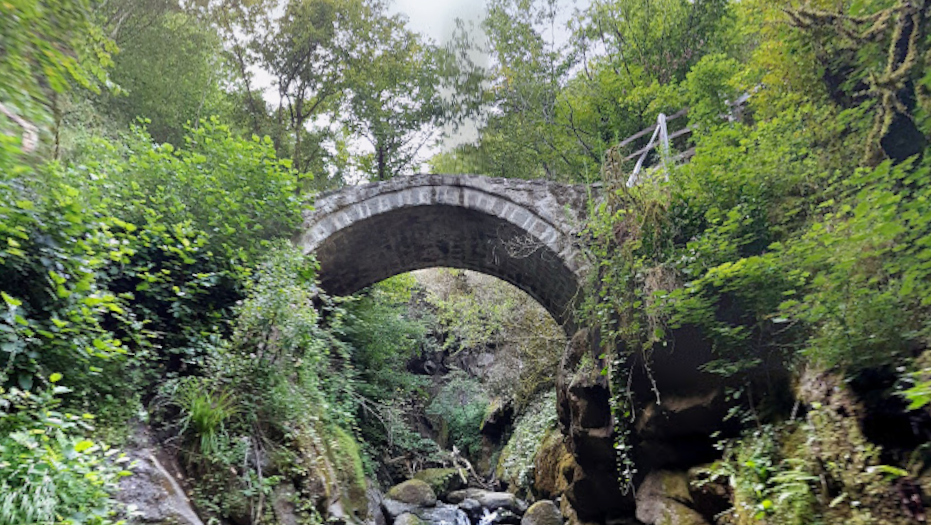
Zemlyanoy Bridge is located near the village of Pirveli Maisi in Keda Municipality. The name can be confusing: it is not a bridge made of earth, but a stone crossing whose appearance is linked with features of masonry and surface.
According to the Madloba card, Zemlyanoy Bridge dates to the 11th-13th centuries, stands on the Chanchakheti River and has a pedestrian surface about 16 m long and about 1.9-2 m wide. It is interesting because it shows another way of perceiving an old crossing: not a high postcard arch, but a more intimate object in a rocky place.
In a route, it is convenient as an additional point if you are already travelling through Keda and are not limited to Makhuntseti only. But for a first trip from Batumi, it is better not to make it the main stop: without context, it may seem less expressive than Dandalo or Makhuntseti.
How to tell an old arch from a later stylization
Bridges may look similar from a distance, but construction details often say more than the legend.
- usually one main span;
- supports connected with rocky banks;
- stone and lime mortar;
- narrow pedestrian surface;
- repair traces may differ from the lower masonry.
- may have two spans;
- reinforced concrete frame may appear;
- stone facing can imitate an older look;
- Soviet reliefs and dates may be present;
- the structure may be designed for a different type of load.
🗺️ Three routes through Adjara bridges from Batumi
The arch bridges of Adjara cannot be comfortably visited on foot like a city route. These are mountain points scattered across valleys and municipalities. So it is better to plan not a “walk”, but car routes from Batumi.
Three routes through old crossings
Choose the route not by the number of bridges, but by the road, weather and how deeply you want to go into mountain Adjara.
A bridge route is easy to connect with other Madloba materials. If you need a ready day with nature stops, see the one-day route from Batumi through scenic trails and waterfalls. If you are only planning your city route, the one-day route around Batumi, the solo route around Batumi and the hub about Batumi viewpoints will be useful.
🧭 What to see near the bridges
Bridges are rarely worth seeing as a separate “came, photographed, left” point. They open up better together with the gorge, village, river and nearby sights.
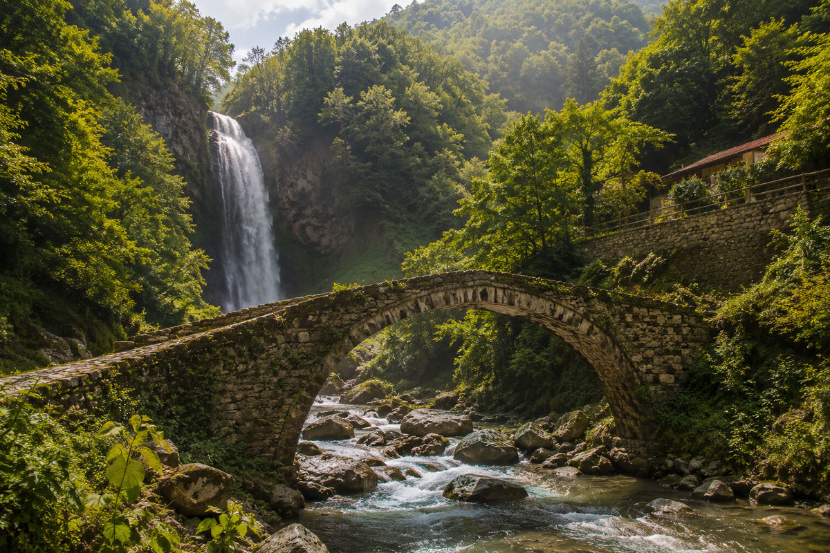
In the Makhuntseti area, it is logical to combine Makhuntseti Bridge and Makhuntseti Waterfall. This is a clear combination for a first trip from Batumi.
Around Dandalo and Dzhaimela, look not only at the bridges themselves, but also at the Adjaristskali valley. Here it becomes clear why old roads followed rivers and why bridges were built exactly in narrow parts of the riverbed.
Furtio can be combined with Skhalta Monastery, Khikhani Fortress and a route through Upper Adjara. If you want to add historical places to the trip, see the category of fortresses and ancient ruins in Adjara.
Tskhemlar opens up together with the Machakhela gorge, Machakhela National Park, Twins Waterfall and Chkhutuneti Fortress. Tskhemvani and Khutsubani can be viewed in connection with the Kobuleti direction, Kintrishi and northern Adjara.
For general navigation through cards, use the category architectural landmarks and monuments of Adjara. If you want to expand the route beyond bridges, also open the page of the Adjara region.
What to open after the bridge hub
If you need a short route, nearby landmarks or a regional guide, these materials will help continue planning.
⚠️ Safety near old bridges
Old bridges in Adjara stand in beautiful places, but they are not always equipped tourist sites. Somewhere there are no railings, somewhere the path is slippery, somewhere a fast river runs nearby, and sometimes access depends on the weather.
Before stepping onto an old bridge
Old crossings in Adjara often stand near mountain rivers, on damp stones and without familiar tourist infrastructure.
Download the Adjara stone arch bridges guide
The PDF includes old bridges, short descriptions, a comparison table, routes and practical tips before the trip. Save it to your phone, so you can open it offline in the mountains.
🧩 Short list of additional bridges
Besides the crossings described above, routes through Adjara may include other bridges, old, later, suspension or local. Add them to your trip only after checking the map and road condition.
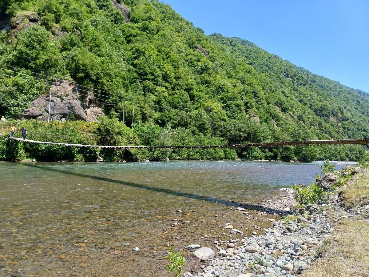
The suspension bridge over the Machakhlistskali River suits those who want not an old stone arch, but the feeling of crossing above a gorge. It is a different type of object, so it should not be mixed with “Tamara Bridges”, but it can be appropriate in a Machakhela route.
The Mirveti Suspension Bridge helps show the contrast between an old arch crossing and a more modern suspension crossing. If you are already in Mirveti, you can see both objects, but it is important not to confuse them in navigation.
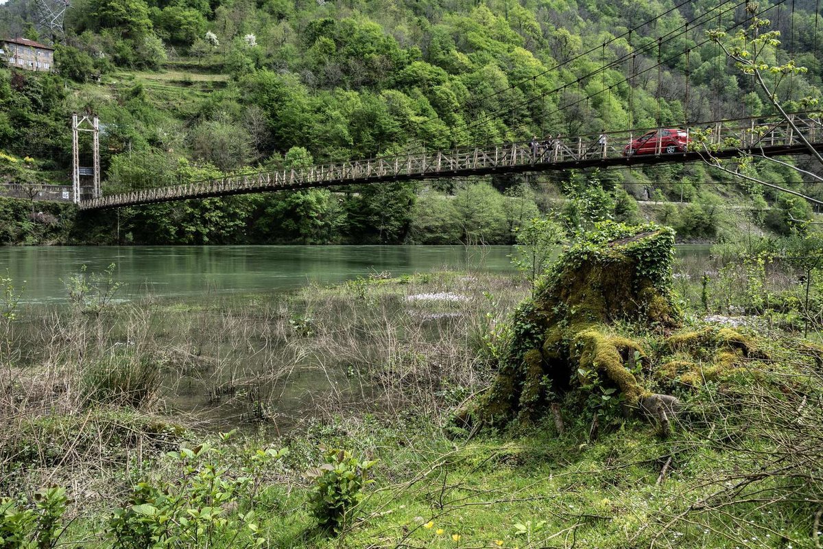
Makho Bridge should be used as a neighbouring card to Old Makho Bridge, so similar catalogue objects are not left without internal links.
If you are building an extended route through Machakhela, see also the articles about Machakhela National Park, the Machakhela Visitor Center, Twins Waterfall and Chkhutuneti Fortress. For a city start or finish, use the one-day route around Batumi and the Batumi places guide.
🤔 Is it worth travelling to the arch bridges of Adjara?
Yes, if you are interested not only in beach Adjara, but also in mountain roads, old villages, rivers, engineering and local legends. The arch bridges give a different image of the region: not resort-like, but historical and road-based. Through them it is easier to understand how mountain Adjara was connected with the coast and neighbouring valleys.
For a first introduction, choose a clear route: Batumi, Makho, Mirveti, Makhuntseti, Dandalo, Dzhaimela. It does not require going too deep into the mountains and gives different types of impressions. For a second route, go to Furtio, Skhalta, Khikhani or Machakhela.
Do not build the trip only around the number of bridges. It is better to see fewer, but calmly: approach the water, look at the masonry, understand the road, connect the bridge with the village and the gorge. Then it will not be a set of old arches, but a complete story about how people crossed mountain rivers for centuries.
💬 Now it is your turn
Have you visited the arch bridges of Adjara? Tell us in the comments which bridge you remember most: Makhuntseti near the waterfall, quiet Dandalo, Furtio in Upper Adjara, green Tskhemlar, Tskhemvani near Kintrishi or later Khutsubani with Soviet symbols. Your experience will help others choose a route and not confuse the legend with the real road.
ℹ️ Information is current as of June 2026. Road conditions, paths, bridge approaches and individual cards may change. Before travelling, check fresh reviews, the weather and the route on the map.
❓FAQ
This is a folk tradition. Locals often call old stone crossings “Tamara Bridges”, connecting them with the queen’s era. Historical dating is more complex: different bridges may belong to different periods, and Khutsubani was built in 1924.
For a first route, Old Makho Bridge, Mirveti, Makhuntseti, Dandalo and Dzhaimela are suitable. This is a convenient direction along the Adjaristskali valley, especially if you travel by car or with a guide.
Makhuntseti Bridge stands near the waterfall, an old stone arch crossing over the Adjaristskali River. It is often visited together with Makhuntseti Waterfall during a short trip from Batumi.
No. Khutsubani was built in 1924 by the Italian architect Augusto Verci. It looks like an old arch crossing, but differs by two spans, reinforced concrete structure and Soviet symbols.
Furtio Bridge is in Shuakhevi Municipality, between the villages of Zamleti and Furtio, on the Adjaristskali River. It is convenient to include in a route through Upper Adjara together with Skhalta and Khikhani.
Some bridges are used by pedestrians, but the condition and safety should be assessed on site. After rain, stones can be slippery, and some crossings do not have modern barriers.
For Machakhela, see Tskhemlar Arch Bridge and the suspension bridge over the Machakhlistskali River. They can be connected with Machakhela National Park and Twins Waterfall.
It is more convenient from spring to autumn, when mountain roads are easier and daylight is longer. After heavy rain, check the road, river level and access to the specific bridge.
For general navigation, use the category architectural landmarks and monuments of Adjara. It includes bridges, fortresses, monasteries and other regional objects.

4 comments
Log in to leave a comment