




🏔️What is Sherkhota volcano and how to climb it
Mount Sherkhota at a Glance
A peak at 3,701 metres in the Kazbegi Municipality, clearly visible from Gudauri. Completely covered in red volcanic scree, which is exactly why it's also known as "Sherkhota Volcano."
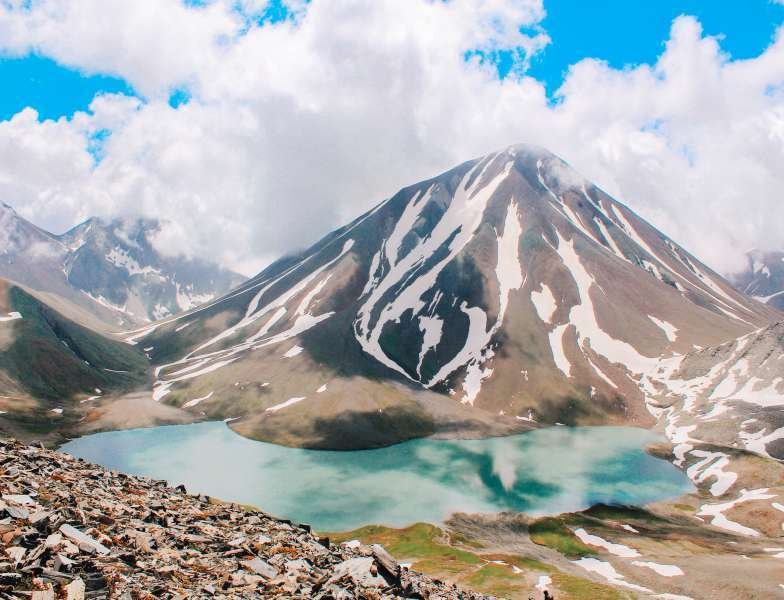
Mount Sherkhota rises to 3,701 metres in the Kazbegi Municipality of Mtskheta-Mtianeti, in the historic Khevi region. It's clearly visible from Gudauri and goes by a second name, "Sherkhota Volcano," which points directly to how it was formed.
This isn't a technical mountaineering objective. It's a peak you can walk up, one that happens to combine a volcanic landscape, panoramic views, and the company of one of the region's more striking high-altitude lakes.
🌋 Why People Call It a Volcano
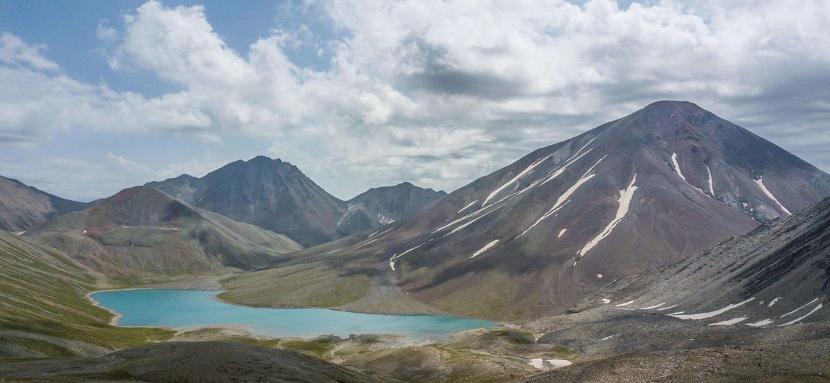
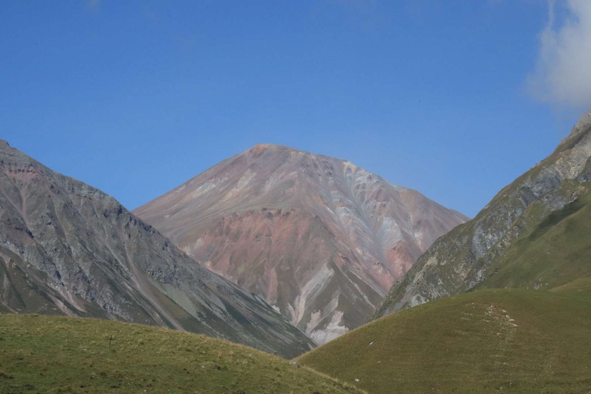
The mountain's alternate name comes straight from its appearance. Sherkhota is covered almost entirely in red volcanic scree, which creates a landscape that stands out sharply against the green alpine meadows and grey rock typical of Khevi's high country. That red tint on the slope is one of the most recognisable visual markers people use to pick Sherkhota out, even from as far away as Gudauri.
Worth noting separately: mountaineering trip reports also mention a Sherkhota Pass, a high-altitude pass in the same area that shows up in descriptions of multi-day traverses, for instance in the sequence "Ortsveri, Sherkhota, Batka." That's not the peak itself, it's a distinct, neighbouring feature that happens to share the name. Worth keeping the two straight if you come across the pass in other sources.
🚶 The Route: Via Lake Kelitsadi
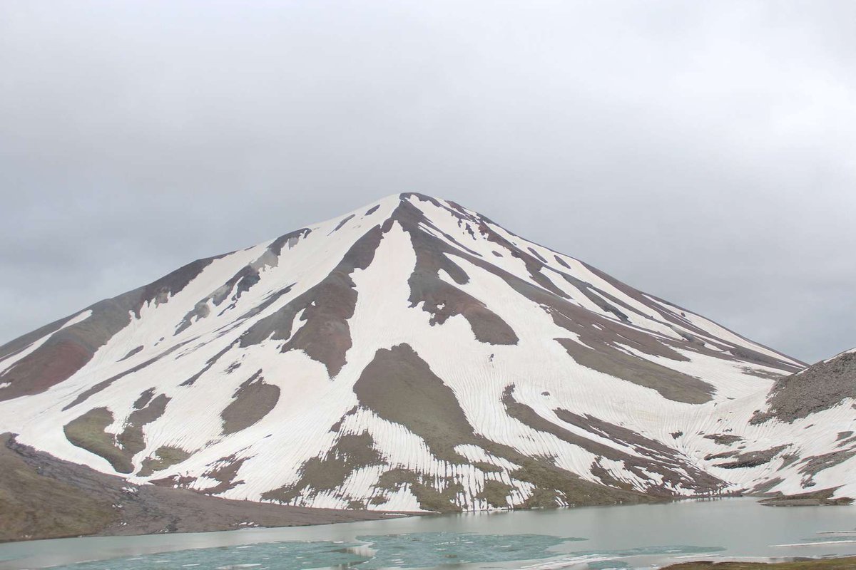
Most people reach Sherkhota by way of Lake Kelitsadi, since the peak stands right beside it. The climb doesn't call for any mountaineering gear and isn't technically demanding, ordinary fitness is enough.
The one real challenge is the surface itself. Going up, your foot sinks into the scree and your pace slows, which takes some extra effort. Coming down, that same scree becomes the enjoyable part, many describe the descent as a quick, almost playful stretch of the whole hike.
3,701 metres is a serious altitude, so acclimatisation matters. If you don't have much experience with high-altitude hikes, it's worth building the route up in stages rather than rushing it.
📌 Practical Information
Coordinates for your GPS: 42.52913, 44.37648. Summer is the best season, when the scree slope is dry and visibility is good. Weather in the high-altitude zone shifts fast, so check the forecast before setting out.
There's no infrastructure at the peak, bring your own water and snacks. A charged phone or a spare battery is worth considering depending on how long your hike runs, signal is unreliable at altitude.
Have you climbed Mount Sherkhota? Leave a review on Madloba: tell us which route you took, how the scree behaved on the way up, and what first-time climbers should know.
Information is current as of July 2026. Check the weather and trail conditions before heading out, conditions in the high-altitude zone can change quickly.
❓ FAQ
💬 In the Kazbegi Municipality of Mtskheta-Mtianeti, in the historic Khevi region, at 3,701 metres above sea level. It's clearly visible from Gudauri.
💬 The mountain is covered almost entirely in red volcanic scree, which points to its volcanic origin and gives it a distinctive look compared to neighbouring peaks.
💬 Most commonly via the route to Lake Kelitsadi, since the peak stands right next to it. The climb doesn't require any special gear.
💬 Not technically, but the scree slope slows your pace on the way up. The descent is faster and more enjoyable thanks to that same scree.
💬 In summer, when the scree slope is dry and visibility is good. Weather in the high-altitude zone changes fast, so check the forecast before setting out.
💬 No, these are two different features that share a name. Mount Sherkhota is the peak itself, while Sherkhota Pass is a neighbouring high-altitude pass that shows up separately in mountaineering traverses.
💬 Yes, the peak is clearly visible from Gudauri and serves as one of the recognisable panoramic landmarks in the area.
💬 3,701 metres is a serious altitude, so acclimatisation matters. Build the route up in stages if you don't have much experience with high-altitude hikes.

2 comments
Log in to leave a comment