




🏰 Javakhaant-Tsikhe Above the Tedzami: The History of Drisi Fortress, Its Names and the Climb
🏰 Drisi Fortress: The Essentials
The ruins of a castle on a crag above the Tedzami river, in Kaspi Municipality, Shida Kartli. The complex of wall, church, tower and palace belonged to the Javakhishvili family and controlled the northern entrance to the Tedzami gorge. The site has never been excavated and there are no facilities of any kind.
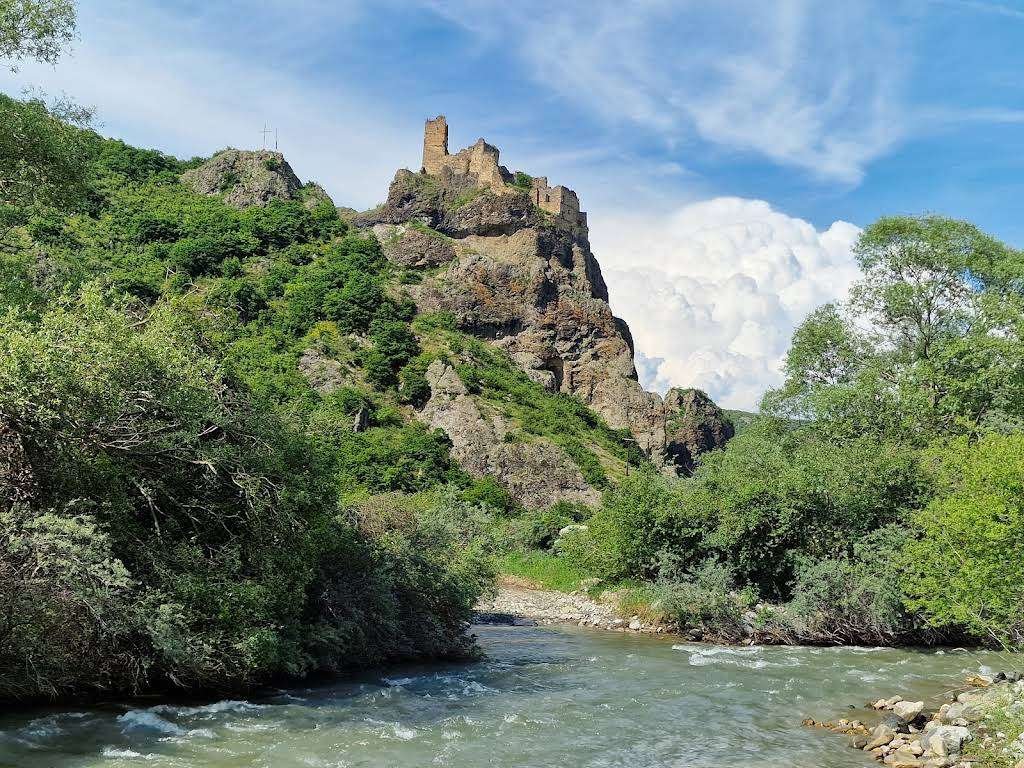
Drisi Fortress is the ruin of a medieval castle on a crag above the left bank of the Tedzami river, in Kaspi Municipality, Shida Kartli. It stands four hundred metres west of the villages of Zedadrisi and Chkopiani.
The place is far less known than neighbouring Rkoni, although it was Drisi that once sealed the approaches to the gorge from the north. And any account has to start with the names, because the castle has at least four of them.
🈁 What This Fortress Is Actually Called
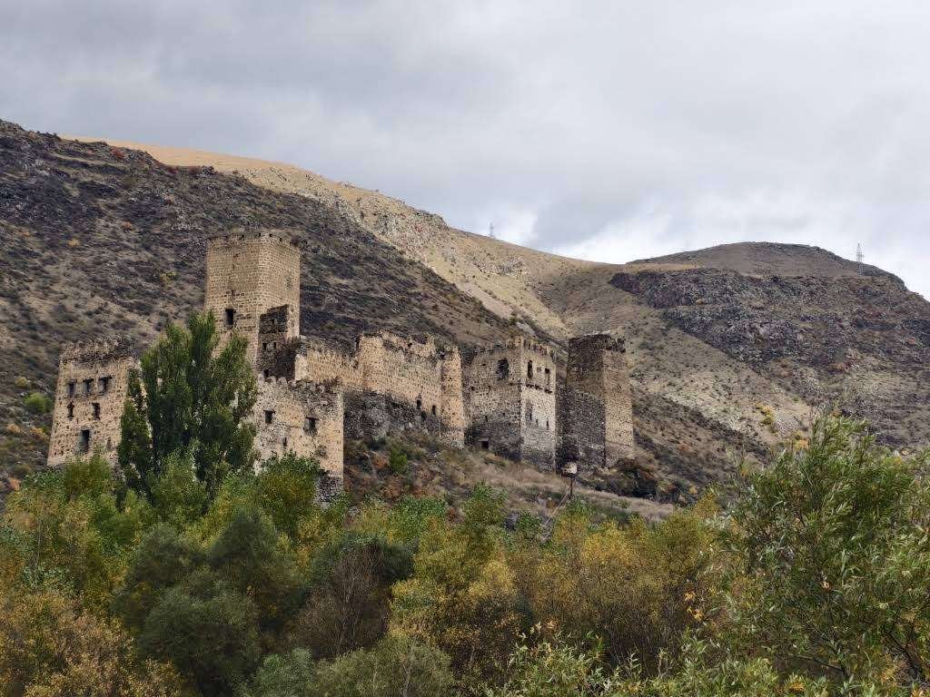
Georgian reference works give the site two names: Drisis tsikhe, Drisi Fortress, after the neighbouring village, and Javakhaant-tsikhe, meaning 'the Javakhishvili fortress'.
The second is easily explained. The castle and the whole upper course of the Tedzami lay within the holdings of the Javakhishvili family. It is a standard pattern for Shida Kartli: a family holds a gorge and the stronghold takes its name. Mzovreti in the neighbouring valley is known by the Tsitsishvili name in exactly the same way.
Russian-language guidebooks and tourism sites usually call it something else: Tamaris-tsikhe, Tamarisi or Javakhis-tsikhe. The first two translate as 'Queen Tamar's fortress'.
Some caution is warranted here. In Georgian reference works Tamaris-tsikhe is the Akhaldaba fortress in Borjomi Municipality, an entirely different site. And a kilometre and a half from Drisi, at Rkoni, stands a genuine Tamar's bridge, which is a likely source of the confusion.
Tamar's name in Georgia is attached to dozens of sites: bridges, castles, fortresses, churches. Popular tradition links the queen to anything old and conspicuous, and names of this kind have to be checked against the reference works every single time.
📜 What Is Known of the History
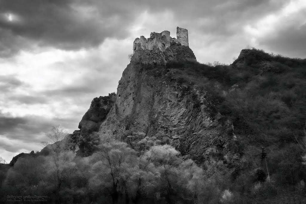
Not much, and that is worth saying plainly.
The castle has never been excavated. No archaeological work has been carried out here, so there is no firm dating: Georgian reference works assign it to the high feudal period, while Russian-language sources give a range of the eleventh to fifteenth centuries.
The principal written record comes from Vakhushti Bagrationi. In his Description of the Kingdom of Georgia he writes that west of Ertatsminda stands the fortress of Drisa, on a high rock, strong, on the river Tedzami.
The owners were the Javakhishvilis, who held the entire upper course of the Tedzami.
The castle's function can be read straight off the map: it closed the approaches to the Tedzami gorge from the north. And it did not stand alone. A whole line of strongholds ran along this gorge, Rkoni and Akhaltsikhe among them. The road through the gorge linked Shida Kartli with Trialeti, and it had to be held.
🗿 What Survives on the Crag
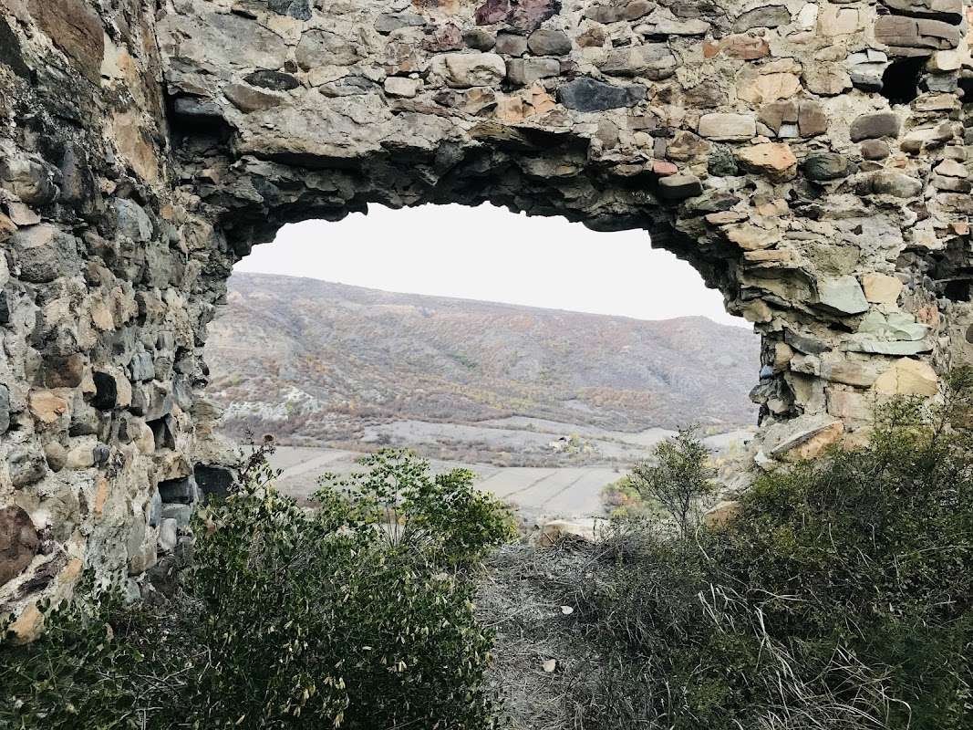
The complex comprises a wall, a church, a tower and a palace. The wall followed a complicated outline: the builders used every ledge of the rocky spur, adapting to the terrain rather than levelling it.
Everything except the church is built of sandstone and cobble. A tower rises on the north side; on the south stood the palace, now wholly ruined.
The most interesting detail is a cave at the base of the crag. It appears to have formed part of the defensive system. Roughly halfway up the southern face there are smaller caves. They were presumably reachable once, but no tunnels leading to them have been found.
Space on the summit was tight, as in many castles of the period. Hence the cramped layout: the buildings press against one another because there was nowhere to expand.
🚶 How to Reach the Ruins
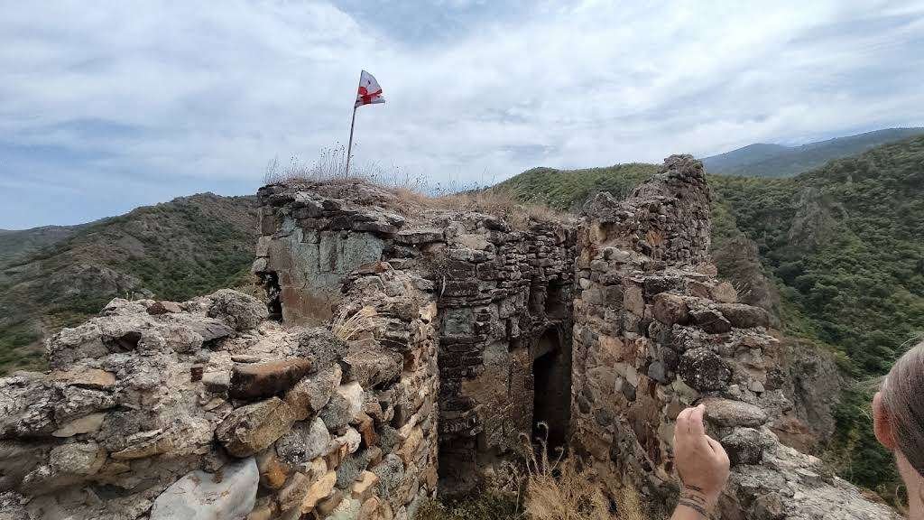
Sources disagree here, and this is a case where it helps to know both versions.
Georgian reference tradition says the climb is possible from the east. A Russian-language guidebook recommends approaching from the west: facing the castle, go around the crag to your left. From there the path reaches the lower wall with the main gates, and on to the castle itself.
Given the mention of gates, the western route looks like the historic main entrance. But it comes down to what the paths are like when you get there.
The climb is not long, though the path is unmade: no steps, no rails, no markings. Proper footwear matters, and after rain it is better to give up on the idea.
🗺️ The Tedzami Gorge: Why One Castle Is Not the Point
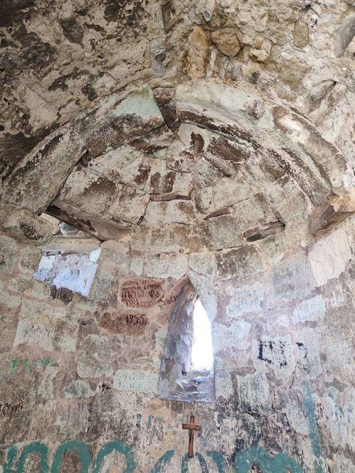
I will put it plainly: the castle alone is not worth the journey. The gorge is more interesting than any single site within it.
The Rkoni monastery complex, a kilometre and a half from the castle. Rkoni was still a well-fortified point in the sixteenth to eighteenth centuries, after which the village gradually emptied.
Tamar's arched bridge, also called Kvakhida, on the monastery grounds. Single-span, 12.5 metres long, with the arch 7.6 metres above the water and a width of 2.2 metres, dated to the twelfth and thirteenth centuries. It carried that same road from Shida Kartli towards Trialeti. Three arched bridges are said to have spanned the Tedzami here in Tamar's time; only one survives.
Ikvi church, from the middle of the eleventh century, where part of the original painting survives.
Chachubeti church, tenth century, with a southern chapel from the thirteenth or fourteenth, on the road into the gorge.
Allow a day for all of that; walkers stretch the gorge over two or three days with overnight stops.
🚗 Getting There
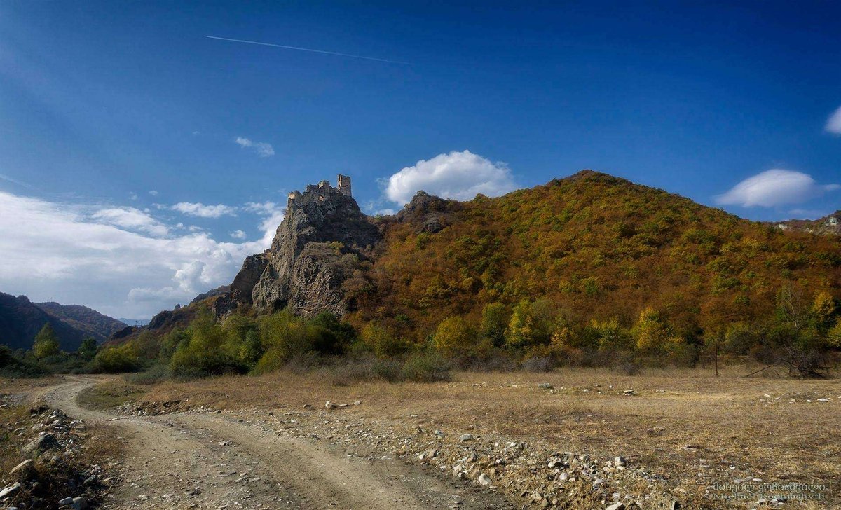
By car. Through Kaspi into the Tedzami gorge, as far as the village of Chkopiani. The road in the gorge is broken up in places, and the last stretch is best judged by the weather.
By public transport. A marshrutka runs from Tbilisi to the village of Akhalkalaki, leaving around nine in the morning. If you miss it, get to Kaspi, then on to Akhalkalaki, and take a taxi from there to Chkopiani.
An important note on the name: the village of Akhalkalaki in Kaspi Municipality is not the town of Akhalkalaki in Javakheti. Georgia has a great many identically named settlements, and it is worth specifying the municipality when buying a ticket or talking to a driver.
On a tour. Off-road trips and treks run into the Tedzami gorge from Tbilisi, usually taking in Rkoni, the bridge and Ikvi church. For anyone without a car this is the practical option.
🧭 Where to Stay and What Is Nearby
There is no accommodation in the gorge itself, so Kaspi or Gori serve as a base.
Climbed up to Drisi? Leave a review on Madloba: tell us which side you approached the crag from, how long the climb took, and what condition the road to Chkopiani was in.
Information is current as of August 2026. The state of the paths and the road into the gorge changes with the season, so check conditions locally before you travel.
❓ FAQ
💬 In Georgia, Shida Kartli region, Kaspi Municipality, on the left bank of the Tedzami river, on top of a crag, four hundred metres west of the villages of Zedadrisi and Chkopiani.
💬 Georgian reference works give two: Drisis tsikhe, after the neighbouring village, and Javakhaant-tsikhe, after the Javakhishvili family, who held the upper Tedzami. Russian-language guidebooks also use Javakhis-tsikhe, Tamaris-tsikhe and Tamarisi.
💬 In Georgian reference works the name Tamaris-tsikhe belongs to the Akhaldaba fortress in Borjomi Municipality. Applied to Drisi it appears in guidebooks rather than in the reference literature. The confusion may stem from the genuine Tamar's bridge, a kilometre and a half away at Rkoni.
💬 There is no firm date: the site has never been excavated. Georgian reference works assign it to the high feudal period, while Russian-language sources give a range of the eleventh to fifteenth centuries.
💬 Vakhushti Bagrationi, in his Description of the Kingdom of Georgia: west of Ertatsminda stands the fortress of Drisa, on a high rock, strong, on the river Tedzami.
💬 A wall of complicated outline, a church, a tower on the north side and the ruins of a palace on the south, entirely collapsed. Everything but the church is built of sandstone and cobble. There is a cave at the base of the crag, apparently part of the defensive system.
💬 Sources disagree: Georgian reference tradition names the east, while guidebooks advise approaching from the west, around the crag to the left, towards the lower wall and the main gates. The path is unmade, and after rain the climb is better postponed.
💬 The Rkoni monastery complex about a kilometre and a half away, Tamar's arched bridge of the twelfth or thirteenth century on its grounds, Ikvi church from the middle of the eleventh century with fragments of its original painting, and the tenth-century church at Chachubeti on the way in.
💬 A marshrutka runs from Tbilisi to the village of Akhalkalaki, leaving around nine in the morning, and from there a taxi to Chkopiani. Do not confuse it with the town of Akhalkalaki in Javakheti; they are different settlements. The easiest way in is an off-road trip or trek from Tbilisi.

5 comments
Log in to leave a comment