



Add organization

🏞️ Colchic Lowland in Georgia: Geography, History and Natural Context

🌊 Geography and history

🌊 How to read the Colchic Lowland

This article looks at the region not as a single stop, but as a natural and historical layer of Western Georgia.

🌊
SeaExplains the coastal character and origin of the landscape.
🏞️
RiversGradually build the plain and reshape its outline.
💧
WaterStays in the low relief and creates wetland areas.
🏺
ColchisAdds historical and mythological meaning to the natural map.
For boat routes, Lake Paliastomi and visitor planning, use the practical guide to Kolkheti National Park. Here, the focus is the lowland itself: how it formed and why it matters for nature and history.

The Colchic Lowland should not be treated as one attraction with an entrance and tickets. It is a large natural and historical region of Western Georgia, where the landscape explains why this area is humid, why rivers move slowly, why wetlands formed here, why ancient settlements appeared nearby and why Colchis became part of powerful myths.
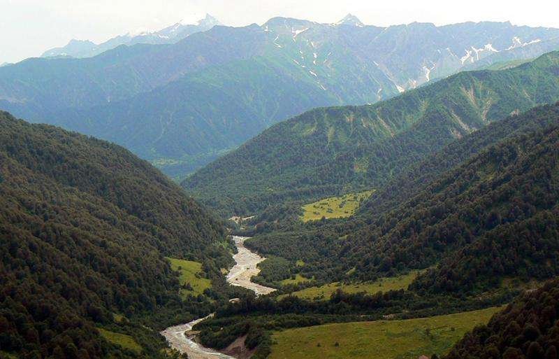
Colchis Lowland

📍 Where the Colchic Lowland is located

The Colchic Lowland is located in Western Georgia, along the eastern coast of the Black Sea. Geographically, it is not a single point but a wide lowland area connected with the coast, rivers, lakes, wetlands and the plains of western Georgia.

For travellers, this territory is most often understood through specific places: Poti, Lake Paliastomi, Kolkheti National Park, coastal parts of Guria, Ureki and other Black Sea locations. But the Colchic Lowland is wider than any single route.

It is best understood as the base layer of Western Georgia’s landscape: a coastal plain where water, silt, trade, agriculture, wetlands, forests and myths have met for centuries.
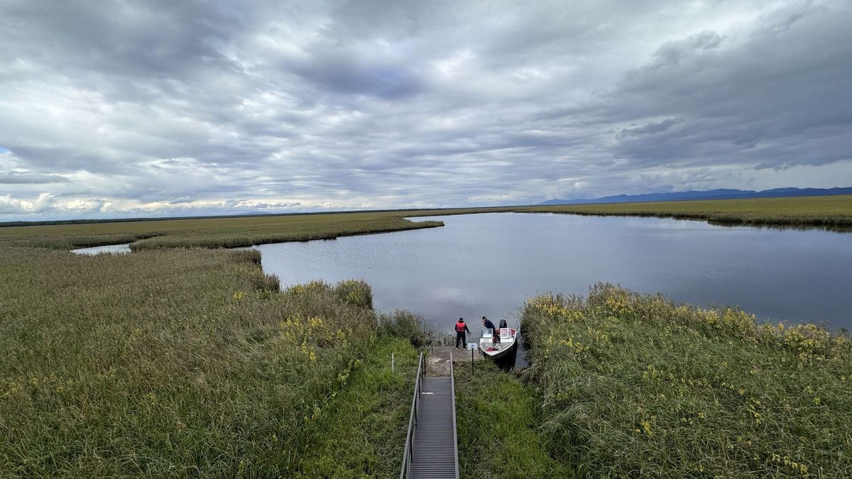
Национальный парк Колхети

🏞️ How the sea and rivers created the plain

The main geographic idea of the Colchic Lowland is simple: this territory was once much more closely connected with the sea than it is today. Older geographic descriptions explain it as a former sea bay that gradually filled with river material.

For centuries, rivers brought silt, sand, clay and other sediment. The sea retreated, and a flat plain formed in its place. That is why this landscape has no sharp relief, mountain drops or fast river valleys. It is low, humid and slow.

🏞️ Landscape formation scheme
1
CoastThe sea gives the future plain its starting shape.
2
SedimentRivers bring material from inland areas.
3
PlainLower areas become wider and calmer.
4
Wet environmentWater remains in the landscape and creates a special natural regime.

This nature may look quiet, but it is complex. Forest, marsh, river, lake and sea do not exist separately here. They are connected in one system, where changes in water immediately affect plants, animals and human life.

🐦 Why the lowland matters for birds

Wetlands near the Black Sea lie on bird migration routes. For migratory species, such places work as stopping points: birds can rest, feed and wait out part of the journey. That makes the Colchic Lowland important not only as a local landscape, but as part of a wider migration system.

In this article, birds should not become a tourist promise. In the historical and geographic context, the main point is different: the conditions of the lowland itself, humidity, lakes, reeds, floodplains and wetlands, create a habitat without which migration routes would be poorer.
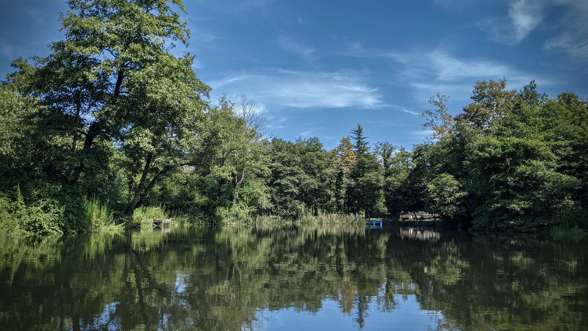
Национальный парк Колхети

The easiest way to see a living fragment of this environment today is through Kolkheti National Park, especially around Lake Paliastomi and wetland areas. But the park is only the protected part of a larger natural system.

🏺 Colchis, Greek colonies and the Golden Fleece

The Colchic Lowland matters not only because of nature. It is connected with ancient Colchis, one of the key historical images of Western Georgia. In ancient tradition, Colchis was seen as a land on the eastern coast of the Black Sea, rich in resources, waterways and contact with the outside world.

Ancient settlements and Greek colonies existed here. The image of Phasis, an ancient city and river mouth often connected with the area of modern Poti, is especially important. For Greeks, these places were not just a far edge of the map, but points of trade, sea routes and cultural contact.

Mythological illustration of Jason and the Argonauts sailing on the Argo toward Colchis in search of the Golden Fleece, with a golden ram symbol visible in the distance.

The legend of the Argonauts and the Golden Fleece is also linked with Colchis. In the myth, Jason and the Argonauts travel to Colchis for the Golden Fleece, while the story of Medea makes the region part of a wider ancient imagination. For a modern article, the point is not to prove the myth literally, but to show why this humid, river-filled and resource-rich land became such a strong symbol.

🏺 Historical layers of the region
Ancient Colchis A historical image of Western Georgia connected with the Black Sea, rivers and early state traditions.
Greek colonies Coastal settlements linked the region with maritime trade and the ancient world.
Golden Fleece The Argonaut myth made Colchis one of the most recognisable symbols of ancient Georgia.

The history of Colchis fits the geography of the lowland well. The sea creates a route, rivers lead inland, the wet plain supports life, and wetlands and forests create a sense of a land that cannot be understood at first glance.

🌾 How people changed the lowland

The Colchic Lowland has been inhabited since ancient times. Fertile land, water, mild climate and proximity to the sea made it suitable for farming, trade and settlement. But as people used the plain more actively, less natural habitat remained.

Today, many parts of the lowland are occupied by settlements, agriculture, roads and infrastructure. That is why the natural environment has not survived evenly, but in fragments: in wetlands, hard-to-access areas and protected territories.

This does not make the lowland “spoiled”. Rather, it shows the complex relationship between nature and people. Here, a plain can be fertile land, historical space, flood-risk zone and rare ecosystem at the same time.
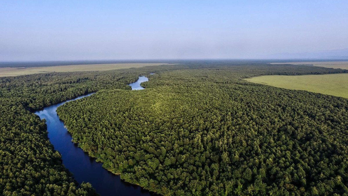
Национальный парк Колхети

🗺️ Where to see the natural context today

The Colchic Lowland cannot be “visited all at once”. But its natural and historical meanings can be seen through specific places.

The most obvious nature route is Kolkheti National Park: Lake Paliastomi, water routes, birds, reeds and wetland views. It is not the whole lowland, but it is one of the best ways to see a living part of it.

For the sea edge of the lowland, Ureki and nearby coastal areas are useful. Here, it becomes clear how the plain reaches the Black Sea and how a natural landscape gradually turns into resort and residential space.

For broader planning around nature themes, open nature of Georgia: the Colchic Lowland will make more sense as part of the country’s larger natural picture.

🗺️ Where to see the Colchic Lowland through places
Place What it shows Why it matters
Kolkheti National Park Wetlands, Paliastomi, birds, water routes A living fragment of the lowland’s natural system
Poti and the Phasis area Connection of rivers, sea and ancient maritime routes Historical layer of Colchis and ancient contacts
Ureki and the coast Transition from plain to sea Shows how geography becomes a resort zone
Protected wetland areas Surviving wetlands and forest sections The natural value of the region is most visible here

💬 How to use this article for a trip

The Colchic Lowland helps you see Western Georgia more deeply. After understanding it, Paliastomi, Poti, Ureki, wetlands and Kolkheti National Park stop feeling like separate points. They become one story: the sea retreated, rivers brought land, water stayed, people settled, traded and cultivated the plain, while nature survived where humidity and protection did not let it disappear.

If you have already visited Kolkheti or the coast of Guria and Samegrelo, leave a review on Madloba. Tell others what you remember most: water, birds, humid air, the plain by the sea, the history of Colchis or the feeling of an ancient landscape. Such impressions help other travellers see Western Georgia as more than beaches and resorts.

Over to you

Do you see the Colchic Lowland as a natural place, a historical region or part of the Golden Fleece myth? Share your impression on Madloba: your experience will help other readers understand why this plain by the Black Sea matters to Georgia as much as mountains, canyons and ancient towns.

The information in this article is current as of June 2026. When planning a trip to protected areas of the Colchic Lowland, check weather, season, route availability and current visiting conditions.

❓ Frequently Asked Questions

❓ 🌊 What is the Colchic Lowland?

The Colchic Lowland is a large plain in Western Georgia near the Black Sea. It was shaped by the sea, river sediment, humid climate and slow-flowing rivers.

❓ 📍 Where is the Colchic Lowland located?

It is located in western Georgia, along the eastern coast of the Black Sea. The lowland is connected with Poti, coastal Guria, Samegrelo and other parts of Western Georgia.

❓ 🏞️ Was the lowland once a sea bay?

Yes. Geographic descriptions explain it as a former sea bay that gradually filled with river material and became a flat plain.

❓ 💧 Why are there so many wetlands and lakes?

Because of the low slope, rivers flow slowly, bend and do not drain water quickly. Moisture stays in the landscape, forming wetlands, lakes, meanders and marshy areas.

❓ 🐦 Why is the Colchic Lowland important for birds?

Wetlands and water bodies near the Black Sea lie on bird migration routes. For many species, these places serve as stops for rest and feeding.

❓ 🌿 Why are Colchic forests and wetlands valuable?

They belong to rare humid ecosystems with relict and endemic species. These forests and wetlands help show what the region’s nature was like long before modern development.

❓ 🏺 How is the Colchic Lowland connected with the Argonauts?

Ancient Colchis, linked with the myth of the Argonauts and the Golden Fleece, was in Western Georgia. The lowland and the Black Sea coast were part of the historical image of that land.

❓ 🧭 How is the Colchic Lowland different from Kolkheti National Park?

The Colchic Lowland is a large geographic area. Kolkheti National Park is a protected area within this natural system that visitors can actually explore.

❓ 🚗 Can you visit the Colchic Lowland as a single attraction?

The lowland is not one point on the map. It is better understood through specific places: Kolkheti National Park, Lake Paliastomi, Poti, Ureki, wetlands and coastal areas.

❓ 📚 Why is this area important for Georgian history?

The Colchic Lowland is connected with ancient settlements, Greek colonies, maritime trade, the Golden Fleece myth and historical Colchis. It is one of the key natural and historical regions of Western Georgia.

Alla Smirnova
By:

Alla Smirnova

Post: Georgia sightseeing expert

My name is Alla Smirnova, and I am completely enchanted by Georgia. My passion is to share the amazing stories and rich ancient culture of this country. As an…

Visit author

41 comments


Log in to leave a comment


  • W
    William Davis
    There's something wild and unpolished about Colchic Lowland that captures my imagination. I remember chatting with my grandmother about ancient myths, and she’d always come back to the Argonauts, their daring escapades swirling like the slow rivers cutting through that lush land. It’s fascinating how that area, once an ancient sea bay, now breathes stories-almost like it’s whispering secrets of Colchis to anyone tuned in. I can almost envision my kids wandering through those wetlands, their laughter mingling with the rustling reeds. Georgia seems to hold a kind of magic, where history and nature intertwine, creating a tapestry that feels both enchanting and strangely accessible. Each visit feels like peeling back layers of time, revealing not just beauty, but a sense of belonging that’s hard to articulate. I can almost taste the air there, rich with earth and history, reminding me that every corner of our world has a story waiting to be told.
  • T
    Tao Huang
    看完这篇文章,我的心情简直像被唤醒了一样!🌊 科尔基低地,这个古老的地方,曾经是阿尔戈英雄们出航的起点,真是令人心神向往。想象一下,古代船只在温柔的河流中摇摆,湿地里充满生命的气息!我总是好奇,这种神秘的土壤和水文条件如何影响当地的文化呢?🤔

    据说科尔基地区的气候就像天然的温室,滋养了一代又一代的植物与动物。非常期待有朝一日能亲自去探索那里,感受大自然的魔力!🔥你有没有推荐的地方,适合在科尔基低地拍照的美丽景点呢?
  • Т
    Татьяна
    Gamarjoba! 🌾✨ Эта статья про Колхидскую низменность — отличный обзор того, насколько удивительно разнообразной может быть природа Грузии! Уже с первых строк ощущается дух этого места: тёплые ветры, широкие просторы, болота и реки, редкие растения и птицы — всё это делает Колхидскую низменность уникальной природной зоной.

    Мне особенно понравилось, как автор рассказывает не только о ландшафтах, но и о биологическом разнообразии этой территории. Колхидские долины — это дом для многих видов растений и птиц, а богатство болот и рек создаёт особую, почти первозданную атмосферу.

    Отдельно хочется отметить практичные подсказки: где лучше гулять, какие места особенно живописны и в какое время года природа здесь раскрывается особенно ярко. Такие советы делают статью не просто информативной, но и полезной для планирования реальной поездки 📸.

    Статья отлично передаёт ощущение простора и тишины, когда за горизонтом — только поле, небо и вода. Такое место идеально подходит для тех, кто любит неспешные прогулки, наблюдение за птицами или спокойные пикники среди природы.

    Спасибо автору за вдохновляющее описание!
    А вы уже были в Колхидской низменности? Что вам там больше всего запомнилось — бескрайние поля, болота или отражения неба в воде? 🏞️🌿✨
  • r
    romanKoshelev
    Интересно узнать, что Колхидская низменность была морским заливом в древности. Особенно впечатляет, как реки сформировали эту территорию со временем. Наводнения и заболачивание, видимо, могут быть проблемой для местных жителей. Захотелось бы узнать больше о роли этих болот для перелётных птиц. Ещё удивило, что, несмотря на активное использование земли, природа сохранилась лишь на охраняемых участках.
  • O
    Orv Bell
    It's fascinating to learn how the Colchian Plain was once a sea bay now filled with river deposits. The region's frequent floods, marshlands, and winding rivers create a unique landscape. Its importance for migratory birds is noteworthy, too. The blend of wet climate and hot summers is interesting, especially considering the agricultural history tied to the legend of the Golden Fleece. It's a reminder of how ancient cultures adapted to their environments.
  • M
    Mamuka Ebanoidze
    ეს სტატია კარგად აღნიშნავს კოლხეთის უნიკალურ ბუნებასა და ისტორიას. ამ რეგიონს დიდი მნიშვნელობა აქვს არა მხოლოდ საქართველოსთვის, არამედ მთელი კავკასიისთვის. მისი მდიდარი ფლორა და ფაუნა აუცილებლად უნდა იქნას დაცული, რათა მომავალ თაობებსაც შესძლონ ამ საოცარი ადგილის ხილვა.
  • B
    Ben
    Are there specific times of the year when the flooding is more severe? It would be good to know when to plan visits to avoid those. Also, I’m curious if the protected areas with preserved nature are accessible for tourists, and if there are guided tours to appreciate the local wildlife, especially the migratory birds in the wetlands.
  • А
    Алексей Алексей
    Удивило утверждение, что природа сохранилась только на охраняемых территориях. Мне казалось, что в таких влажных и сложнодоступных местах, как болота, природа могла бы остаться более дикой и нетронутой человеком. Или болота использовались для чего-то, и это повлияло на их сохранность?
  • ი
    ირაკლი რეხვიაშვილი
    მაინტერესებს, არის თუ არა რეგიონში რამე სპეციალური მცენარეები, რომლებიც მხოლოდ აქ გვხვდება? ასევე, არსებობს რაიმე კონკრეტული ინიციატივა, რომელიც გულისხმობს ბიომრავალფეროვნების დაცვას კოლხეთის დაბლობზე?
  • ლ
    ლუკიან
    დილითან ახლოს მდებარე კოლხეთის დაბლობი თავისი უნიკალური ბიომრავალფეროვნებითა და ლეგენდარული ისტორიით ჩემთვის ნამდვილად დაუვიწყარი ადგილია.
  • A
    Artyom Romanov
    Колхидская низменность впечатляет своим разнообразием и богатой историей. Этот край, с его влажным климатом и многочисленными водоёмами, служит важным убежищем для перелётных птиц. Важно, что природа региона ещё сохраняется в охраняемых зонах. Интересно, как наводнения и заболачивания влияют на сельское хозяйство сегодня.
  • Z
    Zachary
    Is it possible to explore the region's unique wetland ecosystems without disturbing the habitats of migratory birds?
  • Л
    Лёша Виноградов
    В статье упоминается, что природа сохранилась только на охраняемых территориях. А как насчёт остальных участков низменности? Есть ли программы по восстановлению природных экосистем? Ведь это важно для защиты местных видов животных и растений.
  • თ
    თამაზ კილანიძე
    გაინტერესებს თუ არსებობს რაიმე კონკრეტული პროგრამები ან პროექტები, რომლებიც ხელს უწყობენ კოლხეთის დაბლობის ეკოსისტემის დაცვას და თანატოლ განვითარებას?
  • A
    Ashland Tremayne
    The Colchis Lowland's unique blend of humid climate, winding rivers, and significant historical ties like the legend of the Golden Fleece makes it a fascinating area, though I wonder how control over floods has evolved over time.
  • А
    Ася
    Интересно узнать, какие меры принимаются для защиты уникальных болот Колхидской низменности и обитания перелётных птиц.
  • N
    Nicki
    Does anyone have recommendations for visiting the wetlands near the Black Sea? I'm curious about the best time to see the migratory birds and if there are guided tours available in the area.
  • ლ
    ლევანი
    მაინტერესებს, შესაძლებლად მიგაჩნიათ თუ არა, რომ კოლხიდის დაბლობზე ნაკლებად შეინიშნება ბუნებრივი წყალდიდობები კლიმატური ცვლილებების გავლენით? როგორც ვიცი, ბოლო წლებში მსგავსი რეგიონები ხშირი ცვლილებებს განიცდიან, რაც მიდრეკილია მშრალი პერიოდებისკენ.
  • З
    Зинаида Петровна
    Интересно, а почему природа сохранилась только на охраняемых территориях? Неужели даже в таких влажных и труднодоступных местах, как болота у моря, человеческая деятельность так сильно влияет на экологию?
  • З
    Зинаида Петровна
    Интересно, а почему природа сохранилась только на охраняемых территориях? Неужели даже в таких влажных и труднодоступных местах, как болота у моря, человеческая деятельность так сильно влияет на экологию?
  • l
    laylamiller1990
    Are there any popular hiking trails in the lowlands, or is the terrain mostly dedicated to agriculture and conservation?
  • g
    gleb8h8
    Колхидская низменность всегда поражала своей природной уникальностью и историческим значением. Интересно узнать, как древний морской залив стал плодородной землёй для сельского хозяйства. Разнообразие ландшафтов и важность болот для птиц делают это место поистине особенным. Важно бережно сохранить оставшиеся природные территории, чтобы будущие поколения также могли восхищаться этой красотой.
  • G
    G_elel
    Очень интересно узнать больше о Колхидской низменности! Даже не представляла, что она была морским заливом, а теперь здесь можно увидеть и древние греческие колонии, и уникальную природу. Место кажется невероятным сочетанием истории, легенд и красивейших ландшафтов. Особенно привлекли болота на пути миграции птиц — должно быть, это потрясающее зрелище! Спасибо за такую познавательную информацию.
  • А
    Аделина
    Красота Колхидской низменности словно пленяет с первого взгляда. Этот уголок Грузии впитал в себя дух древних времён и неповторимую энергию природы. Путешествие по этим местам наполняет сердце восторгом и умиротворением. С каждым шагом открывается новый мир чудес и удивительных открытий. Колхидская низменность — настоящий рай для тех, кто стремится окунуться в гармонию с природой и открыть для себя новые горизонты красоты.
  • s
    svetlanamagicg
    Природа Грузии просто уникальна и наверное, невозможно перестать удивляться, когда узнаешь о новых исторически значимых местах и достопримечательностях. Вот сейчас из интересной статьи узнала о Колхидской низменности, которая имеет большое значение и характеризуется небыстрыми реками, образующими меандры, и наличием бессточных озер. Я уверена, что посещение Колхидской низменности - это прекрасная возможность познакомиться с уникальными природными и историческими достопримечательностями Грузии.
  • a
    annushka.kvasova
    Я когда читаю статьи о природе Грузии, невольно вспоминаю уроки Географии) Божественная Колхидская низменность, смотришь на нее и думаешь, что это скорее всего картина талантливого художника, вдохновлённого Грузией и придумавшего для неё что-то своё, но на деле же эта распрекрасная низменность правда есть, дарит Грузии такую обворожительную красоту, ей любоваться одно сплошное удовольствие. Страна Грузия своей природой изумит всех туристов))
  • r
    roma
    Колхидская низменность - удивительное место, которое я думаю что стоит посетить. Эта область известна мне своими неспешными реками, способствующими появлению живописных бессточных озер, которые поражают своей красотой и уникальностью.Посетив Колхидскую низменность, я хочу увидеть исторически ценные объекты, в том числе древнейшие греческие колонии, касающиеся античных времен. Это позволит мне погрузиться в атмосферу прошлого и узнать больше об истории Грузии.
  • К
    Кирилл
    Я только что прочитал об удивительной Колхидской низменности в самом большом справочнике-каталоге о Грузии, Madloba.info. Это место, где я уже побывал или собираюсь посетить. Статья рассказывает о том, как низменность когда-то была морским заливом, заполненным речным материалом, и о том, что она подвержена затоплениям и заболачиваниям. Мне интересно, что реки здесь медленные и образуют меандры, а рядом с Черным морем есть болота, привлекающие перелётных птиц. Очень впечатляет также то, что здесь сменяются влажные и сухие ветры, восточные ветры способствуют высокой урожайности, но могут вызывать жаркую погоду и засуху. Кроме того, Колхидская низменность богата историей, с древнейших времён здесь поселялись люди и находились греческие колонии. Хорошо, что природная среда сохранилась на охраняемых территориях. Узнав все это из Madloba.info, я только укрепил своё желание посетить это прекрасное место.
  • l
    lina.manolova
    Как же повезло людям, проживающим в Колхидской местности. Мне, жителю степной местности, интересно, что значит видеть леса и горы каждый благословенный день. Однако интересна частота и сила ветров, ведь это также влияет и на образ жизни человека. Конечно, в данной статье мало информации и Колхидской местности и ее жителях, их культуре, но фотография завораживает. Иногда кажется, что таких мест не существует. Поражает величье Господа, сотворивший этот мир по слову Своему таким прекрасным и живописным! Благодарю автора и сайт за предоставленную возможность найти и узнать что-то новое для себя и поставить новые цели в блокноте о путешествиях!
  • Н
    Надежда
    Маловато информации, конечно. Если здесь зона с плодородными землями - какие культуры выращиваются, в каких объёмах? Только для внутреннего использования, или на экспорт тоже? Кроме того, здесь есть места достаточно древних поселений и археологических находок. Как они называются, какие доступны к посещению? Какие города или значимые деревни здесь есть?
  • g
    gjfroksit228
    В Грузии множество красивых и живописных мест, однако очень жаль читать о том что такую красоту заселили очень большое количество людей, и можно сказать испоганили весь изначальный вид природы, и осталась лишь крупица изначальной природы
  • b
    bikteeva94
    Колхидская низменность была когда-то морским заливом, который был заполнен в четвертичный период здесь речным материалом, но с годами воды утекают, и почти все зарастает зелеными растениями. Мне данная статья очень понравилась, я узнала очень многого об этих окрестностях! Спасибо автору за рассказ!
  • t
    tatyana.popovva
    Уже на третью статью попадаю с информацией о Колхидской низменности, видимо настолько эта местность значимая и стоящая к посещению, что все хотят о ней рассказать, поделиться прекрасным. Из-за климатических условий, долгие прогулки с непривычки, будут некомфортными. Прочитала, что, оказывается, и для выращивания урожая, этот климат не подходящий.
  • v
    vponomareva383
    Колхидская аккумулятивная равнинная низменность располагается вблизи Чёрного моря, то есть, можно поехать на Чёрное море, а потом на Западную Грузию, на эту низменность. Кстати, меня удивило, что Колхидская низменность была раньше заливом из Чёрного моря. Конечно, хотелось бы заехать в эту местность.
  • f
    fgfdrfg2012
    Уже глядя на фотографии этого места, я начинаю очень сильно хотеть посетить Грузию. Я осознаю, что сколько бы раз туда не приезжать, каждый раз будет совершенно новым и незабываемым. Смотря на картинку, мне кажется, что меня обдувает несильный ветер, воздух насыщает мои легкие кислородом и я по-настоящему живу в этом месте. Интересно было узнать, что именно с этой низменностью связана легенда об аргонавтах и золотом руне. До этого момента я этого даже и не знала.
  • v
    volobuevaanastasia331
    Благодатная земля! И по сию пору заселен каждый клочок ее, но и в древности за эту местность беспощадно боролись. Стоит только вспомнить миф об аргонавтах. Только, думаю, обманул их царь Колхидский: не было никакой тайны в золотом руне - обычная покрашенная шерсть. А крылась загадка в плодородии этой уникальной равнины. Мадлоба за увлекательную и подробную статью!
  • И
    Ира
    Андрей, я буду рада, если замечу, что эта фотография действительно взята не просто с какого-то альбома, а сфотографирована кем-то лично, то есть тем, кто читал это прекраснейшее произведение. Поэтому этот город - то, что нужно. Я сильно очень хотела побывать в Грузии, особенно в Батуми, так сказать, чтобы смотреть всякие такие более-менее туристические места, потому что местные жители не всегда смогут подсказать то, что ты хочешь
  • И
    Ира
    Андрей я буду рада, если замечу, что эта фотография действительно взята не из интернета, а сфотографирована кем-то лично, то есть тем, кто читал это произведение прекраснейшая поэтому эти город то, что я вас... Я сильно очень хотела побывать в Грузии особенно в Батуми ну и потом уже выехать в Грузию, так сказать, чтобы смотреть всякие такие вот более-менее туристические места, потому что местные жители не всегда смогут подсказать то что ты хочешь
  • И
    Ира
    Андрей, Колхидская низменность имеет небольшой наклон, из-за чего реки здесь не быстрые. Они образуют меандры, что способствует появлению бессточных озёр. Вблизи Черного моря имеются болота, которые находятся на миграционном пути перелётных птиц. В Колхидской низменности сменяют друг друга как влажные (дующие с запада), так и сухие (с востока) ветры
  • a
    andrew
    Климатические условия и плодородные почвы Колхиды весьма благоприятны для развития пышной растительности. В условиях мягкого влажного климата многие растения вегетируют круглый год. Развитие растений идет очень быстро. За 5—6 лет ольха достигает таких размеров, какие в средней полосе Русской равнины она приобретает в течение 25—30 лет. На вырубках она через три года образует непроходимые заросли. Папоротник-орляк за год становится выше человеческого роста.
  • В
    Влада
    Здесь некогда, еще в раннеантичное время, процветало Колхидское царство, о высокой культуре которого рассказывают многие древние источники. Жители этих мест с незапамятных времен вели борьбу за каждый клочок земли, так как страна болотистая, жаркая, лесистая и полная сырости. Во всякое время года там бывают сильные, проливные дожди. После установления Советской власти в Грузии облик этой земли изменился на Колхидской низменности ликвидированы болота.