




🏰 The Great Wall of Sighnaghi: 4.5 km Fortress, 23 Towers and the Lekianoba
Sighnaghi Wall at a glance
One of the largest fortress walls in the South Caucasus. Not a royal castle — a mass refuge built to shelter an entire region's population. Constructed in the 1770s. Free entry, open around the clock.
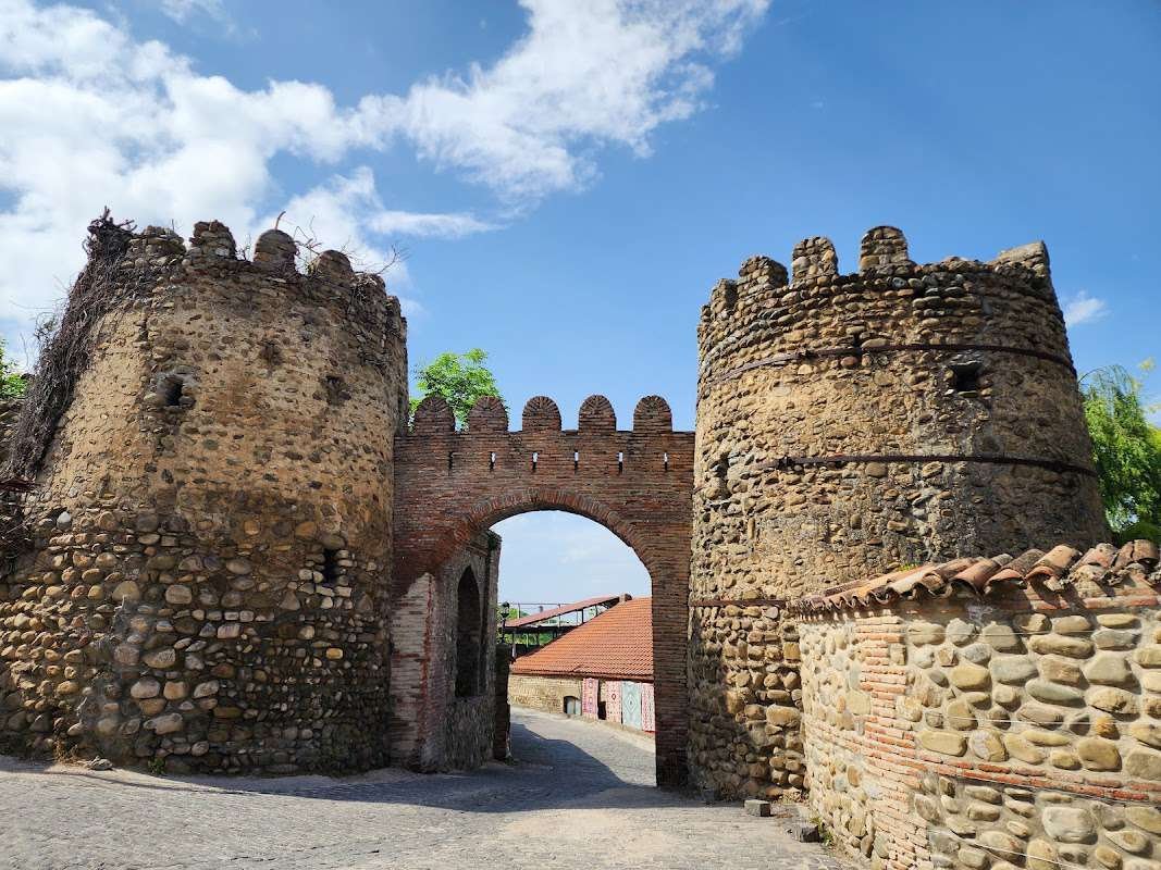
Sighnaghi is best known as Georgia's "City of Love," with its wrought-iron registry gates and round-the-clock wedding house. But the wall surrounding it is an entirely separate historical object, with nothing to do with romance. It is one of the largest fortress walls in the South Caucasus, built in the 18th century for a single purpose: survival. Before your visit, open the Sighnaghi Walls listing on Madloba for coordinates, photos and directions.
For the city itself and everything inside the walls, see the City of Love — Sighnaghi article. This one is about the wall.
📜 History: Why Erekle II Built the Wall
Eastern Georgia in the 18th century lived under constant threat. Dagestani tribes carried out regular raids on Kakhetian villages — seizing slaves, looting homes, destroying harvests. These raids were known as Lekianoba, and for the Kiziki region they were a sustained catastrophe. Ordinary fortresses offered no answer: they protected garrisons, not people.
King Erekle II found a different solution. In the 1770s, on his orders, a wall of a completely different kind began to rise around the town of Sighnaghi — not a castle for the nobility, but a mass shelter for the entire population of Kiziki. Inside the walls there was room for an enormous number of people from the surrounding villages. The name "Sighnaghi" itself, by one account, derives from the Turkic "signak," meaning "shelter" or "refuge."
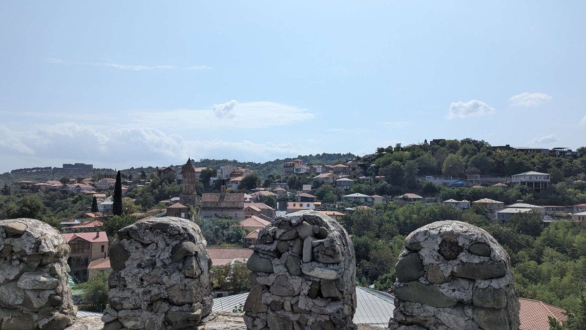
The construction reflected this collective idea: each tower was built by the residents of a specific village and carried its name. The Tower of Vachnadziani, the Tower of Nukriani, the Tower of Tibaani — each structure was one village's contribution to the shared defence. The connection between tower and village was literal: in danger, people knew exactly which tower to run to.
After the Treaty of Georgievsk (1783) and Georgia's absorption into the Russian Empire (1801), the wall lost its military purpose. Through the 19th and 20th centuries it gradually deteriorated. Large-scale restoration took place in the 2000s–2010s as part of a national tourism development programme: wall sections and towers were rebuilt, cobblestone streets repaired, historic building facades renovated.
🏰 Architecture: Towers, Gates and Two-Level Defence
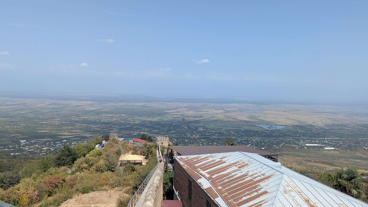
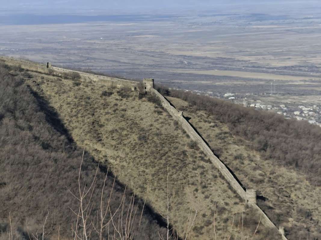
The wall stretches approximately 4.5 km around the hilltop, following the natural contours of the terrain — rising, dipping, bending around rocky outcrops. This is precisely why the comparison to the Great Wall of China has stuck in every guidebook: it too is not straight, but flows along the mountain ridge.
The material is cobblestone with brick accents, characteristic of 18th-century Kakhetian construction. The enclosed area inside the walls covers roughly 40 hectares, at an elevation of around 790 metres. Throughout the length of the wall, two tiers of firing positions were built: the lower level for foot soldiers, the upper for archers and riflemen. Along the top ran a military footpath — the same path tourists walk today.
The 23 towers are distributed around the perimeter to cover the gaps between them with fire. Most towers are two storeys tall. Six arched gateways led into the town from different directions, each with mechanisms for rapid opening and closing.
A basilica built directly into the body of the tower — an unusual arrangement in Georgian architecture. Predominantly red brick with cobblestone details: atypical for Kakhetian churches, where stone construction is the norm. From inside the tower, the arrow slits frame views across the Alazani Valley.
Dress code: cover shoulders. Women are advised to wear a headscarf. Photography is permitted everywhere except during services.
🥾 Walking the Wall: How to Visit
The restored section of the wall takes roughly 1–1.5 hours at a comfortable pace. The most convenient starting point is Sighnaghi's central square: the gates and first towers are five minutes on foot from there.
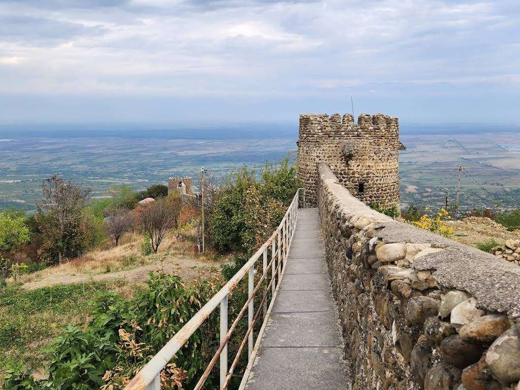
The path along the top narrows in places to 80–90 centimetres, with no railings. The steps on the towers vary in height and some are worn smooth. After rain everything becomes considerably more slippery. Hiking boots or shoes with grip are a necessity, not a suggestion.
The best time for photography is sunset — around 18:00–19:30 in summer — when the light comes from the west and illuminates the wall against the Alazani Valley and the snow-capped Caucasus. The best time for quiet is early morning before 10:00, before the tour coaches arrive. In July and August on weekends the wall is crowded and hot (up to 35°C). Winter brings beautiful views of snowy peaks, but ice on the path is a real hazard.
Walking the wall, exploring the town and having lunch takes 3–4 hours. Adding Bodbe Monastery 2 km from town turns it into a full day.
🗺️ What to See Nearby
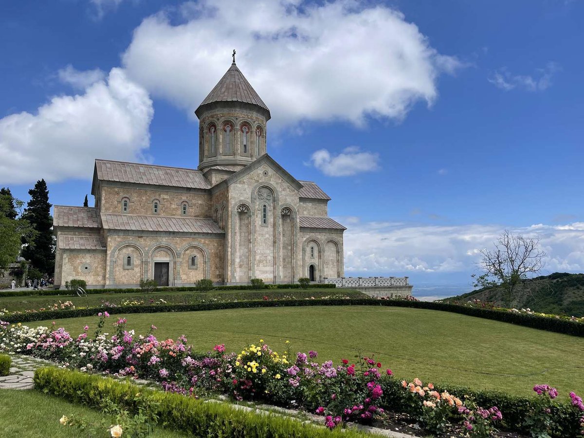
Bodbe Monastery. 2 km from Sighnaghi — an active nunnery on the site of St. Nino's tomb, Georgia's patron saint. Easily combined with the wall in a single day.
Sighnaghi History Museum. Right in the town, 5–10 minutes from the wall. Medieval Kakheti collections alongside works by Niko Pirosmani and Lado Gudiashvili.
Wine cellars in Sighnaghi. After the wall — into the town centre: Lado's Wine, Mari's Wine Cellar and others on Madloba. Kakheti is Georgia's main wine region, and Sighnaghi is the natural base for tastings.
All sights in the town are listed in the Sighnaghi — things to do section on Madloba.
The best view of the wall is not from the top but from outside — on the road coming up from Bodbe Monastery toward Sighnaghi. From there you can see the full ribbon of the wall rolling across the hillside against the backdrop of the Alazani Valley and the Caucasus range. That is the shot that doesn't work when you're standing on the wall itself.
Have you walked the Sighnaghi Wall? Leave a review on Madloba — share the time of day you went, how the path was holding up and which view stayed with you longest. It helps everyone planning the same trip.
Information current as of June 2026. The condition of restored sections and access to individual towers may change — check on arrival.
❓ Frequently asked questions
A fortress wall approximately 4.5 km long encircling the historic centre of Sighnaghi in Kakheti. Built in the 1770s by King Erekle II. 23 towers, 6 arched gates, 40 hectares enclosed. One of the largest fortifications of its kind in the South Caucasus.
The wall follows the contour of the hill — rising and falling with the terrain, as the Great Wall of China does. The comparison is popular rather than official, but it has become fixed in every travel guide. In scale and historical significance, the wall genuinely stands apart from other medieval fortifications in the country.
King Erekle II of the Kartli-Kakheti Kingdom, in the 1770s. Construction was a response to the Lekianoba — systematic raids by Dagestani tribes who plundered Kakhetian villages and captured people as slaves. Each tower was built and funded by a specific village and bore its name.
Because each tower was built by the residents of a particular settlement in the Kiziki region. In the event of a raid, those people knew which tower to run to. The Tower of Vachnadziani, the Tower of Nukriani, the Tower of Tibaani — each one is literally "our village's tower."
Yes. The wall is open 24 hours a day, seven days a week, with no admission charge and no tickets required.
The restored section takes 1–1.5 hours. Add a walk through town and lunch and allow 3–4 hours. With Bodbe Monastery — a full day.
Minibus from Samgori metro station to Sighnaghi, around 2–2.5 hours, fare 12 GEL. By car — 110 km, approximately 1.5–2 hours depending on traffic.
Bodbe Monastery (2 km), Sighnaghi History Museum (in town), wine cellars throughout Sighnaghi. Full list at Sighnaghi — things to do.

1 comment
Log in to leave a comment