




🏰 Bochorma: The Fortress Erekle II Chose as a Refuge in 1747
Bochorma Fortress at a Glance
The ruins of a 10th-century fortress on the Iori River, in one of the hardest-to-reach corners of Mtskheta-Mtianeti. Inside the walls, a six-apse church with surviving frescoes and the remains of a palace.
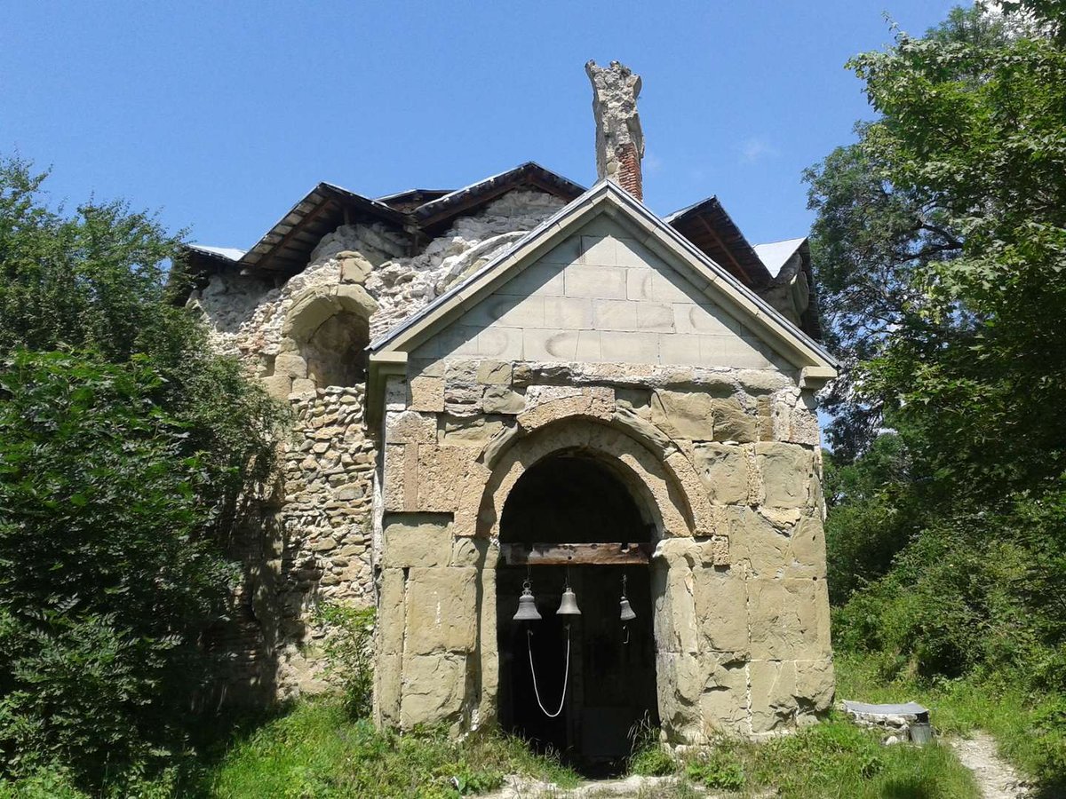
Bochorma Fortress stands on the Iori River, in one of the hardest-to-reach corners of Mtskheta-Mtianeti, in the Tianeti Municipality. The exact date of construction is unknown, and the earliest written mention dates to the 10th century, when Bochorma served as an important strategic point and, for a time, a political center of Kakheti.
Few people know this place, largely because of how remote it is: no tourist route runs through here, and the fortress itself remains an unguarded ruin with no visitor infrastructure to this day.
📜 The Fortress's History
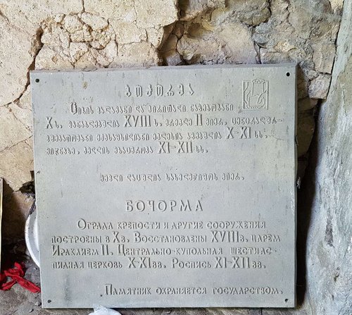
The earliest written accounts of Bochorma date to the 10th century. In 914, the fortress was temporarily occupied by Arab forces, which confirms its strategic importance as early as the early medieval period. For a time, Bochorma, along with several other Kakhetian fortresses, was held by King Bagrat IV, though according to one source he was forced to cede it, together with the fortress of Ujarma, to Aghsartan, the king of Kakheti-Hereti, in exchange for the treasure of Emir Fadlon. This episode comes from a single source, so treat it as a probable detail rather than a firmly confirmed fact.
In the 18th century, a significant portion of the fortress was rebuilt by King Erekle II. In 1747, as the struggle for the throne between Erekle II and his rival heir Abdul-Beg intensified, the king took refuge in Bochorma, using the fortress as a stronghold at a critical moment in the conflict. The fortress remained in use until the end of the 18th century.
Bochorma Without the Gaps
🏛️ The Walls and the Palace
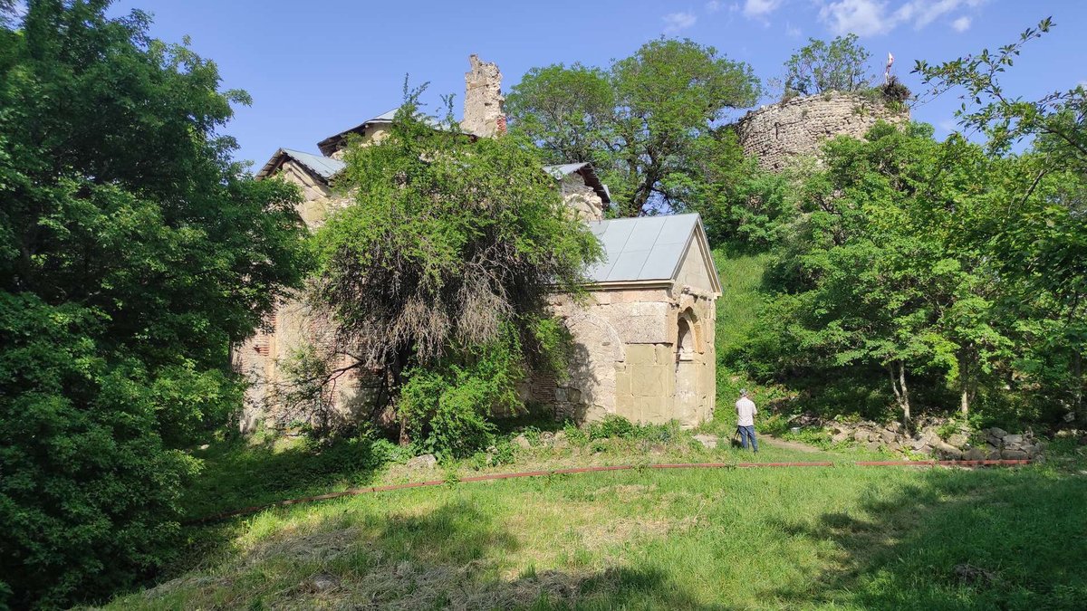
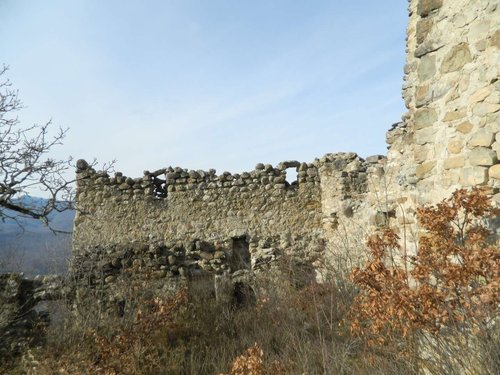
The complex consists of two parts. The main section, an inner citadel, includes walls with towers built into them and an entrance on the eastern side. In the southern part of the citadel stand the ruins of a palace, a rectangular building of rubble stone, partly built into the slope of the hill. The palace held two rooms of differing size connected by a doorway, with two wide entrances on its southern side.
Besides the walls and the palace, the fortress grounds once held defensive and utility structures, though only fragments of many of them survive today.
⛪ The Six-Apse Church
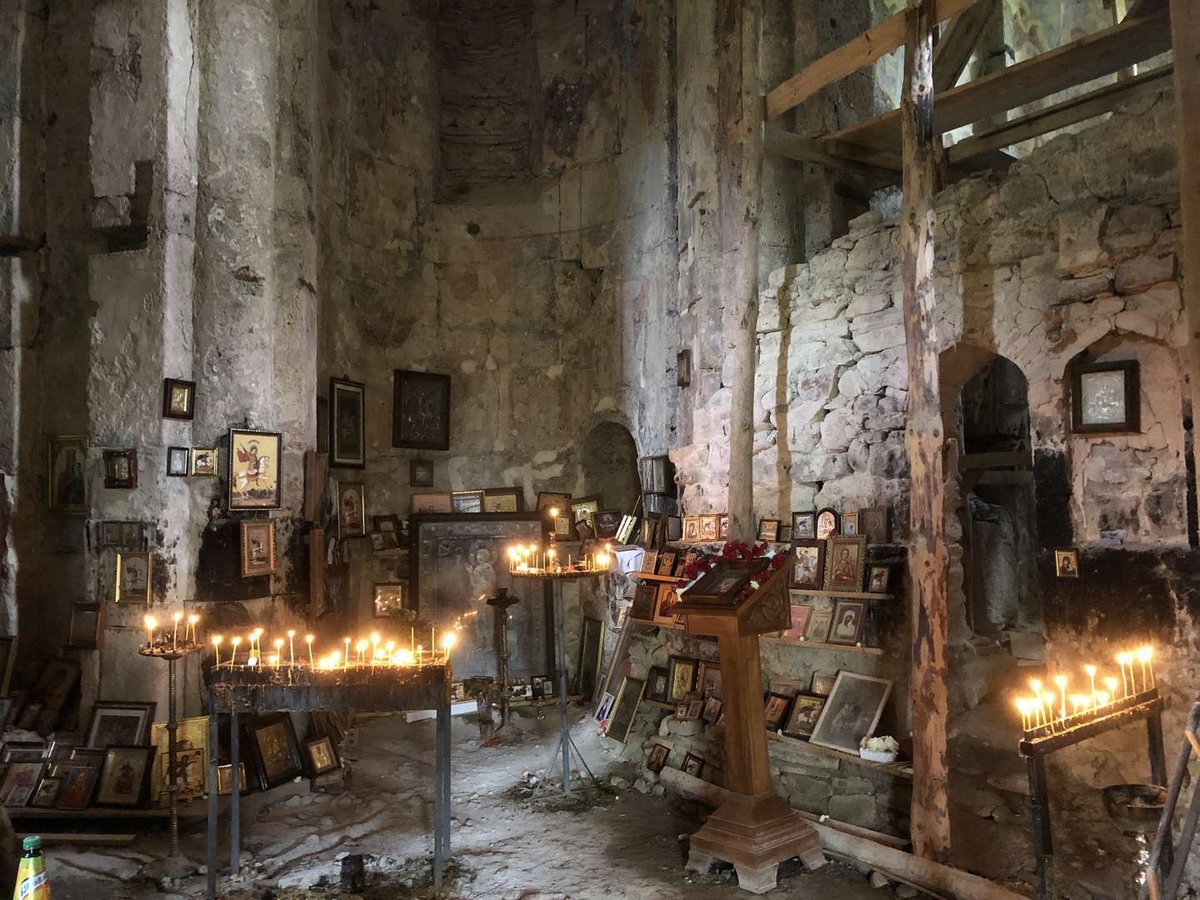
Inside the fortress walls stands the Church of St. George, a domed 10th-century church with a layout unusual for Georgia: six arms radiate from a central space, each ending in its own apse. The altar apse stands apart from the rest, deeper and partly projecting outward, framed by a triangular cornice.
The church originally had two entrances, on the southwest and northwest sides, but only the southwestern portal survives today. The interior is fully painted with frescoes, and although the painting has suffered damage over time, the compositions can still be made out. Builders used local stone and green sandstone, giving the masonry its distinctive tone.
The church is considered one of the notable monuments of 10th-century Georgian church architecture, largely because of its unusual six-apse plan, a layout rarely found elsewhere in Georgia
🟢 Still Standing
🔴 Lost to Time
📌 Practical Information
Coordinates for your GPS: 41.909038, 45.148631. To be upfront: there's no verified, detailed route for this article, and independent sources agree on one thing, this is a remote site, genuinely difficult to reach without preparation. If you're planning a visit, it's worth checking road conditions in advance with residents of Tianeti Municipality or the local administration.
There's no infrastructure on site: no cafes, no shops, no signage. This is a monument for those ready for an independent trip into Georgia's harder-to-reach regions, not a casual weekend outing.
Have you been to Bochorma Fortress? Leave a review on Madloba: tell us which route you took, what condition the church was in, and what first-timers planning such a trip should know.
Information is current as of July 2026. Road conditions and site accessibility may change, check the current situation on the ground before you go.
❓Frequently Asked Questions
💬 In the Tianeti Municipality of Mtskheta-Mtianeti, on the Iori River, in one of the most remote parts of the region.
💬 The exact construction date is unknown. The earliest written mention dates to the 10th century, when the fortress was an important strategic point and, for a time, a political center of Kakheti.
💬 The Church of St. George inside the fortress is domed, with a six-apse layout rarely found in Georgia: six arms radiate from the center, each ending in its own apse.
💬 In the 18th century, he rebuilt a significant part of the fortress, and in 1747 he took refuge here during his conflict with the rival heir Abdul-Beg.
💬 Yes, in 914 the fortress was temporarily occupied by Arab troops, confirming its strategic importance as early as the early medieval period.
💬 There's no verified detailed route. Independent sources describe the site as remote, so it's worth checking road conditions with local residents or the Tianeti Municipality administration before you go.
💬 Yes, the interior is fully painted, and despite the damage from time, the compositions are still legible.
💬 The ruins of a rectangular rubble-stone building in the southern part of the citadel, with two rooms of different sizes and two entrances on its southern side.

2 comments
Log in to leave a comment
أكره كيف أن الزمن والمسافات تجعلنا نشعر بانفصال عميق عن هؤلاء الأفراد. تساءلت عن كيف كانت الحياة هنا في ذروة قوتها. هل كانت صاخبة ومليئة بالأمل، أم كانت تعاني من الاضطرابات؟ هل يمكن للمرء اليوم أن يشعر بتلك الأصداء في هذه الأنقاض؟
فقط تساؤل بسيط، هل هناك معلومات أكثر عن الحياة اليومية في باخورما خلال تلك الفترة؟