




Chule Waterfall Georgia: 30 m Ritual Waterfall in the Mountains
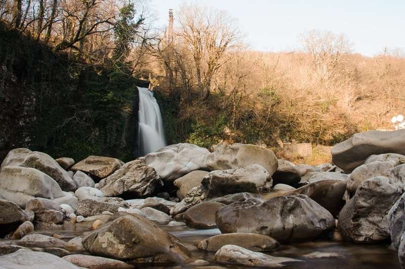
From the Persati plateau flows the Chulescali River, which forms a waterfall (about 30 meters high) near the Chule monastery, northeast of it. The waterfall is consecrated on the Feast of the Epiphany, January 19. There are many legends about the miraculous properties of the waterfall. One winter there were severe frosts, everything was covered with a high snow cover. But the cold did not stop the pilgrims. They broke the ice that covered the waterfall, and held a rite of consecration. After praying, the people went into the water to purify themselves.
A young couple brought a dying two-month-old baby and dunked him in the waterfall. Only one pilgrim abstained from bathing and, frightened by the cold, returned home. But a miracle happened - the pilgrims did not catch a cold and the baby was healed. But the one who returned home without a dip in the icy water got sick: he woke up in the morning with a high fever and could not recover for a long time.
Another oddity in this area - this time geographical - not far from the village of Patara Zanevi such geographic coordinates: north latitude - 41 41' 41'', east longitude - 42 42' 42''.
The water falling from the waterfall, joins the river Kvabaliani, which flows on the southern slope of the Meskheti ridge. Kvabliani starts at an altitude of 2355 m above sea level, flows through Khulo and Adigeni municipalities and then merges with the river Potskhovistskali from the south. The length of the river is 41 km.
The name Chulevi goes back to the word "Churi", which in the ancient Georgian language meant a deaf hollow, a failure. The location of this area is fully consistent with the name. On the road from Adigeni to Chulevi in the village of Patara Zanavi is an early medieval fortress.
Location:
Adigeni Municipality, area adjacent to the village of Patara Zanavi; at the foothills of the Persati Mountains, left bank of the Kvabliani River; at an altitude of 1,480 meters above sea level.
Coordinates:
41°42′19″N; 42°42′16″E.
How to get there:
A road from Adigeni Municipality leads to the waterfall. From the Akhaltsikhe – Khulo – Batumi highway, a road branches off toward the village of Zanavi and then to the village of Chule. Distance from the junction (Adigeni settlement) — 7 km. Distance: from Tbilisi — 237 km, from Adigeni — 20 km, from Akhaltsikhe — 35 km.

43 comments
Log in to leave a comment
Мне очень понравилось, что в статье не только рассказывают про сам водопад, но и подробно объясняют куда и как идти, где удобнее оставить машину, а также дают советы от местных жителей, которые знают эти тропы как свои пять пальцев. Это невероятно помогает, особенно если путешествуешь самостоятельно и хочется чувствовать уверенность в маршруте.
Отзывы других читателей и ответы на частые вопросы тоже добавляют уверенности: от людей, которые уже видели Чуле, можно узнать, в какое время года он полноводнее, какие участки тропы могут быть скользкими и где лучше просто остановиться и полюбоваться природой.
После прочтения я всерьёз подумываю включить водопад Чуле в свой маршрут по западу Грузии — такие места действительно наполняют силой и вдохновляют на новые приключения. 💚
А вы бы предпочли посетить Чуле в сезон, когда он самый полноводный, или скорее в тихую погоду, чтобы спокойно наслаждаться природой и тишиной? 😊