




Devi Lake: Karst Waters and Mountain Trails in Georgia
Lake Davi is one of the most significant karst lakes in Georgia. Its circumference is approximately 550 m, width - 80 m, maximum depth - 10.7 m. The lake occupies two sinkholes. The water in the lake is unusually clear and transparent, with a bluish tint. From the lake flows out of the stream, which hides underground.
Hiking trail. Leading to the lake. Starts in the northern part of the village Mohvi. At an altitude of 1050 m above sea level. The trail goes along the Mokhvura river, runs along the slope and after about one and a half kilometers it ends up in the grove. At 3.5 kilometers.
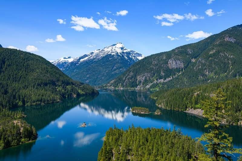
From the village, at the head of the Mokhvura River, the hiking trail crosses the river twice. At this point, the trail passes through a wetland and, heading north, enters the Lake Davie basin. From April through August, the lake basin is filled with water. In September, the water level lowers by about 1.5-2 meters, making it easier to enter the basin.
Many legends are connected with this blue lake in Mokhvi: there are stories about fighting Davi (Davi is a giant monster in Georgian folklore), about defeated fairy-tale creatures, about heroes and about the miraculous properties of the lake. According to one of the oldest traditions, during the summer drought the inhabitants of the surrounding villages went to the lake to "shake" the water: they threw a stone into the lake, as if to shake the water, and prayed to God for rain. And, indeed, according to the legend, the rain began immediately when those returning from the lake were still on their way.
Not only the residents of Imereti, but also the residents of Racha came to the lake. In times of drought the Rachin inhabitants took the lake water in a vessel to the church, gave it to the priest to pray over the water, and then they sprinkled it on the fields. In this way they called for rain.
Location:
Sachkhere Municipality, northeast of the village of Mokhvi, within the forest area of the southern slope of the Racha Ridge, at an altitude of 1,370 meters above sea level.
Coordinates:
42°25′51″N; 43°17′27″E.
How to get there:
Distance from Tbilisi — 194 km, from Sachkhere — 20 km, from Kutaisi — 100 km.

38 comments
Log in to leave a comment
Мне особенно понравилось, как подробно в статье описаны маршруты вокруг озера и есть советы от местных 👣💬 — это помогает не просто увидеть озеро, а прочувствовать его настроением и выбрать лучшие точки для прогулок и фото 📸. Такое место идеально подходит для душевного отдыха и перезагрузки от городской суеты ✨
После прогулки вокруг озера хочется зайти в уютное кафе ☕🍰, обсудить впечатления с друзьями за чашкой ароматного кофе и бокалом грузинского вина 🍷 — так приятно делиться эмоциями от путешествия! 🌞💛
Мне очень нравится, как этот рейтинг помогает почувствовать атмосферу места ещё до поездки, с реальными отзывами и полезными подсказками.
А вы уже были у озера Деви? Какие виды или уголки вокруг него произвели на вас наибольшее впечатление, и в какое время года, по вашему мнению, сюда лучше всего отправляться? 🌿💙
ют легенды об этом озере.Сколько смотрю мест связанных с горами, пещерами, горными озёрами, скалами у меня присутствует ощуще-
ние мистики и какой-то тревоги.Посмотреть было бы очень интересно.