




Mountain Passes in Georgia: Scenic Road Trip Routes
⛰️ Are you ready to conquer the serpentines that lead into the clouds? Somewhere there is a cliff, somewhere there is fog, and somewhere there is silence that you remember. We tell you which passes in Georgia are the most spectacular, when to go and how to prepare for the road to the mountains.
📘 General Info: how to choose a pass, when to go and what to drive
🚗 Ready for a road that will be more memorable than the destination? Let’s take a ride through Georgia's mountain passes — a route where every turn reveals a new world.
Mountain passes are not just road connections — they are journeys through clouds, forests, and rocky ridges. We've gathered seven of the most stunning and unique roads: from the accessible Rikoti to the wild Abano, from the green slopes of Goderdzi to the rugged serpentines of the Cross Pass.
🌿 These routes suit both experienced drivers and those simply seeking adventure — the main thing is to pick the right pass for your season and vehicle.
🗓️ When to go? Many passes are closed in winter. Can you cross them with a regular car? In this article, you’ll find the answers, coordinates, tips, and the spirit of real mountain Georgia.
| 🏔️ Pass | 📏 Elevation (m) | 🛣️ Road Type | 📅 Seasonality | 🚗 Vehicle | 📍 Coordinates |
|---|---|---|---|---|---|
| Goderdzi | 2025 | Asphalt → gravel | Open almost year-round | Regular car (in dry weather) | 41.632674, 42.510252 |
| Zekari | 2182 | Asphalt → gravel | Open in summer and autumn | 4×4 only | 41.827571, 42.861837 |
| Nakerala | 1218 | Asphalt | Open all year round | Any vehicle | 42.376673, 43.037221 |
| Rikoti | 996 | Asphalt | Always open | Any vehicle | 42.051447, 43.492769 |
| Cross Pass | 2379 | Asphalt + serpentines | Often closed in winter | Car / Bus | 42.505078, 44.454127 |
| Bear Cross | 2676 | Dirt road | Open in summer | 4×4 only | 42.522219, 45.056201 |
| Abano | 2826 | Dirt road + landslides | Summer only | 4×4 only | 42.278111, 45.508332 |
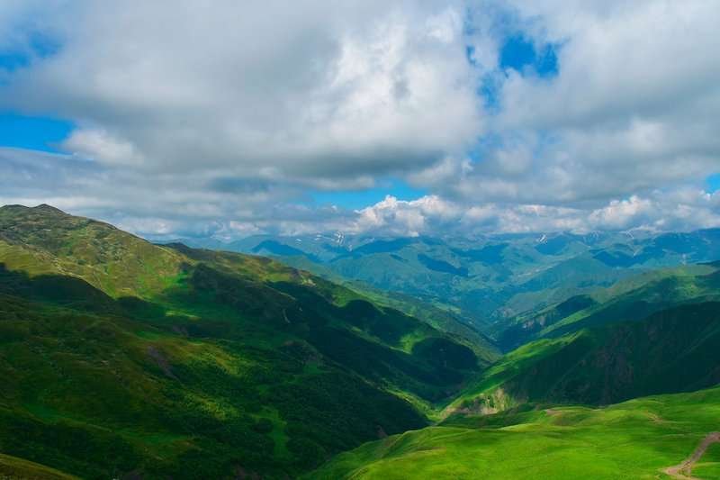
🌲 Goderdzi Pass — the most accessible route through the Adjara Mountains
Goderdzi is one of the most accessible and picturesque passes in Georgia. It connects Batumi and Akhaltsikhe, passing through pine forests, mountain meadows and mineral springs. The altitude is about 2025 meters, and the road in places resembles a postcard.
Although part of the route is gravel, in dry weather it is accessible to cars. There are guest houses, cafes, gas stations, and a ski resort in winter along the way. This makes Goderdzi an ideal choice for family road trips and short mountain tours.
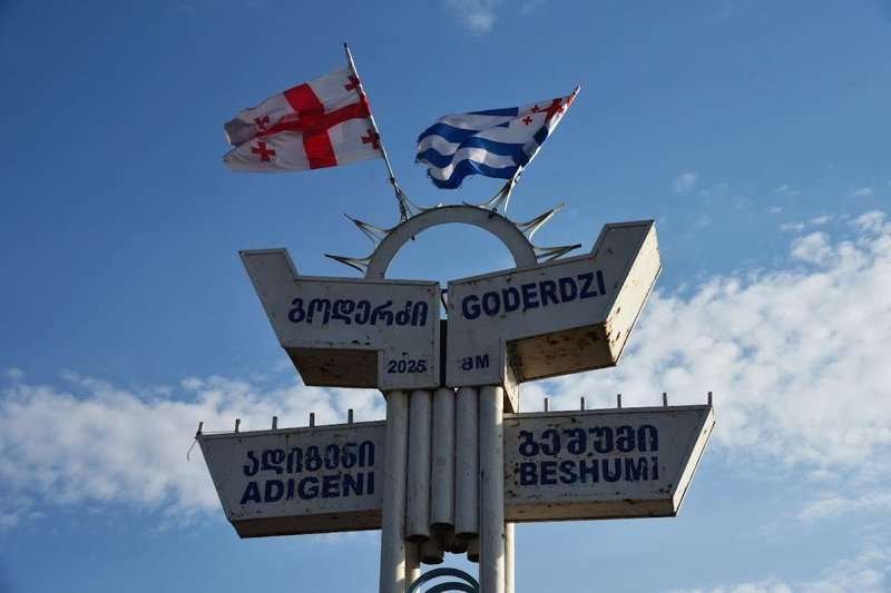
📋Main characteristics:
- Height: 2025 m
- Road type: Asphalt → crushed stone
- Seasonality: Open almost all year round (restrictions possible in winter)
- Transport: Suitable for regular cars (in dry weather)
- Infrastructure: There is accommodation, food, gas stations, resort
📍 What to see near Goderdzi Pass
🌿 Goderdzi ski resort - open both in summer and winter.
🌲Botanical garden with relict plants near the highway.
🟢 Green Lake - 5 km from the pass, a hiking trail to a panoramic point begins.
🧭Pre-trip tips:
- Check the road before the trip - there may be landslides in the spring
- Take warm clothes even in the summer - it is windy at the top
- The best time to go is September-October: beautiful, calm, comfortable
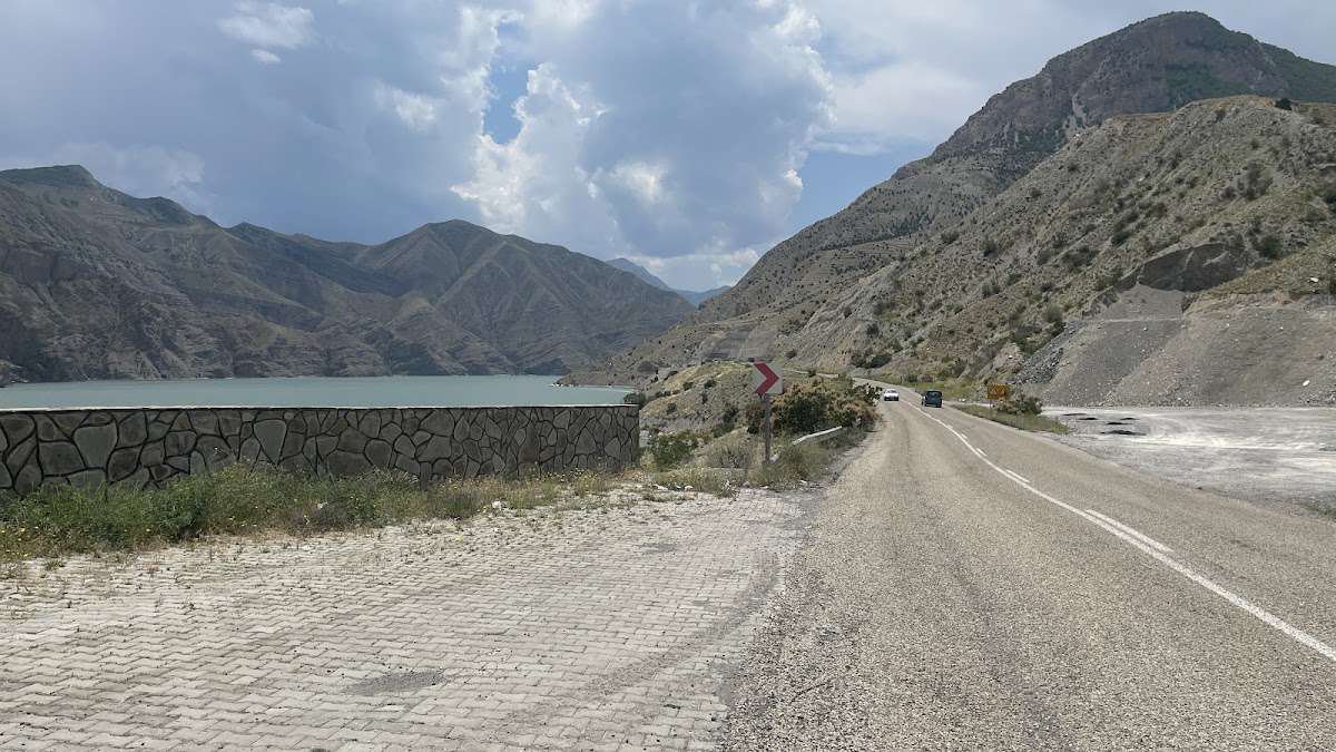
🌄 Zekari Pass — one of the most scenic routes in Imereti
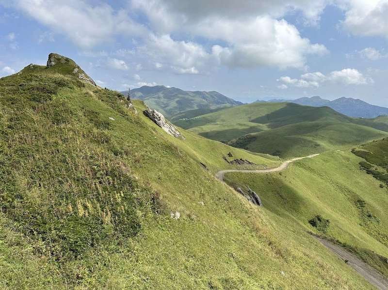
The Zekari Pass is located at an altitude of about 2182 meters and connects the regions of Imereti and Samtskhe-Javakheti. This is one of the most impressive routes in Central Georgia: serpentines, pine forests, green slopes and open horizons create a feeling of true mountain freedom.
The road climbs high into the mountains and in good weather is accessible even for regular cars, but in some areas it is better to drive an SUV. The asphalt quickly turns into gravel, and after rain the road can be washed out.
Suitable for: experienced drivers, seekers of secluded views, half-day travelers from Kutaisi or Baghdati.
📋 Brief characteristics:
- Height: 2182 m
- Road type: Asphalt → gravel
- Season: May to October (closed in winter)
- Transport: Better by 4x4, but in summer it is possible to travel by regular car
- Infrastructure: Minimal, petrol and food in advance
🧭Pre-trip tips:
- Check the weather forecast before you go: the road can be slippery in the rain.
- The summit is cold even in summer - take warm clothes.
- Stop at the viewpoints: the views of the valleys are unforgettable.
📍 What to see nearby:
- 🧱 Tsminda Tsmeba — an ancient chapel at the top of the pass
- 🌲 Sadgari forests — coniferous forests with panoramic views
- 💧 Zekari mineral springs — you can collect water
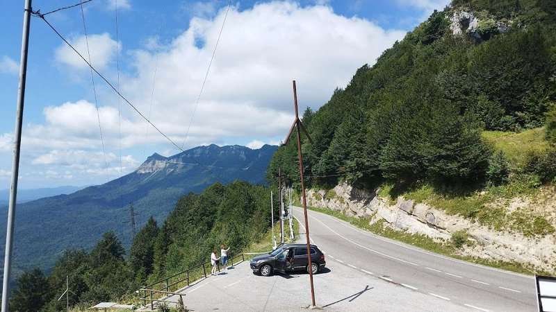
🍂 Nakerala Pass — a perfect mountain route to Tskaltubo Lake
The Nakerala Pass is located at an altitude of about 1,218 meters and runs through the ridge dividing Imereti and Racha. It is one of the most accessible and beautiful routes for a short trip by car - especially in autumn, when the mountains are covered in golden colors.
The road is well paved and suitable even for small cars, but be careful on the turns - they are steep and narrow, especially closer to the pass.
Suitable for: novice car travellers, family trips, those travelling from Kutaisi towards Ambrolauri.
📋 Brief characteristics:
Height: 1218 m
Road type: Asphalt
Season: All year round (sometimes closed after snowfalls)
Transport: Suitable for any car
Infrastructure: Minimal, connection is not available everywhere
🧭 Pre-trip tips:
- It is better to go during the day - at sunset the turns are shaded, visibility decreases.
- Be sure to stop at the observation deck - the view of Lake Shaori is stunning.
- During the rainy season, traction on the road can be reduced - be careful.
📍 What to see nearby:
- 🌊 Lake Shaori is one of the most beautiful in Georgia, ideal for a picnic
- 🏔 Viewing platform near the tunnel - panorama of Racha and part of the pass
- 🪨 Karst caves of Tskaltubo - a little off the route, but worth a visit
🛣️ Rikoti Pass — the artery where West meets East
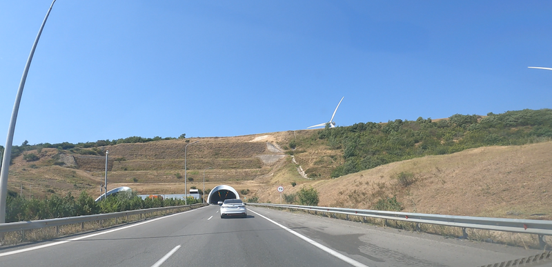
The Rikoti Pass is located at an altitude of 996 meters and is considered the most important automobile pass in Georgia. The E60 highway runs through it, connecting the East and West of the country - the capital and Kutaisi are connected by this road. Rikoti is not about the beauty of nature, but about strategic importance, and yet the road winds among green hills and opens up panoramas of Imereti and Mtskheta.
Work is actively underway at the pass: a new tunnel is being built, sections of the highway are being widened. This is the busiest route - especially in summer and during the holiday season. But at the same time, it is completely paved, with developed infrastructure - gas stations, cafes, repairs.
Brief characteristics:
Height: 996 m
Road type: asphalt
Season: open all year round
Transport: suitable for any transport
Infrastructure: cafe, gas station, maintenance
📍 What to see nearby:
- 🏰 Shiomgvime Monastery — a secluded place in a gorge nearby
- 🪨 Old Rikoti Tunnel — part of a historical road
- 🏞️ Ruins of Rikoti Fortress — right at the top
🧭 Pre-trip tips:
- Watch the traffic - there are traffic jams due to repairs and trucks
- Keep your distance on the climbs - especially in rainy weather
- Stop for a panoramic view at the old tunnel - the views are worth it
⛰ Cross Pass — the heart of the Georgian Military Road
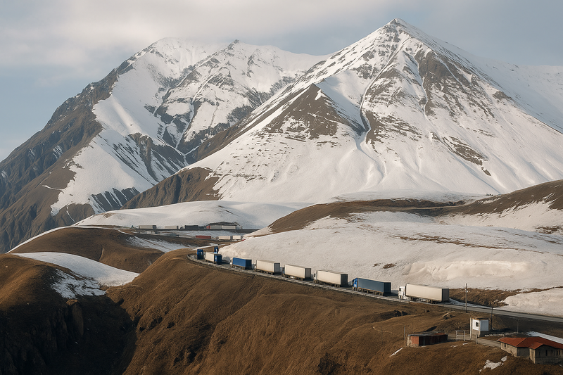
The Cross Pass (or Jvari) is one of the most famous and highest passes in Georgia. It is located at an altitude of 2379 meters and connects Mtskheta-Mtianeti with the historical region of Khevi. The famous Georgian Military Road runs along it, leading to Kazbegi and the border with Russia.
The road here is paved, but the serpentines require attention. The pass is open most of the year, although snow drifts are possible in winter. The place impresses with panoramas of Kazbek, the Terek River and snow-capped peaks - especially in clear weather.
📋 Main characteristics:
- Height: 2379 m
- Road type: Asphalt (damaged in places)
- Seasonality: Usually open, but may be closed in winter due to snowfall
- Transport: Suitable for any car (in winter - with chains or 4x4)
- Infrastructure: There are cafes, parking lots, observation decks nearby
📍 What to see near the Cross Pass
- 🏔️ Kazbek (5033 m) – a majestic mountain, visible right from the pass.
- 🌊 Terek River – turbulent streams create mini-waterfalls and picturesque rapids.
- 🛤️ Georgian Military Road – a historical route with stone arches and breathtaking views.
- ⛪ Gergeti Holy Trinity Church – stands at the foot of Kazbek, like a keeper of the mountain spirit.
🧭 Pre-trip tips:
- Check the road conditions in winter - sometimes it is closed for clearing
- Be sure to stop at the viewpoints - the views are truly breathtaking
- Bring water, a first aid kit, extra fuel and a phone charger
🌁 Bear Cross Pass — a high-mountain route in the heart of Khevsureti
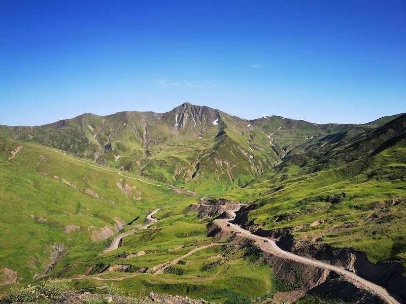
Bear Cross is one of the most remote and wild passes in Georgia. It is located at an altitude of 2676 meters and connects Outer and Inner Khevsureti. It offers breathtaking views of two valleys at once, and it is here that you feel how Georgia becomes a real mountain country.
The road to the pass is not easy: first asphalt, then dirt road and rocky sections. The path is only suitable for SUVs and requires caution - especially in rainy weather. The pass itself is not only a point on the map, but also a sacred place for the locals, surrounded by legends and history.
Brief characteristics:
- Altitude: 2676 m
- Road type: asphalt → dirt road, rocks
- Season: open only in dry weather (June to September)
- Transport: 4x4 only
- Infrastructure: none
📍 What to see nearby:
- 🏛️ Shatili — a unique fortified village with towers
- 🛕 Anatori — ancient tombs by the road
- ⛰️ Argunu Valley — wild and picturesque, almost without people
🧭 Pre-trip tips:
- Check the forecast - driving in fog and rain is dangerous
- Be sure to take warm clothes and extra fuel
- Navigation often loses signal - download offline maps
⛰️ Abano Pass — the most extreme route to Tusheti
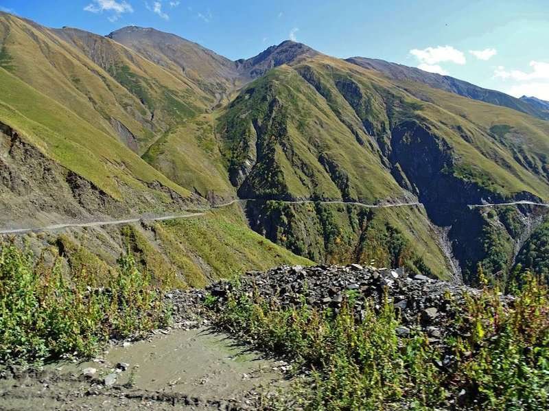
Abano is not just a mountain road, but a real challenge even for experienced drivers. At 2,826 meters above sea level, it is the highest automobile pass in Georgia and one of the most dangerous in Europe. It connects the Kakheti region with the hard-to-reach Tusheti, an area accessible only by this road.
The route is only open during the summer months (usually from mid-June to October), as the rest of the time it is completely covered in snow. Serpentines, cliffs without guardrails, waterfalls right on the road and narrow sections make the path both exciting and scary. But it is here that the wildest and most magnificent views of the Caucasus open up.
Brief characteristics:
Height: 2826 m
Road type: dirt road, rocks, rocky areas
Season: June–October (depending on snow)
Transport: only 4x4 and experienced driver
Infrastructure: completely absent
📍 What to see nearby:
- 🏰 Omalo — the main village of Tusheti with towers and a museum
- 🌲 Tusheti National Park — a reserve with unique nature
- 🐎 Konashira — the starting point for horseback riding tours through the gorges
🧭 Pre-trip tips:
- Before leaving, check if the pass is open - there are unexpected avalanches
- It is not recommended to go alone - it is better to be accompanied
- Be sure to check the equipment, take a spare canister and a first aid kit
✅ Useful tips for those heading to the mountains
Even the most scenic route can bring surprises. Prepare in advance — and your journey through Georgia's mountain passes will be filled with vivid memories!
Half of the passes on this list are 4x4-only, and rental contracts say so explicitly. Take a car that is actually allowed there.
Need a 4x4?
Local companies rent Pajero, Delica and Prado with full cover. Compare prices and availability for your dates.
Affiliate link: we may earn a commission, your price stays the same.
❓ Frequently Asked Questions about Georgia's Passes
🗻 What is the altitude of the Zekari Pass?
Zekari Pass is located at an elevation of 2182 m above sea level.
🚗 Do I need a 4×4 vehicle for Nakerala?
In summer, a regular car can pass, but a 4×4 is recommended for added confidence.
❄️ When do mountain passes close in winter?
Most mountain roads are closed from November to April due to snow and ice.
🛤️ Which roads are best for first-time trips?
We recommend paved routes for beginners, such as (Nakerala, Rikoti) — no major gravel sections.
📅 What is the best season to travel through Rikoti Pass?
The best period is April–October, when the road is clear of snow and ice.
⛽ Where can I refuel on the way?
There are gas stations at the foot of the passes, but not at high altitudes — carry extra fuel.
📶 Is there mobile signal in the mountains?
Signal often drops in narrow gorges — download offline maps before the trip.
🛑 What dangers might be encountered on the road?
Be cautious of sharp turns, washed-out roads after rain, and sudden fogs.
🎒 What should I take with me?
Water supply, warm clothes, first aid kit, phone charger, fuel canister, and snacks.
🌅 What is the best time to start the trip?
We recommend leaving before sunrise (5:00–6:00) to enjoy the views and avoid traffic.
📸 Where are the most scenic viewpoints?
Rikoti: by the old serpentine, Nakerala: near Shaori Lake, Zekari: at Tsminda Tsmeba.
🧭 May the road lead you to discoveries — time to head to the mountains!
The mountain passes of Georgia are more than just routes through the ridges. They are journeys where every turn reveals a panorama worth capturing and remembering. It's a path where the silence at the summit speaks louder than words.
Now you know which passes are open, where a 4WD is needed, and what to see nearby. All that’s left is to choose your route, check the weather — and hit the road!
💬 Have you been to one of the passes? Share in the comments which route stood out to you the most.
📩 Want to suggest a new pass? Send us the info — and we’ll include it in the next update of this article.

22 comments
Log in to leave a comment
Но, честно говоря, иногда было страшновато в некоторых местах! Эти серпантины… блин, жутковато и красиво одновременно! Какой совет дашь для тех, кто едет в одиночку? Как избежать проблемы с авто, если вдруг сядет батарея на этих высоких перевалах?
Особенно понравилось, как в рейтинге перечислены самые живописные перевалы — от Крестового до Годердзи и Перевального хребта — с подробным описанием, откуда открываются лучшие виды и какие тропы стоит выбрать для похода. Раздел с советами местных жителей оказался бесценным: благодаря ним я узнал, где безопаснее остановиться на привал, какие виды открываются на рассвете и как подготовиться к изменчивой горной погоде. Я уже прошёл часть маршрута к одному из перевалов и в планах посетить кафе‑гестхаус у подножия Годердзи, о котором упоминали читатели в отзывах — говорят, там подают отличный хинкали с видом на хребет.
Очень порадовали отзывы туристов и ответы на часто задаваемые вопросы: они помогают не только выбрать маршрут, но и почувствовать себя увереннее перед выходом в горы.
А вы бы предпочли начать с более простого перевала для первой горной прогулки или сразу отправились бы к самому зрелищному из перечисленных? Спасибо каталогу мадлобу за такие рейтинги!