



Add organization

Mount Gombori - a picturesque pass and panoramic route in Kakheti

Open 24 hours
Updated at:
0.0/0 reviews
Gombori Mountain
Tsiv-Gombori Range
Gombori Mountain
Gombori Mountain
Gombori Mountain
Tsiv-Gombori Range
Gombori Mountain
Tsiv-Gombori Range
  • General
  • Description
  • How to arrive
  • QnA
⏰ Working hours
📍 Coords and Plus Code

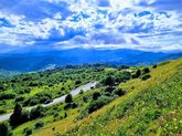
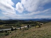
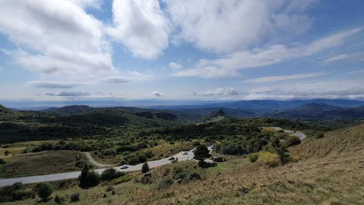
Gombori Mountain is a winding mountain pass and part of the Tsiv-Gombori Range in Kakheti, connecting Tbilisi and Telavi. The road climbs to 1,620 metres above sea level, running through blooming subalpine meadows, coniferous forest and the sharp turns of a mountain serpentine, one of the most recognisable mountain landscapes in eastern Georgia.

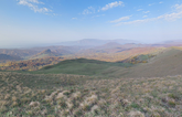
Gombori forms the watershed between the Alazani and Iori valleys, dividing Kakheti into an inner zone (Shida Kakheti) and an outer zone (Gare Kakheti). From the pass, views open onto vineyards, dolmens and mountain ranges, particularly striking in autumn when the forests turn gold.

The pass is accessible year-round, though the seasons noticeably change the character of the drive. Spring and autumn are especially photogenic, summer stays cool in the forest shade even in hot weather, and in winter the road can close due to snow and fog, so checking conditions ahead of a winter trip is worthwhile. Along the mountain route, small villages offer stops where honey, vegetables, nuts and berries are sold directly by local residents.

Gombori Pass is often seen not as a standalone destination but as part of the journey between Tbilisi and Telavi: for the full story of the pass's history, its role in Kakheti's trade routes, and seasonal driving notes, see the article Gombori Pass.
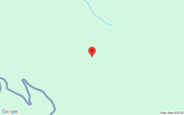
🚗 By car: Gombori Pass, part of the Tsiv-Gombori Range, lies on the direct mountain road between Tbilisi and Telavi, in Kakheti. It's a shorter but steeper route compared to the lowland road via Sagarejo: the mountain road through Gombori can close in winter due to snow and fog, unlike the lower-elevation route.

🚌 Without a car: there's no regular public transport directly over the pass; marshrutkas between Tbilisi and Telavi usually run via the lowland Sagarejo route. A car or taxi is needed to take the Gombori road specifically.

❓ Frequently Asked Questions

🏔️ What is Gombori Mountain?

Gombori Mountain, or Gombori Pass, is covered in detail in the article Gombori Pass: it's a winding mountain pass and part of the Tsiv-Gombori Range in Kakheti, connecting Tbilisi and Telavi.

📏 What is the elevation of Gombori Pass?

The road climbs to 1,620 metres above sea level.

🗺️ Why is Gombori significant for Kakheti's geography?

The pass forms the watershed between the Alazani and Iori valleys, dividing Kakheti into an inner zone (Shida Kakheti) and an outer zone (Gare Kakheti).

📅 When is the best time to drive Gombori Pass?

Spring and autumn are especially scenic, summer stays cool in the forest shade, and winter can bring road closures due to snow and fog: check conditions before a cold-season trip.

📸 What can you see from the pass?

Views of vineyards, dolmens and mountain ranges, particularly striking in autumn when the forests turn gold.

🍯 Can you buy anything along the way?

Yes, small villages along the route offer local products, including honey, vegetables, nuts and berries sold directly by residents.

🚗 Is the road suitable for a regular car?

Yes, it's paved, but it's a winding mountain road with sharp turns; drive carefully in rain or snow.

Location map
Click to load interactive map

Do you want to increase the number of clients by 5 times?

Choose premium placement on Madloba and attract customers who are currently leaving for your competitors.

I want
Be the first to leave a review
Give a rating
Upload photos