




Kojori near Tbilisi: Azeula Fortress, Forest and Walks
In short
Kojori (კოჯორი) sits in the hills southwest of Tbilisi. People come here for forest walks and the ruins of Azeula Fortress. For a short trip, stick to the village and the fortress, and plan the route to Kabeni Monastery and its waterfalls as a separate outing: the tourism portal describes an 11 km trail with no waymarks. You can get there by car or by public transport. Sources and route details were checked on 19 October 2026.
Where Kojori is and how high it is
Georgia's official tourism portal gives the road from Tbilisi to Kojori as 16 km, about 35 minutes by car. Treat that as the portal's estimate, not a promise from your hotel door: the trip depends on where you start, your stops and the traffic.
The same portal puts the village at roughly 1,350 to 1,400 m. The height of a particular hill or of the fortress is not the height of Kojori as a whole. In summer it is a pleasant place for a forest walk, but talk of "healing air" is no substitute for medical advice.
How to get there from Tbilisi
By bus
In the Tbilisi Transport Company journey planner, search for Kojori or კოჯორი from your starting point. Check the stop, the day of the week and the bus back before you set off on your walk.
On the day we checked, Moovit listed route 380 from Baratashvili Street to Kojori (page in Georgian). Moovit is a third-party listing, not an announcement from the operator, so double-check the route with TTC before you go. We do not give minute-by-minute times or the last bus here, so that an outdated table does not leave you waiting at the wrong stop.
The bus stop in the village is not the same as the start of the path to the fortress. Mark both on the map first and work out how far you still have to walk. Check the fare and transfer rules against the current TTC tariff; how paying for city transport works in general is explained in our Tbilisi transport guide.
By car or taxi
Set your route to the exact point you need: the village, the start of the walk or the fortress. Do not assume you can drive right up to the ruins. Before the forest section, check the road surface and where you can turn around; after rain, choose a shorter route if the road or path has turned to mud.
If you take a taxi, decide in advance how you will get back. Being able to get to Kojori does not mean there will be a free car by the trailhead in the evening. Booking options and ways to pay are covered in our article on taxis in Georgia.
What to see: Azeula Fortress
Kojori Fortress is also known as Koroghli or Azeula. According to Georgia Travel, parts of the walls and two towers survive on a rocky base. Think of it as a walk to a ruin, not a visit to a fitted-out museum.
Choose whether to climb to the fortress depending on the weather and your fitness. On wet rock, do not go near the edge for a photo. If you have a child with you, check the last stretch of the climb in advance: a path does not mean railings or a safe spot for a pushchair.
Local stories about Queen Tamar are legends, not established history. The history of the fortress is covered in more detail in our article on Kojori Fortress.
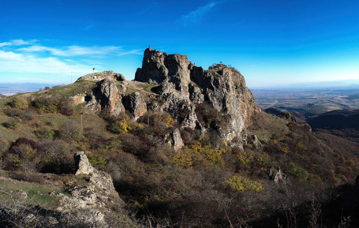
Kojori (Azeula) Fortress.
Kabeni: a separate walk to the monastery and waterfalls
The tourism portal describes an 11 km route from the centre of Kojori to Kabeni Monastery and its waterfalls, and warns plainly that the trail is not waymarked. If the description calls it "easy", that is no reason to set off without a map, water and time to spare.
Pick your route in advance and save an offline map. Check how the trail is after rain, wear proper shoes and leave enough daylight. If you only came for a short walk, do not tack the waterfalls on to the fortress by default. There is a separate article on the Kabeni waterfalls.
Which plan suits your trip
| Plan | What to bear in mind |
|---|---|
| Village and forest | Good for a short walk without having to climb to the ruins. Note the stop for the way back. |
| Fortress | Add the climb on foot and check the weather; do not plan on a pushchair without checking on site. |
| Kabeni | A separate route with no waymarks. Prepare the route and allow plenty of time. |
| By bike | The portal has a Kojori - Turtle Lake route, but check how hard the descent is and the surface beforehand. |
The Kojori - Turtle Lake bike route does not mean every forest descent suits a beginner or an ordinary city bike. Bring kit suited to the route, and do not count on riding a snow-covered trail in winter.
What to take and check before you go
- An offline map and the point you will return to.
- Water, comfortable shoes with a good grip and clothes for the weather.
- A charged phone; the time of your transport back or an arranged pick-up.
- For the walk to Kabeni: trail conditions and the time left before dark.
Do not base your route on unconfirmed tips about free access to former private dachas. If a site is closed or on private land, choose a walk that is open to the public.
Frequently asked questions
How far is Kojori from Tbilisi?
The tourism portal gives the road as 16 km; the route from your address to the point you choose may differ.
Are Kojori and კოჯორი the same place?
Yes. კოჯორი is the Georgian spelling. It helps when you search for transport or a place on the map.
Which bus do I take?
Moovit lists route 380. Before you travel, confirm the route, the stop and the times back with TTC. If another listing shows route 316, check that with the operator too.
Where can I check the last bus back?
In the current TTC journey planner for your day. Do not rely on an old table from an article or an undated screenshot.
Are Azeula and Koroghli different fortresses?
Georgia Travel uses these names for Kojori Fortress. When you plan your route, check the point on the map.
Can I drive right up to the ruins?
Do not count on it. Plan the drive and the walk separately, and check the surface and where you can park.
Can I take a pushchair?
Plan a walk along the village's accessible roads and the climb to the fortress separately. Whether the last stretch is suitable for a pushchair has not been confirmed.
How long does it take to walk to the Kabeni waterfalls?
The portal describes an 11 km route, but that is the length of the trail, not a promise of time. Your pace, the surface and the weather all change how long it takes.
Is the trail to Kabeni waymarked?
The tourism portal describes it as unmarked. Sort out your navigation in advance.
Can a stay in Kojori treat health conditions?
This article is about walking. It gives no medical advice and makes no promises of treatment.

37 comments
Log in to leave a comment
Климат умеренно сухой, средних гор, зима умеренно холодная, малоснежная, лето сухое, умеренно тёплое.
Исцеляются туберкулёз лимфатических желез, костей и суставов, бронхит и плеврит, детские кишечные заболевания, вторичное малокровие, малярия, рахит, бронхиальная астма, невроз.
Расстояние от центра Тбилиси 16 км, высота до 1350 м.
Раньше Коджори назывался Агарани, а воз ведённая в его окрестностях летняя резиденция грузинских царей - Агарской крепостью.
В давние времена окрестности Тбилиси изобиловали зелёными насаждениями, садами и лесами, и в городе было прохладнее, чем сейчас, и люди в летний период не стремилось выехать за город.