

The most unusual natural places and lakes in Georgia. Interesting Lake Erzo.
If you want to see an interesting Georgian lake, then do not pass by Lake Ertso, which is not for nothing the largest karst lake in all of Georgia. The lake water is very clean and mirrored. Sometimes the water in the lake disappears, this is due to the presence of karst depressions under the bottom of the lake.
Приглашаем для общения про Грузию


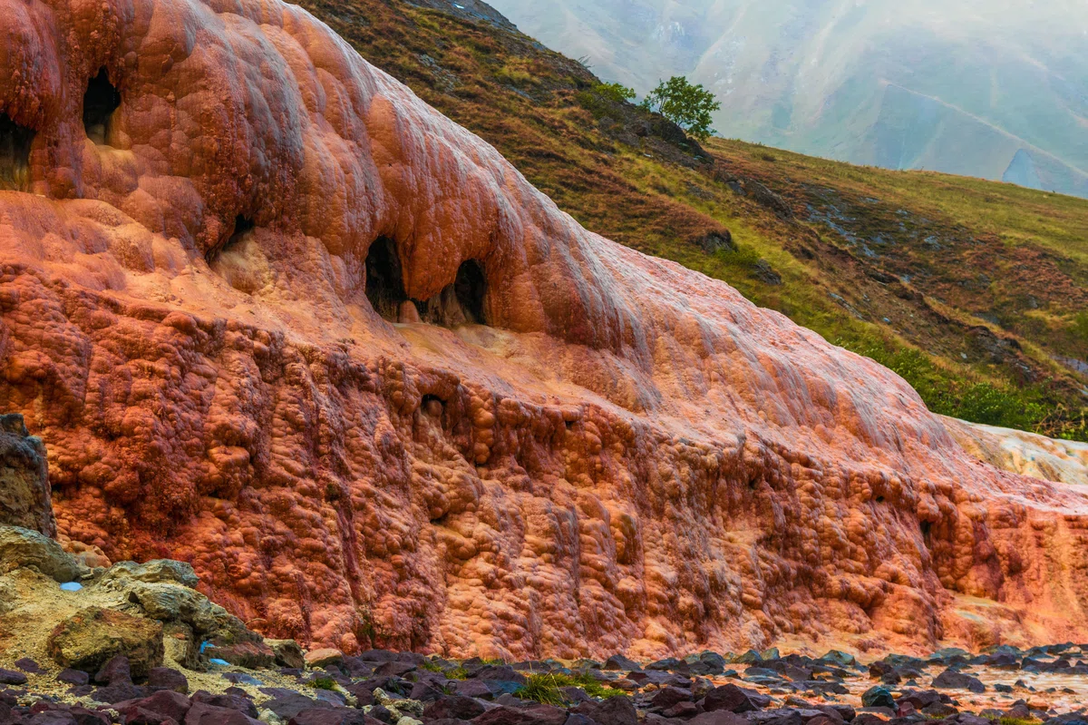
In Java, in the vicinity of the village of Britati, and partly on the territory of the village itself, there are significant reserves of limestone travertine in the bowels of the earth. Limestone travertine is also found in other areas of Georgia: at the source of the Patara Liakhvi River and in the valley of the Lehura River, at the Jvari pass; as well as in Western Georgia – Racha, Imereti, Svaneti.

The Tskhinvali region is located on the southern slope of the Central Caucasian Ridge between the main watershed ridge and the northern part of the Shida Kartli plain. The Alevsky Ridge adjoins it from the east, and the Likhsky, Rachinsky and Kedelsky ridges from the west. Historically, this region belonged to the Eristavs of Racha and at different periods was part of the Kartali and Kakheti kingdoms. As a result of karst processes (as a rule, chemical decomposition of karst processes), oval-shaped basins are formed on the earth's surface, which are called karst funnels. In some cases, such craters are filled with a lake. For example, Lake Ertso (Tskhinvali region, Java municipality, the source of the Kvirila River, where the Rachensky and Likhsky ridges intersect) occupies four funnels; whereas the second most famous karst lake Devi, located in Sachkhera, on the southern slope of the Rachinsky ridge, at an altitude of 1370 meters, is only two. Accordingly, Lake Ertso is considered the largest karst lake in Georgia.
The area of the mirror surface of Lake Erzo is 0.31 km2, the volume of water is 650 m3, the greatest depth is 19 meters. There are sinkholes not only on the shore of the lake, but also on its bottom. These holes are visible even from the nearest mountains. Funnels with a depth of 5-19 meters make the bottom of the lake uneven. With a certain frequency, the water in the lake disappears. According to scientists, the disappearance of water is caused by the presence of karst depressions under the bottom of the lake.
The waters of the lake are fed by the Eroskali River (the left tributary of the Kvirila River). Not far from the lake originates the river Kvirila. It flows through the village of Tsona (Java municipality), and at the village of Khapalgomi it connects with the river Erzostskali, then heads west towards Imereti. The total length of the Kvirila River is 140 km . It is noteworthy that the name "Kvirila" ("screaming") in Georgian toponymy is associated with water flows flowing in remote places.


18 comments
Log in to leave a comment
ет,а потом снова появляется.Учёные всё -же предполагают, что это явление связано с карстовыми воронками на дне озера, но я так поняла,
что они не утверждают этот факт.Возможно есть какие-то другие причины.Хотелось бы посмотреть процесс исчезновения и появления озера.
В результате карстовых процессов на поверхности земли образуются котловины овальной формы, которые называют карстовыми воронками. В некоторых случаях такие воронки заполнены озером. Например, озеро Эрцо занимает четыре воронки; тогда как второе самое известное карстовое озеро Дэви –всего лишь две. Озеро Эрцо с зеркальной поверхностью, глубиной 19 метров. Карстовые воронки имеются не только на берегу озера, но и на его дне. Эти отверстия видны даже с ближайших гор. Воронки глубиной 5-19 метров делают дно озера неровным. С определённой периодичностью вода в озере исчезает. Полагают, что исчезновение воды вызвано наличием под дном озера карстовых углублений.
Водами озера питается река Эросцкали. Недалеко от озера берёт своё начало река Квирила, длиной 140 км , протекая через село Цона.