Akhaldaba Fortress (Tamara Fortress) in Samtskhe-Javakheti, Georgia.

  • Description

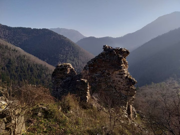
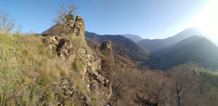
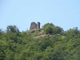
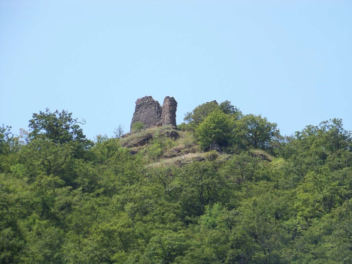
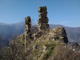
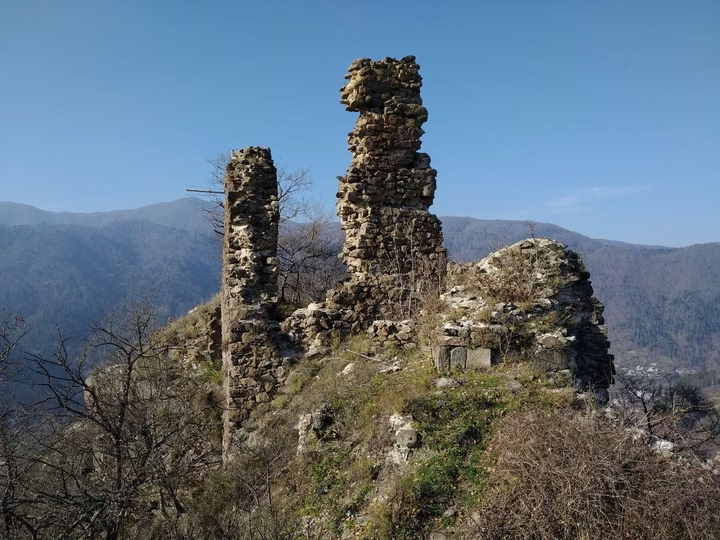
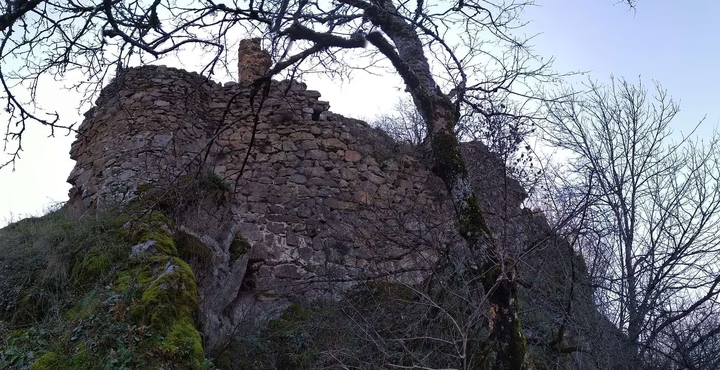
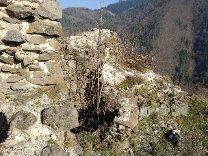
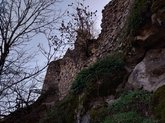
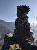
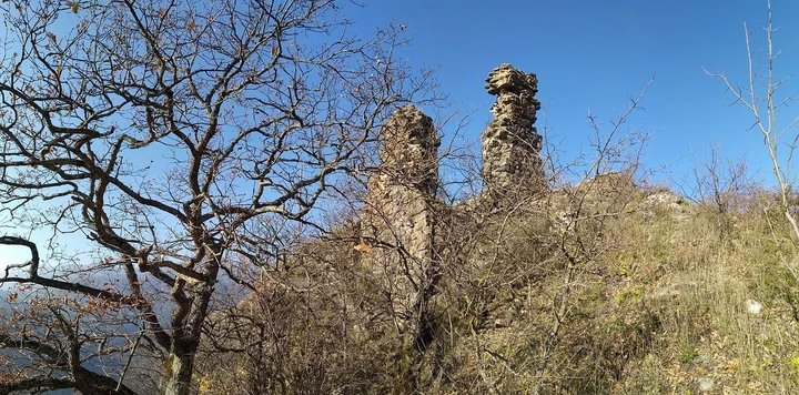
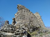
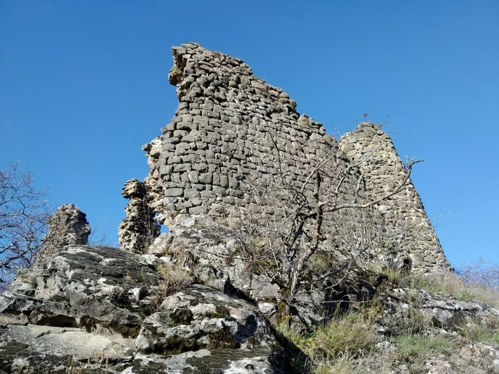
In the very heart of the Borjomi municipality, on the top of the mountain, rises the majestic Akhaldaba Fortress, comparable to the power of the Tamara Fortress. This impregnable fortress, located on the right bank of the Mtkvari River, offers stunning views of the entire city of Akhaldaba and its strategically important roads. The mountain covered with mixed forest creates a unique natural environment, attractive with its picturesque beauty.

The pine forest, which occupies part of the territory around the fortress, adds mystery to this place. Several trails leading into the forest provide the opportunity to immerse yourself in nature and eventually reach the fortress itself. The fortress trail, which stretches over 1.5 km, is surprisingly easy and accessible to everyone, providing an exciting adventure in 30 minutes. The 360-degree view from the top of the fortress seems to immerse you in the grandeur of the gorge, emphasizing this with the symbolic Georgian flag and cross on the fortress itself.

The history of the Akhaldaba Fortress deserves special attention. In historical sources it is referred to as a “small city” or even a “micro country”. This is not surprising, given the dozens of historical monuments discovered in this place. Possibly built in the 9th-10th centuries, when the Niedzwi Gorge was home to holy monks, the Akhaldaba Fortress was an important trading center and a key point on trade roads. With her presence, she participated in numerous battles, becoming evidence of great events and influence on the history of Georgia.

For those who value not only the historical heritage, but also the splendor of nature, a visit to the Akhaldaba Fortress will be a unique experience. The combination of history, natural beauty and breathtaking views make this place a must-see for those seeking to better understand and enjoy the culture and nature of Georgia.

Архитектурная достопримечательность
Дети
Copy coords
43.49259,41.92354
Coords are copied
Address
Borjomi Municipality, Samtskhe-Javakheti Region, Georgia
Work schedule
They speak languages
Русский
ქართული
English
I'm the owner Correct inaccuracy

Do you want to increase the number of clients by 5 times?

Choose premium placement on Madloba and attract customers who are currently leaving for your competitors.

I want
Increase the number of clients
7 reviews
to leave a review.
  • N
    gray stars
    red stars

    Situated atop a mountain, there's a well-marked hiking trail that starts from the village of Akhaldaba. The views along the way are stunning and really add to the experience.

  • V
    gray stars
    red stars

    Hidden in the rugged beauty of the Georgian wilderness, this ruined fortress left me in awe. Climbing up the steep path, the anticipation grew. Once at the top, the view was breathtaking. The ruins, standing tall even in their decayed state, whispered stories of ancient times. You can almost feel history under your fingertips, touching those aged stones. It’s a different kind of peace up there, surrounded by nothing but nature and the silence of the past. Worth every step.

  • Е
    gray stars
    red stars

    Заброшенное очарование переносящее в прошлое... Вид на Боржоми просто потрясающий! Немного приключений при подъеме, зато какая награда — панорама города в лучах заходящего солнца. Уютное местечко для тихого созерцания и редкого кадра в своем альбоме. পরিষ্কার আকাশে সূর্যাস্তের সময়ের মতো সুন্দর দৃশ্য পাওয়া যাইনা!

  • Y
    gray stars
    red stars

    The castle is difficult to get to, but its ruins, which include dwellings and a reservoir, are worth a look. Inside the castle, you can see the foundations of secret warehouses and large half-filled white limestone pits. The castle shows signs of restoration despite the destruction and still protects its historical secrets.

  • M
    gray stars
    red stars

    ამ ციხის შესახებ მადლობადან შეიტყვეს. ამ ადგილის მონახულება მინდა

  • natali mkrtchan
    gray stars
    red stars

    ციხე საგრძნობლად დააზიანა 1920 წელს მომხდარმა მიწისძვრამ. ციხე ძნელად მისადგომია. დღესდღეობით დანგრეულია, ჩვენამდე მოაღწია მხოლოდ მისმა ჩრდილო-აღმოსავლეთმა მხარემ. გადარჩენილი ციხის სიმაღლე 10 მეტრს აღწევს. ციხეს ქვემო გალავანიც ჰქონია, რომელიც მას იცავდა სამხრეთ დასავლეთის მხრიდან. გალავნის ნაწილი დაშლილია, რომელიც ნაგებია ლოდებითა და დუღაბით. გალავანი მთის რელიეფს მიუყვება და უსწორმასწორო ფორმისაა. გალავნის შიგნით, მცირე ფართობზე ციტადელია. მის კედლებში რამდენიმე სართულიანი კოშკებია ჩართული. ციხის ქვედა ნაწილში საცხოვრებელი სახლები და წყალსაცავია. ციხეში კარგად ჩანს ჩაქცეული სათავსოების საძირკველი. დასავლეთ კუთხეში შეინიშნება ქვითკირით ამოშენებული ნახევრად დაშლილი დიდი ხარო. ციხეს ეტყობა რესტავრაციის კვალი. იგი იცავდა ნეძვისა და მტკვრის ხეობას, რომელიც მას უვლის სამხრეთ-აღმოსავლეთით.ციხე კეტავდა ქართლის ცენტრალურ ნაწილს - მტკვრის ხეობაში შემოსასვლელს.

  • gray stars
    red stars

    Археологический памятник расположен на правом берегу реки Куры, на вершине высокой горы. С северо-востока к нему стекает вода из Неджвура. Местные жители называют его «Крепость Тамары» или «Золотой крепостью». Впервые это место упоминается в грузинских источниках в 1260 году. Крепость описывается как мощное сооружение на высоком утесе. Она была отремонтирована в 1743 году, а в 1747 передана Каихосро Орбелиани, который подготовил её к возможным набегам. В 1772 году путешественник отмечает, что крепость была пустой. Землетрясение 1920 года значительно её повредило, и сегодня до нас дошла только северо-восточная часть, высотой около 10 метров. Крепость окружена нижним валом, часть которого сохранилась. Внутри вала находится цитадель с многоэтажными башнями. В нижней части крепости были жилые дома и водохранилище. Можно увидеть остатки фундаментов и полуразрушенного большого здания. Стены показывают следы реставрации. Крепость контролировала долины Неджви и Куры, защищая вход в центральную часть Картли.