What to see in Georgia - Mtirala Nature Reserve in Adjara, Tbilisi National Park and Algeti National Park in Kvemo Kartli.
Choosing what to see in Georgia is quite difficult due to the abundance of picturesque nature reserves in the country. There are two-day and one-day track routes in the Adjara Reserve of Mtirala. Tbilisi National Park offers cycling routes and horseback riding tours. The National Park in Algeti will be interesting to nature lovers...
Go on a trip to the national parks of Georgia⬇️
Mtirala
Adjarian Mtirala National Park It is surrounded by the city of Kobuleti, and the villages of Khelvachauri and Keda. In Chakvi there is an office of the park administration, on the 9th kilometer of the road there is a shelter with overnight accommodation for guests, and at a distance of 15 km from Chakvi, in Chakvistavi, there is a visitor center. The roads here are convenient and have special markings.
Altitude above sea level: up to 1761 m (mt. Mtirala).
Area: 156.98 km2 or 15.698 ha.
GPS coordinates: N41.69432, E41.82220.
Year of foundation: 2006.
Website: http://apa.gov.ge /.
Tel.: +995 577 10 18 89 (visitor center, Chakvistavi).
The park administration is located in Chakvi.
How to get to the park?
From Tbilisi
Chakvi is located at a distance of about 350 km from the capital, the trip by car will take 5-6 hours. This is the fastest way, but if you take a taxi, it will cost too much. The way out of the situation is to go by train. It will take 6-9 hours and will cost 15-30 lari (346 – 692 rubles). There is also a third option: minibuses from the bus stations "Didube" and "Ortachala". Tickets cost 20 lari (461 rubles), and the journey will take 6 hours.
From Batumi
Chakvi is very close to Batumi – only 10 km away. From the bus station of Batumi to Chavi can be reached by minibus in 20 minutes, and a ticket costs 1 GEL (23 rubles). Renting a car or a taxi ride will also be inexpensive.
The best season to visit Mtirala Park is the period from spring to early autumn. Visitors are offered trips here for one or two days. There are fields for picnics and the installation of tents, with special places for fire. The park's services include walking, horse riding, as well as zoology and botany tours.
Tourist routes in the Mtirala Park
The path to the chestnut forest
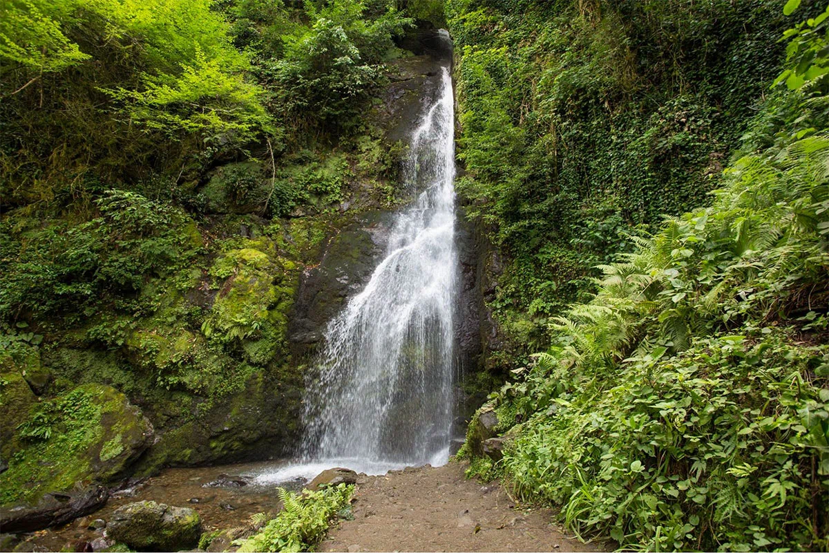
One-day, seven-kilometer tourist route. It is easily overcome on foot. The maximum height of the trail reaches 442 m relative to sea level. On this road there is a gorge of the Chakvistskali River, a lake and a waterfall with a height of 15 m. Camping and fishing are also allowed here. Trout fish live here in large numbers.
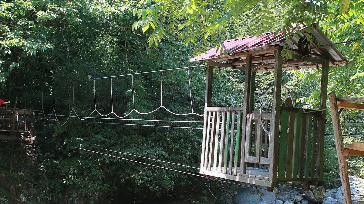
This tourist route can be carried out at any time of the year, in winter the snowy mountain peaks look especially beautiful here. This option of walking is more entertaining and spectacular, even with children they go on a trip. In the case of a trip to the national park by car, it is best to stop near a local cafe and cross the mountain river Chakvistskali using an old mobile cabin.
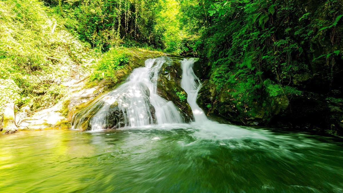
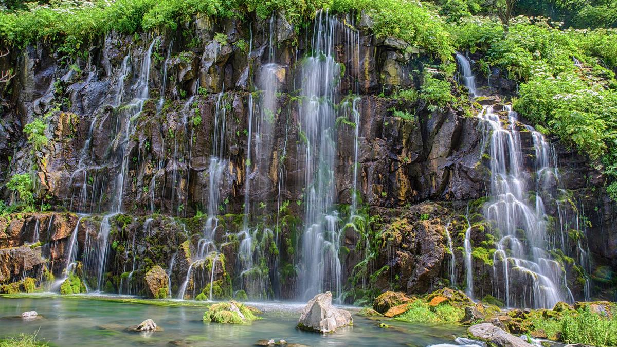
Not far from the waterfall, which is considered the central attraction of the trail, you can see a cozy picnic table. There is also a lake with amazing emerald water nearby, the distance to the Tsablnari waterfall is about 300 meters. The waterfall, surrounded by boxwood and ivy, gives coolness on summer days, especially to those tourists who dare to go beyond the water flow.
The Tsivtskaro Trail
A two-day route with a length of 15 km. Moderately difficult. It is overcome on foot or on horseback. The maximum height of the trail above the sea is 1250 m. This trip fully reveals the diversity of the local animal and plant world. On this territory there are natural springs, places for tents and a shelter for park guests.
There is also an attraction called "zipline" – a rope fixed at two ends. On it, with the help of a special holder, they go down. And there are also small cars that ride across the river. The price is 1 GEL (23 rubles). You can spend the night and have lunch with local residents.
The area has a diverse flora and fauna. There are forests with chestnut, beech trees and mixed forests of the Colchis region, as well as endangered plant types of Lazistan and Adjara. For example: primrose, epigea, etc. As an undergrowth, rhododendron Ponticum, laurel, boxwood Colchis and various lianas grow. The park is home to: brown bear, roe deer and wild boar, while the avifauna includes common kestrel, buzzard, dwarf eagle, owl, owl, hoopoe, woodpecker, raven and oriole. Amphibians inhabiting the park include the Caucasian salamander, the Caucasian toad and the Caucasian viper.
On the territory of the park at an altitude of 1761 m above the sea there is a mountain of the same name. The weather in this place is foggy and rainy. This is the reason for the name – Mtirala, which means "crying" in Georgian. Experts believe that this is the wettest territory of Georgia and Europe as a whole.
Among other attractions of the park, you can also note the local mountain lake and chestnut waterfall.
Tbilisi National Park
It is located in the East of Georgia. It borders the Mtskheta-Mtianeti and Kvemo Kartli regions and is located between the Iori and Mtkvari rivers.
Altitude above sea level: from 600 m to 1.7 km
Area: 243 m2 or 24300 ha
Year of foundation: 1973
Website: apa.gov.ge
Тел.: +995 577 64 04 74
Administration Tbilisi National Park it is located in the village of Saguramo.
The road here from Tbilisi is about 32 km long and will take about an hour by car. Admission is free.
The park is home to rare species of local animals.
Historical castles, old temples and settlements are often found in the park. For example: Svetitskhoveli Cathedral, monasteries: Samtavro, Jvari, Zedazeni in Mtskheta.
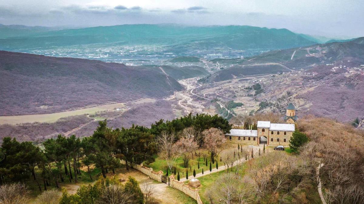
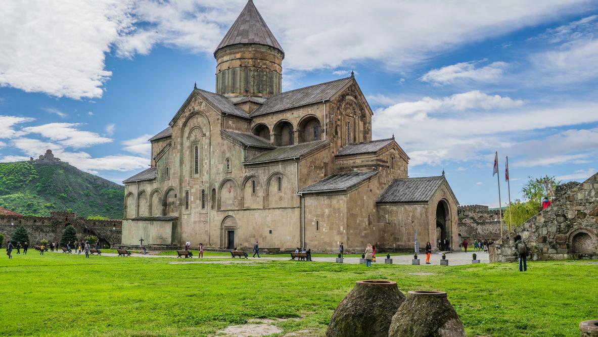
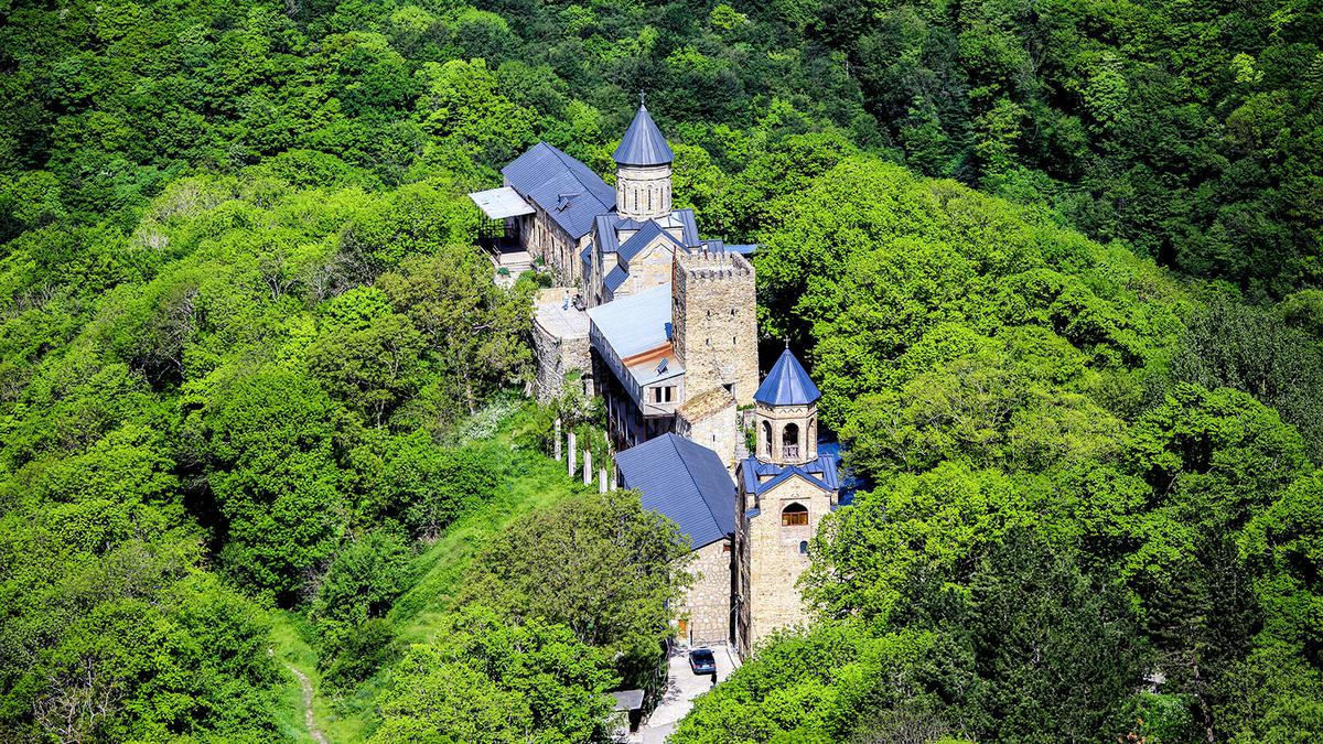
The attractions of the Zedazeni Forest include Martkopi Valley and the divine Monastery.
The road is located along the Saguramo Ridge with rich vegetation. Along the way, there are also destroyed and abandoned Virginia buildings and the Cathedral of the 7th-8th century Zedazeni, from where the Holy Cross Monastery is visible. Tbilisi can be viewed from the top of Didveli Mountain. Mtkvari and Aragvi gorges are also visible from here.
Sights of Georgia, beautiful landscapes, as well as outdoor recreation – all this is available to guests of the park. Of the modes of transport, horses, cars are available, and you can also walk. There is also a camp in the park where you can spend the night.
The following types of routes with different lengths (from 10 to 44 km) and terrain are available to tourists here:
- bike tour with three difficulty levels: 25, 38 and 44 km;
- 10 km long walking route;
- horse riding on horseback (average difficulty).
Tracks have markings. There are also tents for sleeping and places for bonfires.
Routes of the Tbilisi Park
The route "Big panorama" from Gldani
An easily traversable track with a length of 10 km. The track is designed mainly for walking, part of the roads are covered with asphalt, and the other part is forest–type roads. The path starts from the village of Gldani and ends in Didveli, passing through the river of the same name. On the way there are sights such as: freshwater spring and the steel cross of Rkinis Jvari on the mountain with a full view of the park.
Circular route from Mamcode
This is a 38-kilometer route requiring an average level of training, passing through the settlements of Mamkoda, Lelubani, Martkopi and Norio. The road is mostly unpaved and only a small part of it (8 km) is covered with asphalt. There is also a pass, the height of which reaches 1460 m above sea level, from where Tbilisi is clearly visible.
Difficult route from Mamcode
Just like the previous route, it starts from the village of Mamkoda. All roads here are unpaved. The total length of this route is 44 km. Its complexity is due not only to its long length, but also to the terrain. To overcome it, a high level of training is needed. On the road are Mamkod Monastery and the village of Lelubani.
Route from Saguramo
This 25-kilometer route deserves special attention. It starts from the village of Saguramo, has an average level of difficulty. The maximum height throughout the entire track is about 1440 m above sea level. Throughout the road you will see a great many attractions. Eg, Ilya Chavchavadze Museum etc.
How to get to various places in the park?
In Gldani
The village of Gldani can be reached by buses No. 45. The stop is located at the Akhmeteli metro station. The journey will take you about 20-30 minutes.
In Mamkoda
This locality is located in the immediate vicinity of Gldani. At a distance of only about 3 kilometers. This path can be traversed both on foot and by car.
In Saguramo
You can get from the bus station of Tbilisi (Didube) in the village of Saguramo by minibus. They rarely go, the road lasts 30 – 40 minutes.
Algeti National Park
Altitude above sea level: from 1100 to 2000 m, the highest point – Mount Kldekari (2000 m).
Climate: temperate.
Area: 68.22 km2 or 6822 ha (the smallest national Park of Georgia by area).
GPS coordinates: 41.723258,44.308285 (Algeti River).
Year of foundation: founded in 1965 as a nature reserve, the status of a national park was awarded in 2007.
Website: apa.gov.ge
Telephone.: +995 595 08 60 80.
Administration Algeti National Park located in Manglisi.
Location
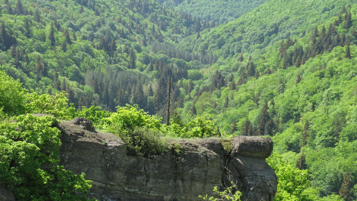
The park is located entirely in the Kvemo-Kartli region. The terrain is mountainous, relief, with frequent and sharp ascents and descents. The Trialet ridge is also partially included in the territory of the park. The river of the same name also flows through the park.
Plants and animals
The park was originally founded as a nature reserve to protect spruce forests and Caucasian fir – native plant species that were in danger of extinction. There are also many species of animals in need of protection. Here are some of them: wild boar, bear, badger, fox, hare. The diversity of birds in the Algeti National Park exceeds 80 different species. For example: deryaba, yellow, yellow-headed kinglet, black-headed nuthatch, jay. Such a rich flora and fauna attracts both visitors coming for recreation, and ecologists and biologists interested in exploring this area.
The territory of the Algeti National Park is called the “floral node”, since the reserve is famous for representatives of the Caucasian, Colchian, Hyrkanian and Iranian flora. The most common are beech forests, which were formed in places where spruce and fir forests were cut down. Hawthorn, rosehip, hazel, cherry, sea buckthorn, clover and oregano are especially common.
Interesting places for tourists
The park and the territories bordering it are famous for their ancient sights, such as battlefields, churches and fortresses. Special attention is attracted by the one at the entrance Cathedral of the Assumption of the Blessed Virgin Mary, built, according to historians, in the 4th century. It is believed that one of the nails of the cross on which Christ was executed was kept here. At a distance of 1 km from the village there is a cave where, according to rumors, the well-known hero and fighter for the rights of peasants Arsen Odzelashvili lived.
The park is open to the public all year round. The terrain and weather are suitable for outdoor recreation and walking along mountain paths. The park administration is responsible for organizing hikes (hiking and horseback riding), as well as providing maps and reference information to guests.
Excursions
Visitors to the park are offered guided tours on the following topics: archeology, botany and ecology. The 6-8-hour route "Royal Ridge" with a length of 6 km is in the greatest demand. It passes along the Royal Ridge Road. To pass it, a tourist requires at least an average degree of physical endurance.





34 comments
Log in to leave a comment
Прогулки в таких местах, при хорошей погоде - это отличный вариант для семейного отдыха. В статье нам представлены прекрасные примеры таких мест. Иллюстрации просто поражают воображение. Спасибо автору.