


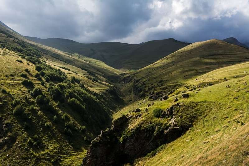
Tkarshet lava flow
As a result of one of the closest in time volcanic eruptions on the Kazbegi Mountain the Tkarsheti lava flow arose, which burst out from one of the side cenotes (mountain Tkarsheti, height - 3425 m above sea level), descended to the old valley tributary of the Terek and dammed the river Terek. The Tkarsheti lava flow has a well-preserved uneven surface. The final limit of the lava cuts the erosive canyon of the Terek. The stream itself is outlined on both sides by narrow, almost impassable canyons of "twin rivers".
At the end of the stream, in the cliffs of the terraces of the right bank of the Terek, there is a chain of lake covers, which appeared as a result of the above-mentioned damming of the Terek lava. Petrified forest can be found here. Vertically standing tree trunks are an evidence of the fact that accumulation of lake sediments took place very quickly. These are trunks of poplar, birch, juniper, and other trees of high-mountainous forests. Petrified forest was discovered in 19888868 during a catastrophic flood, when water came out of the Terek River, broke the edge of the terrace. Radiocarbon analysis of tree trunks determined their age - 5850-5960 years. Which makes it possible to determine the date of the eruption of the Tkarshet lava flow - it is 6000 years.
From the Tkarsheti lava flow, if you follow the valley of the Terek River in the north direction, you can see the Arshi waterfall, which is called the Women's Hair.
Here the Arshistskali (Chkhati) river flows along the rocks with wavy silvery ripples and resembles women's curls. The lower Arshi waterfall can be seen from the highway. You can get to the waterfall by taking a hiking trail that runs among brown rocks. The length of the trail is 2 km. The height of the upper waterfall of Arshi is 21 m, and 200 meters from it is the lower cascade, the height of the fall which is 15 m.
In 1976 the Kazbegi Reserve was established with the purpose of preservation and reproduction of flora and fauna. Almost treeless reserve is the abode of rare species of fauna: eastern Caucasian mountain goat, chamois, bezoar goat, brown bear. It is also home to birds included in the Red Book of Georgia.
Location:
Kazbegi Municipality, territories administered by the villages of Goritsikhe and Sioni, at an altitude of 1,820 meters above sea level.
Coordinates:
42°36′16″N; 44°34′26″E.
How to get there:
From Stepantsminda, a 10 km road leads to the lava flow, followed by a 0.5 km hiking trail. Distance from Tbilisi — 140 km, from Mtskheta — 125 km, from Stepantsminda — 10 km.

0 comments
Log in to leave a comment