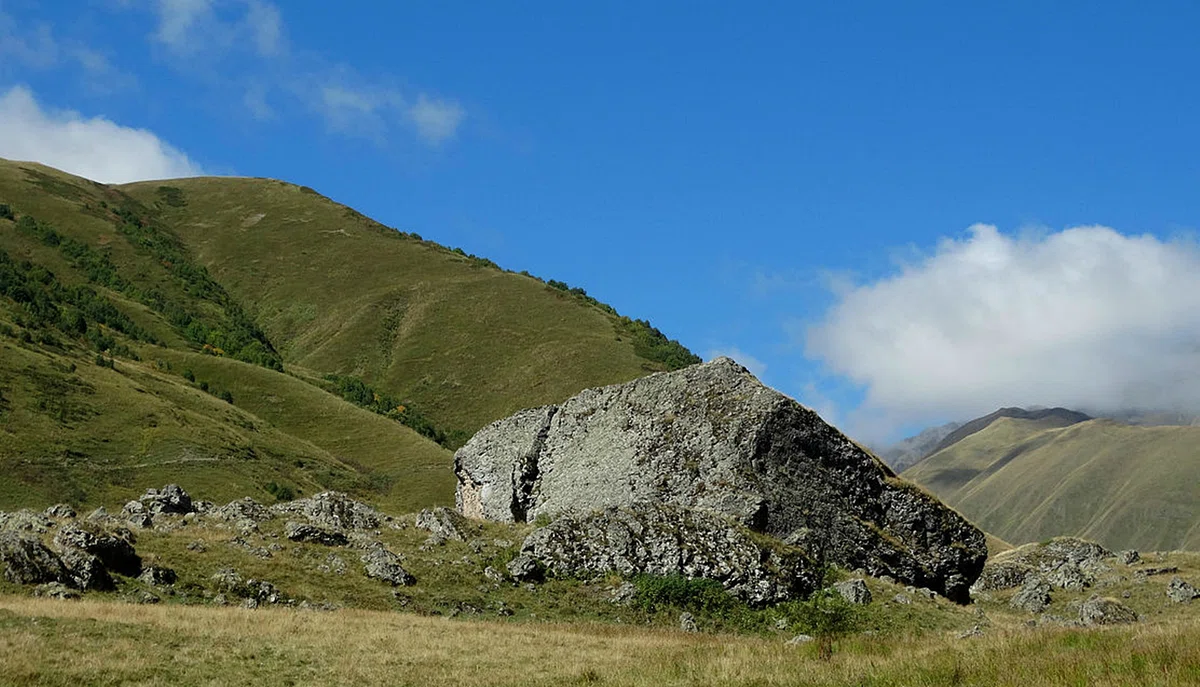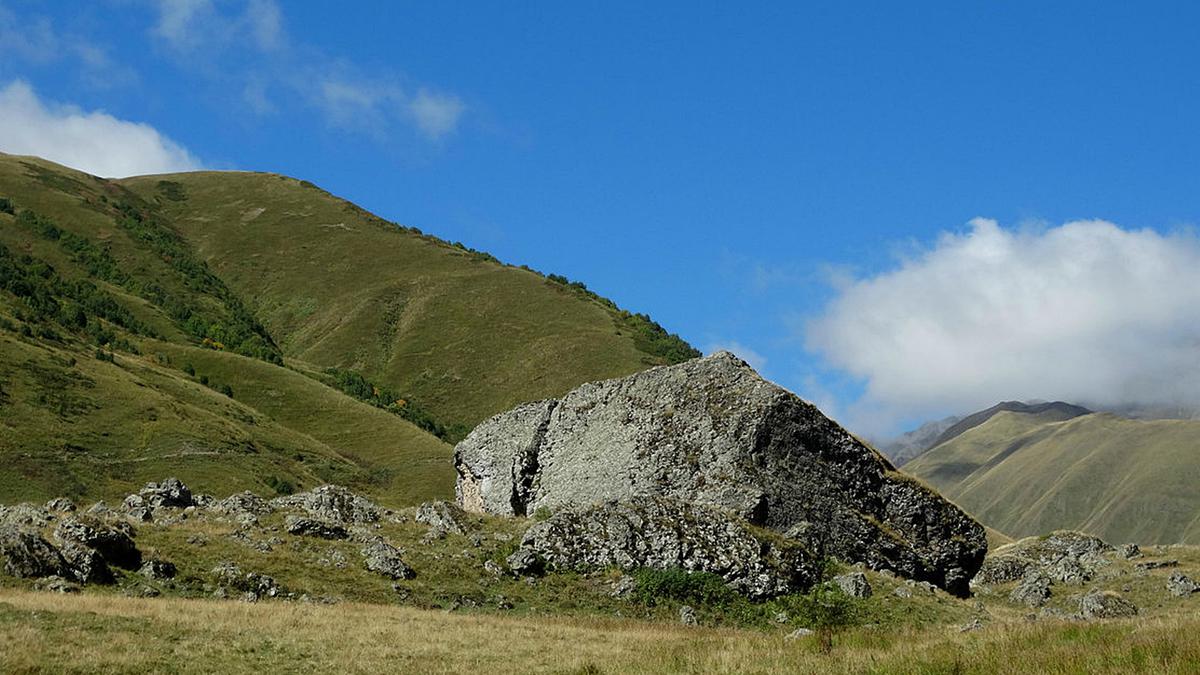
Where can you see moving glacial blocks in Georgia? The Roshka Cliffs.
In the past, the Roska Glacier was more than eleven kilometers long, moving southeastward through the Roska valley. At the moment, there are two glacially descended blocks in Roska. What makes them special is that they are moving. They are some of the largest moving glacial blocks in the entire world.
One of the most mountainous and permanently inhabited villages of Georgia, Roshka is located on the southeastern slope of the Chaukheb massif of the Greater Caucasus watershed ridge. It is in the upper reaches of the Roshkistskali River (right tributary of the Khevsur Aragvi). The valley of the Roshka has well preserved traces of old glaciation processes. In the geological past the length of the glacier exceeded 11 km. It advanced southeastward through the Roska valley and overlapped the valley of the Khevsur Aragvi. The end of the glacier was near the village of Gelisvake, at an altitude of 1450 m above sea level (now this place has risen to a height of 1650 m).
From the Chauch Mountains, the Abudelaury Glacier descended into the Roshka two huge blocks. Which are among the largest moving blocks in the world. Their dimensions are 19x5x7 and 22x13x10 (length, width, height). The blocks consist of igneous rock - diabase. Compared to these blocks, the dwellings of Hevsureti seem like toy houses. Above the village there are much larger blocks: the size of the "Split Stone" is 25x10x11.
Relatively smaller, but very impressive glacial boulders are scattered in large quantities along the upper part of the Abudelauri valley, as well as below Roshka - along the valley of the Khevsuri Aragvi River. The lower (southern) boundaries of these blocks almost reach the mouth of the Oherekhevi River. All these blocks came down from the Chaukh massif. This massif is referred to in the oral folklore of the Khevsurs, Mtiyuls and Mokhevs as Rocky Mountain.

Location:
Dusheti municipality, the village of Roska and its surroundings; at an altitude of 2050 m above sea level.

Coordinates:
N42 32'42''; E44 53'29''

How to get there:
It is possible to climb Roshka by 8 km road, which separates from the highway Jinvali-Shatili above the village Barisakho. The distance from the center of the territorial administration to the village of Bariskho is 17 km; the distance from Tbilisi is 105 km, from Dusheti - 75 km, from Mtskheta - 90 km.


38 comments
Log in to leave a comment
Чаухских гор Абуделаурский ледник спустил в Рошку две огромные глыбы, это самые большие в мире глыбы.На их фоне дома кажутся игру-
шечными.Большое количество ледниковых глыб рассыпаны по верхнему участку Абуделаурской долины,а так-же по долине реки Хевкурской
Арагви.Очень интересные факты.