


Mount Mepistskaro Georgia, Supsa River, Sarime-Mepistskaro Mountain Route
For tourists who love hiking mountain routes, the path from the Sairme resort to Mepistskaro will be an excellent choice! In our article we will tell you how Mount Mepistskaro stands out among other mountains of Georgia, where alpine meadows come from, the role of the Supsa River in the life of Western Georgia. Read and discover new places to visit!
Приглашаем для общения про Грузию


In the ancient era, the Supsa, along with other rivers, connected the eastern provinces of Rome with Western Georgia. Along the river route, the Byzantines exported local raw materials and imported their products.

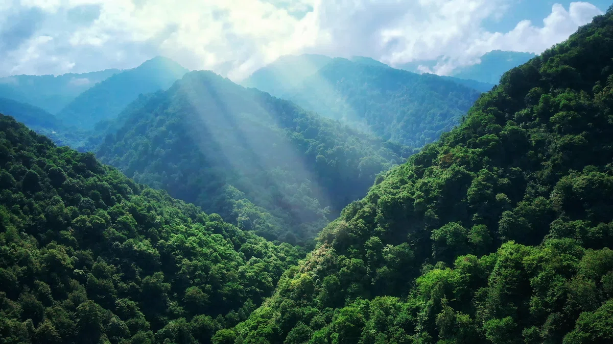
Mepiscaro- the highest peak of the Meskhetian ridge (2850 meters above sea level) is the border of three municipalities: Chokhataursky, Adygensky and Vansky. The foot of the mountain and the lower slopes are covered with subalpine plants, and the middle and upper part of the slopes are covered with Alpine meadows. Bears, deer, roe deer, chamois live here in hard-to-reach places.
From the top of Mepistskaro there are magnificent panoramic views. On the slope of the mountain there is a spring of water that tastes wonderful. According to legend, when Georgian kings traveled along this road, they preferred to rest at this spring.
It should be noted that from the Sairme resort (Baghdad Municipality)There is a 25 km long walking route to Mepistskaro along a steep slope. The other — the motorway — starts on the motorway Akhaltsikhe-Khulo-Batumi, near the village of Mlashe. This is a rocky road that goes through the villages of Chechla and Mohe to the summer pastures, near the village of Zeda Gagvi. The distance from Tbilisi is 280 km, from Adigeni – 50 km, from Batumi (through the Goderdzi pass) - 180 km.
On the northern slope of the Meskhetian ridge, near the village of Mepistskaro, at an altitude of 2,800 meters above sea level, the largest river in Guria - Supsa originates (length - 108 km, basin area - 1130 km2). Near the village of Grigoleti, the Supsa flows into the Black Sea. Originally, the river was called "Surpsa" - Surebi water, as the river flowed through the mountains of the historical region of Suberi. The toponym means "Surebi waters". Under the name "Mgros", the river was first mentioned in the writings of the Greek geographer Pseudo – Skill of Kariand. Supsa is the only river flowing through the territories of all three municipalities of the Guria region.

Wonders of Georgian nature


16 comments
Log in to leave a comment
В античные времена Супса, вместе с другими реками связывала восточные провинции Рима с Западной Грузией.
Средняя и верхняя часть склонов гор покрыты альпийскими лугами. В труднодоступных местах здесь обитают медведи, олени, косули, серны.
С вершины . На склоне горы Мепистскаро, с которой открываются великолепные панорамные виды, находится родник чудесной по вкусу воды и проезжающие грузинские цари предпочитали отдыхать у родника.